Environment
Creating pathways for nature in one of Ontario’s top ski and beach regions
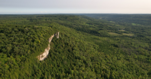
How the Escarpment Corridor Alliance is balancing the needs of wildlife and people in southern Georgian Bay
- 1750 words
- 7 minutes
Environment
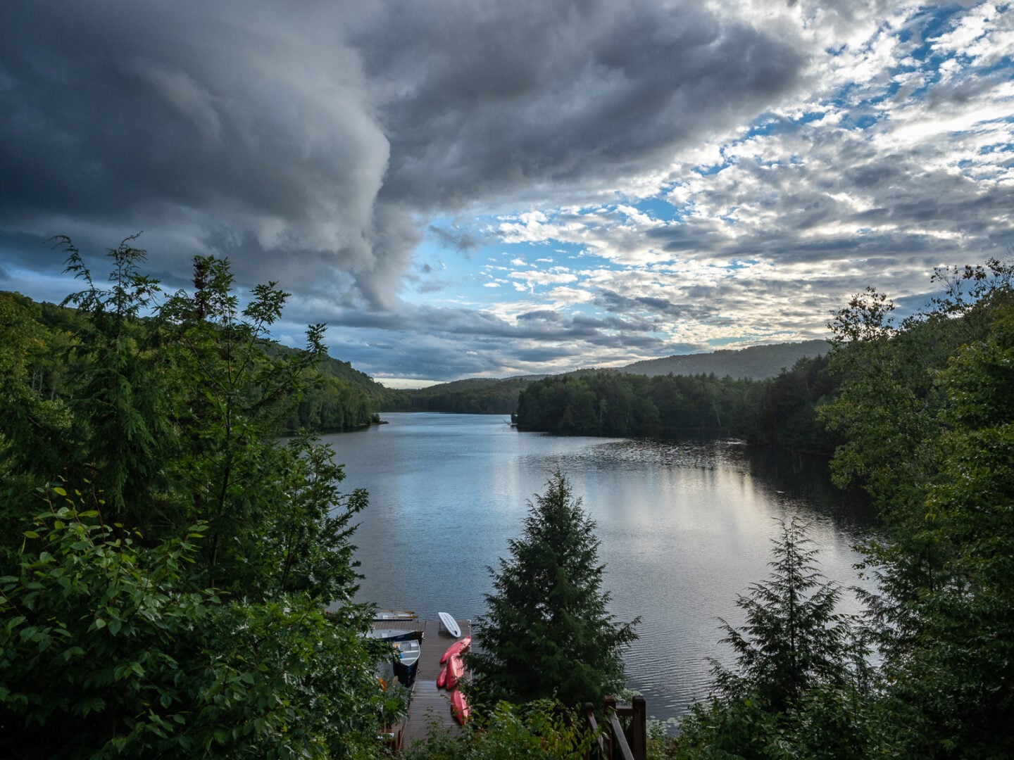
The new Plaisance-Tremblant (P2T) Connectivity Plan is preserving space for nature in a rapidly developing area between Ottawa and Montreal
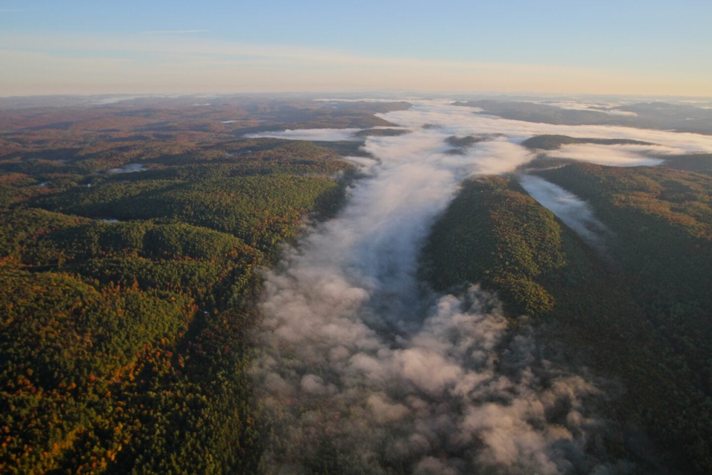
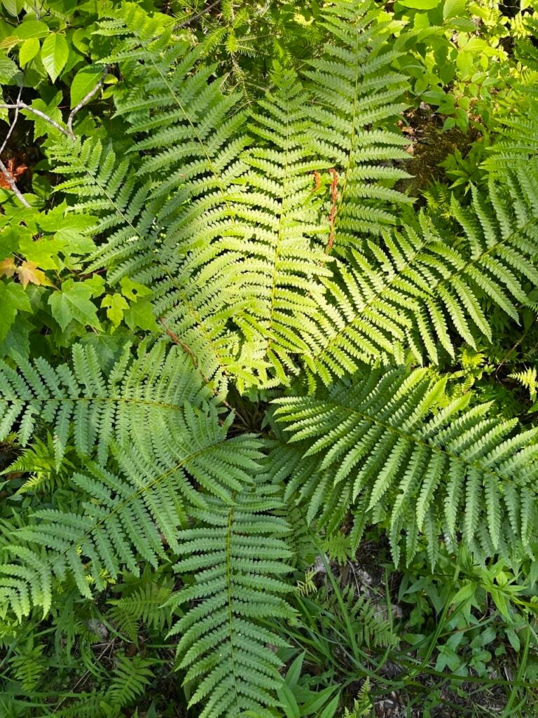
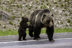
The Laurentian Highlands, rising north and east of the Ottawa River, are best known for three things: seasonal recreation, small-scale forestry and agriculture, and an abundance of nature. The latter includes many rare and threatened species — from eastern wolves and four-toed salamanders to wood turtles and bobolinks — that find shelter, food and places to reproduce in critical niches of natural habitat across this landscape.
Parks and other protected areas help preserve this biodiversity, yet outside their boundaries it’s a different story. There, important wildlife habitat has been lost or is threatened by new residential and commercial development. More roads and increased traffic add new risks and barriers for species trying to move between protected areas or migrate through the region.
What might be possible if those involved in recreation, forestry, farming and area management came together to become part of the solution? That’s the essence of the Plaisance-Tremblant (P2T) Connectivity Plan, a newly crafted, NGO-led blueprint to preserve and restore ecological connectivity in a vital 2,430-square-kilometre, north-south segment of the lower Laurentians.
All of these communities were closely consulted in the plan’s creation — its success now hinges on their owning, embracing and executing it.
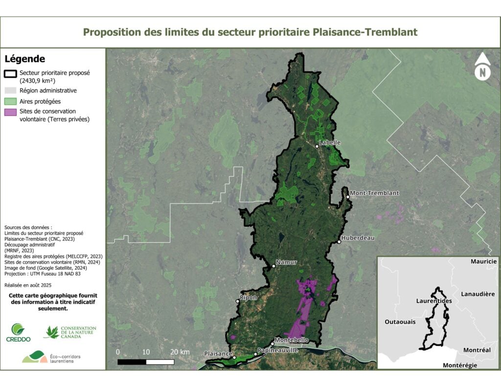
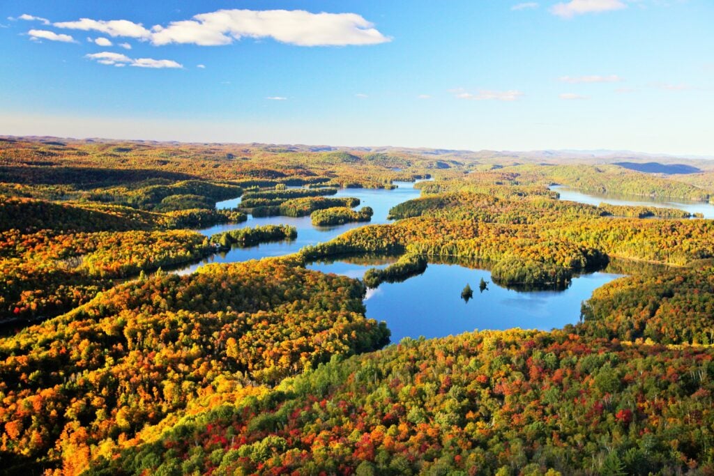
The P2T connectivity area is a scenic, verdant mosaic of towns, valley-bottom farms, forests and recreational areas midway between Ottawa and Montreal. Half the size of Prince Edward Island, it runs from Plaisance National Park on the Ottawa River, northeast to the western edge of Mont Tremblant National Park. While it straddles two provincial administrative regions (Outaouais in the south, Laurentide in the north), its boundaries closely align with one of the 23 national priority areas for ecological corridors identified by Parks Canada in 2024.
“It’s an important area for large mammals as well as many other types of species,” says Marie-Andrée Tougas-Tellier, a project manager for the Nature Conservancy of Canada (NCC), which founded the Quebec Ecological Corridors Initiative in 2017. It’s also a link in a larger movement corridor extending all the way into the Adirondack Mountains in New York State.
The P2T connectivity plan, which launched in early 2026, highlights the power of cooperative planning. It reflects the work of two regional environmental organizations that are part of the provincial corridor initiative and wrote the plan — Éco-corridors laurentiens (ECL) and Le Conseil régional de l’environnement et du dévelopment durable de l’Outaouais (CREDDO) — as well as of Ducks Unlimited Canada, which secured a Parks Canada grant of almost $1 million to fund key aspects of the project.
The corridor plan is backed by science, including extensive fieldwork and modeling of wildlife movement to identify barriers, hazards and relative connectivity potential throughout the zone.
That type of information is critical for identifying how wildlife move through the corridors and developing targeted initiatives that best restore connections. Working with landowners — participation is voluntary —the measures to open up connectivity might include removing fences, planting buffer strips of trees, shrubs and grasses along waterways, preserving woodlots or installing culverts under roads.
P2T is also one of the first connectivity initiatives in North America developed using the International Union for Conservation of Nature’s “Guidelines for conserving connectivity through ecological networks and corridors.” Other environmental organizations are watching it closely to see whether it works as a potential model for the successful creation and management of other ecological corridor networks in Canada and around the world.
Nature Conservancy of Canada has been active in this region for about 15 years, but the process of creating a formal regional connectivity plan for P2T, based on the IUCN guidelines, only started in 2023. “We were trying to find a tool to make sure that we had planning at a scale that makes sense for connectivity,” says Tougas-Tellier.
For help, they called on Gabe Oppler, international policy and partnerships specialist at the Center for Large Landscape Conservation in Montana. The CLLC is the Secretariat for the IUCN specialist group that produced the guidelines. “Our job was to bridge their existing work and their interests with the guidelines of the document as well as our experiences in other parts of the world,” says Oppler.
A key contribution: the Center’s road-tested workshop methodology, which CREDDO and ECL used to engage with more than 60 municipal and community representatives. In two sessions held a few months apart in 2024 and early 2025, they presented the P2T area concept and highlighted how measures to enhance connectivity would lead to concrete benefits for local communities and the local economy.
Attendees weighed in with their desires and concerns, then worked in breakout groups to help shape the final product, from corridor design and governance to action plans for land management and monitoring.
“It’s pretty important not to come into those introductory meetings with a corridor drawn on a map already and say, ‘Here it is, we want your feedback,’” says Oppler. “We wanted to start with some structure but enough flexibility, like a map that doesn’t have strict borders around any corridors, to let them fill in where those areas are.”
The payback, he adds, is seeing people excited to discover that they’re located in a corridor and understanding that what they do for connectivity on their property is part of something bigger. “Once they understand that we’re not taking land away from them, but rather adding maybe some ecological significance and value to the place where they live and work, they feel committed to the connectivity objectives and see their role in it.”
Though they are not directly involved in the Plaisance-Tremblant connectivity plan, Kitigan Zibi Anishinabeg First Nation supports the initiative. Kitigan Zibi already leads their own lands and waters protection program in the Outaouais region. Called Kidjīmāninān, which means “our canoe” in Algonquin, the name of this program expresses its goals: “Like a canoe moving with the current, we go further when we paddle together. By sharing knowledge, respecting the land, and working in partnership, we can create real change not just for today but for the generations to come.”
Through Kidjīmāninān, the community partners with conservation groups like CREDDO, as well as with researchers, municipalities and other community members working on individual projects within their traditional territory.
Rather than take part in P2T directly and divide its energies, Kitigan Zibi agreed to have Kidjīmāninān work with CREDDO to identify common conservation priorities. “We keep them aware of [the project],” says Raphaële Cadieux-Laflamme, project coordinator on CREDDO’s natural environment conservation team. “They do a lot of stuff for all of Outaouais and they’re really happy that we’re working on it.”
“Once people understand that we’re not taking land away from them, but rather adding some ecological significance and value to the place where they live and work, they feel committed to the connectivity objectives and see their role in it.”
Area landowners who wonder what a commitment to connectivity looks like in action don’t have to go far to see it in its ultimate form. In the southeast quadrant of the P2T territory there’s Kenauk, a spectacular 26,000-hectare (260-square-kilometre) tract of largely intact forest and lakes, including some old growth and an entire watershed. Kenauk has been protected through private ownership since the King of France originally granted this wilderness domain to François de Laval, a Bishop of New France in 1674.
In 2013, four families bought the land in partnership with the Nature Conservancy of Canada. Since then, working with NCC, they’ve permanently conserved more than a quarter of the property and work continues on their goal of protecting the entire 26,000 hectares as the Kenauk Nature Reserve.
A year after the purchase, the four partners established the Kenauk Institute, a charitable organization that coordinates scientific research and promotes environmental education on the property. To date, well over 100 rare and endangered species have been observed there. At the same time, there is a commercial side to their enterprise. Portions of the forest are used for selective timber cutting and Kenauk is also open to hunting, fishing and other recreational activities.
“Being able to secure those forest lands was … a big first step to move the [connectivity] project forward,” says Tougas-Tellier.
Successful implementation of the P2T connectivity plan hinges on the participation of many organizations in the region. Two of the most influential are the Terra-Bois Forestry Group and the Union of Agricultural Producers, both of which took part in the P2T workshops. Terra-Bois and UPA already work closely with individual woodlot owners and farmers to help them make informed land management decisions that protect wetlands and soil health, support biodiversity and ensure the long-term viability of their properties. With the advent of the P2T plan, their guidance now also emphasizes ecological connectivity and properties’ proximity to newly identified ecological corridors in the region.
Athanasios Mihou, a project manager with ECL, explains: “Every time [Terra-Bois] meets with a new landowner, they present to them that they are actually in a corridor in our model and they tell them about connectivity. They teach them about the importance of it for their land and the overall continuity of the services that the ecosystems bring. They’ll create a management plan with that property owner that takes [it into account] — something that wasn’t done before in terms of forestry.”
Once the P2T connectivity plan is launched, much of the work will shift to monitoring its progress and collecting further data to determine both the success of its uptake and where additional efforts are required. “Corridors can be adjusted,” says Oppler. “[The IUCN] planning approach really stresses adaptive management. [But] you can only adapt, say, 10 or 20 years down the line with good data.”
A big part of this effort involves collecting species data, using wildlife camera traps, field tracking and other techniques to determine how closely animal movement on the land matches the connectivity models on which the plan is based. Tougas-Tellier says “a model is still a model,” which needs to be validated with what is being seen on the ground.
Given the threat roads pose to connectivity, a critical area of ongoing research involves locating and mapping wildlife-vehicle collision hot spots through key connectivity corridors.
Local governments and the provincial highway ministry are open to installing underpasses (or even overpasses) in priority locations, says Mihou, but “we need to give them a better understanding of how the animals will use that infrastructure if they are to invest millions of dollars [to build it].”
CREDDO’s Cadieux-Laflamme expects her organization and ECL will hold follow-up meetings every year or two with all the decision-makers involved in implementing the P2T plan to report on new research, update on actions taken and make revisions as needed. “This will tell us if we’re accomplishing the actions that were planned. And are we seeing the results that we’re hoping to see in terms of connectivity,” she says. “That’s the long-term vision.”
This story is part of a series about ecological corridors produced with support from Parks Canada. Learn more by visiting the Right of Passage website.
Environment
How the Escarpment Corridor Alliance is balancing the needs of wildlife and people in southern Georgian Bay

Mapping
Connecting protected areas allows wildlife to roam, and is a vital part of the conservation conversation
Environment
The ambitious B.C. non-profit is working with like-minded organizations to create a regional network of 12 protected corridors in the Kootenays

Environment
The planet is in the midst of drastic biodiversity loss that some experts think may be the next great species die-off. How did we get here and what can be done about it?