Wildlife
Unpacking the mystery of grizzly bears in Wapusk National Park
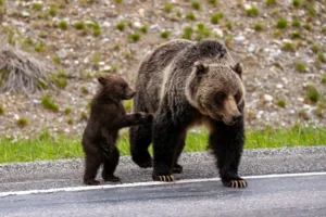
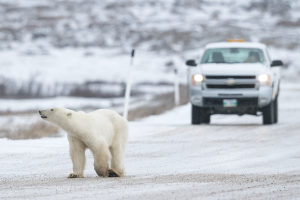
In the Hudson Bay Lowlands, polar bears have reigned supreme. Increased sightings of a new predator have everyone on high alert.
- 5236 words
- 21 minutes
Environment
The ambitious B.C. non-profit is working with like-minded organizations to create a regional network of 12 protected corridors in the Kootenays

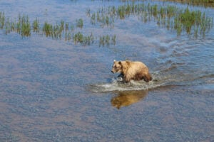
When independent grizzly bear research scientist Michael Proctor is asked to explain what landscape connectivity means, he often pulls up an animated map.
The map tracks the movements of a single blue dot around an aerial photograph of the Purcell Mountains in southeastern British Columbia. That dot is the location of a grizzly bear — an ornery adult male that conservation officers trapped in the Columbia Valley after reports of conflict with residents, then relocated to the flanks of the Purcells.
Before the bear was released, Proctor affixed a GPS-radio collar around its neck, allowing him to track its movements. Over the course of the next nine months, the grizzly — nicknamed Drone Bear — travelled from habitat high in the Purcell Wilderness Conservancy to Kootenay National Park and back again. To do so, Drone Bear had to cross the Columbia Valley, navigating around the north end of Columbia Lake and through a dangerous gauntlet of houses, farms, golf courses and roads.
“He walked up and down the valley looking for a place to get across,” says Proctor, pointing to the zig-zag path of the blue dot on the map. When he eventually crossed the valley, he walked right through a property that had recently been purchased by the Nature Trust of B.C. Drone Bear then continued through a lot owned by the Nature Conservancy of Canada before finally finding a safe place to hibernate in Kootenay National Park.
The following spring, the dot began to move again as Drone Bear emerged from hibernation and set off on a return trip to the Purcell Mountains. This time, he made his way back using a different conservation corridor located further up the valley — once again avoiding potentially lethal interactions with humans. “This is what landscape connectivity is,” says Proctor, adding you couldn’t ask for better proof that those protected corridors are working.
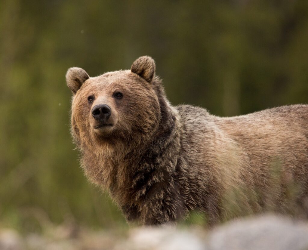
Before the arrival of European settlers, grizzly bears roamed freely over much of western North America. Today their habitat in southern Canada is limited to fragmented chunks of land that function, ecologically, like islands. That fragmentation can limit the bears’ genetic diversity and their ability to adapt to climate change. Smaller, isolated populations of grizzlies, such as those found in southern B.C., tend to be much more vulnerable to extirpation.
One of the best ways to encourage more movement and connection, Proctor says, is to create corridors that can act as bridges between larger wilderness areas. These corridors allow bears and other wildlife to safely pass through areas that tend to be more densely populated. The end result is more opportunities to mate, which, in turn, leads to greater genetic diversity and stronger animals that are more resilient to climate change.
Proctor started working on landscape connectivity more than 20 years ago and has been radio-collaring bears for 15. Conservationists tested a variety of tools, including the strategic use of electric fencing to limit conflict on farmland, while at the same time working with conservation groups to purchase large tracts of land. These projects have shown clear benefits for grizzlies, says Proctor. “We actually reversed the fragmentation and threatened status of one of the worst-threatened populations of grizzlies in North America.” More than that, Proctor says, these pilot projects have helped a myriad of other species that rely on low-lying habitat.
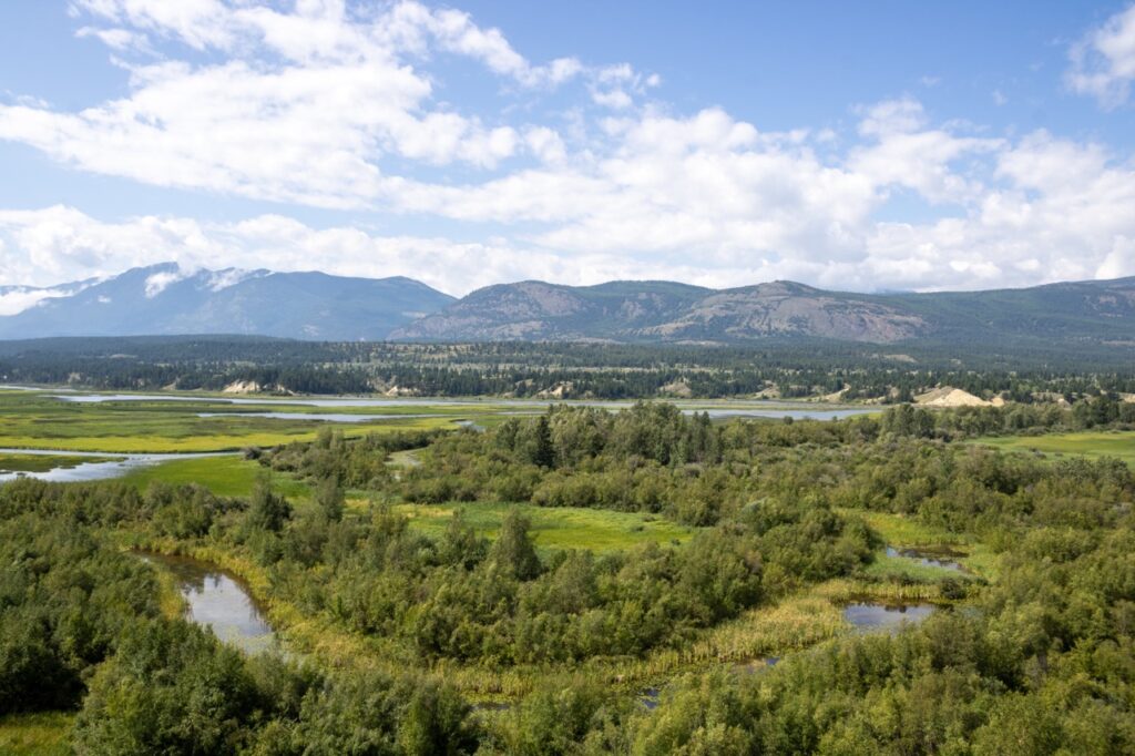
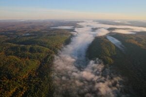
In 2019, Proctor and ecologist Marcy Mahr published a report titled Kootenay Connect: Riparian Wildlife Corridors for Climate Change, then launched the Kootenay Connect initiative with the aim of creating a network of biodiverse ecological corridors in the region. The idea was to take a large-scale landscape approach to conservation that would benefit multiple species. Their goal was an ambitious one: establishing a regional network of 12 key connectivity areas that connected the rich riparian wetland ecosystems in the valley bottoms with the surrounding mountain ranges. “It’s about connecting up the corduroy [low-lying pathways] of our region,” says Mahr.
The Kootenay region might be best known for its rugged conifer-covered peaks. But it’s the valleys in between where conservation corridors are most needed, says Mahr. It is the valleys that are home to thousands of people, including in places like Creston and Fairmont Hot Springs. These are the areas rich in wetland and riparian habitat that are being lost to development.
The 12 corridors prioritized by Kootenay Connect were chosen based on field data, modelling and expert opinions, says Mahr. One of the most important datasets in the decision-making was the movement of grizzly bears, tracked using radio collars much like the one Drone Bear wore. Grizzlies are known as an “umbrella species” (an umbrella species typically needs large areas to thrive, so protecting their habitat and corridors will also benefit many other smaller species that share the same area). “When Michael and I started looking at the overlay of his grizzly data and wetland habitat, we found they were completely aligned and where we needed to focus for conserving connectivity and biodiversity,” says Mahr. “’I’d been looking more in valley bottoms, he’d been looking at large landscape connectivity, but we just think so similarly that everything started flowing.”
Created in 2012, the Frog Bear Conservation Corridor near Kootenay Lake provides an early example of this approach, which benefits multiple species beyond the grizzly bear. Meant to aid two at‐risk populations of grizzly bears as they move between the Selkirk and Purcell mountains, the corridor also provides protection to a number of rare species, including the endangered northern leopard frog, northern rubber boa, American bittern and western screech-owl. In recent years, wetlands along this corridor have been restored, cattle exclusion fencing has been installed to keep livestock out of riparian areas, and the Nature Conservancy of Canada has purchased a 63,000-hectare parcel (among the largest conservation purchases in Canadian history) to boost the size of these essential habitats.
The Frog Bear Corridor initiative relies on the support of numerous partners to be successful. It’s this model that Kootenay Connect has adopted as it approaches its more ambitious goal of creating a network of corridors in the region. “Michael and I first thought of ourselves as catalysts, injecting ecological connectivity and corridors into any conversations that were happening,” says Mahr.
Like the roots of a healthy tree, the network of participants in Kootenay Connect has steadily grown, adding partners with a range of skills, interests and motives. “We’ve got folks that are concerned about bats and they’re putting up artificial roost structures because we’ve lost old growth in our forest,” says Mahr. “We’ve got badger studies looking at the connectivity under highways [using culverts]. We’ve got studies looking at floodplain wetlands and vulnerability to drought. And we’ve supported a comprehensive biodiversity inventory that documented over 4,000 species, including snails, slime molds and fungi, in two of Kootenay Connect’s corridors spanning the Slocan Valley.”
These diverse specialists, along with foresters, farmers and a variety of other stakeholders, have all played a role in identifying where conservation corridors need to be located to have the greatest impact — and how best to restore these lands.
Since its launch, Kootenay Connect has inspired Kootenay Connect Priority Places, a program managed by the Kootenay Conservation Program which has amassed a wildly impressive list of achievements. Working with some 40 organizations, encompassing non-profits, biologists and governments, the initiative has leveraged a whopping $14 million dollars. That funding, provided by Environment and Climate Change Canada’s Community-Nominated Priority Places program with substantial matching funds from partners, has been used to deliver more than 60 habitat enhancement projects in seven of the 12 originally identified corridors, supporting creatures ranging from western toadlets to endangered Lewis’s woodpeckers. “I don’t know that there’s any other NGO-driven or -managed initiative on this scale that we’ve ever seen in B.C,” says Mahr.

Going forward, one of Kootenay Connect’s main focuses is the Columbia Lake Corridor. It’s a biodiversity hotspot and an important stopover for migratory birds. It’s also an area that has deep cultural significance. The lake is central to the creation story of the Ktunaxa Nation.
The oral history of the Ktunaxa refers to ancestral times, when the world was ruled by spirit animals. Chief among these animals was Naⱡmuqȼin, who was so tall he had to crawl on his hands and knees to avoid crashing into the sky. Like many spirit animals, Naⱡmuqȼin had a prophesy to fulfill; his was to slay a water monster named Yawuʔnik̓ that lived in the Kootenay and Columbia River system. The monster killed many of the animals there.
Naⱡmuqȼin chased Yawuʔnik̓ throughout the water systems before finally corralling and killing him in Columbia Lake. The water monster’s organs were used to create the human race, while his ribs were scattered and became the hoodoos in the area. Naⱡmuqȼin decreed that the Ktunaxa people were now designated “keepers of the land” and would remain here forever. The story concludes with Naⱡmuqȼin standing up to celebrate and bumping his head on the ceiling of the sky. The impact knocked him dead and his body formed the Rocky Mountain range.
“It’s a story about connection to the land,” says Kris Belanger, operational director with the Ktunaxa First Nation. “There’s certainly a lot of relevance between the creation story and the work of Kootenay Connect.”
The opportunity to bring Indigenous values and perspectives into ecological corridor planning is an exciting prospect for Mahr. The Columbia Lake corridor is an obvious place to do so, given its rich biodiversity and cultural importance. “It’s a meeting place,” says Mahr. “It’s always been a place people wanted to come, a place all beings wanted to come.”
The biggest uncertainty facing the work going forward might be funding. The most recent federal grant received by Kootenay Connect was through the Canada Nature Fund program. It’s not clear whether such programs will be renewed, Mahr says.
Still, despite the current uncertainty, Kootenay Connect moves forward with the knowledge that it has created a strong new model for region-wide conservation planning and has fostered a network of partnerships to advance that important work. It’s those relationships that co-founder Michael Proctor believes could be the most enduring — and impactful — aspects of the initiative.
“You can do things fast by yourself,” Proctor says, “But changes last much longer if you do them with a group.” In that way, Kootenay Connect might be a good example of the Ktunaxa term ʔuk̓iniⱡwitiyaⱡa: Many people working with one heart.
This story is part of a series about ecological corridors produced with support from Parks Canada. Learn more by visiting the Right of Passage website.
Wildlife
In the Hudson Bay Lowlands, polar bears have reigned supreme. Increased sightings of a new predator have everyone on high alert.
Environment
The new Plaisance-Tremblant (P2T) Connectivity Plan is preserving space for nature in a rapidly developing area between Ottawa and Montreal
Environment
Cet ambitieux organisme à but non lucratif de Colombie-Britannique collabore avec d’autres organismes partageant les mêmes idées afin de créer un réseau régional de 12 corridors protégés dans la région de Kootenay.
Wildlife
Humans and bears are sharing more landscapes now than ever before. As we continue to invade their world, will we be able to coexist?