Places

A visit to Quebec’s Baie de L’Isle-Verte National Wildlife Area, where life moves with the tides

A team of volunteers and scientists has carefully nurtured this landscape, making it a sanctuary for wildlife on the St. Lawrence

  • Apr 28, 2026
  • 2,457 words
  • 10 minutes
[ Disponible en français ]
Baie de L'Isle Verte NWA is one of the most important nesting sites in Quebec for the American Black Duck. (Photo: Alexandre Lauzier/Can Geo Photo Club)
Expand Image
Advertisement
Advertisement
Advertisement

In late April, an American black duck flies through clear skies in the Bas-Saint-Laurent region of Quebec that hugs the St. Lawrence River. Flapping its brown-black wings lined with an iridescent line of purple, the duck passes the 85-metre-high Gros Cacouna Mountain. The short peak overlooks the tidal seaway, breaking up an otherwise flat landscape. After 16 kilometres of navigating above the gauzy fog, half committed to land and half to the waves, the duck reaches the marshes. They appear out of the mists, seven of them over a 20-kilometre stretch of salty shoreline, covered with grasses that sway in the breeze. The duck descends, gliding to a stop. These marshes grow wild with cordgrass, a hearty plant that tolerates saltwater and provides the privacy needed — like a natural curtain — for ducks looking to pair off and breed. By way of a pantry, bullrushes, alongside floating duckweed and water lilies, provide food to the waterfowl.

Tidal marshes are crucial for plenty of wildlife: Their dense, salt-resistant vegetation acts as a combination stocked fridge, shelter and breeding ground for many animals, from long-distance flyers to small scurrying mammals. Below the surface there are fish, crustaceans and worms. These flat formations protect the earth, too, via underwater root systems that fix sediments and help to filter heavy metals in the water, an issue is brought on by continuous traffic farther off in the seaway — a crucial maritime shipping route on one of the world’s largest estuaries. Today, the snaking roots work overtime, holding onto dirt as erosion becomes an increasing problem with the advent of stronger spring and fall storms.

Thousands of migratory birds pass through the wildlife area every spring and fall, including waterfowl such as green-winged teals (shown) American black ducks, northern pintails, common eiders, scoters and more. (Photo: Koorosh Badie/Can Geo Photo Club)
Expand Image

Though they’re not the only class of creatures that hang around here, migrating avian species rely on these habitats. At the peak of the spring and fall migrations, these marshes aren’t just beautiful; they’re loud. Lend an ear and you’ll hear overlapping vocalizations from many of the 100-plus species that have been recorded on these grounds — a hub on the annual migration route for species that take a page from plenty of Québécois folks and head south for the winter.

This national wildlife area (NWA), where geography changes with the always-moving tides, is one of the top birding destinations in the province. Its designation by BirdLife International as an Important Bird and Biodiversity Area encourages visits by birders from around the world. As a seriously degraded category of habitat worldwide, wetlands (marshes are a vegetation-rich type of these formations) historically haven’t gotten a lot of love. That poor treatment is diametrically opposed to their importance — the vital services they provide include flood control, groundwater recharge and freshwater supply. They also act as huge carbon sinks. About 70 per cent of wetlands in southern Canada had disappeared prior to the 1990s, with that number climbing to 98 per cent in densely settled areas. A 2018 law gave greater protection to wetlands, though this NWA has had the Ramsar designation (a 1971 international convention to protect wetlands) since 1987.

While the marshes are valued by waterfowl, the tall grasses and hay fields surrounding them are beloved by other types of birds, including at least six species listed as threatened under the federal Species at Risk Act (these include the red knot, bobolink and bank swallow). The male bobolink’s yellow head can often be spotted in the swaying grasses, its short beak opening to let loose a signature rambling song that flows through 25 to 50 notes, echoing towards the mighty St. Lawrence Seaway. In the words of Charles Desrosiers, a protected areas specialist with Environment and Climate Change Canada’s Canadian Wildlife Service, the bobolink’s call sounds like an old cassette tape being played backwards.

“Compared to everywhere else in Quebec, where birds are declining, here, they’re increasing.”

While the marshes are valued by waterfowl, the tall grasses and hay fields surrounding them are beloved by other types of birds, including the bobolink, a bird listed as threatened under the federal Species at Risk Act. (Photo: Andrew Woronecki/Can Geo Photo Club)
Expand Image
The bank swallow, which has suffered a 98 per cent population decline in Canada over the last 40 years, nests at the edge of the Baie de L'Isle Verte NWA. (Photo: Anne Spiers/Can Geo Photo Club)
Expand Image
Peregrine falcons can be spotted hunting in the area. (Photo: Jane LeBlanc/Can Geo Photo Club)
Expand Image

The marshy formations and their surrounding fields don’t just provide an all-inclusive resort for animal guests, though. The banks also act as a buffer zone between the marshes and other human-caused pressures farther south, including commercial farming and road traffic.

Though it has a long history as a haven for migratory birds, the region wasn’t always so well managed for its avian visitors. This NWA teaches a broader lesson in thoughtful change and adaptation. The American black duck we arrived with — one of about 5,000 of its species that visit the site each year — flew over Baie de L’Isle Verte National Wildlife Area, managed by Environment and Climate Change Canada’s Canadian Wildlife Service. Established in 1980, the 568-hectare conservation zone has been altered and managed in part with Ducks Unlimited Canada to optimize it as a living habitat. This huge project has always been defined by collaboration, between humans and landscapes, between governments, Wolastoqiyik Wahsipekuk First Nation, conservation organizations and individuals.

Advertisement
Short-eared owls, which have been declining due to habitat loss, can be found in this national wildlife area. (Photo: Dawn Mehner/Can Geo Photo Club)
Expand Image

Rehabilitating and strengthening the marshlands started in areas already prone to moisture. There, teams dug into the soft earth, working carefully to maintain native plant seeds as they created what are essentially giant pools. Those pools are equipped with traps that allow to control water levels in the marsh. “It’s very important for maintaining vegetation within the marshes, because they’re fresh water, and we don’t want the brackish water to get in,” says Patrick Harbour, the conservation manager for Ducks Unlimited Canada. They have also worked to establish conditions that encourage vegetation growing along what would be the edge of the pools. The management team can raise or lower water levels to encourage plant growth in drier conditions or, inversely, keep it at bay when conditions are overly wet. As tides become increasingly strong and unpredictable, equipment like the site’s check valves play an important role in the conservation effort, closing during high tides to keep salt water out.

The collaborating team working at Baie de L’Isle-Verte National Wildlife Area has also built relationships with local farmers to help them take the necessary steps to make the sure they are stewarding their lands in a sustainable way. Though it’s a protected zone, agriculture still takes place within the NWA, showing that conservation and farming aren’t mutually exclusive. This kind of shared use can be beneficial, as shown by the NWA’s fields of swaying hay, a plant chosen for its role as a food source and shelter for many birds.

Thoughtful agriculture increases the richness of animal habitats in the area. Adjustments like waiting until late June to mid-July to cut the hay rather than harvesting in mid-May mean a world of difference for the birds that build nests among its stalks. “We authorize farmers to cut the fields only after the nesting period is over, which is different than most agriculture in the province,” says Desrosiers. “Compared to everywhere else in Quebec, where birds are declining, here, they’re increasing.” Field-loving birds also need the farmers: if those grasses hadn’t been planted, the species would never have been attracted to the grounds in the first place. This symbiotic relationship is possible because the federal government leases plots to farmers who enjoy access to arable land under the condition that they follow government guidelines on what they can grow and when they can harvest.


Though birds are this area's claim to fame, many mammals are regularly sighted, including muskrat. (Photo: Kelvin Aitken/Can Geo Photo Club)
Expand Image

This greater variety of healthy habitats is a win-win that results in greater biodiversity. “I’d say it’s the mosaic of habitats that turn this into a distinctive place, since we have a mix of saltwater marshes, converted freshwater marshes, forested land, tidelands and cordgrass marshes that are widely used for food by a bunch of species,” says Harbour.

A government department guiding the natural landscape isn’t the only way these lands have changed since 1980. While flying to its marshy pantry and lover’s nest, that American black duck also encountered structures and developments geared toward an entirely different species: humans. The NWA’s grounds now boast observation towers, parking lots, lookouts, a heritage-building-turned-interpretation-centre and walking paths. Along the trails, interpretive signs, some written in partnership with the Wolastoqiyik Wahsipekuk First Nation, describe both bird and plant life, as well as culturally significant features and plants such as sweetgrass. This probably won’t be the NWA’s final form, though. Environment and Climate Change Canada’s Canadian Wildlife Service keeps an eye on lands that go up for sale next to the current national wildlife area.

The federal government would like to keep expanding its mixed-use approach to these lands, integrating human activity into the ecosystems in a beneficial way while also keeping our presence in check. Simply by being present, humans can be one of the greatest threats to this NWA. “It’s important to provide access for the public. Otherwise, they will find their own access, and we’ll lose control,” says Harbour. But human visitors also bring benefits, like a keen eye for bird identifications, which they upload to eBird. The popular app managed by the Cornell Lab of Ornithology is packed with data that is then made available to the NWA’s scientists, providing a wealth of on-the-ground information about animal sightings they would never have the capacity to gather on their own.

“We have a mix of saltwater marshes, converted freshwater marshes, forested land, tidelands and cordgrass marshes that are widely used for food by a bunch of species.”

THOUGH RESHAPING the landscape and subsequently conserving it has struck a biodiversity-enhancing balance, monitoring and remediation is ongoing, and will be forever. At the best of times, nature is unruly and disregards human-made boundaries. This powerful body of water moves chunks of ice and seed-filled dirt as if they were feathers. Invasive plant species are always a threat, even more so as the climate warms.

The American mink is well-suited to the wetland ecosystem at Baie de L'Isle Verte NWA. (Photo: Scott Young/Can Geo Photo Club)
Expand Image

More invasive plants have started popping up in the Bas-Saint-Laurent, rooting into ground that was previously too cold to be hospitable. Japanese knotweed and the blister-causing giant hogweed have been spotted within the NWA’s limits. The common reed, one of the most prevalent and destructive invasives in North America, is a top concern. The fast-growing reed fills space below ground where its rhizomes spread, but it also cuts up the horizon above with tall stalks, punctuated by wispy tufts.

Farther southwest in Quebec, it already fills ditches, looking like armies of tightly packed soldiers. In Boucherville Islands National Park nearly 450 kilometres away, the reed grows into walls so dense scientists have to survey it using drones. In the Baie-de-L’Isle-Verte, biologists are trying to stop it before it can gain a foothold, fighting flora with flora.

They are planting native willow shrubs that can wage an unseen underground battle against the fast-spreading reed (the willows grow extensive root systems and, as a plus, thrive in wetlands where water levels fluctuate).  

Fighting the reed isn’t just a federal effort, though, since the government invests only in lands it owns and manages. The NWA’s boundaries need to be seen as the porous lines they are. This means collaborating with local governments, NGOs and farmers whose lands are located next to the NWA’s official boundaries. It comes down to good communication and a lot of good faith. Desrosiers knows that though their missions are different, everyone can get on the same conservation page if they understand the shared benefits. “One of the region’s greatest strengths is its landscapes and visual beauty. Tourists are attracted to the area for this reason,” he says. “We explain that caring for those landscapes includes considering the common reed, controlling it and thinking about how to eradicate it. That’s how we’re able to get people on board with this project.”

This national wildlife area has become a favourite spring destination in Quebec for the Nelson's sparrow, its healthy numbers directly tied to the health of the marshlands that sustain it. (Photo: Erinn Hoffman/Can Geo Photo Club)
Expand Image

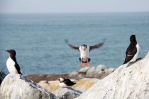
Keeping invasive species in check means all stakeholders working from the same playbook, which includes strict rules on what fill farmers can use and educating them on making sure machinery is cleaned to minimize the chances of introducing invasive species when farmers enter the national wildlife area. But some sources of invasive plants aren’t so easily controlled through communication — the overwhelming number of birds passing through the area carry seeds along for the ride on their long-haul trips.

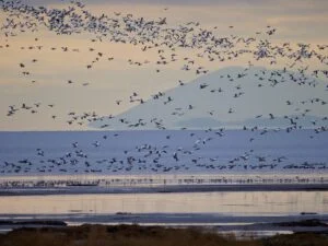
In an increasingly warmer world, the animal species that dominate the maritime area are evolving, too, which can affect the landscapes. The country’s emblematic Canada goose now includes a sizeable population that stays in Canada year-round rather than migrating south for the winter. It’s hard to believe that the resident Canada goose population nearly went extinct in the 1950s due to unregulated hunting. Conservation efforts, paired with milder winters, have led to a massive boom in numbers. The goose still isn’t dominant in the Bas-Saint-Laurent, but it’s starting to show its beak, attracted by the hay fields. In the surrounding farmlands that grow mainly soy and corn, snow geese are the bigger issue, often feasting on these crops.

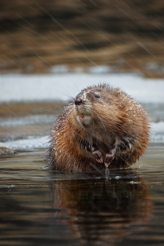
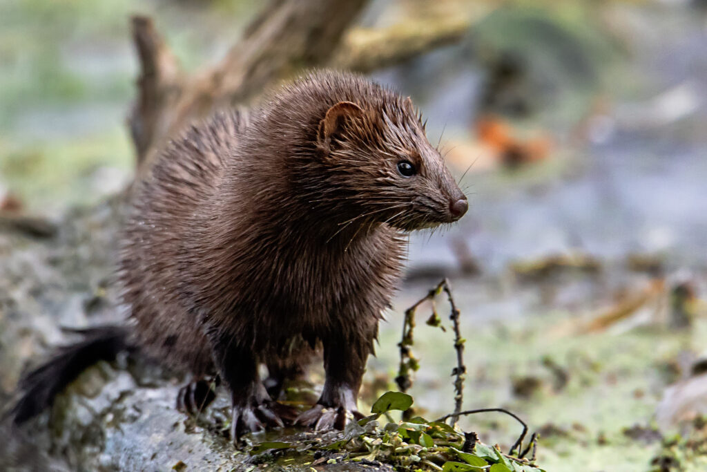
Though birds are this area’s claim to fame, many mammals are regularly sighted — muskrat, American mink, hare, fox, porcupine, bat, marmot and moose, along with the occasional lynx. Back on Gros Cacouna Mountain, in 2024, the Putep ’t-awt observatory was installed by the Wolastoqiyik Wahsipekuk First Nation, which manages part of this formation alongside the federal government. A trail leads to the modern lookout with its breathtaking views over the St. Lawrence Estuary. Putep ’t-awt means beluga trail in the Wolastoqey language, and whale spotting is a popular past-time here.

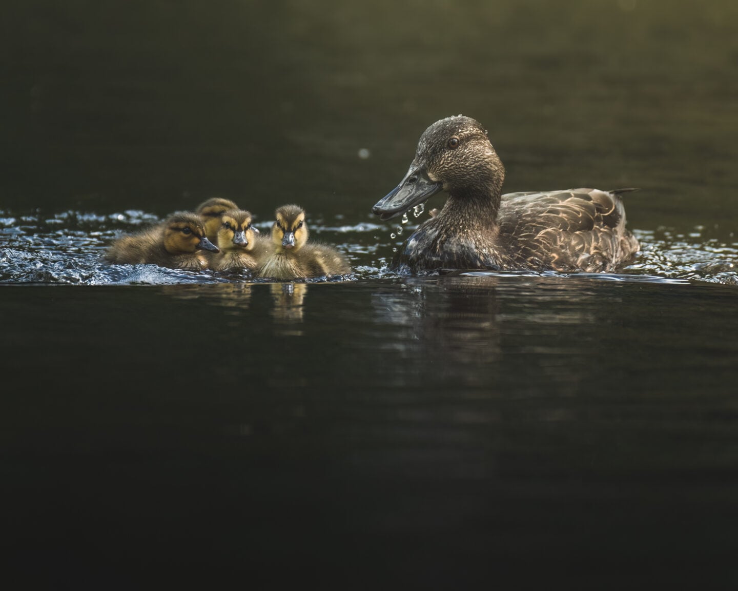
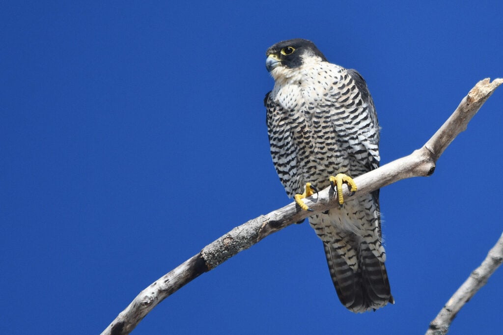
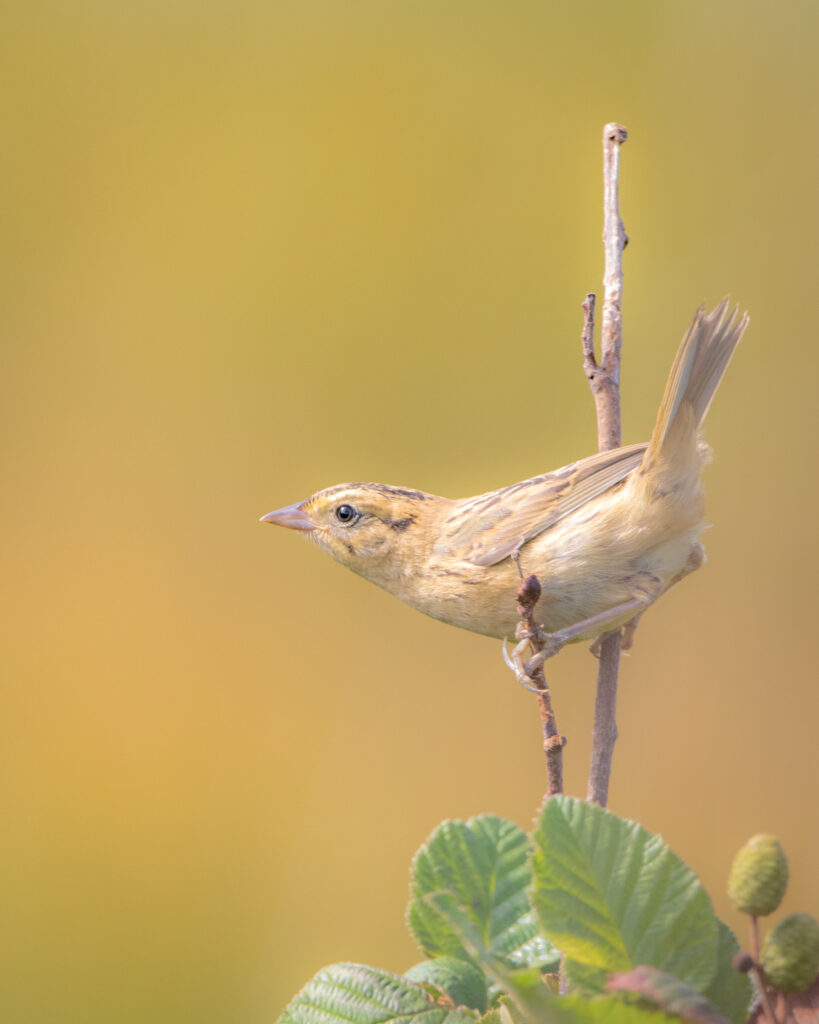
If the national wildlife area were launching today, the American black duck might not be its mascot. As the land here has changed, other rare species have arrived and become emblems for its conservation. The Nelson’s sparrow, rare in many locales though abundant in the area, might fly under the radar with discreet brown and grey plumage, but this secretive bird is beloved by birders who search it out in the tall grasses that are its preferred habitat. The NWA has become one of its favourite spring destinations in Quebec, its healthy numbers directly tied to the health of the marshlands that sustain it. The Nelson’s sparrow is a symbol of what is possible when humans try to understand a place and guide it accordingly. It shows us that wild spaces are worth protecting and, occasionally, transforming, decades or centuries after they were first bent to our will. It is a reminder that stewardship is an always-morphing process that needs to be built upon. The Nelson’s sparrow’s flittering tweets remind us that gains can’t be taken for granted, lest they go to seed or, like the earth eroding along a coast, get washed away by the powerful tides.

This story was created in partnership with Environment and Climate Change Canada.

Advertisement

Help us tell Canada’s story

You can support Canadian Geographic in 3 ways:

Related Content

Mapping

For the birds! Mapping Canada’s 92 migratory bird sanctuaries

These federally protected areas are located along avian superhighways — also known as flyways — traversed by millions of birds on their annual migrations. They provide vital stopover sites and breeding grounds.

  • 1962 words
  • 8 minutes

Wildlife

By the numbers: Protected landscapes and the birds that live there

National wildlife areas and migratory bird sanctuaries form a vast conservation network across the country. Here are a few surprising facts about these protected landscapes and the bird species that live there

  • 1087 words
  • 5 minutes

Places

Plan a visit to one of these nine national wildlife areas near cities in Canada

Hiking trails, paddling, birdwatching, educational activities and more — all within easy reach of urban areas

  • 1837 words
  • 8 minutes
A man stands at the edge of a lake during sunset

People & Culture

The biggest year in Canadian birds

A tale of joy and persistence: Logging Bruce Di Labio’s birding “big years” almost 50 years apart

  • 4123 words
  • 17 minutes
Advertisement
Advertisement