Environment
Inside the fight to protect the Arctic’s “Water Heart”
How the Sahtuto’ine Dene of Délı̨nę created the Tsá Tué Biosphere Reserve, the world’s first such UNESCO site managed by an Indigenous community
- 1663 words
- 7 minutes
Wildlife
Combining ecological and cultural values, and nearly two dozen planning partners, British Columbia’s Great Bear Sea is a model of conservation cooperation
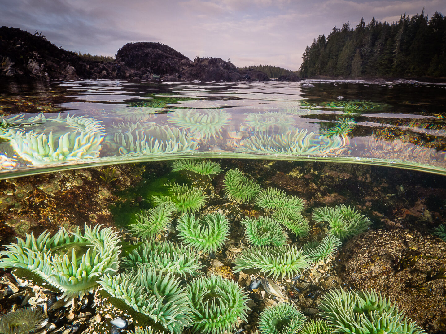
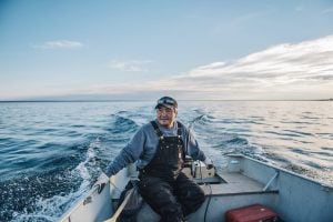
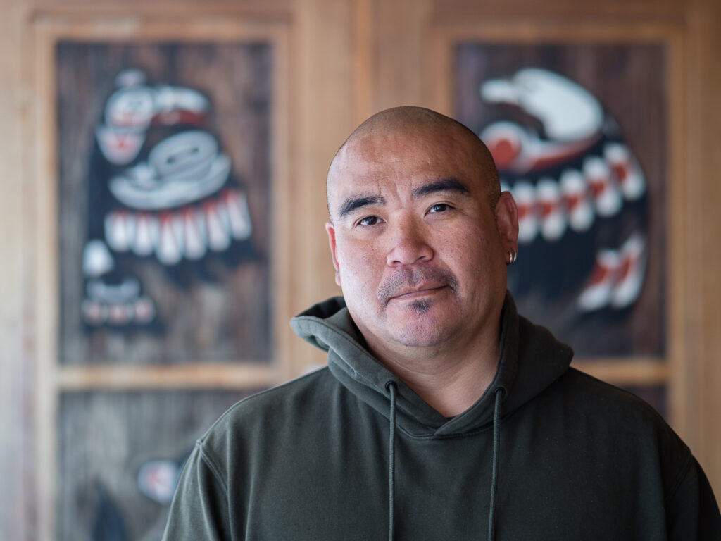
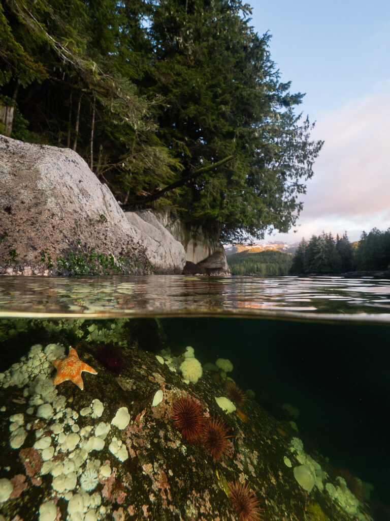
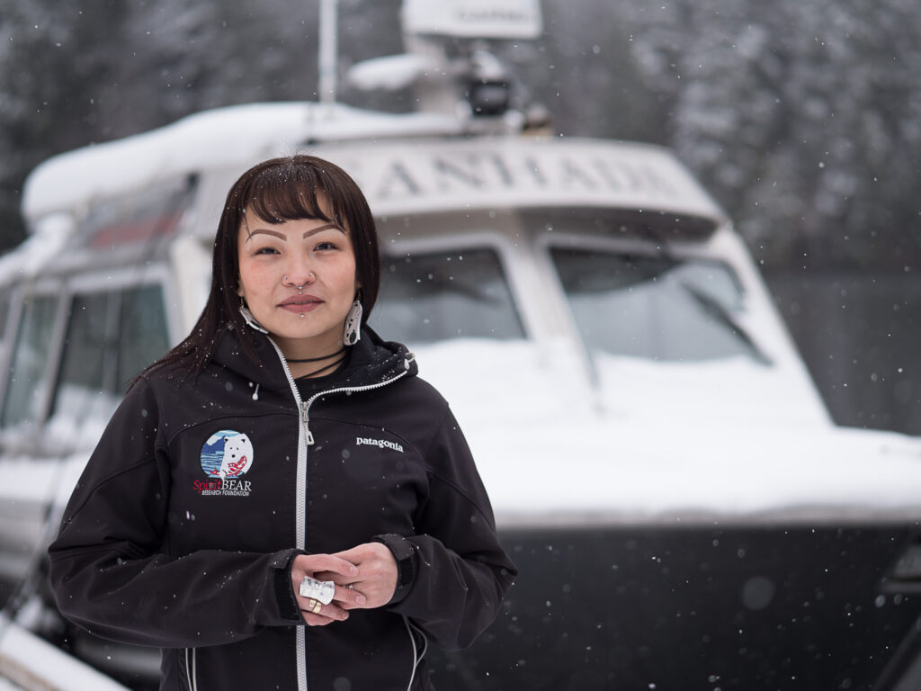
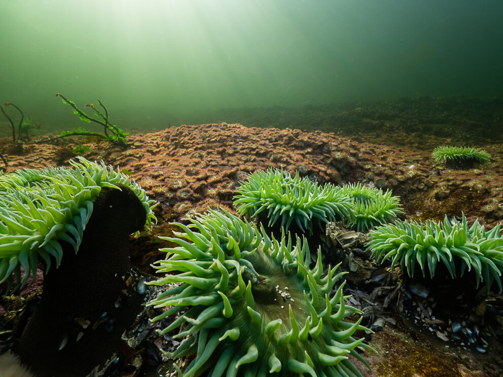
As the mist clears from Kitasoo Xai’xais territory on the central coast of British Columbia, our boat, Ksm Wüts’iin (Mouse Woman), noses into an area of scattered islets called Nowish. The tree-tufted rock formations mark what lies below: stepping stones of habitat — for halibut, sea urchin, geoduck clams and northern abalone. “This is where protected areas really shine,” says Ken Cripps, marine advisor to the Kitasoo Xai’xais Nation Stewardship Authority, who is overseeing the day’s marine survey.
Nowish is part of the in-the-works Central Coast National Marine Conservation Area Reserve. Set to be formally established later this spring, it’s one of the largest zones in a new network of marine protected areas known as the Great Bear Sea. Together, these protected areas will cover a footprint nearly the size of Belgium and connect ecological hotspots between northern Vancouver Island and Alaska.
Protected areas are especially helpful for less mobile creatures like clams, sea cucumbers and abalone, Cripps says. These “broadcast spawners” release millions of eggs and sperm into the water column to be fertilized and resettled sometimes hundreds of kilometres away, depending on species and currents. A single protected area may not be enough for populations to rebound, but a patchwork of them could help restore animals and ecosystems.
That’s the thinking behind the Great Bear Sea network. Once fully operating, it could be a global model of ecological and cultural preservation and of collaborative management between three levels of government: federal, provincial and Indigenous.
“We’ll agree to disagree on who owns [the ocean areas],” says Doug Neasloss, an elected councillor and former chief of Kitasoo Xai’xais Nation. “But we’ll agree to work on the management together. I think that’s quite exciting.”
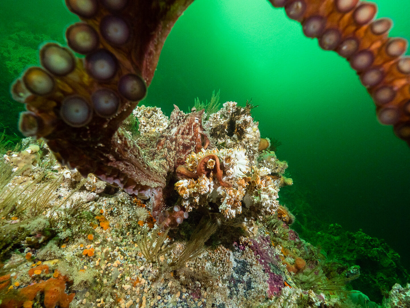
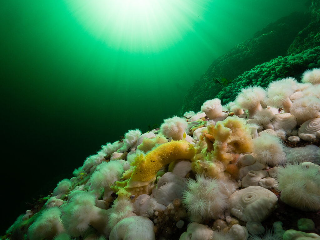
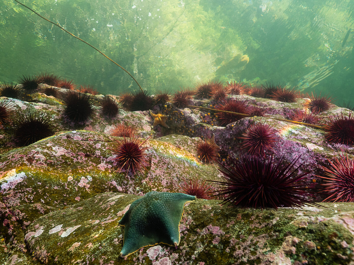
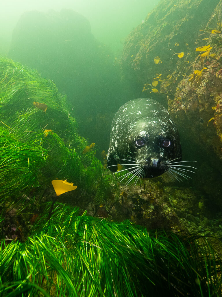
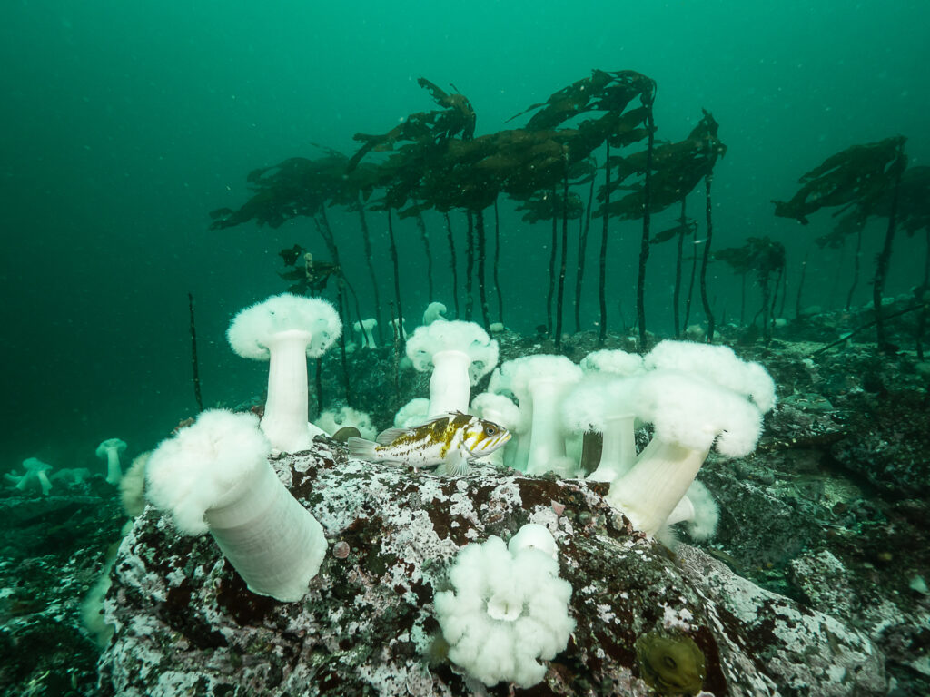
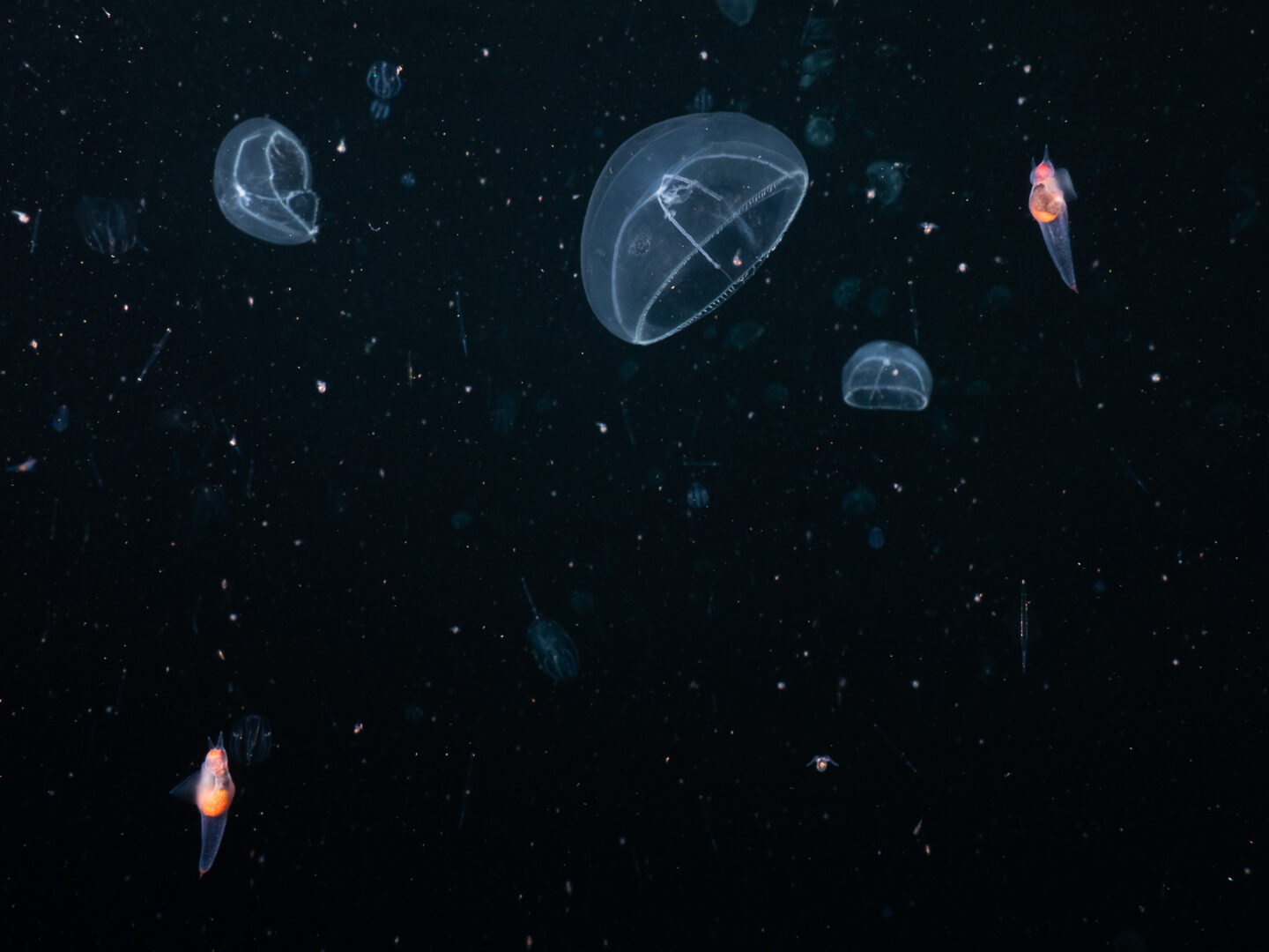
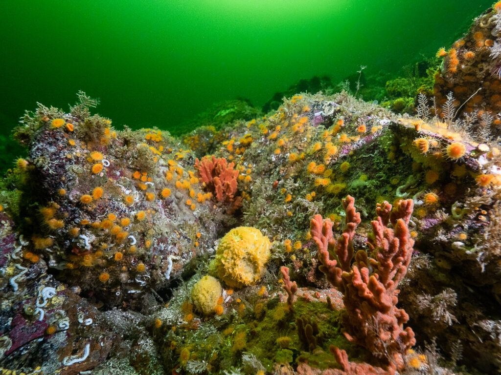
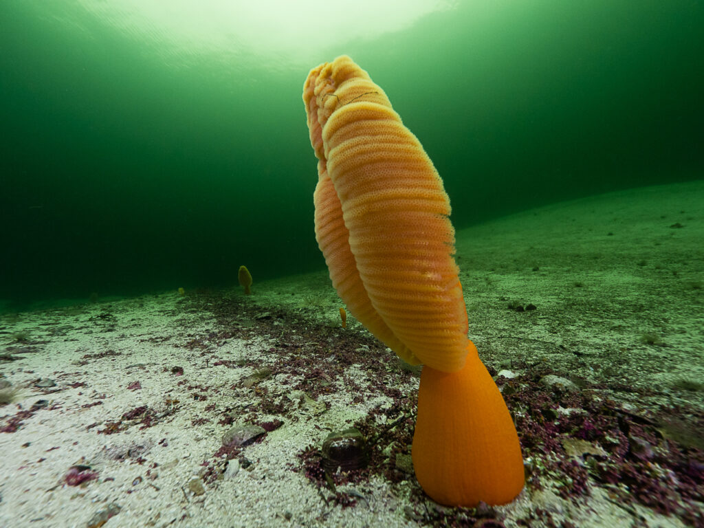
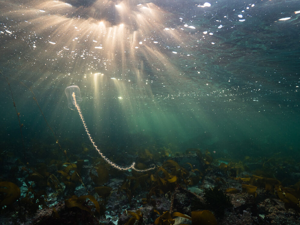
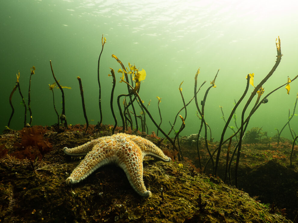
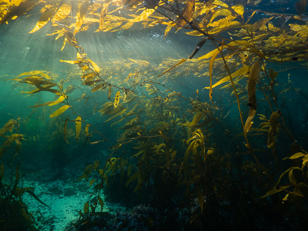
Kitasoo Xai’xais is one of 17 First Nations charting a new course for this 102,000-square-kilometre swath of ocean that feeds and flushes the adjacent Great Bear Rainforest. It’s home to rare corals and glass sponges, vast kelp forests, diverse fish, 20-plus marine mammal species (including the two largest animals on Earth) and Indigenous cultures stretching back at least 14,000 years.
Around 2006, many Indigenous leaders began interviewing Elders about harvest areas and cultural sites to co-develop plans with the B.C. government. But B.C. didn’t have jurisdiction over most of the ocean — the planners had to get Fisheries and Oceans Canada (DFO) onboard. While collaboration on fisheries has been slower, and stickier, over the years, network planning has flowed easier since late 2022, when Canada committed to protecting 30 per cent of its ocean by 2030. “We’ve moved mountains in the last three years,” says Danielle Shaw, chief councillor of Wuikinuxv Nation. “We achieved things I didn’t think we could achieve.”
Case in point: this blueprint for linking some existing marine protected areas with new proposed conservation zones. The network will cover 30 per cent of the Great Bear Sea, targeting 195 priority species, including 84 species at risk, such as sockeye salmon and herring — cornerstones for First Nations. Other cultural priorities, from clam gardens to archaeological sites, were given equal weight to ecological targets. And after overlaying the environmental and cultural values to identify hotspots for protection, the planning team adjusted zone borders to minimize hits to the fishing sector. All this while maintaining the size and spacing requirements for an effective protected area network.
“There is a lot of science that went into this planning process,” says Fiona Beaty, science coordinator for the network. And the combination of Indigenous and western science strengthened protections, she adds. First Nations’ observations of nearshore areas, for instance, were added to extensive federal offshore databases to enhance conservation. Thanks to the involvement of Gitxaała Nation, Kitkatla Inlet, some 60 kilometres south of Prince Rupert, is one of the first two federally designated marine protected areas on the Pacific coast to include the intertidal zone, as well as nearshore kelp and eelgrass habitats.
Planning on the central coast was also strongly influenced by collaborative science. Multi-year studies show that closing certain bays to commercial and recreational Dungeness crab fishing is helping adult male crabs bounce back from past overfishing. Rockfish conservation areas — designed to support a variety of big-eyed, reef-loving groundfish important to First Nations and commercial fisheries alike — are similarly rebuilding fish abundance and biomass in and outside area boundaries.
Much of the network will allow some types of fishing — commercial fishing is worth half a billion dollars in the Great Bear Sea — and First Nations will retain food and ceremonial access. While the science is clear that stronger protections lead to greater fish abundance, body size, diversity, productivity and resilience to climate impacts, partial protections are still valuable, especially if they limit the most destructive types of fishing, says Alejandro Frid, a fisheries ecologist who has studied marine species on the central coast for more than a decade.
Ensuring that a significant portion, ideally more than the stated minimum of 20 per cent, of the Great Bear Sea is highly protected will be key, he adds, as will enforcement by Indigenous and Canadian authorities. A study from 2025 finds that shared governance (as opposed to management by a single state or national government alone) may be even more effective for boosting fish biomass than the level of protection.
“We’re not shutting all fishing down,” says Santana Edgar, Kitasoo Xai’xais community marine use coordinator. “Instead, we’re trying to ensure that we can continue to fish for food in a respectful and sustainable way.”
This is where Indigenous knowledge is key. First Nations have millennia-old sustainable practices, from using specially designed hooks to target only mid-sized fish to dismantling fish traps after harvest to prevent overfishing. Through such systems, First Nations on the central coast kept their waters largely in balance for at least 14,000 years. Their leadership is crucial for sustaining ecosystems into the future.
At the end of the Kitasoo Xai’xais marine survey, Mouse Woman motors up to Boat Bluff Lighthouse, operated by Parks Canada. It’s a fitting image of collaborative management: First Nation stewardship boat on the water, Canadian agency stationed nearby.
And then, we hear them — three humpback whales surfacing behind us, their dark bodies wheeling through the water like ancient, droning dinosaurs. They soon disappear into the deep, to corral herring through a rare behaviour known as bubble-net feeding. Once the fish are trapped in a ring of bubbles, the whales swim back up, vertically, to inhale them. They thrash and splash as they feast.
Humpbacks are one species that’s already rebounded in the Great Bear Sea, and with new protected areas, there will hopefully be many more success stories in their wake. In this moment, near the lighthouse, it feels like the whales are celebrating.


This story is from the March/April 2026 Issue
Environment
How the Sahtuto’ine Dene of Délı̨nę created the Tsá Tué Biosphere Reserve, the world’s first such UNESCO site managed by an Indigenous community

People & Culture
Indigenous knowledge allowed ecosystems to thrive for millennia — and now it’s finally being recognized as integral in solving the world’s biodiversity crisis. What part did it play in COP15?
Environment
The ambitious B.C. non-profit is working with like-minded organizations to create a regional network of 12 protected corridors in the Kootenays
Environment
On the western shores of James and Hudson bays, a group of Omushkego Cree nations have been working to protect both water and land