Travel
The 49th parallel: Our defining line
The 49th parallel has spent more than 200 years as a major part of Canada’s border
- 504 words
- 3 minutes
Places
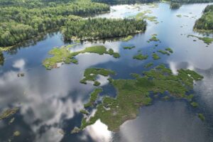
The 49th parallel forms a major part of Canada’s southern border with the United States. Test your geography smarts with our ultimate quiz!
Most international borders adhere to some sort of logic. They follow coastlines or rivers, watersheds or natural barriers. They make sense. Not so the 49th parallel north.
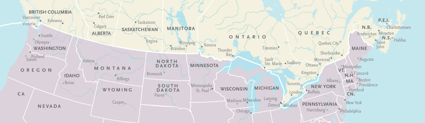
The border from the Lake of the Woods to the Rockies was set in October 1818, and was later extended all the way to the Pacific Coast. A Procrustean solution that causes more problems than it solves, it plays havoc with water reservoirs and mountain routes along the way, which more naturally fall north and south. The border should zigzag wildly up and down like an erratic EKG. Instead, it draws its razor-like line stubbornly to the sea. It defies common sense, slicing off a fingertip of land in British Columbia: Point Roberts, Wash., U.S. territory that can only be accessed via Canada.
It disregards older political boundaries as well: those of the First Nations that had their own trade routes, their own cultural and territorial contours in place long before any surveyors showed up. Indeed, not a single Indigenous culture group is wholly contained within Canada’s borders.
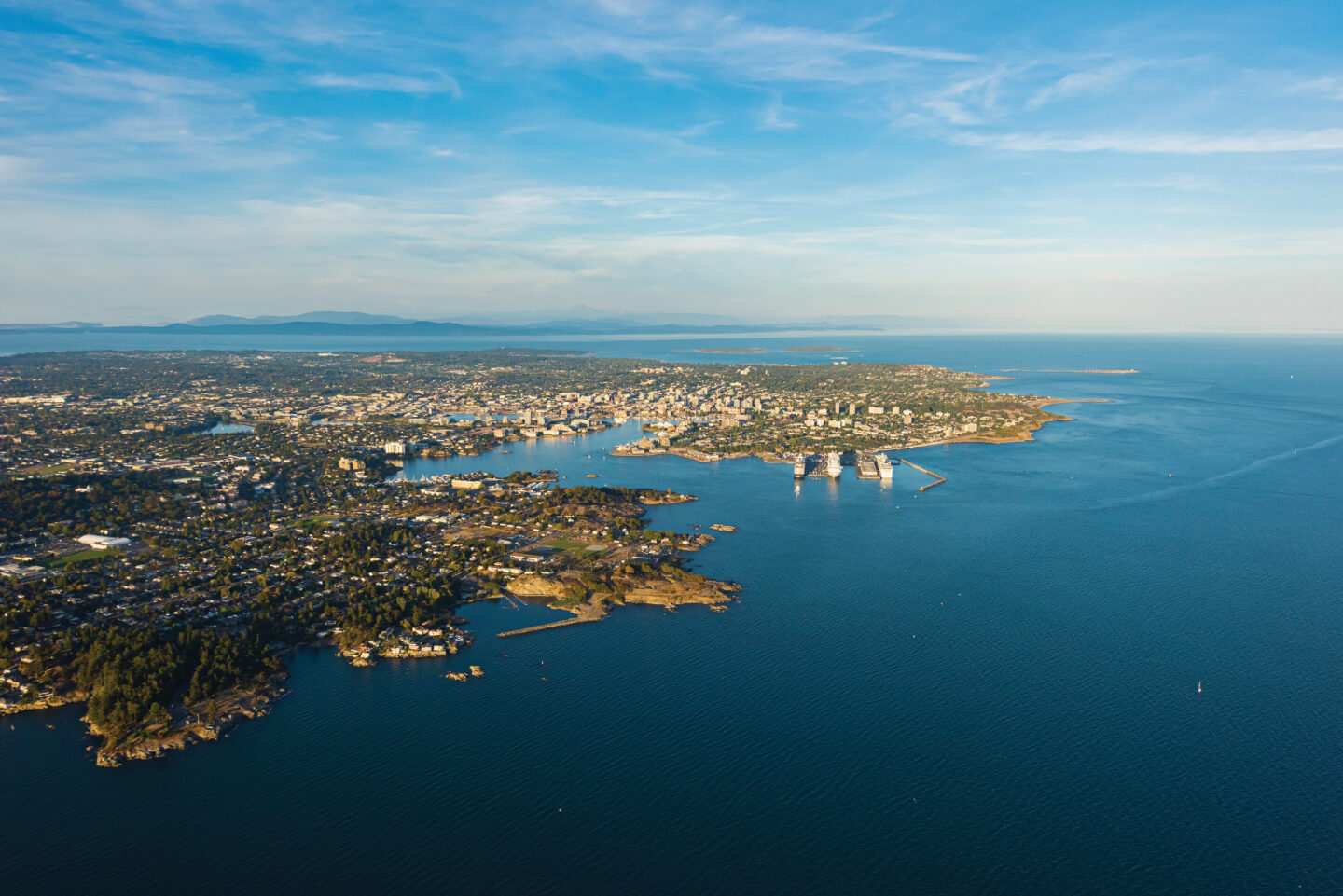
The 49th parallel has since become synonymous with Canada’s border as a whole, as a shorthand for that larger political divide between the Manifest Destiny to the south and the muddled patchwork to the north. Between melting pot and mosaic, as it were. But for the majority of Canadians, the 49th parallel is a northern border. Most of our population lives well below it, would have to drive north to reach it. Only three provincial capitals sit above it. (Victoria dangles below at the southern tip of Vancouver Island by design, not accident. It was a pre-emptive claim by the Hudson’s Bay Company, aimed at blocking the Americans from extending the line across the lower half of Vancouver Island. Fort Victoria helped pin down the western end of our border.)
The Canada-U.S. border is often heralded as the longest undefended land border in the world. Perhaps. But not uncontested. Our border was born of threats and counter-threats, of sabre-rattling brinkmanship and political chess moves. And any border, even an arbitrary one, shapes us. We grow into our borders, whether we like it or not.
I first reached the 49th parallel as a teenager, during a road trip with my father through Saskatchewan, south of Estevan. We came to a large emptiness marked by competing flags: Canadian on one side, American on the other. With the confidence that comes with youth, I declared that I didn’t believe in borders. They “weren’t real.” My dad nodded, then gestured to the open landscape. “Well, if you think it’s imaginary, try walking across that field, see what happens.”
I never took him up on his offer, because I knew that no matter how much I wanted to deny it, borders are real. They matter. So here’s to over 200 years of defying geography, topography, common sense and Manifest Destiny. Here’s to the 49th parallel.
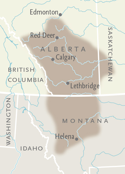
1. Three sections of this large Canadian park border the 49th parallel.
a) E.C. Manning Provincial Park, B.C.
b) Waterton Lakes National Park, Alta.
c) Cypress Hills Interprovincial Park, Sask.-Alta.
d) Grasslands National Park, Sask.
2. How long is the section of the Canada-U.S. border that follows the 49th parallel today?
a) 1,050 kilometres
b) 2,050 kilometres
c) 3,050 kilometres
d) 5,050 kilometres
3. Which province shares a longer stretch of the 49th parallel with the United States? It’s close!
a) British Columbia
b) Saskatchewan
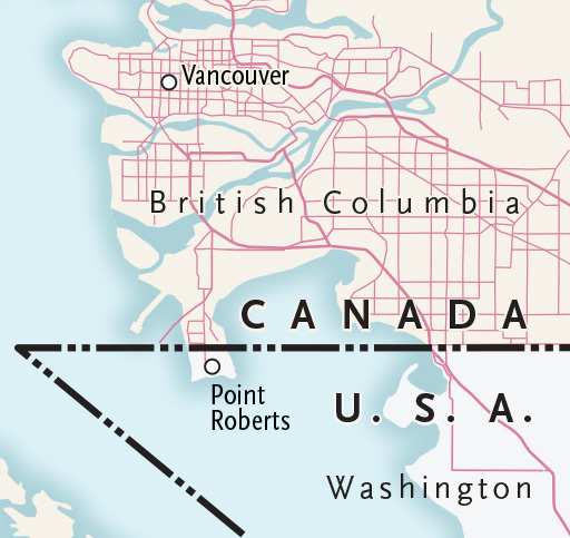
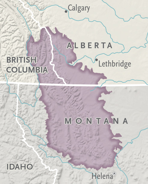
4. Point Roberts, Wash., is separated from the mainland United States by the 49th parallel, the southern tip of a peninsula just south of Tsawwassen, B.C. What is the geographical term for this kind of unattached land mass (see map, left)?
a) Enclave
b) Nodal region
c) Exclave
d) Salient
5. TRUE OR FALSE
From the Strait of Georgia, B.C., to Lake of the Woods, Man., the Canada-U.S. border lies exactly along the 49th parallel.
6. The International Boundary Commission maintains more than 8,000 monuments along the entire Canada-U.S. border. How many of these appear on the 49th parallel?
a) 212
b) 912
c) 2,112
d) 4,012
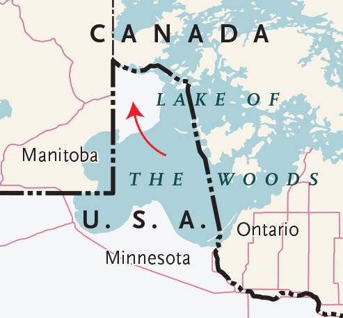
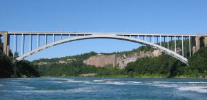
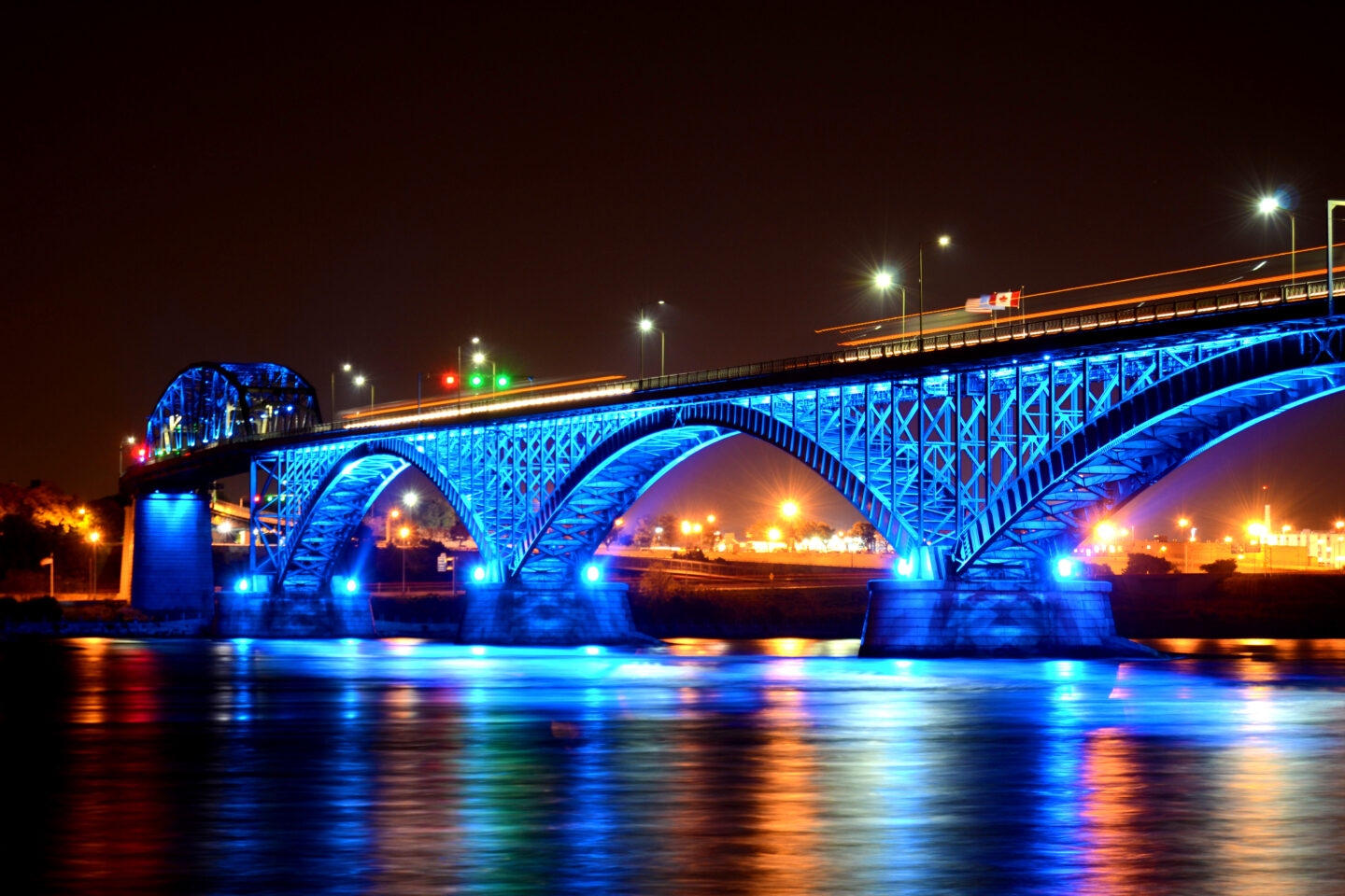
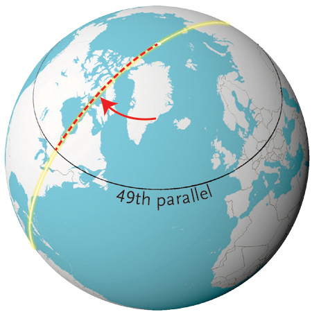
7. The small piece of Minnesota shown in the map to the right (the result of a cartographic error) is the only piece of the lower 48 states that lies north of the 49th parallel. What is its name?
a) The Northwest Angle
b) The Minnesota Wedge
c) The Kenora Corner
d) The Northern Slice
8. TRUE OR FALSE
The Canada-U.S. stretch of the 49th parallel is the world’s longest “straight” international border.
9. How many provinces lie entirely south of the 49th parallel?
10. This is the width of the “border vista,” the clearcut strip of land kept free of trees and brush along the entire international boundary.
a) 2 metres
b) 6 metres
c) 60 metres
d) 200 metres
11. This is North Dakota’s official state nickname, which refers to a large commemorative garden that straddles its border with Manitoba.
a) Unity Garden State
b) Botanical Brotherhood State
c) Peace Garden State
d) Peaceful by Nature State
12. Set in 1818, the border along the 49th parallel did not initially extend all the way to the Strait of Georgia and the Pacific Ocean. Where did it end?
a) The Manitoba-Saskatchewan border
b) The Saskatchewan-Alberta border
c) Midway, B.C.
d) The summit of the Rocky Mountains
13. The border divided the homelands of several First Nations, transforming tribal and family relationships, ancient hunting routes and more. Whose traditional territory is shown on the map at left?
a) Iroquois
b) Ojibwa
c) Blackfoot
d) Dakota
14. In 1844, soon-to-be president of the United States JamesPolk campaigned on taking over all of Oregon Country, a huge territory jointly occupied by Britain and America that stretched all the way to Alaska’s southern border. What was his still-famous campaign slogan?
a) To Alaska and beyond!
b) Fifty-four forty or fight!
c) Forty-nine is not enough!
d) Sixty or here come the Yanks!
15. This person was prime minister of Canada when the 49th parallel was first set as the Canada-U.S. border.
a) Sir John Abbott
b) Sir John A. Macdonald
c) Alexander Mackenzie
d) There was no Canadian prime minister
16. This popular American belief in the God-given right to expand across the continent gave Britain reason to settle on a firm border in a hurry.
a) The American Dream
b) Manifest Destiny
c) New Imperialism
d) America’s Burden
17. TRUE OR FALSE
The United States and Britain originally planned to divide their territories along the route of the main east-west pioneer trail.
18. TRUE OR FALSE
The 49th parallel was nicknamed “the Medicine Line” because of the superior British medical care available in communities north of the border.
19. Which country gained more land in 1818 by agreeing to a straight boundary?
a) United States
b) Britain
20. TRUE OR FALSE
Hudson’s Bay Company was the first group to make a reference to the 49th parallel as a boundary.
21. TRUE OR FALSE
Mongolia, through which more than 2,000 kilometres of the 49th parallel passes, is the world’s least-densely populated country.
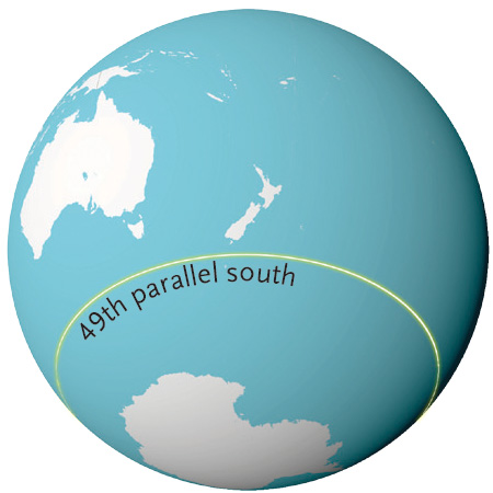
22. TRUE OR FALSE
The 49th parallel south does not pass over any land mass as it crosses the Pacific, Indian and Atlantic oceans.
23. The 49th parallel crosses through this many countries.
a) 12
b) 18
c) 31
d) 49
24. In the Czech Republic, Slovakia and Ukraine, the 49th crosses this major European mountain range.
a) Eastern Alps
b) Caucasus Mountains
c) Scandinavian Mountains
d) Carpathian Mountains
25. The 49th crosses the Pacific Ocean without bisecting a single island except for Vancouver Island, on its east side, and Russia’s Sakhalin, on its west. Which island is bigger by area?
a) Vancouver Island
b) Sakhalin
26. What is the distance of the 49th parallel from the North Pole? (Hint: The north-south circumference of the Earth is 39,931 kilometres.)
a) 2,572 kilometres
b) 4,572 kilometres
c) 6,572 kilometres
d) 8,572 kilometres
27. TRUE OR FALSE
About one eighth of Earth’s surface lies north of the 49th parallel.
28. This country has the longest share of the 49th parallel after Canada.
a) Mongolia
b) Kazakhstan
c) Ukraine
d) United States
29. Stand on the Canada-U.S. border between Alberta and Saskatchewan, and this country is on the 49th parallel on the exact opposite side of the Earth.
a) China
b) Mongolia
c) Kazakhstan
d) Ukraine
30. Is Paris south or north of 49?
a) South
b) North
31. TRUE OR FALSE
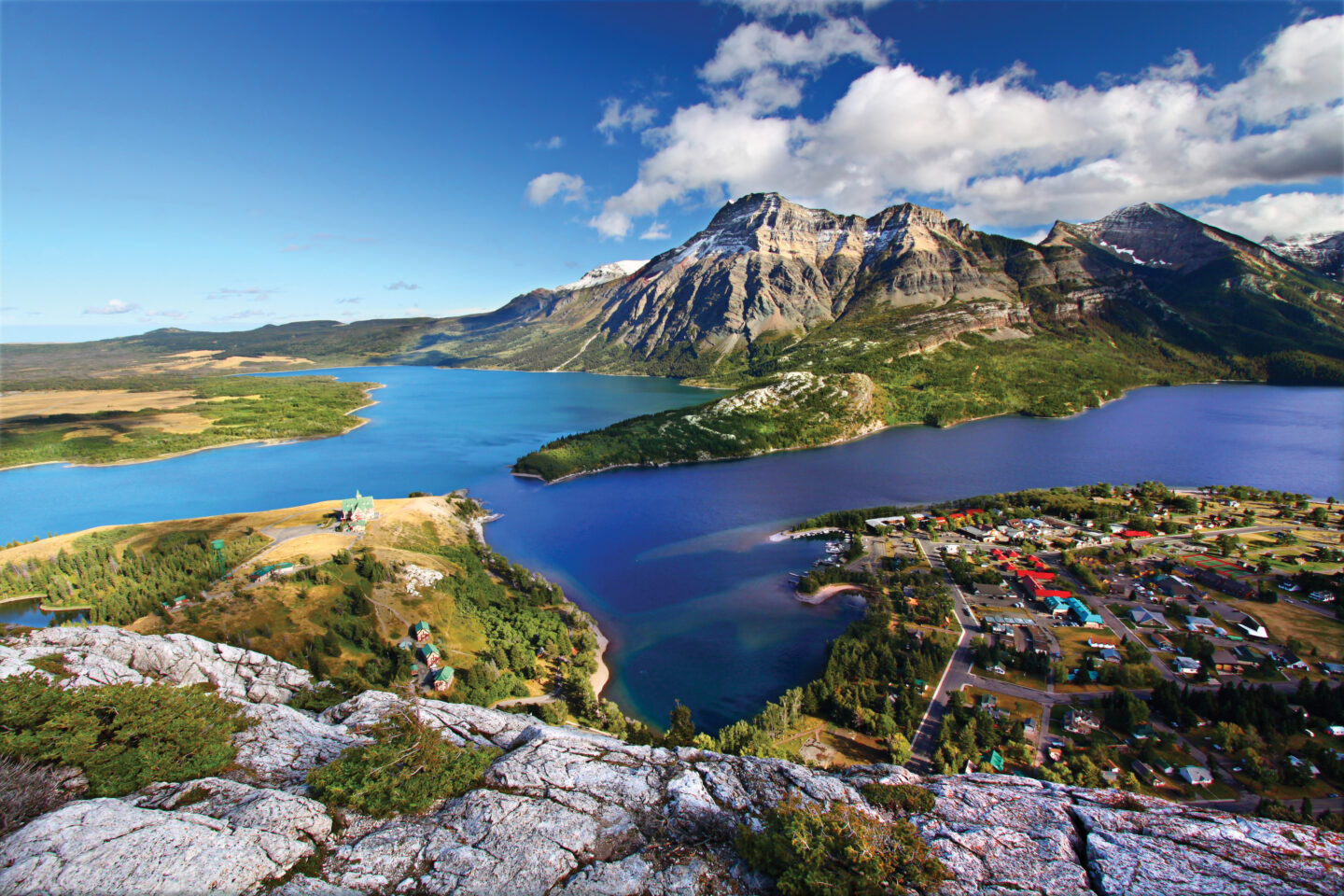
In 1932, Waterton Lakes National Park, Alta., and Glacier National Park, Mont., were joined across the 49th to create what was then the world’s largest park.
32. Only two provinces share border crossings with four U.S. states each. Which ones?
a) British Columbia and Ontario
b) Alberta and Ontario
c) British Columbia and Quebec
d) Ontario and Quebec
33. TRUE OR FALSE
There are no tunnel or bridge border crossings to the United States between British Columbia and Manitoba.
34. Close to this many Canadians currently live in the United States.
a) 100,000
b) 500,000
c) 800,000
d) 3 million
35. This became a requirement for Canadians entering the United States in 2009.
a) Declaring all purchases in excess of $200
b) Presenting a driver’s licence or other standard government-issued identification card
c) Submitting to routine vehicle searches
d) Presenting a valid passport or a Nexus card
36. How many times does Canada’s southern border with the U.S. cross north of the 49th parallel?
a) Zero times
b) Once
c) Three times
d) Four times
37. About 1.5 million people cross into Canada from Washington state each year. What state is Canada’s next biggest source of visitors along the 49th parallel?
a) Minnesota
b) North Dakota
c) Montana
d) Idaho
38. Rank these border states in order of most to least visited annually by Canadians.
a) Washington
b) Maine
c) North Dakota
d) New York
39. The Ambassador Bridge, connecting Windsor, Ont., and Detroit, Mich., is the Canada-U.S. border’s:
a) highest crossing
b) busiest crossing
c) slowest crossing
d) tightest security crossing
40. This massive, border-crossing ecosystem is critical habitat for a high concentration of large carnivores and numerous other endangered species.
a) Rocky Mountain Stronghold
b) Corridor of the Sun
c) Mountain Heart
d) Crown of the Continent
41. What issue most recently stirred up the centuries-old Canada-U.S. dispute over tiny Machias Seal Island, in the Gulf of Maine?
a) Illegal immigration
b) The island’s strategic position
c) Seabird protection
d) Lobster fishing
42. This is the line of latitude that marks the border between southern Quebec and New York and Vermont.
a) 48th parallel
b) 45th parallel
c) 40th parallel
d) 32nd parallel
43. What per cent of Canadians live within 160 kilometres (100 miles) of the U.S. border?
a) 50
b) 60
c) 75
d) 90
44. Canada has a total of 119 border crossings with the U.S. Which province has the most?
a) Quebec
b) Ontario
c) Manitoba
d) British Columbia
45. How did Canada end up owning all of Vancouver Island, about 7,500 square kilometres of which lies south of the 49th parallel?
a) Fort Victoria (now the provincial capital) was established before the 49th parallel was stretched to the Pacific
b) Islands are traditionally not cut in two when determining international boundaries
c) Inaccurate maps of the day showed all of Vancouver Island lying north of 49
d) a and b
46. Crews clear the southern “border vista” of trees and brush every five or six years, while Canada’s northern border with Alaska is cleared every 15 years. Why?
a) The North is considered less of a liability to national security
b) Its remoteness makes it much more difficult to access
c) Shorter growing season
d) a and b
47. This part of the Canada-U.S. border was settled in 1903 after a rush of development in the region a few years before.
a) The Yukon-Alaska border
b) The Alaska Panhandle
c) Southern Vancouver Island and the San Juan Islands
d) The New Brunswick-Maine border, including Grand Manan Island
48. TRUE OR FALSE
Many of Canada’s interprovincial/territorial borders are drawn along major lines of latitude and longitude.
49. How many U.S. states does Canada border by land and water?
a) 8
b) 10
c) 13
d) 16

This story is from the September/October 2018 Issue
Travel
The 49th parallel has spent more than 200 years as a major part of Canada’s border

Mapping
New map-based quiz tests your ability to list countries by name
People & Culture
PBS interview program Canada Files has spent six years asking notable Canadians that question. This is what they had to say.
People & Culture
Grounded in Indigenous methodologies, Manomin examines our interconnectedness with the natural world