Environment
Why we need to totally rethink plastic waste
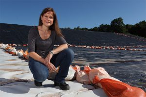
Myra Hird, a sociology professor at the School of Environmental Studies at Queen’s University in Kingston, Ont., discusses why recycling isn’t a perfect solution
- 1268 words
- 6 minutes
Travel

As a nation, Canada has always been a faintly preposterous idea. It stretches across six time zones. It touches three of the world’s five oceans. All of the European Union’s 27 countries would fit into our 8.97 million square kilometres twice over, with room to spare.
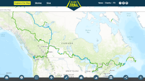
Perhaps that’s why we’ve always been a bit obsessed with finding ways to knit together this far-flung landscape. In 1992, Trans Canada Trail was founded with a vision to create a recreational trail for all Canadians to explore and learn about Canada — on foot and on horseback, by bike, ski, snowshoe and canoe. The founders’ vision was to link up existing trail networks across the country to create one continuous trail.
It wasn’t easy, but on August 26, 2017, the Trans Canada Trail celebrated its connection goal of over 24,000 kilometres of routes from coast to coast to coast. In 2022, Trans Canada Trail marks its 30th anniversary.
However, just as the Last Spike was only one milestone in the history of the Canadian Pacific Railway, the full connection of the Trail doesn’t mean the project is finished. “Now that the Trail has achieved this important and historic connection and achievement, how do we build on that?” says Eleanor McMahon, President and CEO of Trans Canada Trail.
The question is a bit rhetorical, as Trans Canada Trail has already developed a six-point strategy for the Trail’s future, based on extensive consultations. Its aims include improving trail signage and accessibility, recruiting and developing youth volunteers, fostering eco-tourism, and using digital technologies to help more people explore the Trail.
Some dedicated trail users envision a day when the Trans Canada Trail becomes a little like Europe’s famed Camino de Santiago, dotted with inns and rich with tradition.
“It would take a thousand years to get to what a Camino is, so that’s not necessarily the goal,” says hiker Simon Lanoix of Ottawa. Rather, he would like to see some sections of the Trail offer more amenities, which might entice novice hikers to explore.
Lanoix and his wife, Julie Chatelain, spend four to six months a year hiking, often traversing isolated areas and camping along the way. So far, they have completed the Trans Canada Trail in stages from St. John’s to the Ontario–Manitoba border. They hope to finish the entire route in 2024.
McMahon says plans are already afoot to classify the Trans Canada Trail’s sections into beginner, intermediate and advanced routes, and to compile and share information on trail amenities. She also hopes to bring more of the country’s history to the attention of trail users—in particular, by drawing on Trans Canada Trail’s partnerships with local trail groups and Indigenous communities. “The Trail embodies all of our history. It is the trading routes. It goes back centuries,” she notes.
History, amenities and fresh air attract many users to the Trail. However, many also mention a Trans Canada Trail benefit that might surprise those who think of hiking, cycling and paddling as relatively solitary pursuits.
“It is about connection,” says Dianne Whelan of Garden Bay, B.C. She traversed the entire Trail in stages between 2015 and 2021, on foot and by canoe — the first person to do so — and is now making a film and writing a book about the experience. She says she was initially trepidatious about travelling much of her route alone but soon dismissed those worries. “In the whole journey, I never met anything but human kindness.”
Chatelain agrees. “The friendliness in certain regions was overwhelming,” she says with a chuckle. As she and Lanoix hiked through the Maritimes in pre-pandemic times, residents constantly offered them water, meals, hot showers and glasses of wine. One man drove back to his house to bring them preserved lobster and clams.
Ensuring the Trail continues to appeal to as many people as possible—from urbanites looking for outdoor exercise to more hardcore adventurers who want to scramble up remote mountains—will likely always be a delicate dance for Trans Canada Trail. Avoiding the pitfalls of overtourism “was really a vibrant conversation before the pandemic overtook us,” says McMahon, who expects the discussion to continue into the future.
It will be fascinating to see what path the Trail follows in the years to come. After all, the world-famous Camino began as a humble local pilgrimage route. We may all be witnessing the birth of something that becomes a key part of Canada’s national identity, like the transcontinental railways. “I think it’s really important to start not being afraid to dream way past our lifetime,” says Whelan.
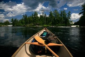
Dianne Whelan and her partner Louisa reached this small community above the Arctic Circle in October 2019, after a daunting 3,500-kilometre canoe trip from Alberta via the Peace River, the Slave River, Great Slave Lake, the Mackenzie River and the Arctic Ocean. They paddled among islands, through vast landscapes of muskeg and black spruce, and past towering mountains. While Whelan both hiked and canoed during her long quest to complete the Trail, she says the water routes were her favourites. “Camping is really beautiful, because you’re in remote sections,” she says. “The rivers take us places that the roads don’t.”


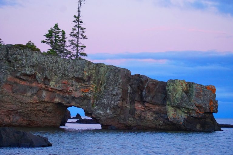
Both Whelan and Julie Chatelain mention the north shore of Lake Superior as a must-see part of the Trans Canada Trail. “The rocks, the blue water, the wind,” is how Chatelain succinctly summarizes the appeal of the shoreline trails.
Whelan paddled the Lake Superior Water Trail, which connects Sault Ste. Marie to Thunder Bay and is almost 1,000 kilometres long. “I actually didn’t see a human being for close to a month,” she recalls. “That was really an amazing personal experience.”
This area of the Trans Canada Trail will seem familiar to many art lovers, as the Group of Seven frequently painted there throughout the 1920s. Lawren Harris’s North Shore Lake Superior is one of the best known of the artworks they created.
“The Fundy Trail was phenomenal and we felt we were on the West Coast. It was so beautiful,” says Chatelain. Going east from Salmon River, trails of varying lengths and difficulties take hikers across gorges, beside a five-tier waterfall and along the edges of wind-blown cliffs overlooking the Bay of Fundy. The Fundy Trail is easy to reach for casual day hiking, as the western access gate is roughly 11 kilometres from the village of St. Martins.
Chatelain and Lanoix mention this remote spot in central Newfoundland, where four hills tower above a sweep of rocky tundra, as one of the highlights of their Trans Canada Trail travels.
On a ship, a topsail is a sail set above another sail on a mast. Given the province’s maritime history, it’s not surprising that Newfoundlanders would name these prominent hills Main Topsail, Mizzen Topsail, Gaff Topsail and Fore Topsail.
The Topsails are located in one of the most isolated sections of T’Railway Provincial Park. Far from any road, they’re only accessible on foot, by bike or by off-road vehicle. “It’s absolutely rugged,” says Lanoix of the area. He adds, with a tinge of regret, “Because it’s so difficult to get to, most people will not experience this.”
Gray Creek Pass is an 80-kilometre, summer-only route linking the small community of Gray Creek to the outskirts of the city of Kimberley in southeastern British Columbia. The pass is a dirt-and-gravel forestry road, used by hikers, mountain bikers and vehicles. The trail offers challenges for users—in the first 15 kilometres after Gray Creek alone, it climbs some 1,500 metres—but the rewards are great, including stunning views of Oliver Lake, Mount Loki and the Kokanee Glacier.
Many users travel the Trans Canada Trail on foot, by bike or by canoe, but it’s also possible to explore it on horseback. This wilderness area on the Alberta side of Cypress Hills Interprovincial Park features riding trails ranging from easy to challenging. The equestrian campground in the Battle Creek Valley has a paddock, pens and tie stalls. And at Fort Walsh National Historic Site, visitors can learn about the history of the North West Mounted Police and participate in an Indigenous Culture Camp.
The Chief Whitecap Waterway follows the South Saskatchewan River for over 100 kilometres from the Gardiner Dam to the edge of Saskatoon. Waterway users travelling its length may spot pelicans, deer, jackrabbits and coyotes as they paddle through the territory of the Whitecap Dakota First Nation, which partnered with Trans Canada Trail to develop this waterway along a traditional trading route.
Chief Whitecap, for whom the waterway is named, played a major role in the region’s 19th-century history. When John Lake arrived in the area in 1882, seeking a place to found a new temperance colony, Whitecap suggested the site of what is now Saskatoon.
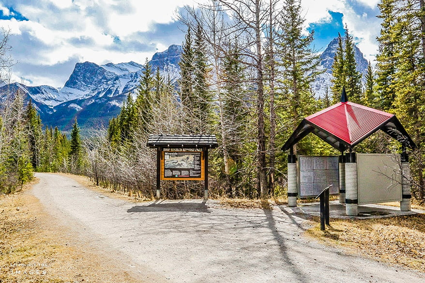
This urban trail leads hikers, cyclists, skiers and snowshoers 93 kilometres through Manitoba’s largest city. One small downtown section, easily done in a day, includes some of Winnipeg’s biggest attractions.

Now a National Historic Site, this small church was built in 1855 to serve a growing population of African-American refugees settling in St. Catharines. It replaced a series of smaller churches on the same site; the oldest, built in 1814, was one of the first Black churches in Ontario.
While the simple style is similar to that of other churches linked to the Underground Railroad, this chapel has a special history: Famed Underground Railroad conductor Harriet Tubman was a member of the congregation in the 1850s. Today, visitors can discover it while hiking the nearby Laura Secord Legacy Trail.
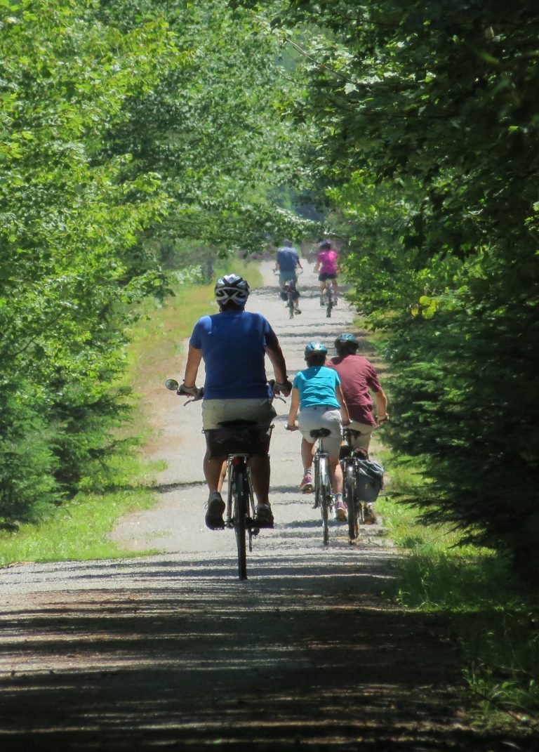
Not all trips on the Trans-Canada Trail need to be arduous. Le P’tit Train du Nord, a 234-kilometre rail-to-trail conversion that connects the northern suburbs of Montreal to Mont-Laurier in the upper Laurentians, is largely flat. It passes through numerous towns and villages, where cyclists can stop for a meal or bed down for the night. And those who want to travel light can send their luggage ahead on the Autobus Le Petit Train du Nord, which can also shuttle riders and bikes back to their cars at journey’s end.
Environment
Myra Hird, a sociology professor at the School of Environmental Studies at Queen’s University in Kingston, Ont., discusses why recycling isn’t a perfect solution

Travel
An ancient Mi’gmaq migration route that follows the Nepisiguit River’s winding route to the salt waters of Chaleur Bay, the Nepisiguit Mi’gmaq Trail is now one of the world’s best adventure trails
Travel
Inspired by age-old travelways, a new canoe route knits together the Trans Canada Trail
Mapping
As Canada's most famous trail celebrates its near completion, Esri Canada president Alex Miller discusses the ambitious trail map that is helping Canadians get outdoors