
Travel
Blue space: a 1,900-kilometre feat on paddleboard
Dan Rubinstein, an increasingly obsessed paddleboarder, embarks on a quest to become one with the water
- 2064 words
- 9 minutes
This article is over 5 years old and may contain outdated information.
Travel
Inspired by age-old travelways, a new canoe route knits together the Trans Canada Trail


It’s never just an ordinary day on the canoe trail, at least not for me. I’ve been paddling and portaging in northwestern Ontario for almost one month now, enough time for soft winter palms to blister and harden into thick paddling calluses. My body aches, always, somewhere; if it’s not joint pain, then it’s bug bites or sunburn. Today, however, is an easy traverse on Trousers Lake, in Ontario’s Quetico Provincial Park — 10 kilometres and two portages, mostly soft creek, beaver dams and less than a thousand metres to haul gear. I plan to not push off until after noon, waiting for a break in the nimbus sky that kept me in camp since sunrise.
The aches and pains remind me that I’m no longer in my thirties. I’ve been creating and mapping trails for 35 years, and I figure I’ve covered more than 60,000 kilometres by canoe. At least five percent of that distance has involved humping gear and canoe over rough or non-existent portage trails. This latest assignment is among the most challenging: creating a water-based route around the Superior lakehead to the Manitoba border, more than 900 kilometres in all, to be incorporated into the Trans Canada Trail system. There is a lot of paddling and portaging ahead of me.
As the day winds down on Trousers Lake, I find sanctuary on the lee of a large island, pull my canoe up on shore and lash it to a large Jack pine. If a storm hits, I’ll be somewhat protected; though, if I’m honest with myself, there’s really no safe place out here. With the humidity spawning a scourge of blackflies, I quickly pitch a tent back in the trees and build a campfire for a single-pot meal. Then I settle in with my journal and a dram of Scotch.
Sensing a storm coming, I rope up a secondary fly over my small tent and guy it tight and low to the ground — enough to deflect any summer squall. The loons are unusually quiet tonight. In the confines of the small pack tent, I rub talcum on my feet to prevent trench foot. I wear Bean Boots one size too small, snug so that I can easily navigate over rocky trails. Exhausted, I slip into my sleeping bag. I can feel the wood ticks crawling on my bare skin, and I spend the next 10 minutes plucking them off and tossing them outside the tent.
When the storm arrives, it hits with such a fury that both my tent and fly would have sailed off across the lake had I not wrapped some of the guy lines around my waist and grabbed hold of a nearby spruce shrub. Trees crash down around the campsite: the forest is in a state of chaos. Rain stings my face, while lightning creates a strobelike light show. I think of my wife and kids back home, safe in their beds, and wonder whether this is going to be it: Hap Wilson’s Final Adventure.
Like most summer storms, it departs as quickly as it arrived. But by sunrise, the consequences become clear. Large Jack pines are strewn over the three-kilometre portage that I now have to travel. My artificial knee, even one year after the replacement, still does not have the necessary flex, while the other knee has only a thread of cartilage. For the next five hours, I struggle to haul my canoe and gear over and under a maze of broken trees.
The next day, I am struck by lightning.
I had always assumed that the Trans Canada Trail, first dreamed up in 1992 to celebrate Canada’s 125th year of Confederation, was intended to be a land-based recreational path from coast to coast to coast.
That’s not quite the case, as I discovered in 2009 while attending the Ontario Trails Council annual meeting. Dan Andrews, former executive director of Trans Canada Trail Ontario, sought me out and asked whether I would be interested in mapping a water-based route in the northwest of the province. The stretch between Thunder Bay and the border between Ontario and Manitoba posed a quandary for Trans Canada Trail planners. As Andrews explained, building a land-based trail through these parts, accounting for myriad river and creek crossings, irregular-shaped lakes and large fens, would be costly — at least $6.5 million. Installing infrastructure, such as suspension bridges, boardwalks and puncheons, would triple this estimate.
A water-based route would be much less costly, and faster, to develop. It would have the added benefit of incorporating Canada’s first trails — the canoe and portage routes, the nastawgan, or aboriginal trails, that date back several thousand years — into the national trail system. But there would still be significant hurdles to navigate. Land-use issues plague the North Country. Environmentalists and First Nations vie to keep industrialists and developers transparent and accountable. In response, developers hold job security and local economies as playing cards in the quest for responsible land management. It’s enough to strangle a bull moose in rut.
Just coming up with a name for the quintessential Canadian canoe route took a year of discussions. Bill Mason, the Canadian conservationist, filmmaker and canoeing icon who died in 1988, spent his formative summers at Manitoba Pioneer Camp on Shoal Lake, at the western terminus of the proposed route. So it was fitting that our new route be named Path of the Paddle, borrowed, with the blessing of the Mason family, from Bill’s series of how-to books and films.

The Path of the Paddle Trans Canada Trail follows one of the best displays of Precambrian-era geological activity in Canada. Examples abound: the 2.7-billionyear- old massive cliff along the north shore of Saganaga Lake; the two-billion-year-old microfossils along Gunflint and North lakes; the height of land of the continental divide that separates the Hudson Bay and Great Lakes watersheds.
Social history is no less impressive. The trail has been used for almost 10,000 years by Paleo-Indian, Archaic, Laurel and late Woodland cultures and their Ojibwa and Cree descendants. It was also used, to a lesser degree, by the Sioux, Blackfoot, Bear and Slave peoples. Archaeological surveys along the route have uncovered more than 200 pictograph sites, dolmen stones (used at grave and ceremonial sites), way markers and pottery shards.
In an effort to break up the trail into manageable pieces, the Path of the Paddle is divided into five sections (some of the trails have yet to be finalized). The Anishnabe Trail starts at Falcon Lake, Manitoba, passes through Shoal Lake No. 40 First Nation Reserve at the Manitoba border and continues east to Kenora. Part of the route near Shoal Lake follows the meandering Falcon River, once used by fur traders as an alternate route to Lake Winnipeg to avoid the strong current on the Winnipeg River.
The Eagle-Dogtooth Trail — at 251 kilometres, the longest portion of the Trans Canada corridor — connects the towns of Kenora and Dryden. Passing through two provincial parks, it boasts some of the most scenic stretches of the Path of the Paddle. Not that you would be able to linger: the trail features several “green zones” established by the Ontario Ministry of Natural Resources (MNR) that disallow non-residents camping privileges over much of the route. (Trans Canada Trail Ontario is negotiating with MNR for a solution to this restriction.)
The Maukinak Trail runs southeast from Dryden to Atikokan, the canoe capital of Canada. Quetico Trail takes a less travelled easterly trek through Quetico Provincial Park as far as Northern Light Lake. Finally, the easternmost section, the Omimi Trail, touches the international boundary along the historic Boundary Waters canoe route on its way to Lake Superior.
For those who can persevere, this is a challenging slice of Canadiana.
I lie there on the warm rock, eyes closed to the hot July sun, stripped naked as a jaybird, sucking in the piney air and thinking, It’s not so bad. The canoe is tied up and bobs offshore, waiting patiently like a sled dog eager to get back to work.
I am still a little shaky after being hit by lightning the day before — it knocked me about one metre into the air and I couldn’t hear anything for at least five minutes — and it is hard getting into the usual easy rhythm of pathfinding. I know full well that I could be lying on the shore of Saganagons Lake, fried like a piece of bacon, had I been a few metres one way or the other. But that’s the immutable truth about wilderness travel — the more time you spend out here, the greater the chance of being struck by lightning.
I am no expert in any field and remain a student of nature. I can find ancient trails and locate the best routes, read rapids and gauge water levels. But I acquiesce to the vagaries and conditions of the wilderness as my teacher. There are obvious and often perilous gaffes in the national topographic charts and seriously outdated canoeing information in this country, or no information at all.
But after working on this project for a year and a half, I am starting to know these trails like the back of my callused hands. Some sections of the water trail are much more difficult than others. This is not intended to be an easy paddle for the casual cottager. There are long, arduous portages, violent whitewater rapids, windswept lakes and seemingly endless swamps to contend with. The Anishnabe Trail along the Falcon River, crossing the Manitoba border into Ontario, can be easily kayaked in four days, with only one 10-metre portage. In contrast, the Omimi Trail along the border with the United States, the route used by the voyageurs, is choked with more than 15 kilometres of portages. It also happens to be the most aesthetically spectacular stretch of all.
Of course, there is always a price to pay for the privilege of experiencing wilderness in its raw form. That point was driven home once when I was looking for an alternate Canadian take-out point that eliminates the gruelling 14-kilometre Grand Portage. I had to use my mountain bike because my four-by-four truck was stuck in the clay mud on a logging road paralleling the Pigeon River. After some time pedalling, I came upon a rather large black bear some 50 metres away, the third bear I had seen along this bush track. The other two hadn’t minded my presence; this one, however, charged me with its head lowered. I hurriedly got off the bike, picked it up and waved it madly in the air, throwing out some choice expletives for good measure. It did the trick.
In the end, that excursion to create a new trail involved a 28-kilometre round-trip bike trek in 30ºC heat and a two-hour flagging mission. The frenzied vehicle extrication from life-sucking mud amid a cloud of blackflies prompted a much-needed bug- and bear-free dinner in Thunder Bay. The day ended with a $300 parking ticket.
In canoe or on foot or bicycle, I figure I have another three months of fieldwork left (target completion is October 2012): researching some stretches to gauge river dynamics during low and high water, calculating Global Positioning System coordinates for campsites and portage trails, scouting alternate routes and networking with local outfitters. Usually, it’s solitary work. Having to continually deviate, stop to pace portage trails, map rapids, climb ridges and zigzag down lakes looking for campsite locations would drive most companions crazy. Once this work is done, I will spend several months more drawing and illustrating maps of each trail by hand.
Although there is still work ahead, I can already say that the decision by the Trans Canada Trail planners to opt for a water route over the lakehead was inspired. There are traces of Canada’s past everywhere along the Path of the Paddle. Pictographs contain the teachings of shaman artists. Stone circles speak to gatherings long ago. These ancient water trails can lead today’s paddlers not only to an understanding of our shared history but also to a realization of what these waterways can mean for our shared future.

Q&A: How to build a concrete canoe
Why in the world would you want a canoe made of concrete? Ask the engineers.
Travel
Dan Rubinstein, an increasingly obsessed paddleboarder, embarks on a quest to become one with the water
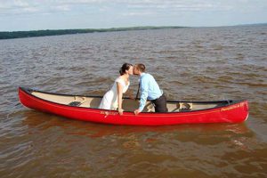
History
Canadian Canoe Museum explores the link between paddling and romance

People & Culture
March 30 is the launch date! The Montreal-born investor and philanthropist will complete a 10-day mission that combines bucket-list trip with research and environmental agenda

Exploration
David McGuffin shares insights from his daily log during his summer 2018 expedition retracing a legendary trek on the Yukon’s Peel River