This article is over 5 years old and may contain outdated information.

Environment

Clean commute

Canada's largest cities are paving the way for more eco-conscious commuting choices
  • May 31, 2012
  • 3,352 words
  • 14 minutes
Montréal is taking great strides to reinforce its image as the “most bike-friendly” city in North America Expand Image
Advertisement
Expand Image
The Bloor-Dundas intersection in west Toronto is a prime example of a hub where many modes of transportation, including streetcars, can function together. (Map: Chris Brackley/Canadian Geographic)

There’s no use denying it: North Americans are addicted to cars. We’ll curse through morning traffic jams and hop right back into rush hour for the slow drive home. We’ll even sit in the drivethrough and wait for our morning coffee.

The transportation network that stocks our supermarkets with Costa Rican bananas and Chinese garlic is the same system that instigated a post-Second World War building boom, setting the stage for urban sprawl and suburban big-box stores. It’s what makes us so dependent on cars for almost everything we do. But cheap and abundant fuel will run out eventually. And like crash-test dummies, we’re accelerating as we approach the wall: global demand is surging as world production sags, causing prices at the pump to skyrocket.

Our reliance on automobiles also dredges up a plethora of related issues, from air pollution and greenhouse-gas emissions to inactivity and obesity. As demographics continue to skew toward an aging population, how will North Americans get around in isolated suburban enclaves without access to a car?

If that doesn’t worry you, consider the bottom line: road congestion is leading to reduced economic output and accompanying job loss. To commuters, gridlock may be frustrating, but its cost is projected to balloon to $7.8 billion a year by 2031 in the Greater Toronto Area (GTA), Canada’s most populous urban centre. With nearly half of Canadians living in the six largest urban regions — the GTA, Montréal, Vancouver, Ottawa-Gatineau, Calgary and Edmonton — this toll will be felt directly by a huge number of Canadians, let alone the indirect effects on rural Canadians from an economy stuck in traffic.

“We’re destroying the environment, and we’re destroying our health,” says transportation researcher Eric Miller, director of the University of Toronto’s Cities Centre. But pointing out the problem, he says, won’t lead to positive change. People will stop listening if all they hear about is the “dystopia of the do-nothing approach. You have to say, ‘Ah, but there is a better way.’”

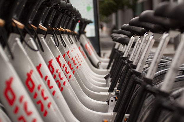
Canadian cities, thankfully, are exploring that “better way” on many fronts, from bike lanes and greenways to wind-powered electric trains. Whether it’s to save gas money or to save the planet, it doesn’t really matter. Sustainable transportation is the only alternative.

Idea: Toronto’s mobility hubs

Standing near the corner of Bloor and Dundas streets on Toronto’s west side, you can’t help noticing several different getaway strategies. As the subway rumbles beneath your feet, an above-ground streetcar screeches into the transit station. There, passengers can transfer to either the subway or city buses that head northwest through the Junction, a historic neighbourhood that runs parallel to the train tracks which once carried products from the city’s famous meat-packing plants — the origin of the “Hogtown” nickname. From this intersection, you can also cycle beside the tracks on the West Toronto Railpath or even catch a regional GO Transit bus all the way to surrounding cities such as Guelph and Kitchener. It’s no wonder this spot is a testing ground for the city’s “mobility hubs” concept, an effort to enhance critical transit stations in this highly integrated and multi-modal regional transportation network.

With a population that’s projected to grow from nearly six million people to almost nine million by 2031, the Greater Toronto and Hamilton Area (GTHA) requires the full slate of transportation modes to move people around efficiently, from regional buses and suburban bike lanes to Toronto’s downtown subway and streetcar system. It’s a fact that Toronto Mayor Rob Ford learned the hard way earlier this year when City Council rebuffed his call for “subways or bust.”

The challenge is to integrate all the different ways of getting around so that they work together efficiently. “You have to think about it as a network,” says U of T’s Eric Miller. “Transit is not a door-to-door service. You have to think about the whole chain in order to get that coverage and connectivity. It’s not going to be done just with buses or just with subways.”

Formerly known as the Greater Toronto Transportation Authority, Metrolinx is the Ontario government agency tasked with creating an efficient and fully integrated transportation network for the GTHA. In The Big Move, an ambitious transportation plan released in 2008, Metrolinx vows to drastically cut car use by 2031. Its goal is to ensure that more than 30 percent of all work commutes will be taken by transit and 20 percent by walking or cycling.

The Big Move identifies 51 mobility hubs in the region, each selected for its strategic location, and suggests ways to make these key transit points function as seamlessly as possible. In its assessment of the Dundas-Bloor hub, for example, Metrolinx recommends the construction of convenient weather-protected access to all transit platforms at the intersection, from subway, streetcars and buses to the GO Transit station. The agency also suggests ways to promote active transportation at the station, such as adding facilities for storing bicycles and making nearby streets both safe and attractive to encourage walking and cycling.

Mobility hubs demand coordinated planning that goes beyond specific forms of transportation, which is why Metrolinx works directly with municipalities to help concentrate development in these areas, increasing population density and ensuring they are vibrant centres where people live, work and play. By taking all factors into account — from efficient transit coordination to land use and social interactions in surrounding neighbourhoods — mobility hubs are a blueprint for sustainable transportation in large cities.

Status Metrolinx is actively engaged in the planning of 10 key mobility hubs throughout the GTHA, including busy Toronto intersections and strategic, outlying regional centres such as Brampton, Markham and Oakville. For the latter, a public workshop was held in early 2012, outlining detailed plans for the mobility hub in Midtown Oakville. Over the next 25 years, Oakville plans to improve transportation linkages around the area’s GO station, including enhanced pedestrian and bicycle routes and new dedicated bus lanes to decrease car use in the area. If Toronto and other key regional transit hubs in the GTHA carry out similar enhancement plans, this could be the most important step toward creating an efficient and sustainable transportation system.

Expand Image
A train station for Calgary’s CTrain. Roughly half of Calgary’s downtown workers take transit to work. (photo: dan_prat/istockphoto)

Idea: Vancouver’s greenways network

Expand Image
Advertisement
Vancouver’s extensive network boasts 85 kilometres of greenways and will eventually total 140 kilometres, ensuring that people anywhere in the city are no more than a 25-minute walk or a 10-minute bike ride from a greenway. (Map: Chris Brackley/Canadian Geographic)

If you walk or bike along the famous Stanley Park Seawall, a popular stretch on Vancouver’s 20-kilometre Seaside Route, you’ll understand why greenways are becoming the city’s claim to fame. Offering easy public access to city parks, nature reserves, cultural and historic features as well as busy downtown neighbourhoods and retail hot spots, greenways keep Vancouverites (and legions of tourists) in touch with the city’s stunning natural surroundings. They can range from rustic park trails to dedicated bike lanes on city streets, but they share one characteristic: a focus on “active” forms of transportation, such as walking or cycling. Vancouver’s extensive network boasts 85 kilometres of greenways and will eventually total 140 kilometres, ensuring that people anywhere in the city are no more than a 25-minute walk or a 10-minute bike ride from a greenway.

Although the plans had been on the table for many years, they received a huge boost in 2009, when Mayor Gregor Robertson announced intentions to make Vancouver the world’s greenest urban centre by 2020. Among the many initiatives laid out in Vancouver 2020: A Bright Green Future, the city’s action plan for attaining that audacious ambition, is a commitment to non-car forms of transportation — a target of more than 50 percent of all future trips in the city by foot, bicycle or public transit.

The key to achieving that goal, says Dale Bracewell, Vancouver’s manager of active transportation, is to make greenways safe, convenient, accessible and functional. “We’re building these for all people, for all age groups and abilities,” he says. That means engaging everyone along the route during the public consultation process, from school groups to seniors, to ensure that greenways are designed for everyone’s benefit.

For Vancouver’s upcoming Comox-Helmcken Greenway project, to be built later this year if approved, the city is working with the Centre for Hip Health and Mobility — a research team that strives to enhance seniors’ physical wellbeing through active lifestyles — to find out how the project will influence older adults living in the area. In surveys conducted throughout the neighbourhood’s community centres and other meeting spots, the older adults approached were unanimous in requesting more park benches, and many wanted community gardens and public artwork on display — anything to brighten up their stroll. The research team will conduct a second survey after the greenway is complete to learn how the changes are affecting people in the area in terms of increased activity and also in less tangible ways, such as perceptions of the neighbourhood and quality of life.

Status The Comox-Helmcken Greenway is the third and final phase of construction for the Central Valley Greenway, a 25-kilometre stretch that links downtown Vancouver with the surrounding communities of New Westminster and Burnaby. The new section will be a short but key artery, cutting right through downtown and connecting Stanley Park to False Creek, on the southern edge of the city’s commercial district. The Central Valley Greenway serves as a strategic travel route, linking neighbourhood centres with multiple transit stations and bus routes and connecting with other greenways and bike routes throughout the region.

Although not many urban centres can match Vancouver’s natural spaces, other Canadian cities are starting to latch on to the greenway concept. Toronto, for instance, is currently improving bike trails in the Don Valley watershed, creating a network in the heart of the city’s ravine system with strategic connections to roads heading into the downtown core.

Idea: LRTs in Calgary, Ottawa, Kitchener-Waterloo and Hamilton

Calgary’s light-rail transit (LRT) system is one of the continent’s busiest, carrying more than 270,000 passengers every weekday. But the CTrain is known for an even more impressive fact: it’s the first and only LRT in North America to run on 100 percent renewable energy.

Expand Image
The CTrain carries 600 people per trip. Without the CTrain system, downtown Calgary would see an additional 74,000 vehicles every day. (Map: Chris Brackley/Canadian Geographic)

Powered by 60 turbines from TransAlta’s Castle River wind farm near Pincher Creek, in southern Alberta, the CTrain’s aptly named “Ride the Wind” initiative has eliminated more than 325,000 tonnes of CO² emissions since the program began in 2001. “That’s like decreasing the number of private vehicle trips on Calgary’s streets by more than eight million every year,” says Theresa Schroder, Calgary Transit’s communications strategist.

LRTs are best suited for busy urban thoroughfares that are too densely populated for city buses but perhaps not quite busy enough for the huge expense of a subway system. Calgary fits the bill perfectly. Even though the city is spread out and was originally built for the car, explains Schroder, roughly half the downtown workers now take transit to work. If they all decided to drive, she says, it would be traffic chaos — an extra 74,000 vehicles in the downtown core every day. Trains alleviate these bottlenecks effectively because they can carry a large number of passengers — the CTrain carries 600 people per trip — and unlike buses and city streetcars, they are separated from other traffic and not slowed down by it.

LRTs are not just about sustainability and convenient transit options. They also satisfy the bottom line. As part of its consideration for an LRT in Hamilton, Metrolinx reviewed the experiences of several cities around the world. The agency’s 2010 study found that property values can be as much as six percent higher for vacant residential land close to LRT stations and 14 percent higher for vacant commercial properties. Reliable and fast transit encourages businesses to expand in the downtown core, and the LRT stations act as hubs for future growth and development.

Status With Calgary setting an example, other Canadian cities are looking to build LRT systems to unclog busy arteries the sustainable way. In June 2011, Waterloo Regional Council approved a light-rail link between Kitchener, Waterloo and Cambridge, three closely linked cities southwest of Toronto that are connected by a very congested main road. Urban planners hope that a light-rail line, scheduled to be completed by 2017, will transform the Waterloo region by controlling urban sprawl and supporting downtown revitalization.

For Ottawa City Council, which recently approved plans for an LRT tunnel through the city’s downtown (construction begins in early 2013), the benefits will not be confined just to easing congestion. By limiting car usage, an LRT will reclaim densely packed downtown spaces for pedestrians and cyclists and promote healthier lifestyles. To take advantage of that scenario, Ottawa is planning to invest in artwork gleaned from nearby communities for permanent display in transit stations. It’s just part of a larger effort by the capital, described as “arguably the largest and most important public project in its history,” to ensure that the city’s downtown transforms alongside its transit system.

Idea: Montréal — bike city

Expand Image
In addition to its network of bike paths accessible year-round, Montréal plans to double its 400-kilometre network of bike lanes within seven years and to create five times the number of bicycle parking spots. (Map: Chris Brackley/Canadian Geographic)

Take a stroll along Montréal’s Boulevard de Maisonneuve on a cold January day, and you might wonder who’d be hardy enough to cycle along this popular strip in winter. But since the city started clearing snow from this busy cycling thoroughfare, winter ridership has taken off. In 2007, Montréal completed a flagship bike path along the boulevard, about 3.5 kilometres of separated lanes that take pedal-powered commuters east-west through the heart of downtown and the wealthy Westmount neighbourhood. Known today as the Claire Morissette path, named after the late Montréal cycling advocate who passed away in 2007, the bike lane is one of the first to be open year-round — a section of the city’s Réseau blanc (“white network”) that will one day total up to 63 kilometres of bicycle paths maintained for winter cycling.

It’s part of a larger effort to increase active forms of transportation and to decrease automobile use. With the release of Reinvent Montréal in 2008, an ambitious transportation plan that outlines a host of sustainable transportation initiatives, the city made a strong commitment to reinforce its image as the “most bike-friendly” urban centre in North America.

In addition to its white network, Montréal plans to double its 400-kilometre network of bike lanes within seven years and to create five times the number of bicycle parking spots. To further integrate bicycles with its transportation system, the city is also adding more bike racks on city buses and taxis and plans to build indoor spaces near busy transit stops, where hundreds of bicycles could be parked. These bicycle stations would offer a variety of services for cyclists, such as lockers, repair shops and toilets.

One of the most innovative projects in the city’s transportation plan, and certainly the most well known, was the creation of a system of self-serve bicycles for rental at key locations. BIXI Montréal, launched in 2009, offers residents and tourists the chance to rent more than 5,000 bikes from over 400 stations throughout the city.

Status BIXI Montréal’s success is based on its automated payment structure. With an easy touch-screen interface at stations throughout the city and online credit card payments for year-long memberships, regular users can ride any bikes in Montréal for 30 minutes or less with no additional fees. They can also get up-to-date stats on how many bikes are available at each station by visiting the BIXI website.

The concept is catching on beyond Montréal. BIXI has now spread to other cities, including Ottawa, Toronto, London (England) and, most recently, New York City, which will eventually have the largest bike-sharing system on the continent, with 10,000 bikes and 600 stations.

Toronto-based writer Fraser Los is the communications manager at Evergreen, a national environmental charity which is hosting MOVE: The Transportation Expo this summer.

A world of ideas


Transit breakthroughs around the globe


Copenhagen, Denmark: cycling city
A whopping 55 percent of all commutes in Copenhagen are made by bicycle. No wonder someone started a blog about it. Copenhagenize.com celebrates the world’s most renowned cycling city, and now the phrase “to Copenhagenize” essentially means to plan a city with cycling in mind.

Curitiba, Brazil: world’s first BRT
Before the 1990s, Curitiba was well on its way to a car-based transportation system. Today, roughly 70 percent of the city’s commuters use bus rapid transit (BRT) instead, keeping the air in this hot, sticky metropolis clear and breathable. By convincing almost 30 percent of car drivers to switch to BRT, Curitiba reduced overall car trips by roughly 27 million a year.

Bremen, Germany: transit integration
Only one organization oversees 35 transit operators in Bremen, a city of about 550,000 in northern Germany. The integrated approach allows for coordinated planning of a series of regional mobility hubs that link public transit, cycling routes, car sharing and taxis, resulting in more than 60 percent of all trips in the region being made by bicycle, transit or walking.

Hong Kong, China: smart cards make transit easy
As one of the busiest transit systems in the world, Hong Kong’s Mass Transit Railway (MTR) owes much of its success and efficiency to the use of a simple rechargeable payment card. The Octopus Card can be used for repeated trips, allowing the MTR to collect fares seamlessly.

New York City: the High Line greenway
For sheer ingenuity, you can’t beat the High Line, an elevated park built atop an unused elevated railway line in Manhattan’s West Side. Set for demolition in the 1980s, the innovative greenway today features nearly 2.5 kilometres of public gardens and artwork along a scenic walk through a revitalized neighbourhood.

Portland, Oregon: solar highway
In 2008, Oregon became the first American state to build a solar highway — an array of almost 600 panels on the interchange of Interstates 5 and 205 near Portland, producing more than 100,000 kilowatt hours per year. The project’s initial cost of $1.28 million will be recovered by the generation of solar power sent back to the grid as part of a partnership with Portland General Electric, Oregon’s largest utility company.

Denver, Colorado: multimodal downtown With its comprehensive FasTracks plan, Denver is adding more than 225 kilometres of new rapidrail and bus-transit lines throughout the growing city. It also plans to enhance its downtown Union Station, creating a multi-modal hub that will offer bicycle parking, pedestrian walkways, car-share opportunities and even a boutique hotel in the floors above the station.

Vancouver: electric cars
Partnering with the local car co-op Modo, Vancouver is promoting electric-vehicle (EV) and car-share opportunities. The city is also conducting a trial by adding EV-charging areas at key fuel stations, community centres and parking lots, as well as requiring EV-charging infrastructure for 20 percent of all parking stalls in new condo buildings.

Toronto: sharing cars
Even urban dwellers need a car sometimes. Toronto’s shortterm AutoShare service, which became Canada’s first car-sharing company to offer a plug-in hybrid in 2007, now has more than 10,000 members and 100 vehicle locations across the city, providing members with easy access to a car minus the high costs of car ownership.

Advertisement

Are you passionate about Canadian geography?

You can support Canadian Geographic in 3 ways:

Related Content

Climate strike Victoria BC

Environment

Why Canada should recognize its citizens’ environmental rights

David Boyd, a Canadian environmental lawyer and UN Special Rapporteur on Human Rights and the Environment, reveals how recognizing the human right to a healthy environment can spur positive action for the planet

  • 1444 words
  • 6 minutes

Environment

Canada officially recognizes the right to a healthy environment

The Canadian federal law regulating toxic substances has been updated for the first time in more than two decades

  • 1074 words
  • 5 minutes

Environment

Opinion: Environmental racism and Canada’s wildfires

Ocean Bridge Ambassadors address the burning injustice of the climate crisis on marginalized communities

  • 1036 words
  • 5 minutes

Environment

How does your garden grow?

As cities and towns continue to expand into our wild landscapes, conservation gardens can provide refuge for Canada’s plummeting biodiversity

  • 3586 words
  • 15 minutes