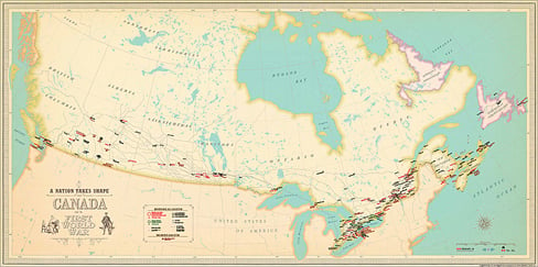
The First World War affected millions of Canadians, both past and present. Canadian Geographic Education’s newest educational map visualizes some of these impacts in stunning new detail. ‘A Nation Takes Shape: Canada and the First World War’ is designed to take students back to the turn of the 20th century, a time when Canada was still a Dominion, Newfoundland was a separate entity, and women couldn’t vote. To learn more about how this map can help students grasp the First World War’s staggering influence on Canada, we sat down with Sara Black, programs coordinator at Canadian Geographic Education.
What makes this map different from all other first world war maps?
This is Canadian Geographic Education’s first ever tiled map. This is the first of its kind and gives students the opportunity to explore Canada and the impact the First World War had, piece by piece. It challenges students to connect their Canada to the one that existed around the First World War. This map is also the first step of a journey into Canada at the beginning of the 20th century. Each of the ten accompanying learning inquiries highlights a different geographical lens for Canada, from women’s roles to conscription and even present day memorialization and commemoration of the war.
What do you like best about this map?
There are so many things I love about this map. First, I like how it is free to all teachers. All teachers need to do is go to our website, download the map and teachers guide and voila, you have a map and ten different learning inquiries. Teachers can download it in English or French and in colour or Black and White, it’s that easy. Secondly, I like how this historical map of Canada helps students make connections between the war and the development of Canada as a nation. Finally, my favourite thing about this map is the opportunity it gives students. Canada’s role in the First World War is a difficult and diverse subject for students to grasp. This map helps teachers divide the First World War into themes, allowing students to ask the important questions and develop their critical thinking skills helping them gain a greater understanding of how Canada progressed into the nation we recognize today.
How will this map change the way students learn about the First World War?
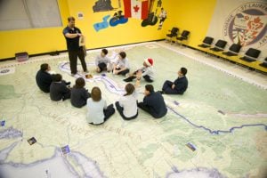
Students get to connect to this map in an interactive way. By putting Canada together like a puzzle they get to focus on areas they may not notice right away when looking at the map as a whole. Combined with the ten learning inquiries, students have the opportunity to learn about women’s roles, internment, conscription, and the political and physical landscape of Canada before, during and after the FWW. Additionally, this map highlights to students how spatial awareness is an important concept to consider when examining this momentous subject.


