
People & Culture
On thin ice: Who “owns” the Arctic?
As the climate heats up, so do talks over land ownership in the Arctic. What does Canadian Arctic Sovereignty look like as the ice melts?
- 4353 words
- 18 minutes
This article is over 5 years old and may contain outdated information.
Mapping


Editor’s note: What goes into deciding where to travel in the Canadian Arctic? In this second northern-themed instalment of our Map Monday series, Hugh Dale-Harris explains how his New Land Expedition team chose their route. Read his first post on the differences between navigating in the north vs. the south.
Stated simply, our choice of route for New Land 2013 was primarily rooted in history. It was a celebration of Otto Sverdrup’s 2nd Fram Expedition. From 1898-1902 Sverdrup and his team mapped over 200,000 square kilometres of the Canadian High Arctic – more area than any other polar expedition before the era of aerial photography.
We had to decide which parts of their routes we wanted to retrace. Sverdrup traveled for four years; we had a single season. Here’s some of the historically significant places we could have started from:
In the end, it came down to a balance of history, cost, and logistics. We flew into Resolute, then chartered a Twin Otter to Goose Fiord, where the 2nd Fram expedition spent 2 winters.
But where to go from there? Not unlike the way many of us solve a maze, if we figured out where we wanted to end up, then we could work backwards from the end to get to the beginning. For us, the only real option was to finish in Eureka and charter a Twin Otter to fly out back to Resolute. That way we were able to cover some of the same ground as the 2nd Fram’s routes, and at the same time stay within our financial constraints.
Next, we turned to several different sources to determine our exact route.
To connect our route to a few of the 2nd Fram’s springtime routes, we took our lead from Toby, who was like our personal Lonely Planet Guide to all things Sverdrup. He painstakingly read through various sources and identified several critical places for us to include: The Fram’s exact location in Goose Fiord for our starting point, the crossing of Bjorn Pennisula, Trold Fiord where they described the “gates to paradise”, Eureka Sound, White Mountain (the beacon of Nansen Sound), Butter Porridge Point, and Lands Lokk among others.
Next we wanted to consider another primary goal of the expedition: filming the amazing landscape and wildlife of Ellesmere and Axel Heiberg Island.
With a nice variety of big bay, fiord, overland, pack ice we were sure to get some stunning landscape shots. And with the majority of our travel on new ice in the fiords and sounds, our travel was sure to be relatively flat and safe. While the ice is nice for travel, the land is where all the fun is. As someone advised us, “If you want to get to know Ellesmere, get off the ice.”
There is something very special about the land up there. The British Empire Range in the northeast and Victoria and Albert Mountains with the Agassiz ice cap to the southeast all form a giant triangular barrier that create a unique microclimate. Unlike the surrounding area, this arctic jewel boasts more stable weather, relatively temperate climate and an increase in vegetation—prime conditions for wildlife. We were sure to get some amazing photos.
Even Otto Sverdrup took note: “I venture to assert that no other arctic region can show a greater abundance of specimens of arctic animals. It would be correct to consider these regions as the sole natural Arctic Zoological gardens which have escaped the destructive hand of man” (Otto Sverdrup, Oslo, Norway, January 1929)
For the more specific plans about which fiord or valley to travel up on our route, we spent hours poring over digital and paper topographic maps. It takes experience and skill to translate what you read on a map to what the landscape looks like in real life, so we consulted several people we knew who had traveled extensively up there, including Inuit elders, expedition leaders and authors. We gathered as much information as possible from these first hand accounts, and are very excited that this same kind of information is now available in this incredible new resource: The Pan Inuit Trails Atlas.
Another consideration was travel through Inuit Owned Land (IOL). Protected from surveying, prospecting and any other activities on the surface deemed harmful to the ecosystem, these lands are managed by Qiqitani Inuit Association. An application, including an outline of the trip, it’s purpose, impact on the environment and background information needed to be filled out and approved before we could travel through these areas.
We were all very curious to see how all that planning and research stacked up in reality. With a route that seemed to provide a nice balance between telling Sverdurp’s story and shooting footage of Ellesmere, all the while providing us with a challenging, exciting, and yet safe expedition, all we had left was to skijor 1,000 km and film in -40 degree weather.
People & Culture
As the climate heats up, so do talks over land ownership in the Arctic. What does Canadian Arctic Sovereignty look like as the ice melts?
Environment
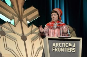
The uncertainty and change that's currently disrupting the region dominated the annual meeting's agenda
People & Culture
For generations, hunting, and the deep connection to the land it creates, has been a mainstay of Inuit culture. As the coastline changes rapidly—reshaping the marine landscape and jeopardizing the hunt—Inuit youth are charting ways to preserve the hunt, and their identity.

Mapping
Industrial engineer Cheryl White uses visual problem-solving and team engagement techniques in her day job. Now she’s using them to crowdsource a national mapping project.