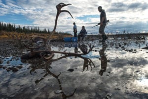
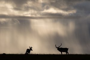
For caribou in the far north region of Ontario, there are storm clouds gathering. A recent analysis published in the Journal of Wildlife Management, which I helped to coauthor, projected possible population declines of anywhere from 17 to 30 per cent for northern caribou over the next 50 years.
There are two major factors behind this decline: climate change and expanding resource development, including a race to develop the mineral-rich Ring of Fire area in the Hudson Bay lowlands. These factors will combine to make life a lot more difficult for caribou in multiple ways.
But it is in understanding the multiple ways that caribou will struggle with the combined impacts of climate-driven landscape changes and human development that things get tricky. Things in nature are deeply intertwined — changes in one species can cascade to another. For example, in the computer modelling work in the paper, researchers had to look just as much at the impacts of a changing climate on moose as on caribou. That’s because we know that in areas with a higher percentage of younger regrowing forest, moose are more plentiful. As a result, wolf populations also tend to increase, and these higher wolf populations also take a bite out of caribou herds. The model suggested this could happen particularly along the southern band of the far north region, where warmer temperatures and increased fire will affect forest regrowth and age.
Now add in the human element: logging activities also often lead to younger forests favoured by moose as new forest grows in, which drives this same cycle of wolf increase and caribou declines. Factor in roads for forestry and resource development, where wolves’ access to prey becomes easier, and you start to understand the importance of looking at cumulative effects and not treating each impact in isolation.
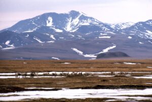
This is not the easiest set of conditions to model, but thanks to the increasing sophistication of the online ALCES conservation tool, the research team could combine a wide variety of factors and look at how impacts were compounded by different combinations. Equally importantly, they were also able to look at impacts at different scales. Researchers were able to zoom in and out by looking at the entire region — an area 10 times the size of Switzerland — down to the area directly surrounding four potential new mines in the mineral-rich Ring of Fire area and model how multiple impacts would interplay at each level.
While it is by no means clear at this point just how many and just how quickly new mines and roads and other infrastructure will be built in this region, plans are well underway for a road corridor designed to open up the region. This range of potential future outcomes – from many mines and multiple roads all the way down to no economically viable projects whatsoever – made it important to model different potential outcomes in different ways.
For example, while the broad landscape scale was useful for looking at the impacts of things like new roads or transmission lines that crossed large areas, it also tended to disguise the impacts of new resource projects such as mines. When the researchers drilled down to the finer level closer to the direct footprint of a project, they found that declines in caribou populations could be almost twice what they saw at the broad regional level. Clearly, when cumulative impacts become highly concentrated in one area, wildlife can be more negatively impacted.
So why does all this matter? We increasingly understand that it is not the impact of any one action or project that determines the fate of a species, it is the combination of multiple stressors and changes that is much more important to consider. So when a species such as caribou is already grappling with changes to predator populations driven by climate change and a new mine is built in its habitat, the disturbance to habitat and “avoidance behaviour” likely to result is just all that much more dangerous because the species is already under stress. Add to this is the reality that once the first project comes to fruition, it facilitates the development of more projects by providing “proof of concept” and access to newly built infrastructure. This is the very essence of cumulative impacts.
By looking at multiple overlapping pressures at multiple scales, this research helped demonstrate that we can consider cumulative impacts and not just project-specific issues. This is important because the federal government has — at the urging of WCS Canada and others — started a Regional Environmental Assessment process for the Ring of Fire area.
A regional assessment is a new approach to trying to come to terms with multiple issues before decisions about new roads, mines, and hydro lines are baked in. But it will only work if it is well informed by the science around cumulative impacts, involves Indigenous communities in affected areas in the governance of the process, and considers multiple species in its analysis of impacts on wildlife.
Too often, governments and planning agencies have opted for simplistic projections of environmental impacts: ie.e building Road X will destroy X hectares of habitat. The impacts of Road X, however, go far beyond the direct disturbance caused by building the road corridor itself. And those impacts are often, in turn, amplified by other pressures like climate change.
The modelling work undertaken by the research team for this study as well as the work being continued by WCS Canada is therefore as much about considering how to shape resource extraction in the region to reduce cumulative impacts as it is about predicting the possible future and conservation potential for a species at risk (caribou).
The caribou herds in the far north in Ontario are among the most robust in the province for one major reason: they occupy our last remaining large intact wild landscape. If development is going to make changes to this landscape, we must try to understand all the ramifications — including interacting cumulative effects — before we act if we are serious about saving a species that is in decline across Canada.
Claire Farrell is an Associate Conservation Scientist with Wildlife Conservation Society Canada. Prior to joining WCS Canada, she helped to coauthor the caribou population study published in the Journal of Wildlife Management.