
Environment
The Ontario Greenbelt is expanding — So what does that mean?
The expansion could offer economic, social and environmental benefits to the area
- 637 words
- 3 minutes
Mapping
With Canada facing a housing crisis, a look at growth and conservation in its densest urban area
In 2005, the Ontario government, in consultation with nearly two dozen municipalities around Toronto, came up with a bold plan: to prohibit urban development on a huge swath of land beyond existing built-up areas. The Greenbelt was born.
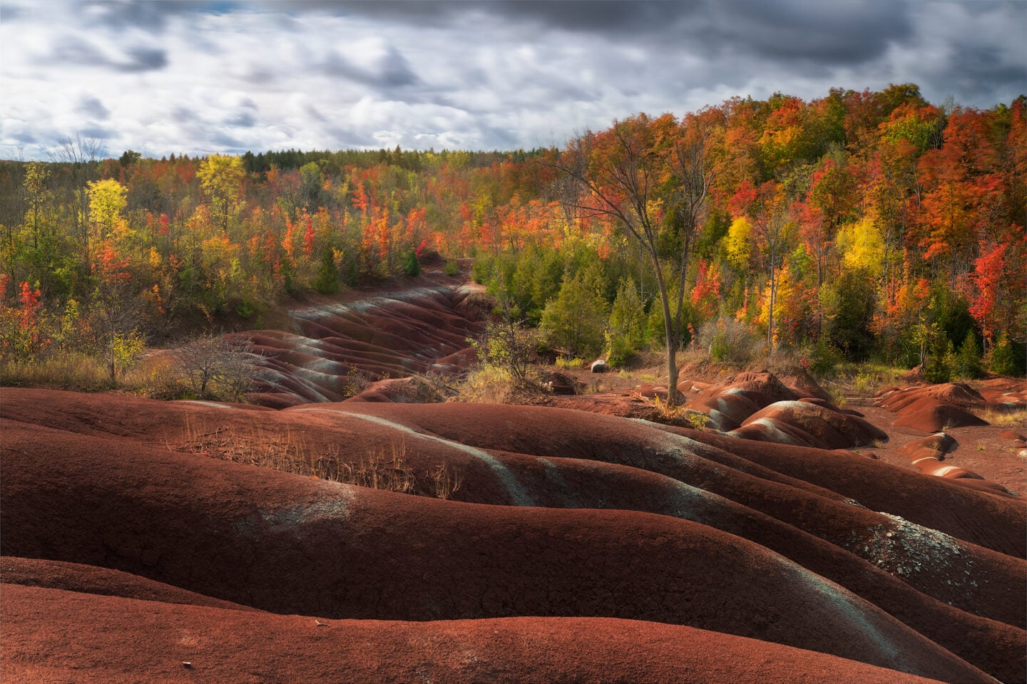
Its goal: to promote smarter, denser urban growth and protect farmland, forests and other natural areas by reining in sprawl. In all, more than 800,000 hectares (8,000 square kilometres) were set aside, including 300,000 hectares of prime farmland. The Greenbelt’s boundaries took in previously protected areas like Oak Ridges Moraine and the Niagara Escarpment, plus an even larger area newly designated as “protected countryside.”
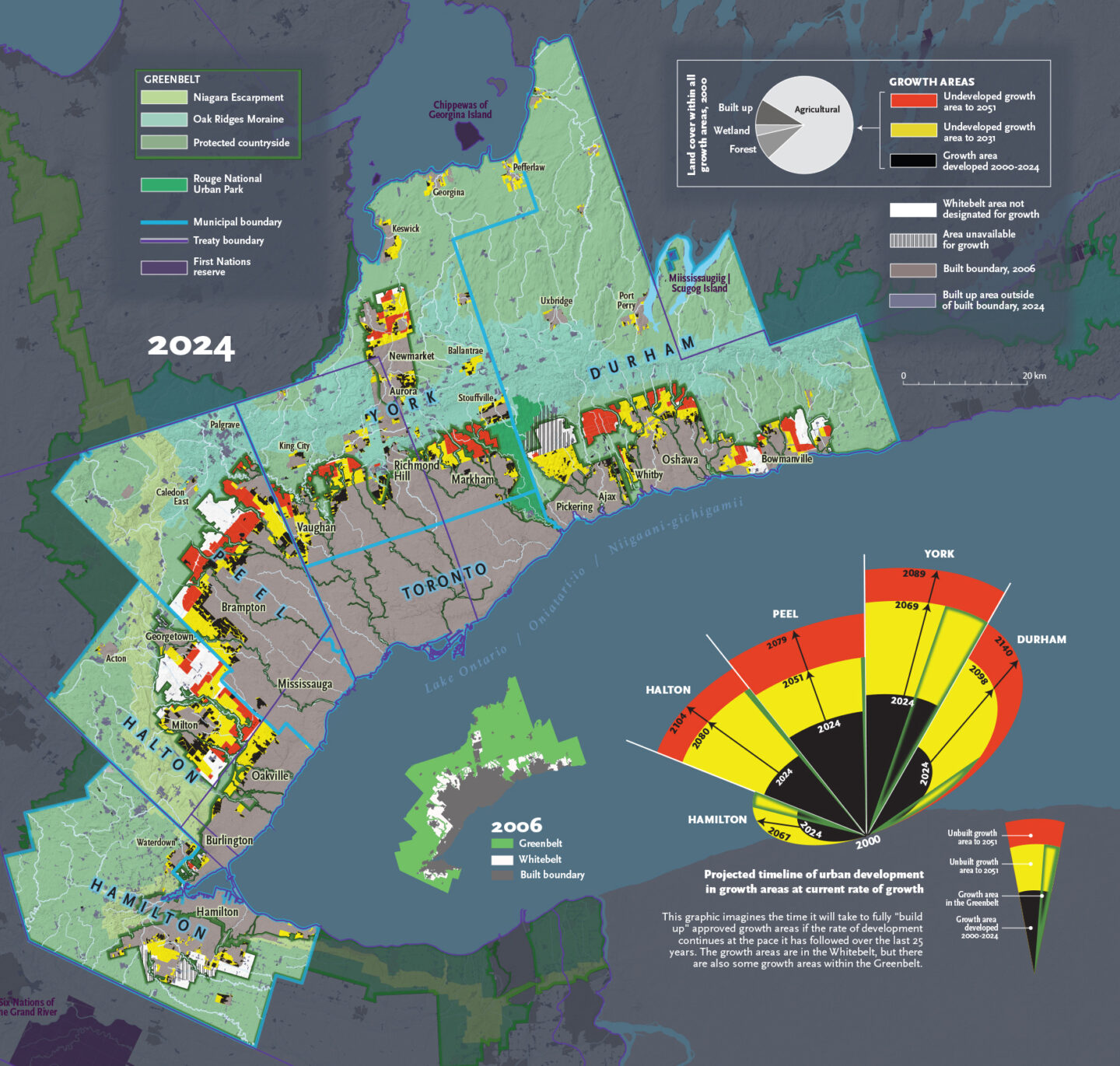
Two decades on, this map sheds light on what has and hasn’t been achieved since the Greenbelt’s creation. Based on data and satellite imagery through the end of 2024, it shows where development has taken place since 2000 (in black) and highlights the evolution of critical land-use designations (in white, yellow and red) in the six largest municipalities in the region: Halton, Peel, York and Durham and the cities of Hamilton and Toronto.
Until last year, the province’s growth plan for the Greater Golden Horseshoe guided all development, defining built-area boundaries, limiting new development to designated growth areas and setting minimum density requirements for housing to limit sprawl while ensuring housing needs are met through 2031.
This growth plan worked even better than expected. “Far less land has been consumed than was designated as sprawl up to 2031,” says Phil Pothen, land use and land development program manager at Environmental Defence.
As the map shows, bits of the Greenbelt have been developed since its creation, largely in local growth areas or sites exempt from the plan that were approved before 2005. But most new building has taken place in the Whitebelt, a buffer zone between the Greenbelt and the urban boundary that was to stay undeveloped except in designated “growth areas.”
However, after 2020, the Progressive Conservative government updated the Greater Golden Horseshoe’s planning horizon to 2051. It also compelled municipalities to expand growth area boundaries in the Whitebelt in line with population and employment projections, while simultaneously rolling back minimum density thresholds on greenfield development. That lifted the share of growth area in the Whitebelt to 86 per cent. Pothen says the remaining 14 per cent is also now at risk following the government’s decision last year to repeal the growth plan for the Greater Golden Horseshoe altogether.
The government’s rationale was that more land is needed to alleviate the housing crisis. However, both Pothen and Victor Doyle, the original lead planner for the Greenbelt, say there’s still ample room available within the 2031 boundaries. With the Greenbelt’s next mandated 10-year review pending, it’s clear these development boundaries will continue to be debated
This story is from the November/December 2025 Issue
Environment
The expansion could offer economic, social and environmental benefits to the area

Places
Celebrating urban agriculture in Canada’s national capital region

Mapping
Maps have long played a critical role in video games, whether as the main user interface, a reference guide, or both. As games become more sophisticated, so too does the cartography that underpins them.

Kids
Canadian Geographic Education’s series of giant floor maps gives students a colossal dose of cartography and is a powerful teaching tool