
Science & Tech
Finding a whale in a watery haystack
Satellite detection of whales is improving rapidly, but finding the behemoth creatures is still surprisingly tricky
- 964 words
- 4 minutes
This article is over 5 years old and may contain outdated information.
Science & Tech


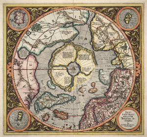
As Arctic summer sea ice recedes in the face of climate change, new opportunities are emerging for commercial shipping, energy exploration and tourism. Those activities are a challenge, however, because of a lack of detailed, timely information on how much, and what kind of ice, vessels or drilling platforms may encounter at any given time.
“There’s less ice in the Arctic than there used to be, but it’s potentially more hazardous, because we have ice floes colliding with one another,” says Randall Scharien, a post-doctoral researcher at the University of Manitoba’s Centre for Earth Observation Science. “You have thin ice that’s colliding and becoming thick ice, which could damage vessels or drilling rigs.”
One solution to mitigating such hazards is the use of ever-more-advanced radar satellite imagery, which unlike optical images (photos) can “see” Arctic ice in the dark and through clouds, and could one day be able to differentiate between relatively harmless thin, soft ice, and thick, hard ice, which could be dangerous.
Scharien, a leading expert in radar satellite image interpretation, has developed a new technique that uses radar data to map melt ponds, which affect the strength of sea-ice and the amount of sunlight it reflects. This technique boosts understanding of ice and helps improve the models used to predict climate change. Scharien says that new imaging technologies and the use of multiple satellites working together — “satellite constellations” — could greatly reduce much of the current guesswork and danger from Arctic navigation.
“When it comes to radar satellite technology, the images carry much more information than they used to, which means we have many more options than we used to,” says Scharien. Now, he says, it is a matter of finding the right combination of technologies and constellations that will give us solutions to these particular problems.
The long-term result? Helping to more safely open up the Canadian Arctic to all sorts of new possibilities.


Science & Tech
Satellite detection of whales is improving rapidly, but finding the behemoth creatures is still surprisingly tricky
People & Culture
In this essay, noted geologist and geophysicist Fred Roots explores the significance of the symbolic point at the top of the world. He submitted it to Canadian Geographic just before his death in October 2016 at age 93.

People & Culture
As the climate heats up, so do talks over land ownership in the Arctic. What does Canadian Arctic Sovereignty look like as the ice melts?

Environment
The uncertainty and change that's currently disrupting the region dominated the annual meeting's agenda