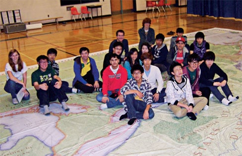
Walking through Canada’s network of national parks, national historic sites and marine conservation areas would normally take many years, if not decades. But there will soon be a much quicker way to get your feet onto these natural and historical riches and learn about them in the process — a giant floor map.
The new, fully bilingual map of the Parks Canada system, created by Canadian Geographic Education in collaboration with Parks Canada, measures approximately 11 by 8 metres and will be available in early 2013.
The map arrives hot on the heels of CG Education’s successful War of 1812 giant floor map, which is available to educators for the next three years, free of charge. Both maps are part of CG Education’s continuing plan to help educators provide students with a more interactive learning experience.
Jen Rissanen, who taught at Negahneewin College — part of Confederation College, in Thunder Bay, Ont. — was one of the first teachers to use the War of 1812 map in the classroom. “I probably wouldn’t have taught the War of 1812 if it weren’t for the map,” she says. “It’s a great idea and a great teaching tool.”
For more information about the new map, visit the following website this January: www.canadiangeographic.ca/educational_products.


