Environment

The perils and possibilities of the Mackenzie Valley Highway

The planned highway is meant to connect a vast stretch of the Northwest Territories. But the challenges are real and the promised benefits may not be guaranteed.

  • Oct 13, 2026
  • 1,677 words
  • 7 minutes

Editor's note

This story is the second in a series, supported by the Pulitzer Center and co-published by Canadian Geographic and APTN News.
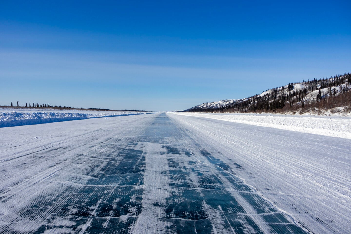
The 117-kilometre Inuvik-Aklavik ice road, which runs along the Mackenzie River. In the summer and fall, the community of Aklavik is only accessible by air and water. Until the recent construction of a new all-weather road, coastal Tuktoyaktuk was also connected to Inuvik by a seasonal ice road. (Photo: Meral Jamal)
Expand Image
Advertisement
Advertisement

“That’s the question I’m always getting is, when’s it gonna start?” Gwich’in Tribal Council Grand Chief Frederick Blake Jr. says about the construction of a new highway being proposed for the Northwest Territories. 

“A lot of people wanted to see the Mackenzie Valley Highway a reality, especially our Elders, because it’s been a discussion throughout their adult life. They’d like to see it and drive on it before it’s too late.” 

The 800-kilometre, all-season gravel road is meant to connect communities in the Northwest Territories’ Sahtu region, and to reduce the driving time between two major hubs — Yellowknife and Inuvik — from 38 to 23 hours. 

On June 24, 2026, the federal government announced it has begun the process of designating the proposed Mackenzie Valley Highway a “project of national interest,” with the aim of fast-tracking environmental reviews and federal permitting ahead of construction. 

The first phase of construction will connect an existing highway in Wrigley to Tulita and Norman Wells. The second phase will see the highway continue north to Fort Good Hope and end at Inuvik, the third largest community in the territory. 

Once completed, it will serve as an all-season economic corridor, for communities along the Mackenzie Valley. It will also join 10 other gravel highways as well as 3,873 kilometres of all-weather road networks across the Northwest Territories. 

Yet like its predecessors, researchers say the new road will face growing climate pressures — and concerns about the benefits promised to communities along its route.

Building on permafrost

The definition of permafrost is pretty straightforward, according to Dr. Fabrice Calmels, a research chair on permafrost and geoscience at Yukon University: it is any kind of ground — peatland, silt, sand, clay, bedrock — that has a temperature of 0 degrees Celsius or below for at least two years. 

Yet the material the permafrost is composed of can affect its thickness and average temperature. For example, when permafrost contains well-draining and coarser material, it is less vulnerable to degradation than when it contains fine materials such as silt or clay. 

Permafrost can also have different layers, with the active layer thawing and freezing each year while others remain frozen the entire time. And it can be frozen continuously in some parts of the North, while in others it is discontinuous and existing in patches. 

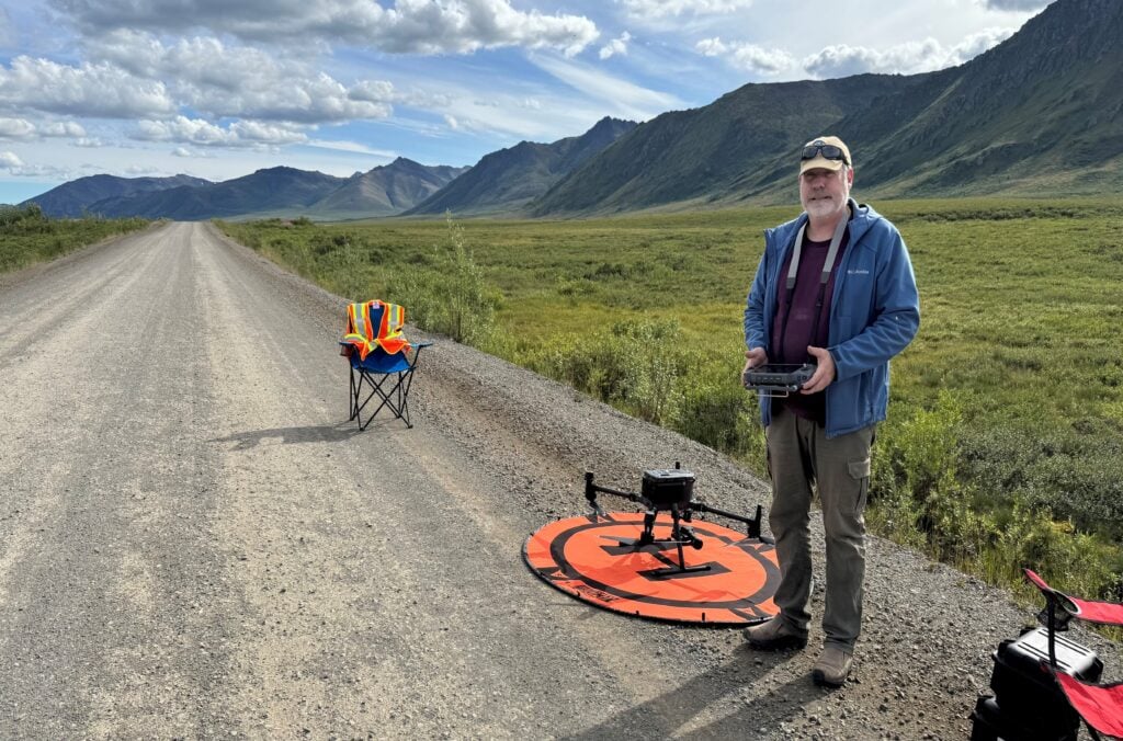
Dr. Fabrice Calmels, a research chair on permafrost and geoscience at Yukon University, during a drone LiDAR survey mapping subsidence locations and rates along the Dempster Highway. (Photo: Cathy Koot/Yukon University)
Expand Image

Calmels, who has been studying and mapping road networks across the North for over 14 years, says all roads in the region end up requiring maintenance because they’re built on this “patchwork” of permafrost. “You’re not [building] across a single environment, so you have to adapt.”

According to Calmels, the amount of ice found within permafrost can affect how quickly it melts as well. This can then have cascading effects for the roads built on top of it. “When you lose ice, you lose volume in the ground. The ground collapses or the topography changes,” he says. “In some cases, you can also have sloping or like a retrogressive slump, or you can have an active layer detachment …. You can have lakes that form at some places, which are known as thermokarst lakes.”

“There is no happy road on permafrost, except if the geology allows that,” Calmels adds. “Now that the climate is warming, even if you have a good design, you still have the permafrost that degrades due to environmental change.”

Learning from the Dempster and Inuvik-Tuktoyaktuk Highways 

According to Jennifer Humphries, a permafrost specialist with the Aurora Research Institute in Inuvik, an important aspect of building highways across the Northwest Territories is understanding the variability of permafrost. In Canada’s western Arctic, she says it is generally continuous and “everywhere you walk, providing the foundation for buildings and helping transport people and animals across the land. 

Humphries also says the diversity of permafrost conditions across the region is the reason her team treats each permafrost area as distinct. “Each landscape has its own personality. It has a different history. It has different materials. It has different ice content, different disturbances,” she says.

“Our job as permafrost scientists then becomes understanding the variability or the personality of these different landscapes and permafrost within them — because just like people, each landscape is going to have a unique reaction to a stressor.” 

Having done research on both the Inuvik-Tuktoyaktuk highway, which began construction in 2014 and was completed in 2017, as well as the Dempster Highway, Humphries says there is a lot of existing research that can help shape decisions made for the construction and maintenance of the Mackenzie Valley Highway. 

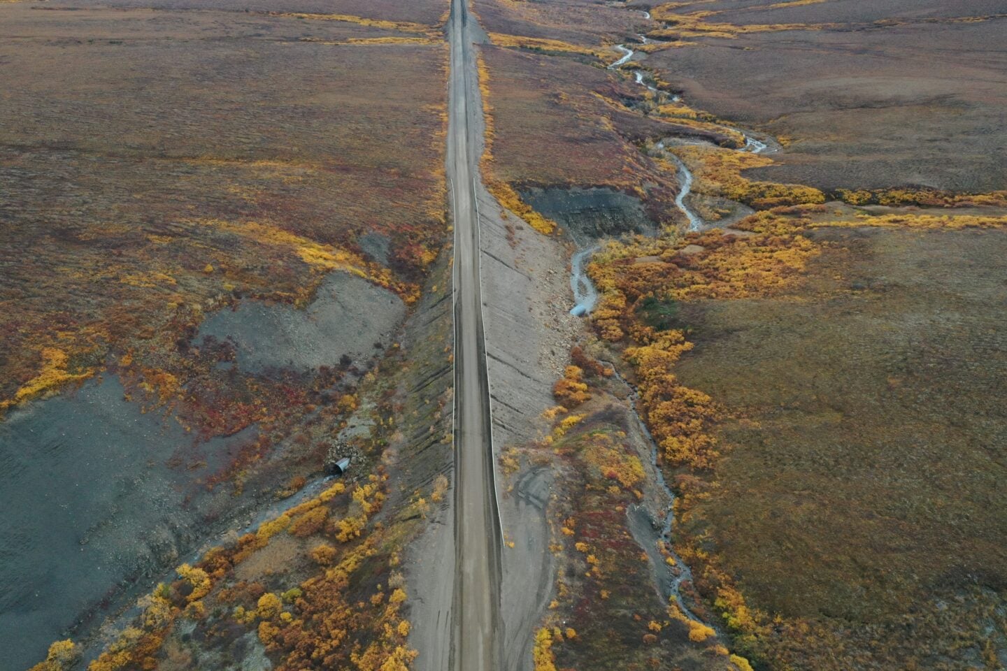
Bird's-eye view of the Dempster Highway in the fall of 2021. Many issues along the highway, including erosion, permafrost thaw, washouts and snow drifting, are related to water management. (Photo: Greg Elias/Aurora College)
Expand Image

The Dempster has been operational for over 50 years, since construction was completed in the 1970s. It started out as a winter road that was built from the south to the north and its maintenance currently is managed by both the Yukon and the Northwest Territories. The highway also “cuts through” a lot of different environments such as mountains and lowlands, which makes it a good contrast to the Inuvik-Tuktoyaktuk highway.

“The landscape [the highway] cuts across from Inuvik to Tuktoyaktuk is very ice-rich permafrost with lots of cross drainage and water management concerns, whereas on the Dempster that might be part of the maintenance challenges but they also have lots of issues with snow level and landslides or things like that. 

“What we learned from the [Inuvik-Tuktoyaktuk Highway] is that the thickest sites were performing better, generally speaking, and [in terms of] lessons learned it reinforces this idea that permafrost and permafrost landscapes have really distinct personalities,” Humphries adds. 

“Maintenance challenges are going to reflect that personality of the land and you have to have a good understanding of that landscape to properly maintain the road.” 

Ultimately, Humphries says it’s important to include communities on the ground not only in consultations for the construction of the Mackenzie Valley Highway, but their knowledge of the landscape as well as the research and monitoring they have participated in so far. 

“We know and understand that climate change is inevitable and it’s changing the state of permafrost,” Humphries says. “What we actually really need is a good monitoring network that involves Northerners and Indigenous partners, produces good data that can be used by engineers and delivers useful information to decision makers.” 

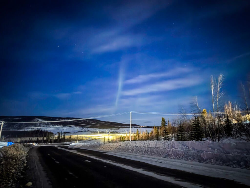
Northern lights above the intersection of the Dempster Highway and Mackenzie Road, which connects to downtown Inuvik. (Photo: Meral Jamal)
Expand Image

The proposed benefits

Annette Salles is a postdoctoral research assistant at Northumbria University in Newcastle, UK. As part of her PhD at Queen’s University in Belfast, she analysed ice thickness and temperature observations and co-produced Indigenous knowledge with a Manitoba First Nation to project the future of winter roads, an essential lifeline for many remote communities in the province. 

Alongside researchers at the University of Manitoba and others, Salles has also looked at the viability of a large-scale northern corridor that “would involve the construction of roads, railways, transmission lines, northern ocean ports and pipelines to enable the local extraction of natural resources and their regional and global transport.” (While there is no one proposed route for the notional corridor, the idea would be for it to reach across both northern and southern parts of the country, including in the Yukon and NWT, and connect all three coasts.) 

The important lesson to be learnt in proposals for economic corridors, Salles says, is the economic development promised through them may “not do much” for socio-economic factors in the communities that live along them, particularly northern and Indigenous ones. 

Like the Mackenzie Valley Highway, the northern corridor was initially suggested as a means of supporting resource development for remote Indigenous communities and reducing the cost of living in them. Yet the research Salles was involved in found that instead of providing such long-term benefits, road networks may bring a ‘resource curse’ to Indigenous communities, wherein they experience mainly negative economic and social impacts in the long run.

According to the team, this resource curse is apparent across Canada already, including at  Norman Wells, which the Mackenzie Valley Highway is supposed to connect to Tulita, and at Shoal Lake 40 in Ontario, “where oil and water pipelines have resulted in negative environmental, health and socio-cultural impacts without providing permanent road access or long-term jobs, and without reducing high food prices.”

Salles says these communities have been experiencing the brunt of “the pollution, the water resources that are being taken from or diverted, dam building for energy projects … communities don’t benefit but have to endure all the disadvantages and all the problems in the end.” 

In the case of the Mackenzie Valley Highway, Salles also says it’s important to look at the Inuvik-Tuktoyaktuk highway and the real benefits it has brought to both communities. Case studies suggest the highway did not improve the price of groceries and the cost of living in Tuktoyaktuk because it did not address other factors such as the cost of transportation and the cost of storage.

 “If you still only have one store or one organization providing the stores [in that community], then you’re not getting away from this monopoly structure and you’re not going to lower food prices,” Salles says, adding that the impact on employment and tourism will also likely be limited because the distance between communities continues to be too far to travel regularly. 

“Employment can only come from either mobility — if you can go someplace else to actually find a job — or from incoming economic opportunities, and that again will have some challenges.” 

Through existing road networks, Salles’ research team found that corridors can in fact worsen food insecurity and promote “the unsustainable use of resources to fuel the global economy, supercharged by late-stage capitalism and colonialism’s legacy of racism.” The benefits also rarely materialize for Indigenous communities in particular as such infrastructure development is not often supported with other changes and funding for communities. 

“It’s finding that balance,” Salles reflects. “If you don’t have enough economic impacts on the positive side, why should you have to deal with all the challenges and with all the problems that [a road] brings with it?” 
Advertisement

Help us tell Canada’s story

You can support Canadian Geographic in 3 ways:

Related Content

Coniferous trees lean at different angles in the snow

Environment

Arctic permafrost is thawing. Here’s what that means for Canada’s North — and the world

Permafrost thaw is widespread, accelerating and irreversible. With it comes visible effects on the ecology, hydrology and landscapes, and communities of the North.

  • 2683 words
  • 11 minutes

People & Culture

Climate security through Arctic security

Facing wildfires, permafrost thaw and flooding, some Northern community leaders say security announcements by the federal government will support adaptation and mitigation on the ground

  • 2048 words
  • 9 minutes

Travel

Under the Beaver Moon on Canada’s most expensive highway

Bucket Listed columnist Robin Esrock heads north on the Inuvik–Tuktoyaktuk Highway, Canada’s road to the Arctic Ocean

  • 1510 words
  • 7 minutes
A retrogressive thaw slump on Qikiqtaruk-Herschel Island

Environment

The big thaw

Arctic permafrost is thawing. What does that mean for the North — and the rest of us? 

  • 1323 words
  • 6 minutes
Advertisement
Advertisement