Wildlife
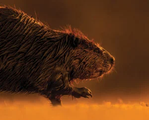
Rethinking the beaver
Has there ever been a national symbol more loathed or misunderstood? Has there ever been a more important time for the beaver to flourish?
- 3360 words
- 14 minutes
Travel
Bucket Listed columnist Robin Esrock heads north on the Inuvik–Tuktoyaktuk Highway, Canada’s road to the Arctic Ocean

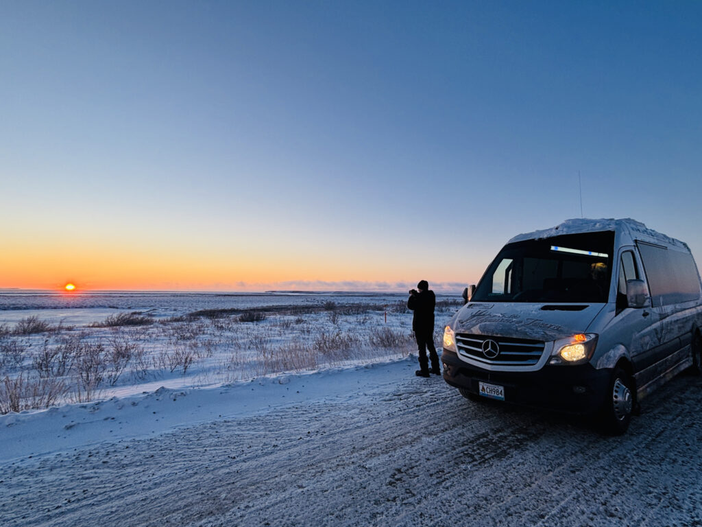
It’s 8:30 a.m., but a Beaver Moon still shines its spotlight on the iced streets of Inuvik, Northwest Territories. The bright November full moon earns its name from the season when beavers make their final preparations for winter, a moon Olav Falsnes has witnessed countless times. The 84-year-old retired aeronautical engineer has more than 20,000 hours of northern bush piloting under his belt, and these days he’s an enthusiastic local tour guide. Leaving the capital of the Western Arctic on this dark morning-evening, we’re heading north on one of the world’s most remarkable roads.
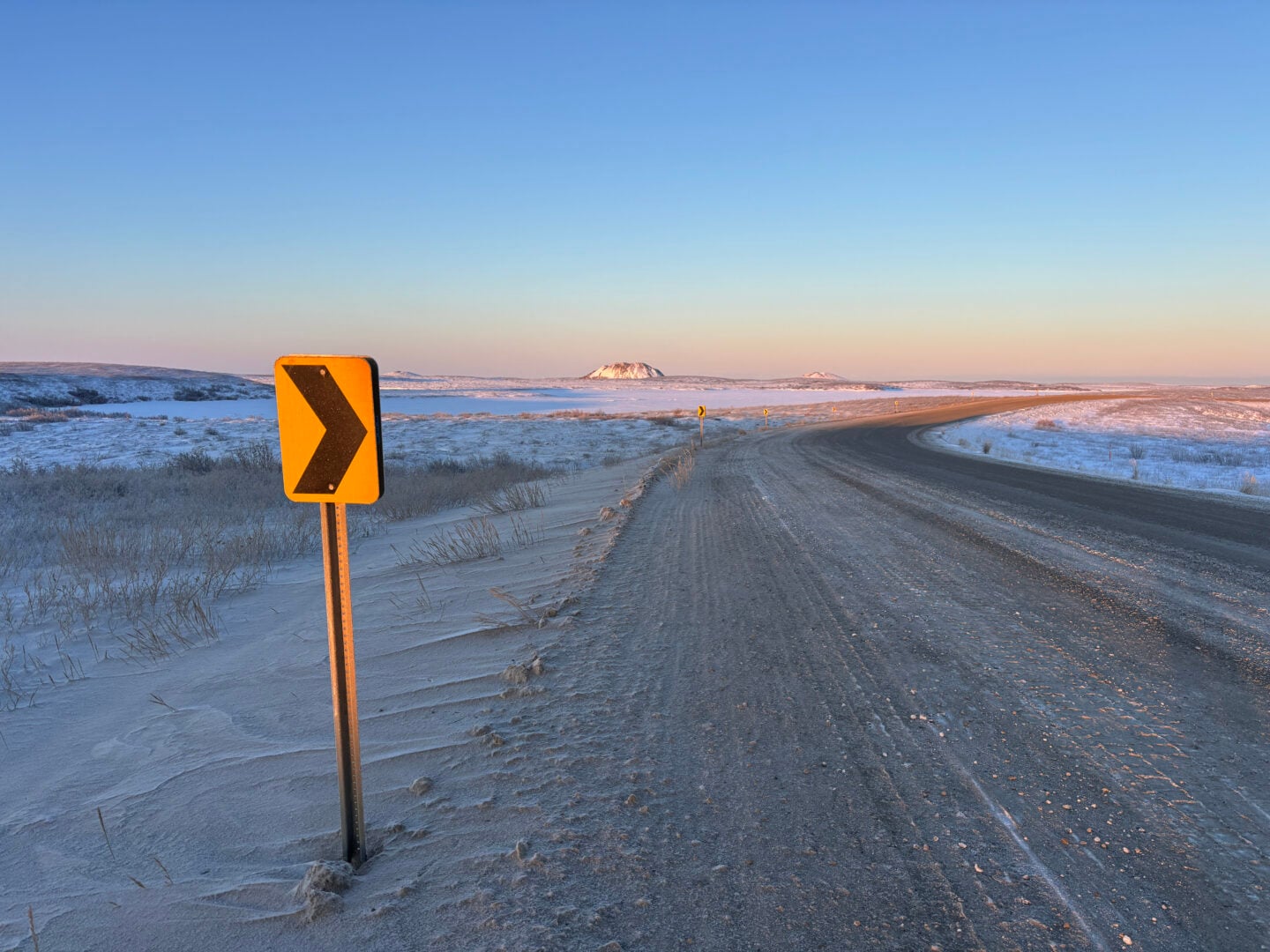
The Inuvik-Tuktoyaktuk Highway (ITH) is an engineering feat, a community lifeline, a tourist attraction and a milestone in northern sovereignty. It took four years to build the 137-kilometre all-weather highway (at a cost of $299 million), which opened in 2017. This addition extends the legendary Dempster Highway from Inuvik to Tuktoyaktuk, a small hamlet on the shores of the Arctic Ocean. In doing so, it also created a fixed road link between Canada’s three oceans and various economic opportunities for the Northwest Territories. For the 900-plus residents of Tuktoyaktuk (known affectionately as “Tuk”), year-round direct access to Inuvik provides cheaper groceries, a serviced airport, hospital, schooling, and government services. For tourists visiting the region by car, bike or plane, the ITH offers a unique opportunity to explore the stark beauty of the treeless tundra, an authentic Inuvialuit community and some unusual natural formations. It is the only road in Canada that reaches the Arctic Ocean.
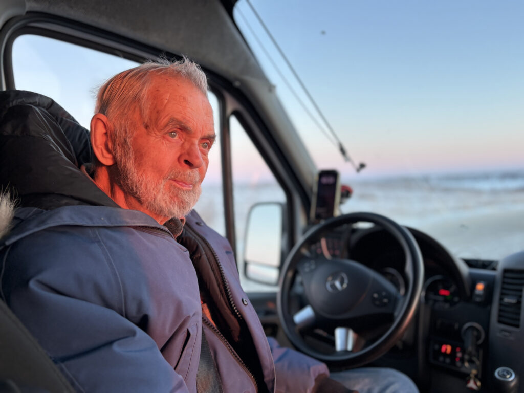
“The road is looking good today; sometimes it can be a little bumpy,” says Olav at the wheel. It’s been a busy year for the Norwegian transplant who has called Inuvik home for four decades. Upon her retirement, his wife, Judi, founded Arctic Chalet to offer visitors accommodation, tours and dog-sledding adventures. “She was kind enough to offer me a job,” says Olav, whose wit is aging as well as his body.
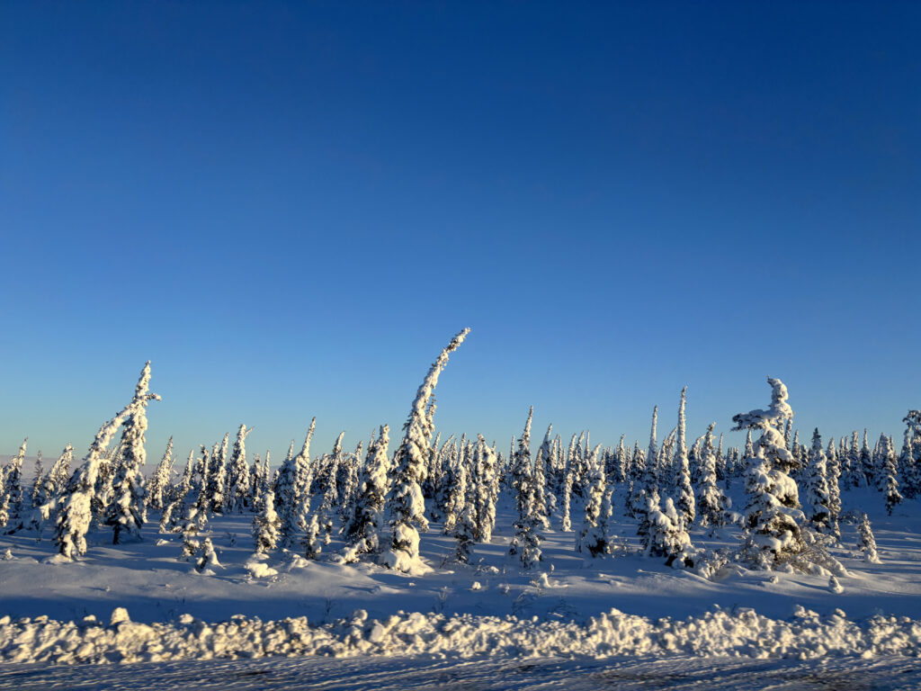
Forests of black spruce gradually diminish outside of Inuvik, and within a half-hour, the trees have shrunk into low shrubs buried under the season’s first heavy snowfall. The sun’s orange orb only crests the horizon around 10 a.m., by which time the landscape has become an endless vista of snow and ice. The caribou have migrated, the lakes have frozen, and Inuvialuit snowmobiles and sleds are positioned off the side of the road for upcoming winter hunts.
“You’d never know hundreds of trucks were bringing in gravel and rocks from behind that hill,” explains Olav. “They really did an incredible job respecting the environment.” As a tinkering engineer, Olav worked on all manner of airplanes, vehicles and equipment over the years. He can appreciate the achievement.
Building the unprecedented highway across thawing permafrost required an engineering rethink. Drawing on the experience of Arctic engineers from Scandinavia, China, Russia and the U.S., the solution was to build on the permafrost rather than cut a road through it, using an insulated layer of geotextile fabric and raising the gravel embankment to one and a half to two metres deep. This insulates the fragile permafrost from car friction and solar heat, but still requires long-term maintenance to address thawing, water ponding and ground shifting. Construction was limited to the freezing winter months of polar darkness, when the permafrost was frozen solid and there would be minimal impact on both wildlife and land. Most of the workforce came from the Northwest Territories, and, mile for mile, it’s one of the most expensive roads ever built, with significance beyond just transportation.
The ITH sends a powerful message that Canada is investing in its sprawling Arctic and its Arctic communities.
As the Arctic continues to melt, Russia, China and the U.S. are sharpening their claws at new prospects for trade routes and resource extraction. Above all else, the ITH sends a powerful message that Canada is investing in its sprawling Arctic and its Arctic communities.
Olav talks about the “reindeer days”, when large herds of reindeer were introduced to the region in a failed attempt to create herding opportunities. He explains how Tuk was initially founded for oil and gas exploration in the Beaufort Delta, and while that later dried up, a new LNG opportunity is on the horizon. In summer, drivers might see caribou, muskoxen, Arctic foxes, snow geese and very rarely, a wolf. Like many characters I meet this week, Olav shares his personal story too; how he ended up in a northern town, a place he loves and will never leave.
Olav’s favourite month is May, when skies lighten, snow thaws and the biting bugs have yet to show up. For the Inuvialuit, it is a season to celebrate, gathering in traditional spots on the permafrost to sing, dance and feast. The thaw of winter feels a long way from this bitterly cold November morning. It is -17° Celsius, and the wind chill shows zero respect for my thick winter parka. Light traffic on the ITH consists of a dozen heavy-duty trucks hauling gravel and rocks to Tuk to protect an eroding shoreline from powerful storm surges. The meandering gravel highway can be unpredictable, and as with the 735-kilometre-long Dempster Highway, this is no road trip for a suburban Prius.
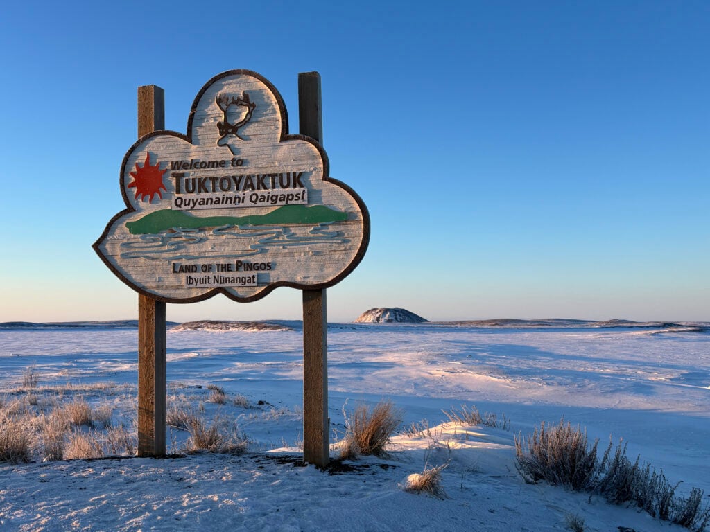
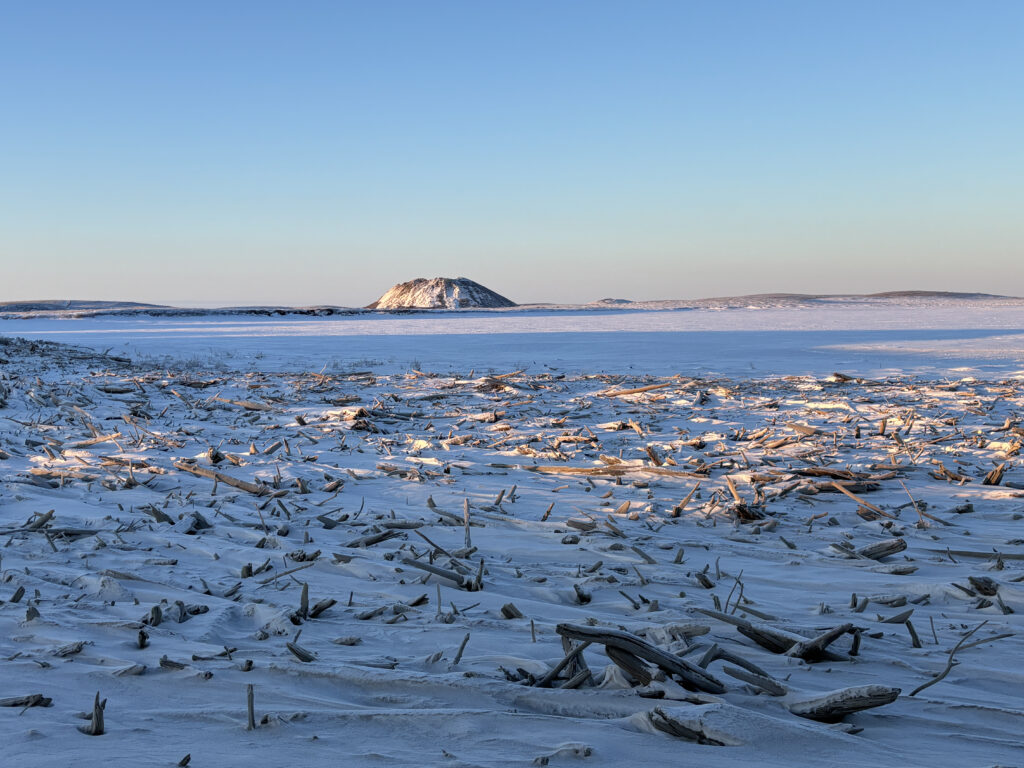
The ITH’s unmistakable natural highlight is the world’s densest concentration of pingos. A pingo (derived from the Inuvialuktun word for “small hill” or “mound”) is a hill of permafrost rising above the flat landscape. Pressurized groundwater freezes and expands beneath the surface, pushing up a dome of earth and vegetation with a core of ice. Co-managed by Parks Canada and the Inuvialuit, the Pingo National Landmark protects 16 square kilometres just west of Tuktoyaktuk, with viewing decks and interpretation boards off the highway.
The largest and most striking is the Ibyuk Pingo, which stands nearly 50 metres tall. Due to the fragile nature of the pingos, they can only be observed from a distance, and hiking across unstable permafrost or ice for a better view is not permitted. As the Arctic continues to warm, pingos are melting along with the surrounding permafrost, releasing huge quantities of methane into the atmosphere. Environmental scientists continue to study this impact, lining the highway with measuring instruments and cameras.
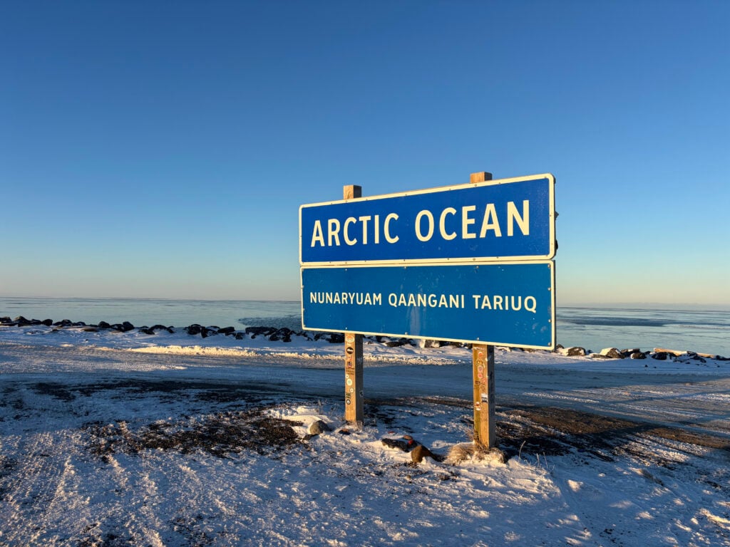
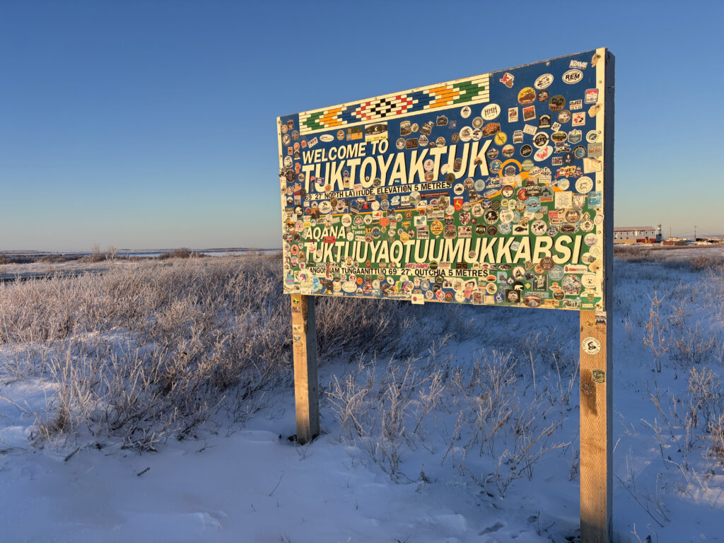
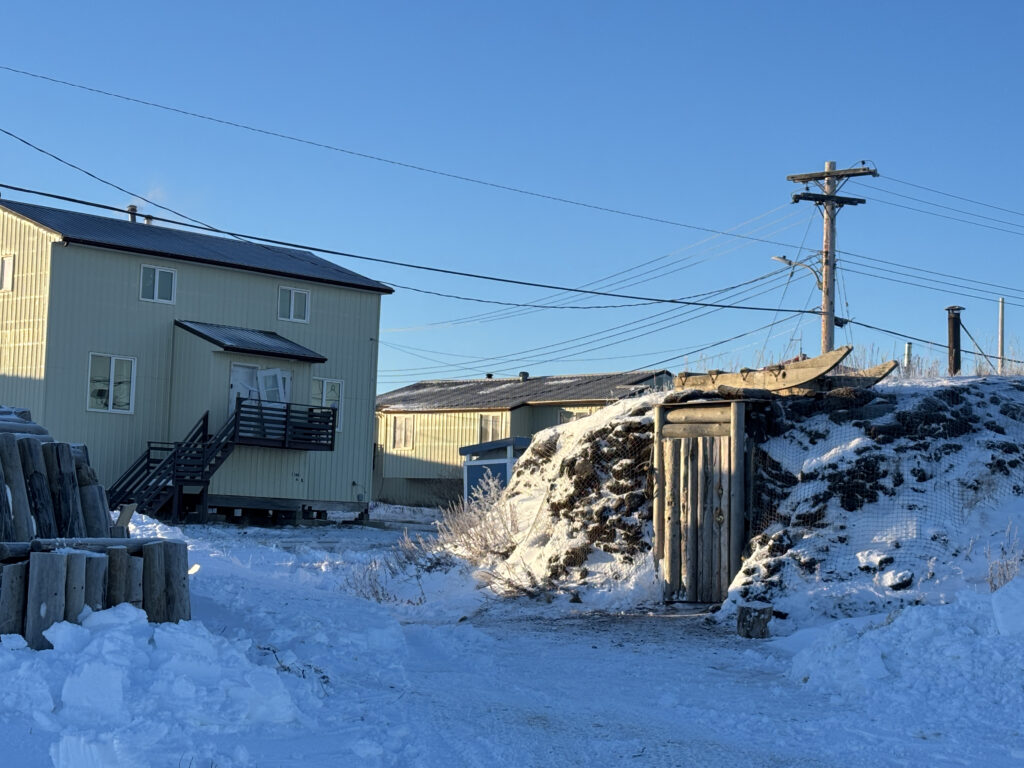
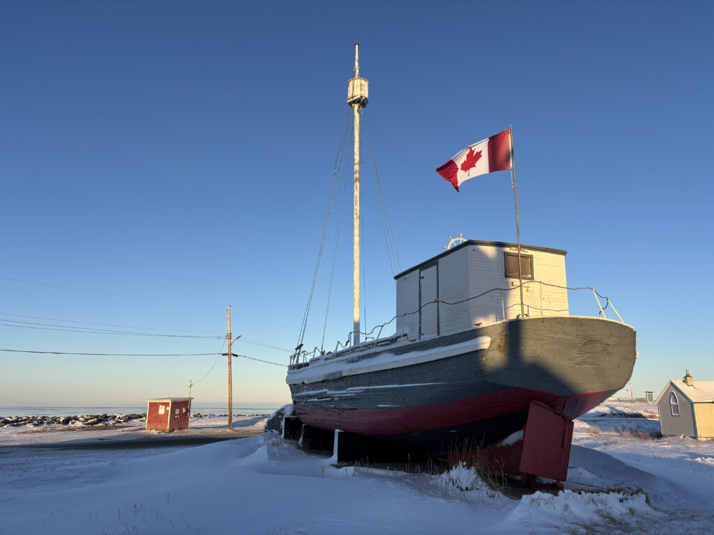
Tuktoyaktuk is quite literally the end of the road. There’s not much to do, but the community is welcoming, and the chance to dip one’s toes in the Arctic Ocean attracts visitors from around the world. The community’s unique underground ice storage facility is no longer in operation or open to visitors, and those expecting traditional igloos in winter may be surprised to find wooden and metal homes typical of modern Arctic communities. Residents of this region have long relied on wood floating down the Mackenzie Delta to build their traditional sod houses.
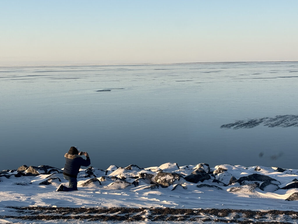
We take a few photos, and even Olav, a veteran of northern wonders, braves the freezing temperatures to capture seawater transforming into ice in real time. As we drive past old churches, the town cemetery, a historic missionary schooner and the RCMP depot, Olav explains how heating oil and fresh water are supplied to locals, sharing stories about the community along the way.
I pick up some jerky from the stocked NorthMart (a chain of food and merchandise stores in Canada’s North), surprised to spot avocados and pineapple at the entrance, shocked by how much they understandably cost. In summer, visitors can engage with locals at the community centre, and a large new hotel is under construction to accommodate an increasing number of overnight stays. I briefly consider dipping into the Arctic Ocean, but it’s a long drive back to Inuvik, best enjoyed without frostbite.
The Inuvik–Tuktoyaktuk Highway represents the epitome of a journey, not the destination. It links two vastly different northern communities that represent the Western Canadian Arctic, a sprawling region so immense it defies imagination. To live here requires resilience, understanding, respect, ingenuity, and a whole lot of character. In a country defined by the North, I wish every Canadian could have the opportunity to explore it.
Wildlife
Has there ever been a national symbol more loathed or misunderstood? Has there ever been a more important time for the beaver to flourish?
Wildlife
An exploration of the buck-toothed, flat-tailed, landscape-shifting icon celebrating 50 years as Canada’s national symbol
Wildlife
A deep dive into the world of beavers as Canada celebrates 50 years of the iconic species as our national animal

Environment
Vancouver might just be home to the greenest building in the world. Meet the geography professor who brought it to life.