Exploration
Canadian Space Agency astronaut profiles
The men and women that have become part of Canada’s space team
- 1067 words
- 5 minutes
Science & Tech
A video by NASA’s Earth Observatory blog reveals the little-known history of tiny Landsat Island — and the Canadian woman who helped discover it
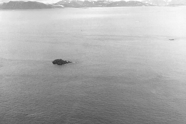
About 20 kilometres off the coast of Labrador lies a tiny island called Landsat Island. It’s only about half the size of a football field and visited mainly by polar bears, but its discovery and naming secured a place in history for a relatively unknown Canadian scientist named Betty Fleming.
Fleming was working as a cartographer for the Surveys and Mapping branch in Canada’s Department of Energy, Mines, and Resources in the early 1970s when NASA launched its groundbreaking Landsat-1 Earth observation satellite. The Canadian Hydrographic Service was interested in how images captured by Landsat-1 might be used to map uncharted navigation hazards on the coast of Newfoundland and Labrador. With her background in photogrammetry and aerial surveys, Fleming’s job was to study images of the coast and plot anything that might be geographically significant.
While most of the specks she plotted moved or disappeared in subsequent images, suggesting they were icebergs, Fleming and her colleagues came across one small speck that remained geographically fixed in each image they examined. Fleming alerted the Canadian Hydrographic Service, which sent a ship to investigate. They soon realized that the speck was not an iceberg but in fact an island. Fleming and her colleagues were so impressed by Landsat-1’s ability to capture even small features, they chose to name the island after it.
NASA recently honoured Fleming with a video in which she narrates the 1976 discovery. Although her contributions to Canadian cartography are a part of a long list of accomplishments achieved throughout her life, she also faced sexism as a woman working in a male-dominated field. She had a university degree, post-graduate training, and her pilot’s license, but when she entered the all-male Surveys and Mapping department, she was given the same entry level job as those given to men with a high school diploma. To ensure her work was not overlooked by editors, she used her initials, E.A., on her technical papers, instead of her full name, Elizabeth. But, she told NASA’s Earth Observatory blog, she really enjoyed her work, and so she stuck with it.
Now 93 and living in Ottawa, Fleming is finally getting her due. She was made an Honorary Fellow of The Royal Canadian Geographical Society in November 2019 upon receiving the Society’s Capt. Joseph-Elzéar Bernier Medal for dedicating her life to enhancing knowledge of Canada’s geography. Fleming charged through the obstacles in her path to make a lasting impact in the field of geography.
Are you passionate about Canadian geography?
You can support Canadian Geographic in 3 ways:

Exploration
The men and women that have become part of Canada’s space team
Environment
Michel Doyon, manager of flight and systems operations at the Canadian Space Agency, walks us through what space debris is and its impact on Canada
Exploration
The significant CSA events since Alouette’s launch
Exploration
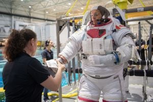
A conversation with Canadian astronaut David Saint-Jacques, who is getting ready to travel to the International Space Station