This article is over 5 years old and may contain outdated information.

Mapping

Toronto exhibition celebrates maps as works of art

Art of Cartography exhibit at the Toronto Public Library features visually stunning maps from the 15th through the 19th centuries
  • Aug 11, 2016
  • 617 words
  • 3 minutes
Septentrionalium terrarum descriptio, Gerard Mercator (1512-1594), 1613. Baldwin Collection of Canadiana, Toronto Public Library Expand Image
Advertisement

For centuries, maps have served as a way to describe and explain the world, but that doesn’t mean they can’t be beautiful works of art. A new exhibit in the TD Gallery at the Toronto Reference Library aims to explore the visual allure of cartography.

The Art of Cartography, which runs from August 13 to October 16 and is sponsored by The Royal Canadian Geographical Society, features stunning maps and atlases from the 15th through the 19th century, created by luminaries like Gerardus Mercator, Abraham Ortelius and Allain Manneson Mallet.

Joanna Morrison, a librarian with the Toronto Reference Library’s Special Collections Department, says while the exhibition touches on the history and methodology of map-making, its central theme is craftsmanship. 

“I think even those people who think that they are not interested in maps will be truly amazed and delighted by these extraordinary and exquisite works,” she says. 

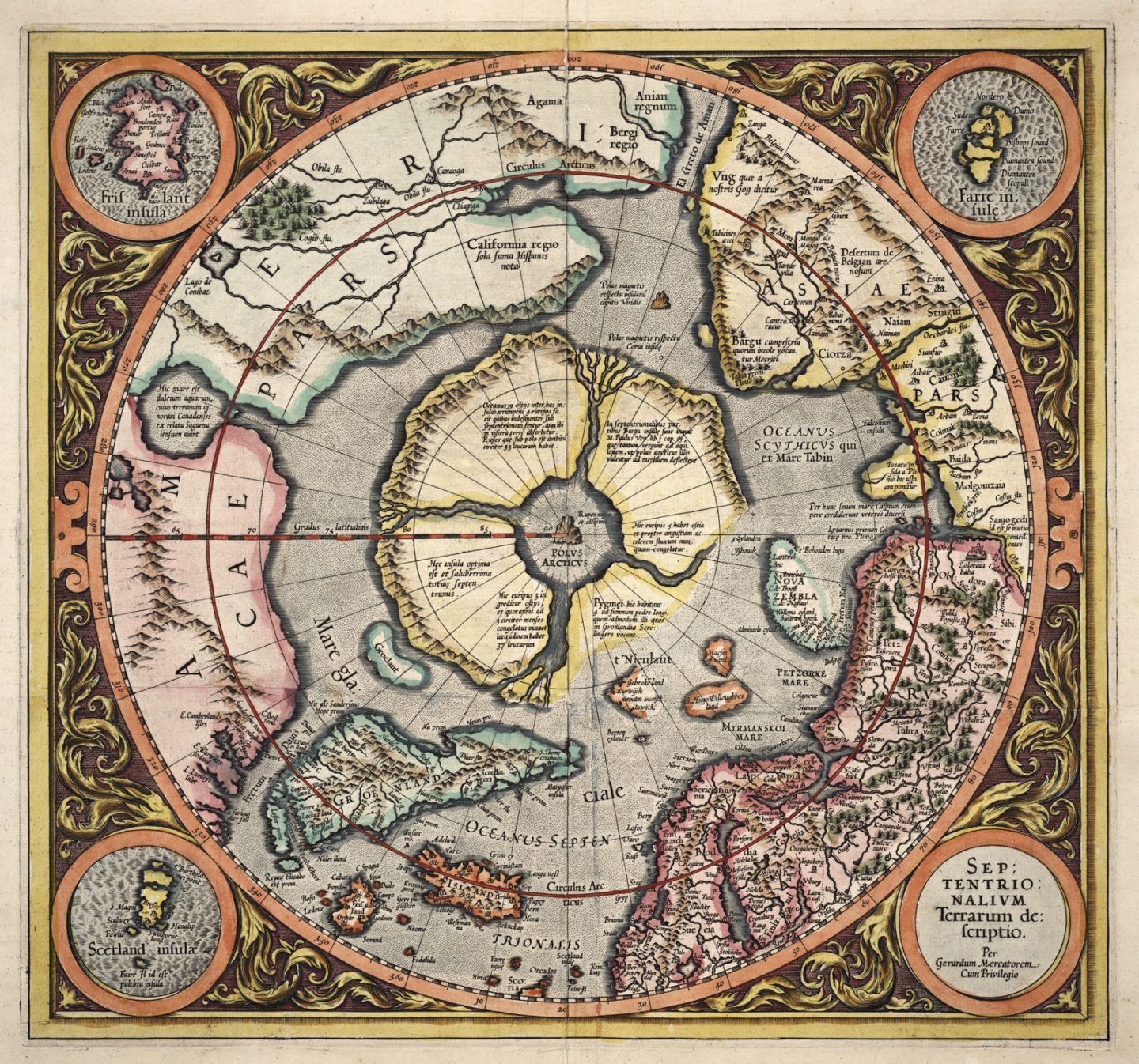
Prior to the 17th century, much of the world was still “terra incognita,” so cartographers used a fair bit of artistic license to flesh out their creations, adding elaborate drawings of plants, animals and mythical creatures to the margins and occasionally even inventing land masses to round out a region’s known geography. Included in the exhibition are a 1755 map by Jacques Nicolas Bellin that features fictitious islands in Lake Superior, and an earlier Mercator map (above) that imagined the Arctic as consisting of four mountainous islands surrounding a black magnetic rock, which was itself surrounded by a whirlpool and river rapids.

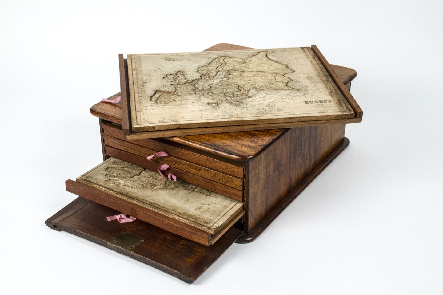
Also on display will be several items on loan from the Thomas Fisher Rare Book Library at the University of Toronto, including the amazing Liber Chronicarum (Nuremberg Chronicle), an illustrated world history that appeared in 1493, and early jigsaw puzzles, which were usually dissected maps designed to teach geography to children. 

“People have often expressed astonishment that we have original maps from hundreds of years ago, in such superb condition,” says Morrison. “I hope this will encourage people to further explore the world of cartography, whether it be ancient maps or modern day.” 

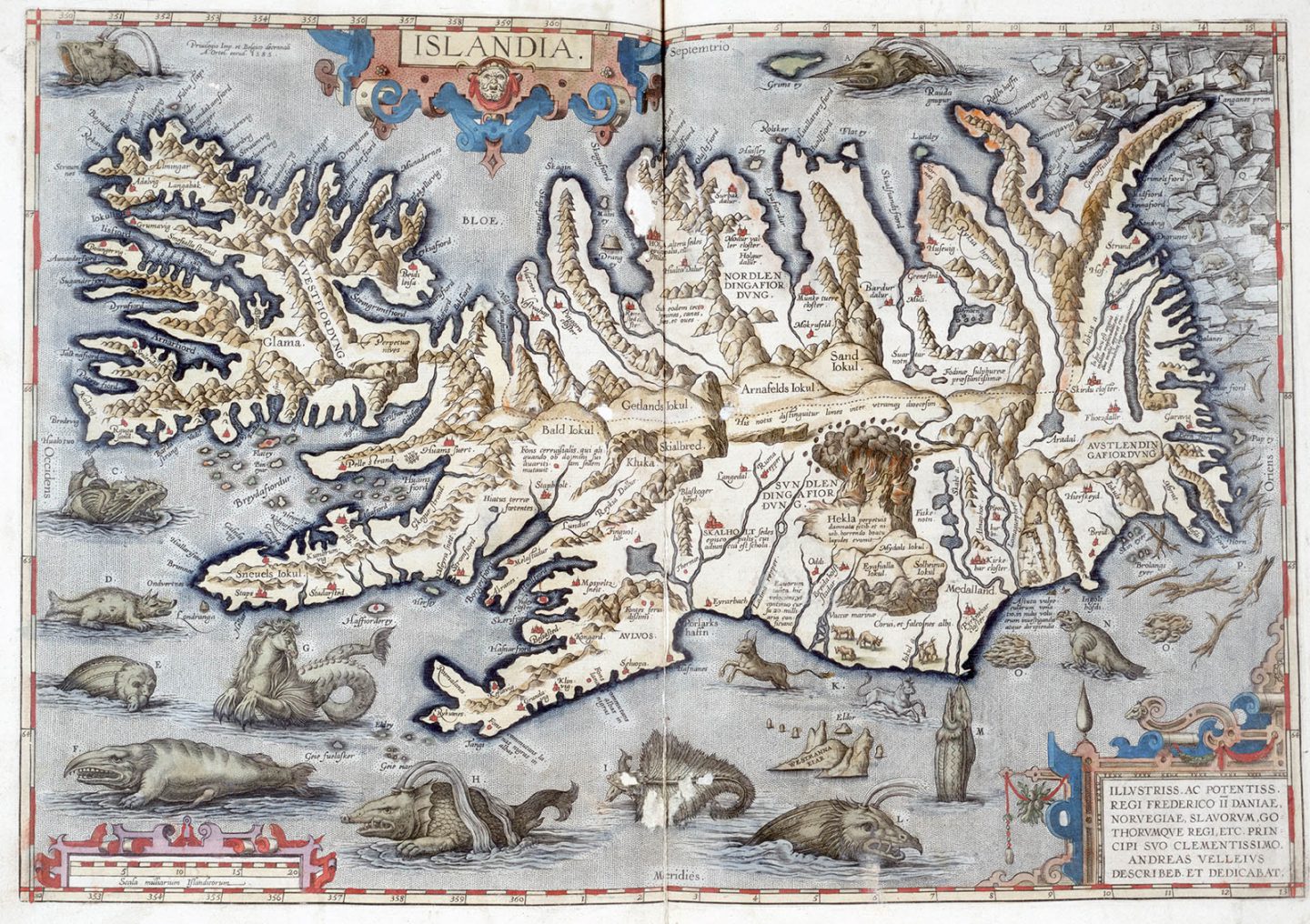
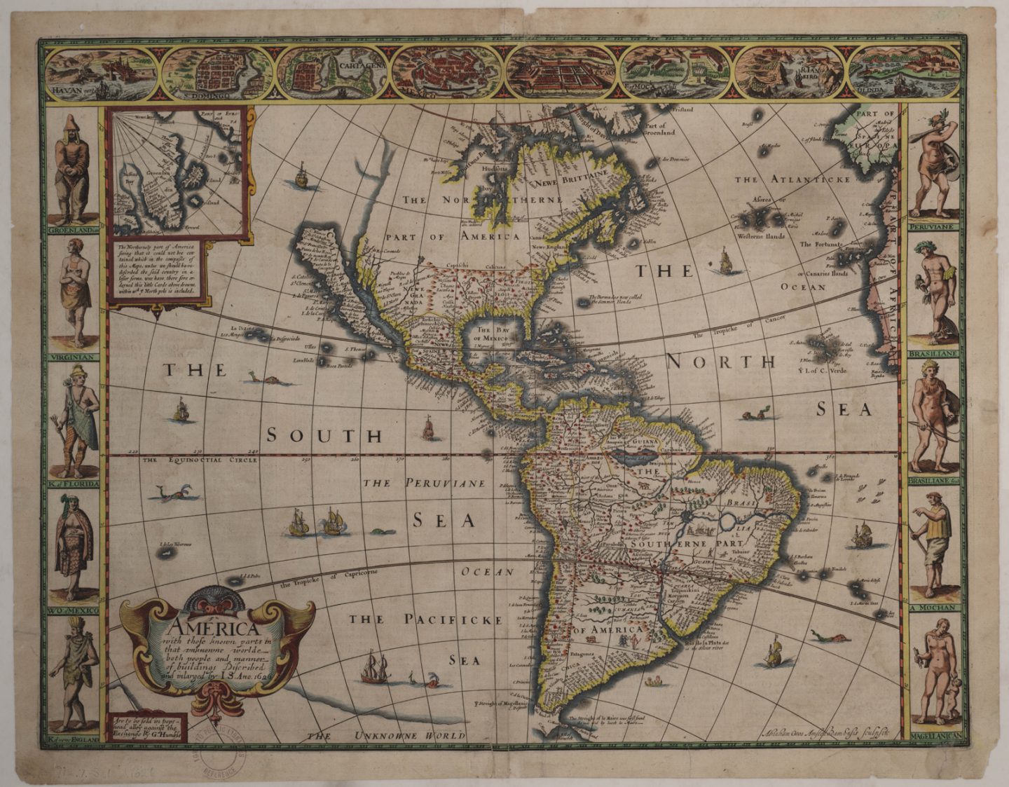
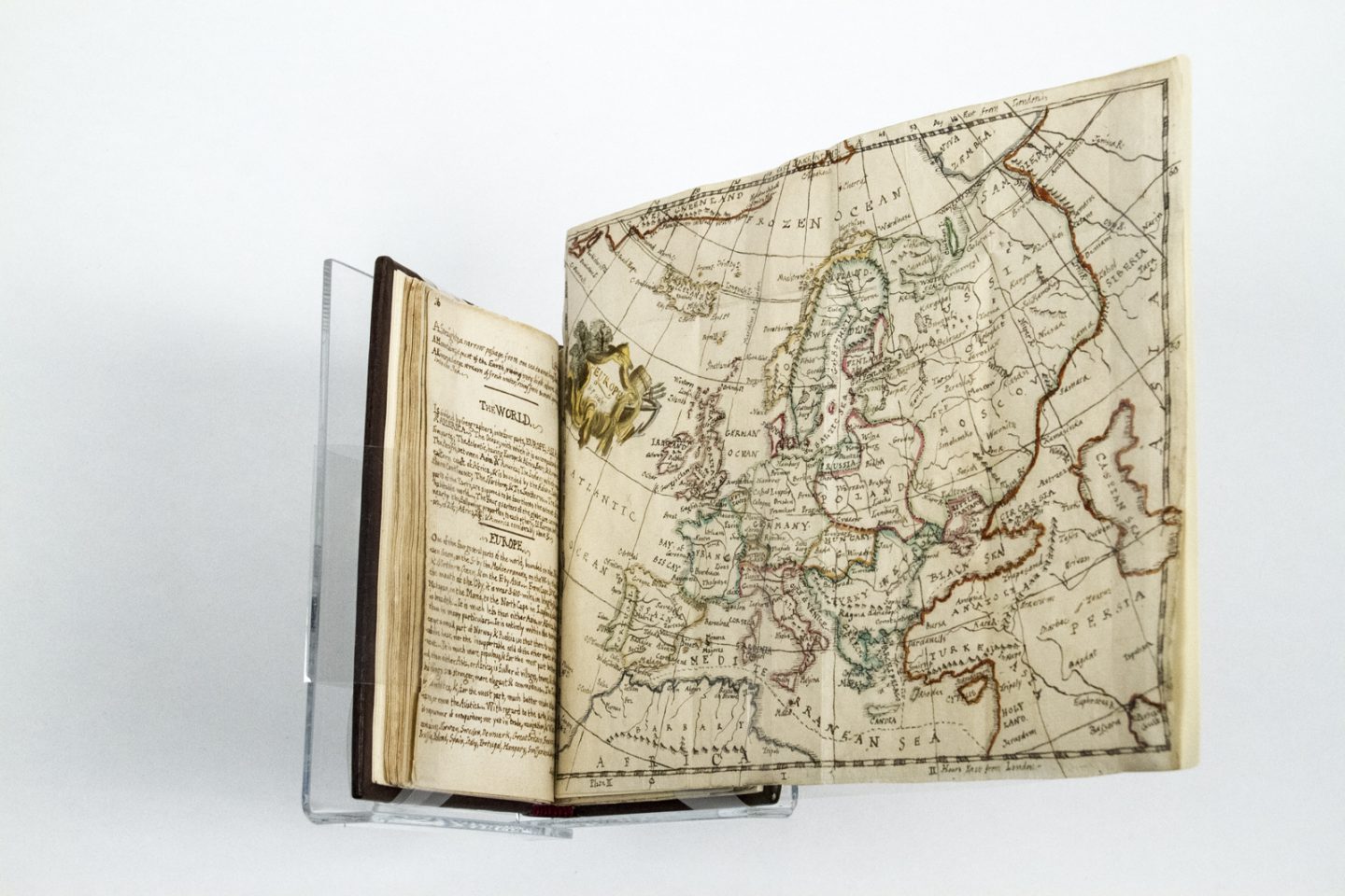
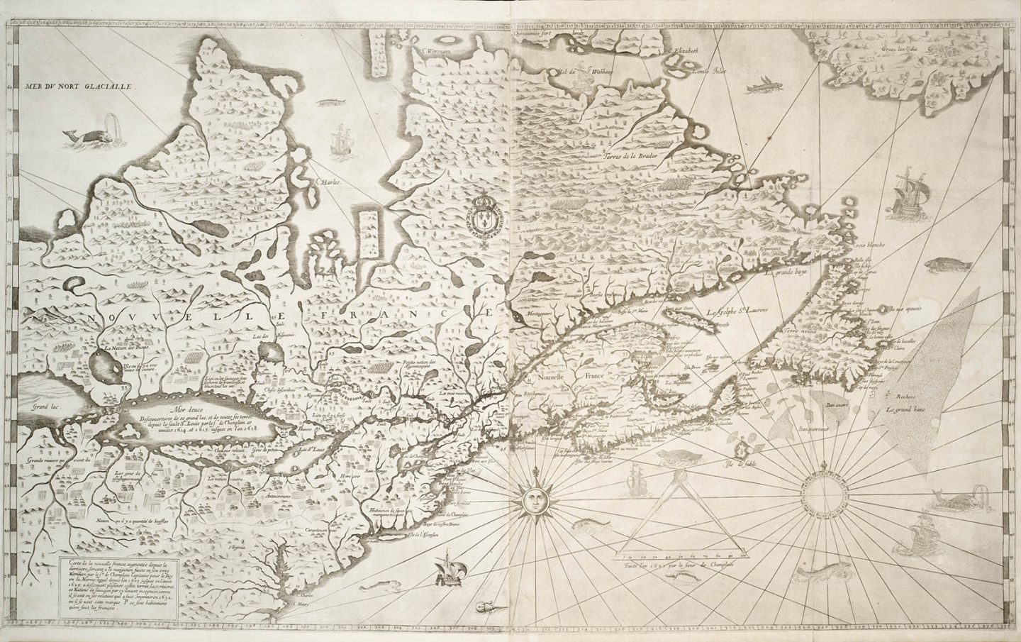
Check out a few more of the maps from the exhibition below: 

Map of Iceland from Theatrvm orbis terrarvm, Abraham Ortelius (1527-1598), 1592. Expand Image
Map of Iceland from Theatrvm orbis terrarvm, Abraham Ortelius (1527-1598), 1592. Ortelius’ “Theatre of the World” is considered the first printed modern atlas. Ortelius included illustrated sea creatures and monsters on many of his maps. This map of Iceland includes many bizarre creatures like the Ziphius, “a horrible sea monster that swallows a black seal in one bite.” (Map courtesy Baldwin Collection of Canadiana, Toronto Public Library)
America with those known parts in that unknowne worlde both people and manner of buildings discribed and inlarged John Speed, 1626 Expand Image
America with those known parts in that unknowne worlde both people and manner of buildings discribed and inlarged, John Speed (1552-1629). Engraved by Abraham Goos (1590–1643). London: G. Humble, 1626. The borders of English cartographer John Speed’s map of America are decorated with bird’s eye views of South American cities and costumed figures of indigenous peoples. Much of North America is unknown territory, and the oceans appear ominous with depictions of sea monsters. This is also one of the earliest maps to depict California as an island. In 1747, King Ferdinand VI of Spain issued a royal decree stating that California was not an island; however, this cartographic error continued to appear on some maps even as late as the mid-1800s. (Map courtesy Toronto Public Library)
 
Eslick map puzzles circa 1880 Expand Image
Eslick’s patent puzzles, Steven Joseph Eslick (1851-1904), ca. 1880. The earliest jigsaw puzzles were dissected maps, created to teach geography to children. This set from 1880 includes six dissected puzzles: maps of Europe, France, Scotland, the United States, Ireland, and England and Wales. (Photo courtesy Osborne Collection of Early Children’s Books, Toronto Public Library)
Charlotte's miscellany Expand Image
Charlotte’s miscellany, printed by Harriet Petrie, ca. 1805. A young British girl named Harriet Petrie created this handwritten compendium of knowledge for her sister Charlotte on her 9th birthday. The section on “Geography” includes five original fold-out maps. (Photo courtesy Osborne Collection of Early Children’s Books, Toronto Public Library)
Carte Generale du Canada ou de la Nouvelle France, Lord Jeffrey Amherst Papers, 1753. Expand Image
Advertisement

Are you passionate about Canadian geography?

You can support Canadian Geographic in 3 ways:

Related Content

People & Culture

5 Canadian artists addressing Canada’s increasingly threatened landscapes 

A century after the Group of Seven became famous for an idealized vision of Canadian nature, contemporary artists are incorporating environmental activism into work that highlights Canada’s disappearing landscapes 

  • 2058 words
  • 9 minutes
Lady Slipper Orchids by Ann Love, one of 48 works of botanical art on display now at the Canadian Museum of Nature in Ottawa. Lady slipper orchids are a native perennial wildflower found across Canada.

Environment

Exhibition celebrates the beauty and intricacy of botanical art

Art of the Plant, on now through October at the Canadian Museum of Nature, is Canada's contribution to a worldwide project showcasing botanical biodiversity

  • 571 words
  • 3 minutes
Assassin's Creed Odyssey landscape

Mapping

Inside the intricate world of video game cartography

Maps have long played a critical role in video games, whether as the main user interface, a reference guide, or both. As games become more sophisticated, so too does the cartography that underpins them. 

  • 2569 words
  • 11 minutes

Mapping

Creative Cartography: Matt Cusick’s map collages

This article is part of a series of Q&As with some of the best artists working with maps. Read…

  • 1186 words
  • 5 minutes