Mapping the moon is surprisingly difficult. It has mountains, suspected caves and vast lava-painted terrains. Unlike Earth, cartographers are working with only a few satellites and surface missions worth of data. Yet this map released by the United States Geological Survey presents the entire surface in stunning 1:5,000,000 scale — a view of the moon’s complex geology never before seen as a comprehensive global map.
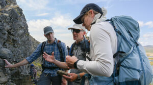
The southern polar view of this map will guide future moon explorers, including Canadians. Earlier this year, the Canadian Space Agency announced Canada will send an astronaut to orbit the moon as part of the Artemis II mission, scheduled to happen no earlier than November 2024. That astronaut, Jeremy Hansen, will surely bring to bear his past geology field training at craters in the High Arctic with Gordon Osinski from Western University in London, Ont., during his flyby.
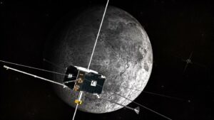
Artemis II — flying three NASA astronauts and Hansen — will inform future landing missions, starting with Artemis III on the far side of the moon’s southern pole no earlier than 2025. All of these explorers will need good maps to do their work, which is where this kaleidoscopic example comes in.
The map, the southern portion of a complete moon map released in 2020, is categorized into 43 geologic units across the entire lunar surface (six are highlighted here). It is based on data gathered from the six Apollo missions that landed on the moon between 1969 and 1972, along with recent satellite missions. A notable inclusion is NASA’s Lunar Reconnaissance Orbiter, which has mapped potential water ice zones near the south pole in high resolution. Future astronauts are expected to land there to build settlements, using the ice for both human and machine needs.
The Lunar Reconnaissance Orbiter also provided elevation data from the north and south poles through its laser altimeter, while equatorial elevation data came from the Japan Aerospace Exploration Agency’s satellite SELENE, short for Selenological and Engineering Explorer.
Unlike during the Apollo years, we now have precise geographic information system software to map features to high definition. But aligning all these sets of data accurately was still a considerable challenge, the United States Geological Survey noted, requiring the help of many other scientists and students at USGS, NASA and the Lunar and Planetary Institute. NASA space grant student Shannon Harrel’s work, for example, brought consistency to the rumpled features of the moon’s surface, like crater rims, fissures, scarps, faults and troughs.
All told, this rugged map presents a history of change on the moon. It’s been rocked by moonquakes and pummelled by meteorites; it even coalesced from the aftermath of a Mars-sized world colliding with Earth some 4.5 billion years ago. The challenge for surface missions, however, is a lack of “ground truth.” Only a handful of equatorial areas on the moon have been visited by humans, and all briefly: three days at most.
That’s where the Artemis surface missions will be useful. Astronauts and robots alike will come equipped with updated measurement tools that will map features to high definition. Further in the future, some folks are hoping to install a GPS satellite network to provide accurate locations no matter where you happen to be putting footprints in the lunar dust.