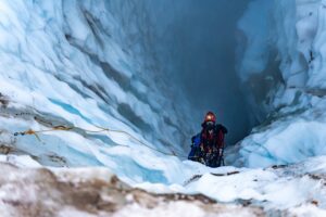
Qwe̓ lqwe̓ lústentranslatesto“cooked face place” or “really hot face” in Ucwalmícwts, the language of the Líl̓wat First Nation. This name dovetails with the story of Mount Meager that scientists have put together. It goes like this: the volcano last erupted about 2,400 years ago, almost yesterday in geological terms. A viscous lava, heated to 800 to 900 degrees Celsius, began to push out of the side of Plinth Peak, the tallest peak in the massif. Without room to move, the growing mass exploded, launching into the sky a glowing cloud of ash, gas and car-sized rock fragments that ripped down the upper Lillooet River Valley at speeds of hundreds of kilometres per hour. The mass couldn’t find enough space to spread out and cool. Instead, the material began to weld itself together, solidifying into a giant dam across the Lillooet River measuring a whopping 110 metres high and more than three kilometres long. Over the next month or maybe two, water pressure built up in the lake that had formed behind the rock wall. According to modelling done by the lab run by University of British Columbia volcanologist Kelly Russell, water burst over the dam and began to slice downwards into the volcanic rock. The force unzipped the land to form a canyon that opened into a waterfall and series of basins. What’s most shocking was the violent speed: water split through 2.5 kilometres of rock in about eight hours.
“This kind of biblical level flooding and unzipping of solid rock, we just don’t think about in modern geologic timescales,” says Glyn Williams-Jones, a professor in the department of earth sciences and co-director of the Centre for Natural Hazards Research at Simon Fraser University. “We think everything’s slow and steady. And this was almost back into the old days of a catastrophic event.”
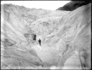
Today, the product of this rupture is a bucolic Instagram hot spot. The resultant Keyhole Falls (Múml̓ eq) and Keyhole Hot Springs are now among the area’s popular hikes, as well as being an important spiritual, cultural and food gathering area for Lílw̓ at Nation. It’s easy to forget that the majestic peaks of the massif, which reach an elevation of 2,680 metres at its highest point, are capable of extreme destruction. But they could, in a matter of hours, dramatically rearrange the verdant pastureland of the valley below.
The danger became very real one weekend in August 2010: around 3 a.m. on a Friday morning, unstable rock layers of the Mount Meager massif gave way, and 53 million cubic metres of rocks, snow and mud came crashing down in Canada’s largest landslide, blocking the Lillooet River. About 4,000 residents of the Lillooet River Valley were told to prepare to evacuate as water pressure built up behind the dam, which appeared ready to burst at any moment. That same weekend, however, Meager Creek mercifully cut a new channel through the debris and eased the buildup. It was a shocking reminder that the grand mountain is highly unpredictable.