Environment
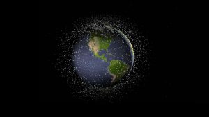
Earth’s orbit has become a cosmic landfill
Michel Doyon, manager of flight and systems operations at the Canadian Space Agency, walks us through what space debris is and its impact on Canada
- 1676 words
- 7 minutes
This article is over 5 years old and may contain outdated information.
Mapping

Geographers around the world have a powerful new tool at their disposal: the most accurate large-scale topographical map of Earth’s surface ever created.
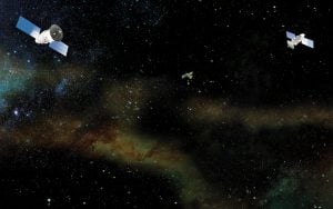
Two German-built satellites, TanDEM-X and TerraSAR-X, spent five years orbiting the planet in extremely close formation, repeatedly scanning Earth’s land masses with powerful radar sensors.
The satellites beamed some 500 terabytes of data back to Earth, where remote sensing specialists at the German Aerospace Centre (DLR) processed it to create elevation maps of unprecedented detail — sometimes accurate to within one metre. Prior to the TanDEM-X mission, elevation models for large parts of Earth were low resolution, inconsistent or incomplete.
The database, which is available for free to researchers, is already proving a boon to scientists studying the effects of climate change: glacial movements can be measured in centimetres, while ice elevation loss or gain can be measured in metres.
“Using the current elevation model, we have shown that in some regions of Earth, glaciers are losing up to 30 metres in thickness per year in the area of the glacier tongues,” says Richard Baumler, director of DLR’s Remote Sensing Technology Institute.
The twin satellites still have some years of life left, so DLR has proposed another mission that would see them produce a new 3D map of Earth every eight days, albeit in less detail. This would allow researchers to track changes in Earth’s topography over time — for example, the impacts of natural disasters or the loss of forested areas.
Are you passionate about Canadian geography?
You can support Canadian Geographic in 3 ways:

Environment
Michel Doyon, manager of flight and systems operations at the Canadian Space Agency, walks us through what space debris is and its impact on Canada

Science & Tech
The last megathrust earthquake to strike Canada was in 1700, and the clock is ticking. How we’re preparing for the impact.

Mapping
Maps have long played a critical role in video games, whether as the main user interface, a reference guide, or both. As games become more sophisticated, so too does the cartography that underpins them.

Science & Tech
As geotracking technology on our smartphones becomes ever more sophisticated, we’re just beginning to grasps its capabilities (and possible pitfalls)