
History
Polar Sea, on guard for thee — or not
Veteran journalist and governor-general spouse Whit Fraser recalls diplomatic row with U.S. over 1980s naval excursion into Canada’s High Arctic in excerpt from latest book
- 4041 words
- 17 minutes
Places
As relations heat up between Canada and the U.S., where does that leave the icy Beaufort Sea?
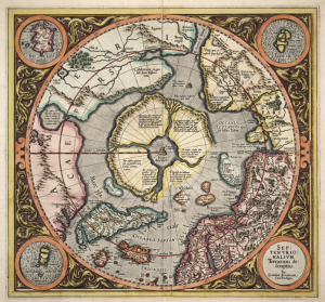
The long-standing dispute between Canada and the United States over the Beaufort Sea can be seen as a metaphor for Canada-U.S. relations.
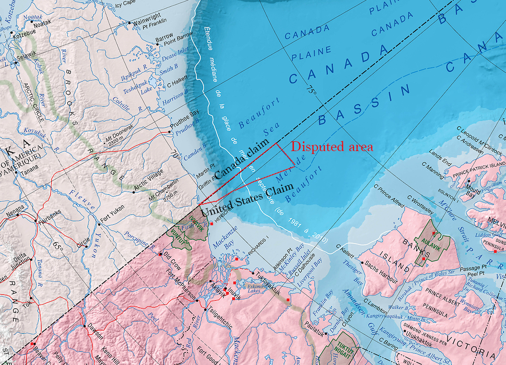
In the Beaufort Sea, which lies north of Alaska, Yukon and the Northwest Territories, there’s a wedge of ocean that has been in question for two centuries. As the border between Canada and America reaches the coastline, the two countries disagree as to which direction that boundary line proceeds into the tides. Canada says it should follow the 141st meridian west, extending the border between Alaska and Yukon. The U.S. asserts the line should instead be equidistant from the two nations.
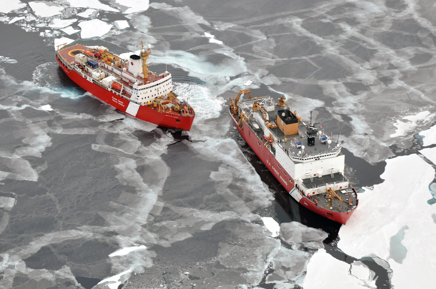
Despite their differences, Canada and the U.S. have been able to resolve a wide range of practical issues, from the pursuit of oil and gas to commercial fishing in the region. The boundary disagreement hasn’t prevented the two countries from developing a seamless defence relationship to protect the region: the two coast guards operate on such a close basis, it’s hard to tell there even is a border. All of this is based on shared values and interests that have made the boundary issue seem almost irrelevant. But this may be about to change.
The re-election of Donald Trump has turned this relationship on its head — and is threatening to undermine it entirely. While Trump has not specifically mentioned the Beaufort Sea dispute, it is hard to see how the cooperation between nations can withstand what he has said.
The seeds for the border disagreement were sown before Canada even existed as an independent nation, back when the Russian Empire still owned Alaska. In the 1825 Treaty of Saint Petersburg, Russia and the United Kingdom agreed to use the 141st meridian as the dividing line between Alaska and the northwestern section of British North America. But there was little concern over the maritime border for two main reasons. First, international law at that time allowed coastal states to control only the area three nautical miles from their coastline. Any differences in how the sea was to be divided were not seen as significant. There was also very little economic incentive for either side to try to exploit the region’s resources, as the sea was frozen for much of the year, making access difficult.
Complicating the issue was the language of the 1825 treaty. It was customary at the time to use French — and what was written was confusing and open to interpretation. Even when Russia sold Alaska to the U.S. in 1867, the issue of the maritime boundary did not attract any real attention.
But tensions over that boundary surfaced in the late 1970s.
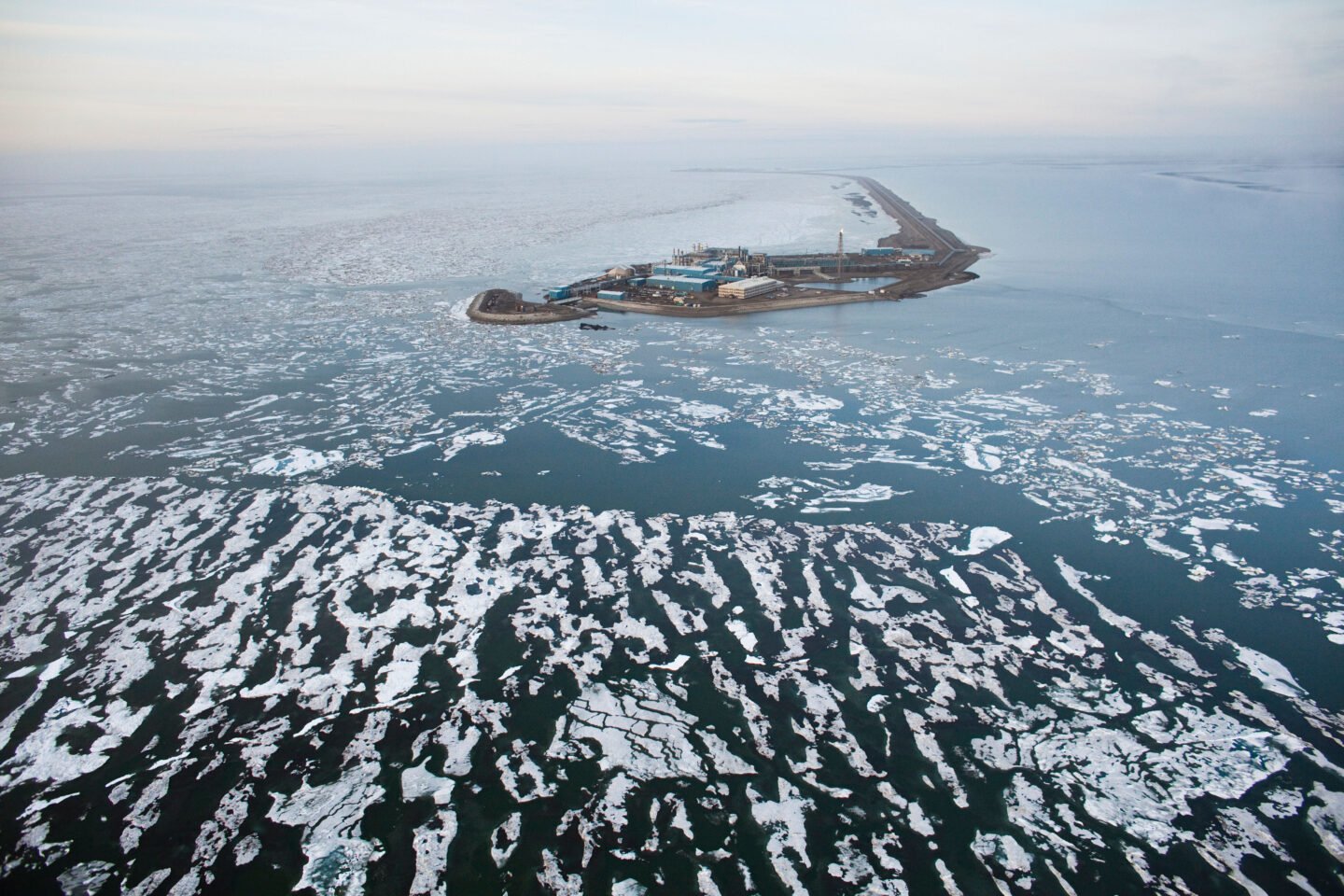
Both states knew the Beaufort Sea probably contained significant sources of oil and gas. The U.S. discovery of large deposits of oil off the north slope of Alaska in 1968 generated unprecedented interest in the region. The two nations suspected the Beaufort Sea would also contain rich deposits.
In 1973, negotiations began for what would become the United Nations Convention on the Law of the Sea. As negotiations went on, it became clear that areas extending into the ocean from coastal states would be expanded from three to 200 nautical miles through the creation of exclusive economic zones. The convention gave all coastal states sovereign control over their EEZ’s resources. In 1977, both Canada and the United States applied this new 200-nautical-mile EEZ to their northern waters.
But given the 1825 treaty’s vagueness, they had differing interpretations of what that would look like. Canada claimed the boundary dividing Alaska from the Yukon and northern British Columbia should be extended in a straight line into the sea. The United States made the case for the “equidistance principle,” which meant drawing a line that extended perpendicular to the coastline. Unsurprisingly, both countries favoured themselves. The difference between the two created a 21,197-square-kilometre wedge of disputed water and seabed.
They tried to negotiate. In the first phase of negotiations in 1977, Canada suggested the two countries resolve several maritime disputes in one fell swoop, aiming to find compromises that could satisfy both nations. They told the U.S. that Canada would “accept a compromise jurisdictional boundary [in the Beaufort Sea] more or less along the geographic coordinates put forth by the United States, provided American officials would grant Canada similar boundary concessions in the Gulf of Maine and off the Strait of Juan de Fuca.” But the Americans refused to link the boundary issues in a comprehensive approach.
Further negotiations took place but never succeeded. The most recent effort was announced on September 24, 2024, renewing hope that this issue would be resolved once and for all, especially in an era of a rapidly changing Arctic. “Our common interests in the region have served as the foundation of our bilateral Arctic relations for many decades and will continue to guide our Arctic cooperation in the future,” read the joint statement by the two governments.
Indeed, Canada and the United States have cooperated on a wide range of issues. In 2016, citing environmental concerns, President Barack Obama and Prime Minister Justin Trudeau both agreed to a moratorium on the search for offshore Arctic oil and gas in the entire Beaufort Sea.
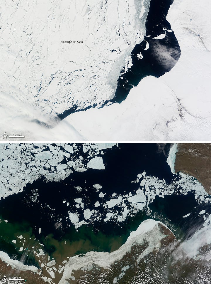
The United States also closed commercial fishing all of its Arctic Management Area, including the Beaufort Sea and the disputed zone, in 2009. The Americans were concerned that not enough was known about existing stocks as climate change reduced ice cover and opened the potential for future fishing. Canada had very limited fishing in the region, with most being Inuit traditional rather than commercial fishing. Canada joined its neighbour in limiting the potential for commercial fishing until more science emerged. They eventually banded together with other fishing nations, Arctic nations and the European Union, leading to the Central Arctic Ocean Fisheries Agreement to prevent unregulated fishing in the high seas of the central Arctic Ocean. Signed in 2018 and implemented in 2021, this agreement stops all commercial fishing in the region for 16 years.
The fact that Canada and the United States disagree about the maritime boundary has also never affected the seamless aerospace defence above the waters. In 1957, to defend and deter the bomber and missile threat posed by U.S.S.R. (and subsequently Russia), the two nations collaborated on a bi-national command called Norad (for the North American Air Defence Command, which was later renamed the North American Aerospace Defence Command). Norad remained in effect even after the Cold War ended. As recently as 2023, Chinese surveillance balloons were tracked crossing the American and Canadian Arctic and subsequently destroyed through Norad.
So: a disagreement that could have been a major political problem has remained in hand since it was argued into existence. But will the ability to manage this agreement persist in the face of the upheavals of the Trump administration’s actions towards Canada?
The threats of tariffs and annexations are beginning to poison this historically amiable relationship. And Trump has already stated his opposition to the existing and accepted borders between Canada and the United States. It is highly doubtful that he would simply ignore a border where a disagreement already exists. He has also stated his intention to reboot the oil and gas industry in Alaska and will probably see that disputed wedge as an American piece of the pie.
All this means the long-term “agree to disagree” spirit that has characterized the Beaufort Sea dispute is likely to come to an end. Does that mean the U.S. will more urgently try to resume talks that were recently restarted, or will it result in more aggressive actions from the Americans? While some observers feel that American officials — many of whom have developed close relationships with their Canadian counterparts — may try to negotiate a fair deal with Canada, that is unlikely to occur. First, Trump has been very effective in ensuring that all of the American bureaucracy serves at his pleasure — and that failure to do so means termination. Second, given his obsession with Greenland, it is highly unlikely he would agree to any terms that would not give the United States 100 per cent of its claims in the Arctic. What this should teach Canadians is that in international relations, there really is no such thing as a permanent special relationship. Canada should have settled this issue a long time ago.
History
Veteran journalist and governor-general spouse Whit Fraser recalls diplomatic row with U.S. over 1980s naval excursion into Canada’s High Arctic in excerpt from latest book

People & Culture
As the climate heats up, so do talks over land ownership in the Arctic. What does Canadian Arctic Sovereignty look like as the ice melts?
People & Culture
In this essay, noted geologist and geophysicist Fred Roots explores the significance of the symbolic point at the top of the world. He submitted it to Canadian Geographic just before his death in October 2016 at age 93.
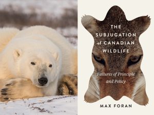
Wildlife
In a new book, Max Foran denounces Canada's failures in protecting its wildlife from human exploitation