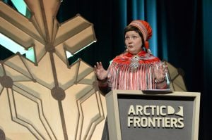
Wayne Pollard, a research scientist and professor in the geography department at Montreal’s McGill University, has been studying permafrost and geohydrology — how water moves underground — in Canada’s High Arctic for nearly 40 years. Pollard’s commitment to understanding the physical landscape of the North has led him to set an impressive track record figuring out the mechanics and drivers of permafrost thaw, the formation and deformation of ground ice and the flow of ground water in such far-flung places as Ellesmere and Axel Heiberg islands. No wonder, then, that he received a standing ovation when he accepted the Weston Family Prize for Lifetime Achievement in Northern Research at ArcticNet, the annual science conference dedicated to northern research, in Halifax on December 5, 2019. Coincidentally, just two weeks earlier, he’d been awarded The Royal Canadian Geographical Society‘s Martin Bergmann Medal for Excellence in Arctic Leadership or Science. He spoke to Canadian Geographic about finding water that never freezes, doing science in the age of Twitter and working with the Canadian Space Agency.
On studying permafrost and groundwater in frozen landscapes
For my PhD, I studied the hydrology of seasonal frost mounds and icings that result from the seasonal interactions of water in the permafrost landscape along the Dempster Highway in the Yukon. During my post-doc, I studied massive ground ice along the Beaufort Sea coast in the northern Yukon, including Herschel Island. I was looking at the formation and deformation of ice at and just under the surface and how water moves in the ground, and how those affect landforms. The assumption was that water should become ice when the active layer — the surface layer of soil that covers the permafrost — froze in winter, and it should not be able to travel through permafrost. Those assumptions were turned on their head when, after my post-doc, I started doing field research on Axel Heiberg Island in the High Arctic and came across water that flowed year-round, not just in the summer. I had come across perennial springs.
On water that doesn’t freeze and the landforms created at perennial springs
In 1990, I became the director of the McGill High Arctic Research Station, MARS, on Axel Heiberg Island. It was a natural extension of the work on permafrost and ground ice and water I had started there in 1988, after joining McGill. I still go there in the winter — the temperature can drop to below -40 C at night, and might creep up to -35 C during the day — because to properly study an extreme cold environment like the High Arctic, you need to be there during the cold months; going there only in the summer doesn’t give you the full picture.
That water that flowed year-round that I had discovered on one of my field trips was salty, like sea water. A botanist who had done research in the area had described such a salt spring, looking at the chemistry and plants, but there was no other information.
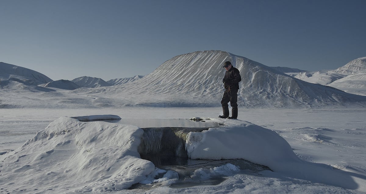
As I was studying this spring — it was actually a set of springs — I found another set of springs. By the mid-1990s, I had found eight different groups of perennial springs, all saline, while exploring the island. A picture started forming, but each of the eight pictures was different — the clusters of springs had different salt compositions. Think of how salt melts ice on a road. Water with salt freezes at -20 C. But in the perennial springs, a different composition of salts forces the freezing point even lower. What I discovered was that permafrost is an obstacle to this salty water, not a barrier, so the water manages to finds its way around, creating a dynamic landscape at the springs.
Each perennial spring has a different surface expression depending on the types of salt it contains. Mounds — they’re essentially seasonal pingos — often form around them, along with surface deposits of salt. Because freezing rejects minerals in solution, you get some unusual mineral formations, but only in winter. While the surface deposits have a transient mineral structure, they can reach 10 metres’ thickness. Since some of these landforms exist only when the temperature drops below freezing, it’s important to spend time in the Arctic in winter.
In the High Arctic, perennial springs should not exist. Their occurrence in the Arctic Archipelago is unique, with Axel Heiberg Island having the second-highest concentration of salt domes in the world. But these mineral deposits also make the Canada Basin, the seafloor that stretches from Ellesmere Island to the Beaufort Sea, a target for mineral exploration.
On collaborating with the Canadian Space Agency and NASA
Through my work in the Arctic, I’ve developed ground penetrating radar to detect ice and water. The GPR is used to map the ground and its structure under the surface, which allows us to see where water might flow. So, when the Canadian Space Agency wanted to map the geology on the moon and NASA wanted to search for water on Mars, the GPR was the best tool. The extreme cold environment in the High Arctic can be used as an analogue to what life on Mars might have been like two billion years ago, so the findings from my research there could be useful when looking for water — and life — on Mars.
On being a scientist in the social-media age
Science is competitive — we’re producing so many scientists — and today, hype and social media like Twitter is changing the way we use science. Everyone wants to get into Science magazine or Nature with their findings because they see media as proper validation of science. But scientists need to represent their work honestly and without getting caught up in the hype. To do good science, you need to ask if your work serves the broader public and be committed to properly represent what you find. There are two types of scientists; if we use the case of field research in the Arctic as an example, you’ve got the ones who go north once or twice, and you’ve got those who keep going back year after year. I’ve worked with about 50 graduate students over the years, and I’m proud of them — they’ve shown commitment by doing science in a systematic way.
On why the North matters
The majority of Canadians live in the southern part of the country, but most of our landmass is located in the North. We need to be committed to understanding the north, not just controlling it politically, and we need to show commitment to the people who live there. To do so, we need to know more, because knowledge allows us to manage the land, not mismanage it, which we have done over and over again by allowing oil and gas exploration. In the last 10 years, there’s been an increased interest in the North with incentives to raise research and involvement, but also to making the research useful for the people who live there. The North has always been a big part of my life. My connection to it is spiritual.


