Mapping
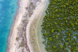
New mangrove forest mapping tool puts conservation in reach of coastal communities
Mangroves provide a range of benefits, including protection from storms and the prevention of coastal erosion
- 1080 words
- 5 minutes
This article is over 5 years old and may contain outdated information.
Mapping
Terrapattern uses satellite imagery and pattern recognition to identify specific visual features of an area


Chances are we’ve all used a digital satellite map to search for a building, a park or a body of water. But what if you’re curious about more esoteric data, such as the number of homes and businesses with solar panels in your city, or the number of traffic roundabouts?
It turns out there’s a map for that.
Terrapattern uses satellite imagery and pattern recognition to locate specific visual features of an area. Once you’ve identified a feature by clicking on an area of the map, Terrapattern locates all other spots on the map just like it, meaning if you wanted to, you could find all the golf course sand traps in your city.
The tool is still in its early stages, with only six searchable cities available so far—Pittsburgh, New York City, Detroit, San Francisco, Miami and Berlin, Germany. The idea behind the project is to give people the opportunity to explore their interests in a novel way and to develop greater knowledge about the “unmappable.” The creators also hope Terrapattern will detect things of sociological, humanitarian, scientific, and cultural significance that have not been previously identified or thoroughly studied.
While Terrapattern certainly sparks curiosity (and threatens to suck you into a vortex of finding all the nautical wrecks off the coast of New York), it also offers some more practical applications.
For example, the creators say one of their friends is using it to locate unused swimming pools, which are ideal for skateboarding.
What would you try to find with Terrapattern?
Mapping
Mangroves provide a range of benefits, including protection from storms and the prevention of coastal erosion
Mapping
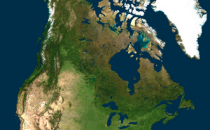
Chris Brackley explores four map backgrounds and makes the cartographic case for why satellite imagery isn’t as useful in mapmaking as you may think it is.

Science & Tech
Satellite detection of whales is improving rapidly, but finding the behemoth creatures is still surprisingly tricky
Environment
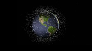
Michel Doyon, manager of flight and systems operations at the Canadian Space Agency, walks us through what space debris is and its impact on Canada