History
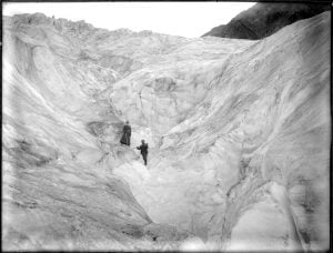
Frozen in time: The remarkable legacy of Mary Vaux, amateur glaciologist
Mary Vaux’s groundbreaking 19th-century study of B.C.’s Illecillewaet Glacier created an invaluable record of the glacier’s recession
- 4293 words
- 18 minutes
Environment
What vanishing mountain glaciers mean for river flows, groundwater and the millions who depend on them
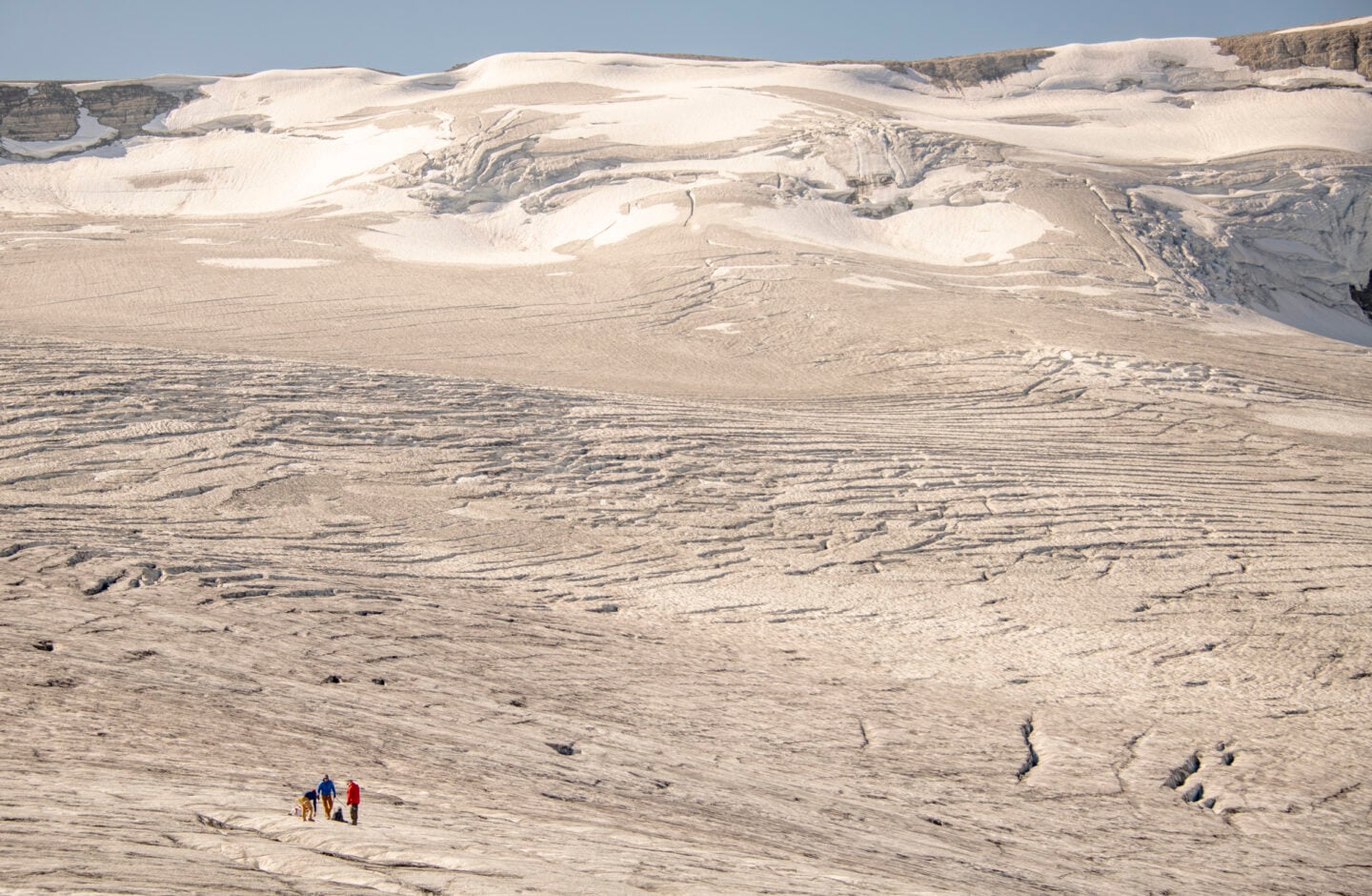
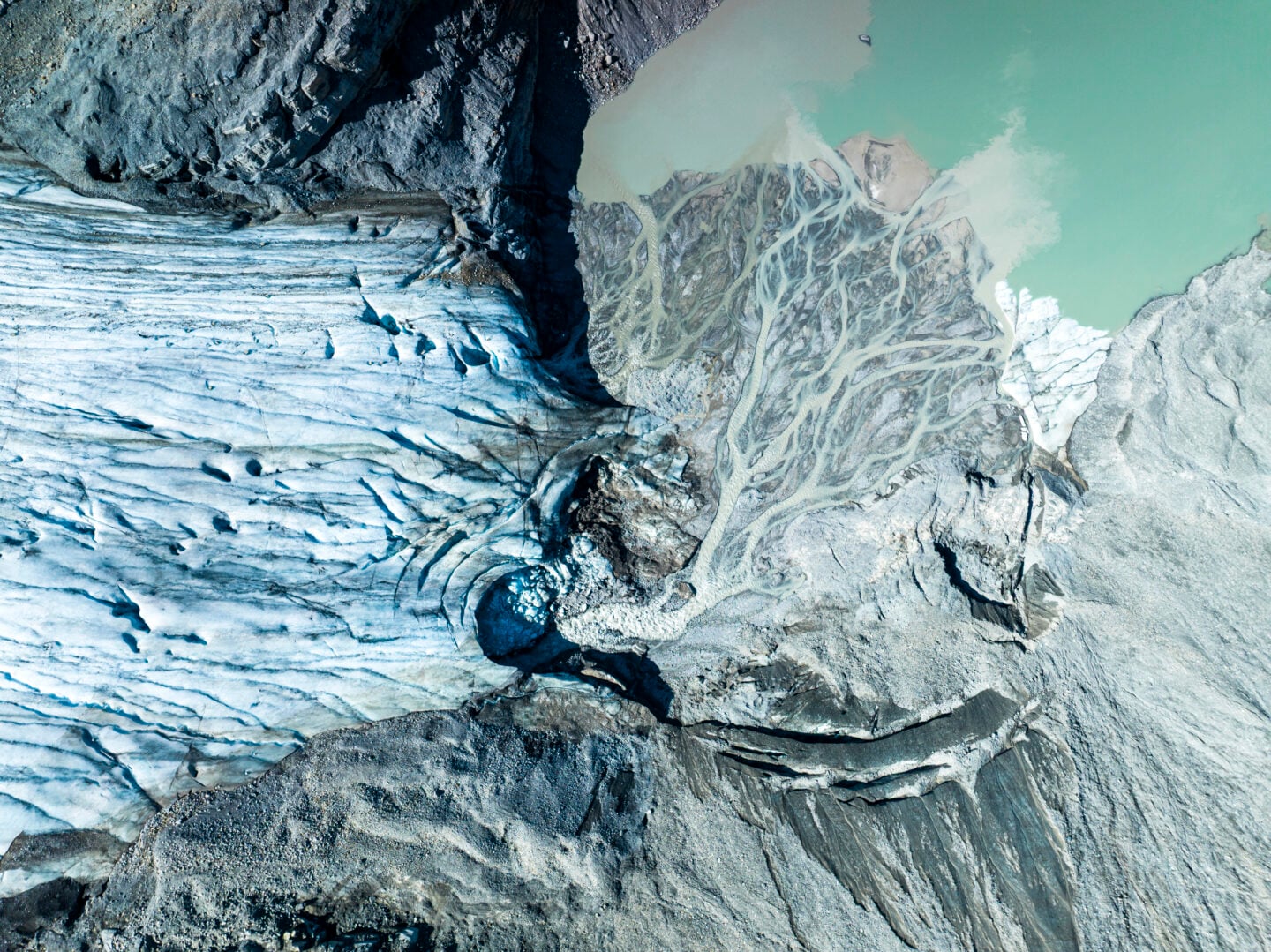
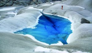
Meltwater skims the ice, forming deep channels in Peyto Glacier’s wrinkled surface. The run-off swirls into a manhole-sized shaft, gurgling downward through tens of thousands of years of accumulated ice before joining an unseen subglacial torrent.
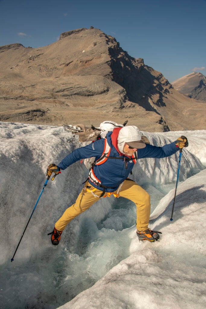
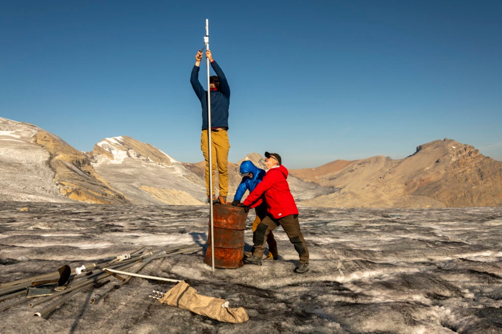
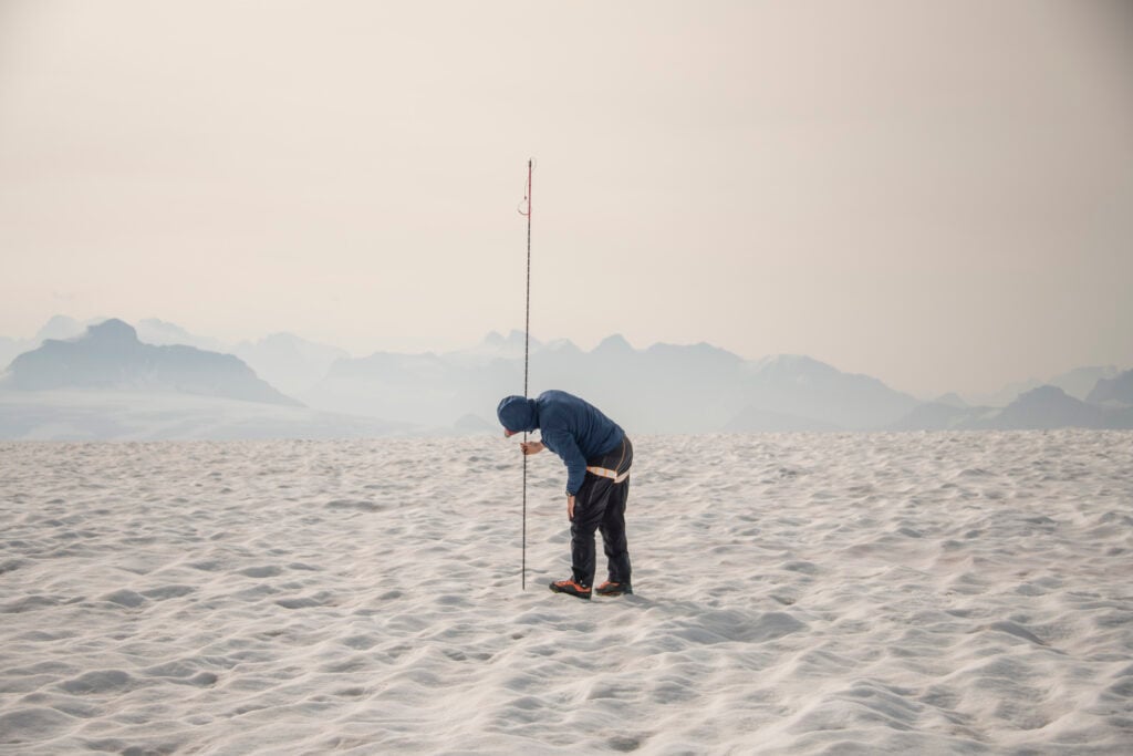
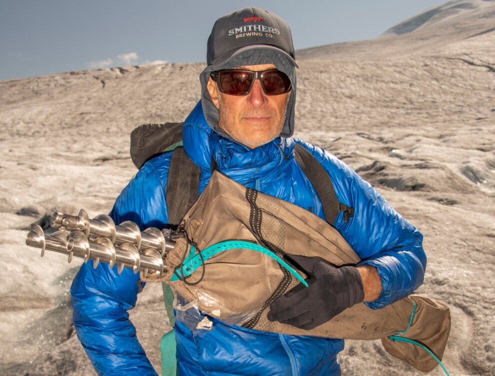
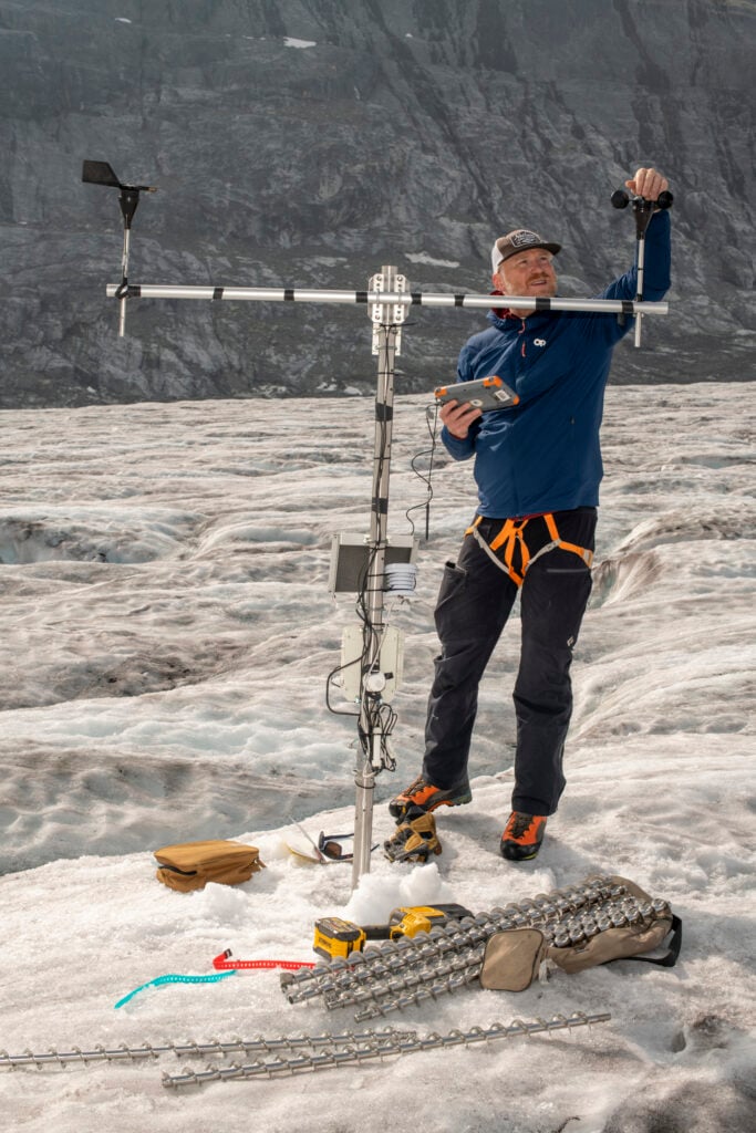
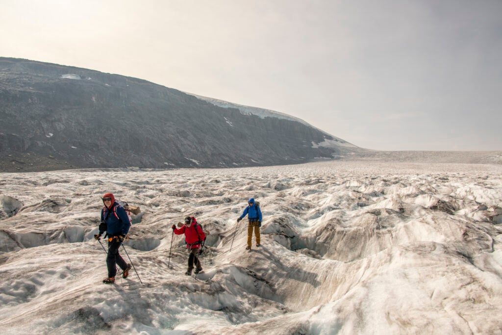
Nearby, Mark Ednie, a glaciologist with the Geological Survey of Canada, and his colleague Rod Smith, bore a new hole for stake number 165. The hefty battery-powered drill whines and labours against the steel-hard ice. Ednie hauls up on the drill, mops his forehead with the back of a gloved hand, then grabs a six-metre aluminum stake, used for measuring snow depth and ice melt. He fits one end into the hole, then releases. The stake drops, disappears, then hits the bottom with a kerplunk.
“There’s been so much melt in recent years we’re drilling the holes up to two metres below the surface, so at least the stakes will still be in the ice next September,” Ednie says.
Or at least, he hopes they will be. Climate change is affecting the glaciers in the Rockies that feed mountain watersheds and the rivers flowing from them. Half the world’s population depends on mountain rivers, including the people of the Canadian Prairies. More than 90 per cent of the water Albertans drink comes from rivers on the eastern slopes of the Rockies. And yet old assumptions about water supply are starting to crumble. Shifting rain and snowfall patterns, a warming climate and disappearing glaciers are happening simultaneously. It makes for a complicated hydrological picture.
Ednie jots numbers into his weathered notebook. A warm wind whisks across the ice, carrying with it the roar of a distant waterfall. For backcountry-skiing and mountain-climbing scientists like Ednie, this is a dream job. Every year, he packs his bags and visits the same six glaciers, two of which, the Peyto and Saskatchewan, are in Alberta. In May, he skis a transect of aluminum stakes from the upper basin to the toe of these glaciers. In September, he hikes that same transect to measure snow and ice melt. “Last May, I was skiing down the glacier towing a toboggan loaded with a drill, batteries and other gear. Not easy,” he says, with a laugh.
It’s laborious, but Ednie loves being in the mountains. He has made dozens of trips to the Peyto Glacier since he started working on this project in 2011. He knows its contours like the deepening lines on the face of an old friend.
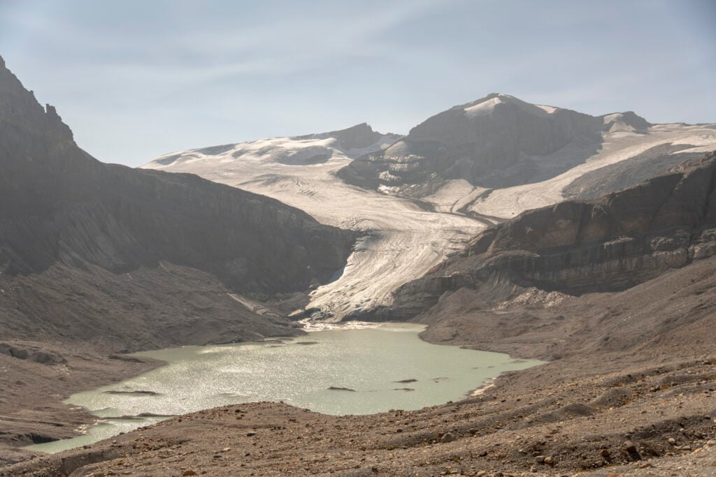
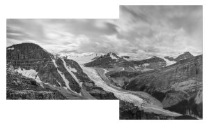
Peyto Glacier is a hallowed place in Canadian glaciology as one of the most studied glaciers in the country. Annual data for the Peyto dates back to 1966, when scientists built a research station a short stroll from the glacier’s terminus. Today, the abandoned station sits like a shipwreck, several kilometres away from Peyto’s rapidly receding toe.
When Ednie’s field season wraps up in the fall, he returns home to his family in Chelsea, Que., within cycling distance of the Geological Survey of Canada’s Ottawa office. There, he sits at the computer and crunches data to find a number called “mass balance” — the difference between the mass added to a glacier in winter (through snowfall, avalanches, windblown snow) and all the mass lost in summer (through ice and snowmelt or calving, when large chunks of ice become detached). A negative mass balance indicates the glacier is losing mass. It’s dying.
“Peyto has been losing mass at an increasing rate since 2015,” Ednie says.
Imagine a healthy glacier as a river of viscous glue moving downhill so slowly as to be imperceptible. The upper basin of a glacier is known as the zone of accumulation. Snow falls throughout the winter, and over the next year becomes “firn,” a type of partially compressed snow. Firn accumulates and is eventually compressed into new ice. These days, many mountain glaciers are melting to bare ice from the top to the terminus. There is no new ice formation, just loss.
For the Peyto, 2023 was a scorcher. That year, Ednie calculated a mass balance of -2,760 millimetres of water. That’s equivalent to 25 million tonnes of water, or enough liquid to fill 1,000 Olympic-sized swimming pools that poured off the glacier into the North Saskatchewan River basin.
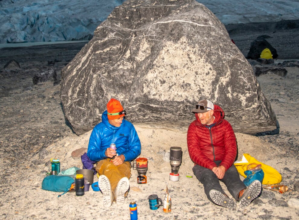
After a full day of fieldwork, Ednie’s and Smith’s shoulders ache from drilling holes in ice. The Catharine and Peter Whyte Hut beckons from a boulder ridge below Mount Thompson. They traverse the glacier past crevasses, natural cracks that form as the ice bends and folds under the pull of gravity. Vertical blue-green walls of ice disappear into blackness.
They find a ramp of smooth ice that exits the glacier onto polished bedrock. So recent is the glacial retreat here that oxidization has not yet darkened the rock, and no lichen is growing on its surface. They remove their crampons and hike up the slope, searching for solid footing in a shifting landscape of loose talus. When the team pull off their boots, it’s time to crack happy hour beers on the hut’s deck. Rockfall suddenly cracks like a pistol shot from crumbling Mount Habel, which has been shedding onto the Peyto’s upper slopes all summer. Then it’s silent again, except for the omnipresent rush of moving water.
“The valley bottom of Kananaskis has about half the snowpack it had in the 1960s, and that’s a very clear signal.”
Though Ednie’s focus is Western Canada, he contributes data to the World Glacier Monitoring Service, a collaboration between more than 30 countries that monitors the mass balance of 130 glaciers. The picture is grim. According to a study published last spring out of Vrije Universiteit Brussel, if trends continue and the planet warms by 2.7 C by 2100, almost 100 per cent of mountain glaciers in the west of Canada and the U.S. will have vanished.
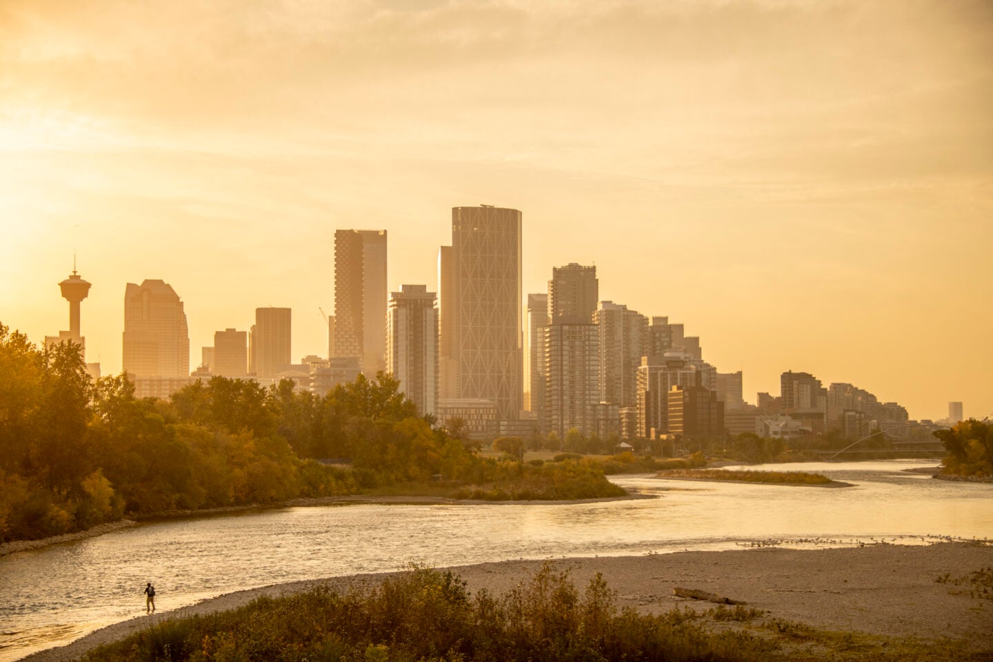
Bow Glacier, just out of view from the hut on the ridge, is another of the Wapta Icefield’s ailing glaciers. Trickles of ice melt on the Bow gather into torrents that feed the glacier’s namesake lake and river, which winds east through the Rockies into the Prairies as surely as it winds through the soul of many Albertans.
Canoeists paddle the Bow River’s gentle rapids between Lake Louise and Banff. Tourists snap selfies in front of Bow Falls near the Banff Springs Hotel. Fishers cast for prized brown trout where the river snakes past the glass towers of downtown Calgary on its journey to meet the Oldman River near Medicine Hat where it forms the South Saskatchewan River.
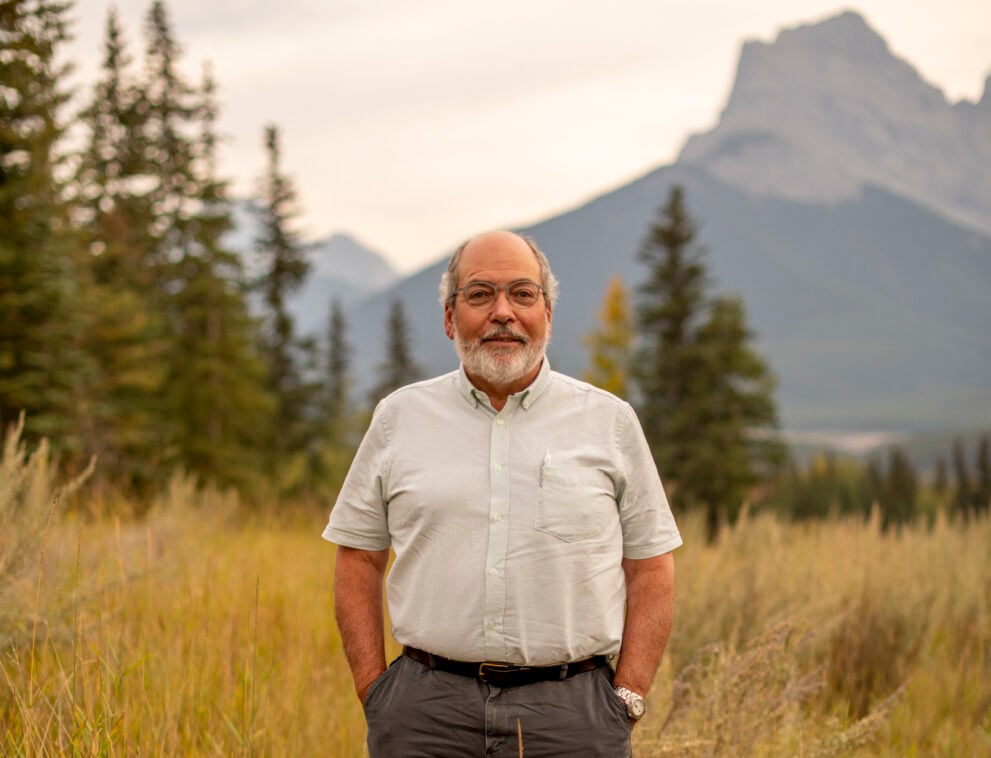
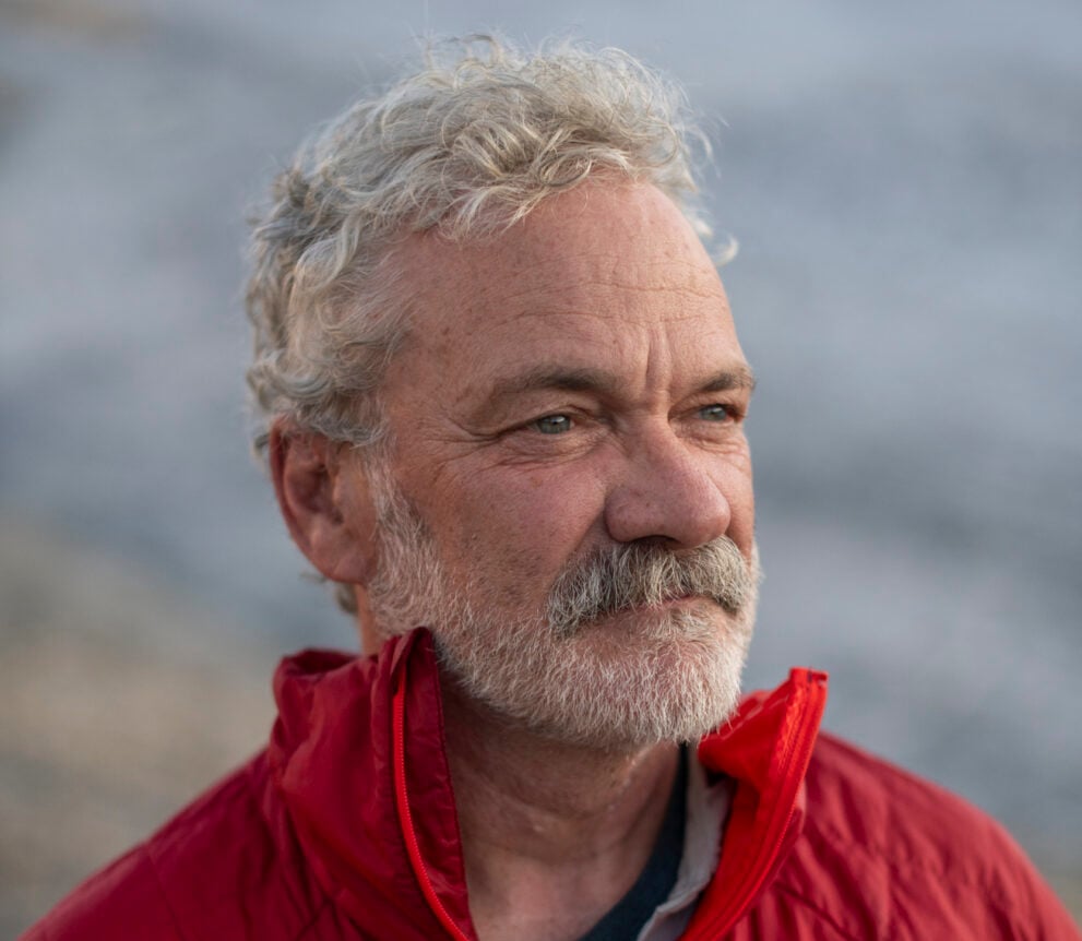
More than a hundred meandering kilometres downstream from the Bow Glacier, Canmore’s downtown bustles with weekend traffic. Tourists jostle for ice cream on the pedestrian main street, enjoying the late summer weather. Locals cool off in Quarry Lake, a manufactured swimming hole with an idyllic sand beach below Ha Ling Peak’s imposing north face. John Pomeroy, Canada research chair in water resources and climate change, is catching up on emails at the Coldwater Laboratory.
Pomeroy heads a team of technicians and graduate students who manage the Canadian Rockies Hydrological Observatory, a network of more than 40 hydrometeorological stations across a swath of rugged mountain country from the Columbia Icefields south to Kananaskis Country. Using radio telemetry, the stations beam real-time data on precipitation, wind, temperature and humidity to the Coldwater Lab. The goal is to uncover what is happening in mountain hydrology — and how that is affecting “exotic rivers,” which deliver moisture from high-humidity regions to dry areas where rivers may be the only reliable source of water. The Bow and North Saskatchewan serve that function for the Canadian Prairies.
When people think of the Canadian Rockies, they imagine iconic glaciers tumbling from mountain peaks toward turquoise lakes. Glaciers are sexy. People love taking photos of them. It’s the reason the United Nations declared 2025 the International Year of Glaciers’ Preservation, a hopeful name intended to galvanize public awareness about the rapid global warming-induced changes in the cryosphere.
Yet despite the thundering cascades of water spewing from glaciers on a hot summer day, ice melt contributes a surprisingly small percentage to the overall flow of mountain rivers. For the Bow River, says Pomeroy, that’s anywhere between three and five per cent. But glacial melt is still an important pulse of cold fresh water that comes at the hottest time of year.
Computing the shifting variables of the mountain hydrology equation — rainfall, snowpack, glacier recession, temperature — and making future predictions about weather is not an exact science. It’s more like a hydrological Rubik’s Cube.
In 2023, Pomeroy coauthored a paper examining hydrological change in the Peyto Glacier basin that highlighted this complexity. By the time the Peyto has nearly vanished like an ice cube in the sun by the end of the century, climate models suggest increased precipitation will compensate for decreased ice melt. Peak stream flows will shift from July to June. And in a deglaciated future, August stream flows will drop by close to 70 per cent.
But there’s uncertainty around future precipitation amounts. Above the treeline at high elevations in the Rockies, snowpack depth varies from year to year, without distinct trends emerging up or down. At lower elevations, it’s a different story.
“The valley bottom of Kananaskis has about half the snowpack it had in the 1960s, and that’s a very clear signal,” Pomeroy says. “So, what we’re seeing is decline from snowmelt run-off, which currently dominates the Rockies perhaps as high as 80 per cent for the Saskatchewan River basin.”
At the same time, the percentage of precipitation falling as rain is increasing. Pomeroy calls this phenomenon the “decoupling” of mountain rivers from their once predictable supply of snowmelt freshet and increasing reliance on less predictable rainstorms. That should worry all downstream water users, from irrigators to city planners, Pomeroy says.
So should another phenomenon that is unfolding on glaciers and further hastening their decline: airborne pollution. Three years ago, forest fire ash darkened the Bow Glacier’s surface so much that it was indistinguishable from the adjacent dirt and rock. That reduced the glacier’s albedo effect, from being able to reflect 30 per cent of incoming solar radiation, to less than 15 per cent. “The result is even more accelerated glacier melting,” Pomeroy says.
When he and his team sampled material scraped from the glacier’s surface they discovered a toxic cocktail of algae, viruses, bacteria, fungi, dust, soot and industrial pollutants from diesel, gas and rubber tires.
“That’s not something I’d want to drink,’’ Pomeroy says.
In the face of shifting precipitation patterns, will water from rainfall and snowmelt be enough to recharge aquifers and headwater lakes?
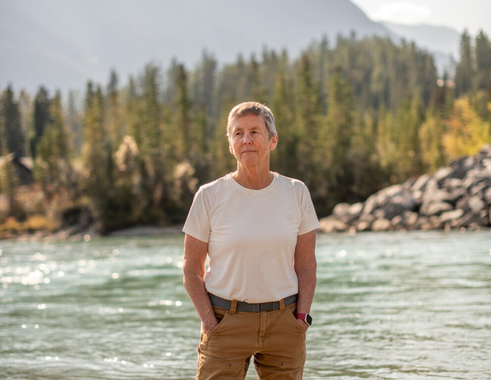
Across the valley from the Coldwater Lab, Cathy Ryan, a University of Calgary hydrogeologist, dips her foot into the Bow River. It’s bone-achingly cold, even on a hot summer day. Ryan calls herself a “groundwater chauvinist.” Photogenic glaciers sell themselves. Groundwater doesn’t. It’s why she believes the importance of glaciers is sometimes overemphasized, while that of groundwater is often overlooked in the mountain hydrology equation.
A keen eye can see evidence of groundwater throughout the Rockies. Ryan points to the sheer northeast face of Mount Rundle, a fortress of sedimentary rock that stretches for about 10 kilometres between Canmore and Banff. Rundle is a textbook example of what geomorphologists playfully call the “Paleozoic sandwich.” The mountain exhibits three distinct layers. Hard cliff-forming Palliser limestone is on the bottom, and equally tough Rundle Group limestone is on the top. Sandwiched in between is a weak and crumbly layer of Banff shale from which water drips and cascades. Climbers love it. In winter, some of the most famous ice climbing routes in the Canadian Rockies, like Professor Falls and Sea of Vapours, form from frozen wisps of ice dripping like candle wax from the porous middle of this geologic layer cake.
For the past three years, Ryan and an all-female group of researchers have taken a deep dive into groundwater. Sampling water from aquifers, groundwater wells and rivers produces geochemical and isotopic “fingerprints” that enables them to trace the journey water takes before it reaches a river.
For a given sample of river water, they can pinpoint what percentage of it came from rock aquifers and what percentage came from water that has spent very little time, if any, underground. Their research indicates that more than 50 per cent of the water in the Bow River where it flows through Calgary originates from aquifers between Banff and Canmore.
“Totally surprising,” Ryan says about these results. “After a big melt event or a big storm event, let’s say a really big precipitation event, the river goes up really quickly. Hydrologists call that ‘quick flow.’ But nobody ever looked at the average age of river water, and nobody understood how much of it was pushed through the groundwater zone.”
The big question is: how long can groundwater delay the onset of drought? In the face of shifting precipitation patterns, will water from rainfall and snowmelt be enough to recharge aquifers and headwater lakes?
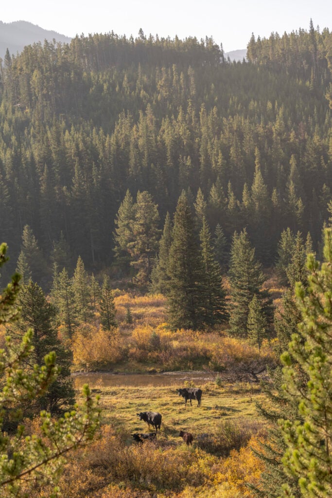
For Prairie people, drought is not abstract; it’s real. The drive south through Kananaskis Country along Highway 40 is one of the most beautiful road trips in Alberta. But the farther south you travel, the drier the Rockies appear. What glaciers remain are mere vestiges of the last ice age, tiny frozen pockets that cling stoically to high shady cirques. Where the road descends south into the Highwood River valley, cattle appear, grazing lazily in ditches and roadside meadows.
Farther south in the Livingstone Range, rancher John Smith pulls into “cowboy camp” in a pickup truck towing a loaded cargo trailer. He rolls to a stop in a pasture nestled against a steep forested hillside. Patches of aspen glow golden among the deep green of conifers. Nearby Mean Creek tumbles down from Mount Livingstone to its confluence with Livingstone River.
Smith steps out of the truck and angles his Stetson against the rays of an already intense morning sun. This is a cowboy’s favourite time of year. For the next week, Smith will ride the Livingstone Range with a few wranglers to round up cattle, herd them back to cowboy camp, then truck them to the Plateau Cattle Co. ranch in Nanton.
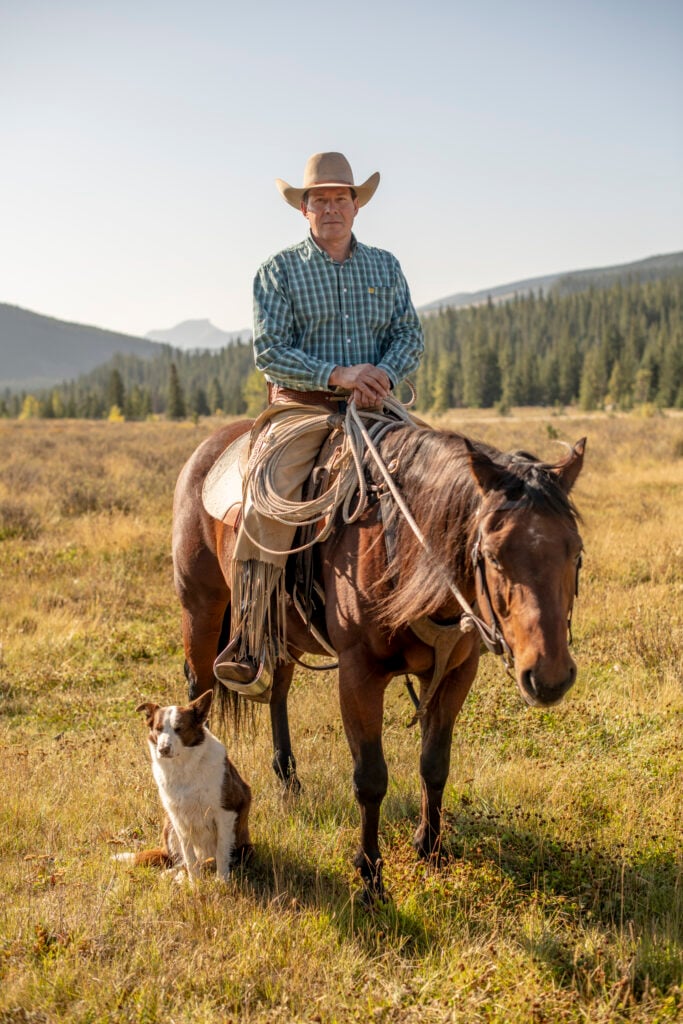
Up here in the Oldman headwaters, there are no glaciers. The river depends entirely on snowpack and rainfall. So does Smith’s livelihood. He’s a third-generation dryland rancher and farmer. He doesn’t use irrigation. The family relies on nature to deliver winter snow and spring rains at the right time of year for a bountiful harvest of hay to feed cattle. When it doesn’t deliver, it can make the difference between boom and bust.
Smith has deep roots in southwestern Alberta. His grandfather was a founding member of the Waldron Grazing Co-op in the 1960s. At the time, it was an innovative way for ranchers to join forces and finance the purchase of grazing lands. In more recent years, it has evolved into a conservation partnership with the Nature Conservancy of Canada. Since 2013, the co-op has signed conservation easements with the Nature Conservancy covering a total of 100,000 acres of land in the foothill prairies that the Waldron Grazing Co-op owns.
The easements mean these private lands in the Oldman River watershed will never be developed, subdivided or cultivated. Instead, they’ll be maintained in a more or less natural state, protecting native fescue grasslands, wetlands, creeks and stands of deciduous and coniferous forest — habitat for black bears, grizzlies, moose and elk. Given the droughts and resource pressures of recent years, this ranching-conservation collaboration has taken on new relevance. “We’ve been in a multi-year drought, basically since 2016,” Smith says, as he unloads horse tack from the trailer.
In the summer of 2024, Alberta faced stage four drought, meaning there were “significant drought conditions in multiple water management areas.” A hundred kilometres south of Smith’s family ranch in Nanton, critically low levels in the Oldman reservoir forced the Municipal District of Pincher Creek to temporarily truck in water at a cost of millions of dollars.
Last summer, the situation looked even worse. In February 2025, Alberta’s Ministry of Environment and Protected Areas published a foreboding water supply outlook that showed snow in the Oldman, Bow, Athabasca and North Saskatchewan basins as much below average. Late-season snowfall boosted the mountain snowpacks, but it was followed by a wickedly dry spring. By mid-July, numerous Alberta counties and municipal districts, including Pincher Creek, declared agricultural emergencies. Then suddenly, nature’s tap turned on. Drought became deluge. Parched fields turned lush green. Smith estimates the ranch received 180 millimetres of rain in a span of three weeks — more than what fell in the last two years combined.
“I don’t know what would have happened if we didn’t get that rain,” Smith says.
It takes a certain kind of resilience to gaze at a blue sky and distant snow-fringed mountains with faith that water will arrive when needed.
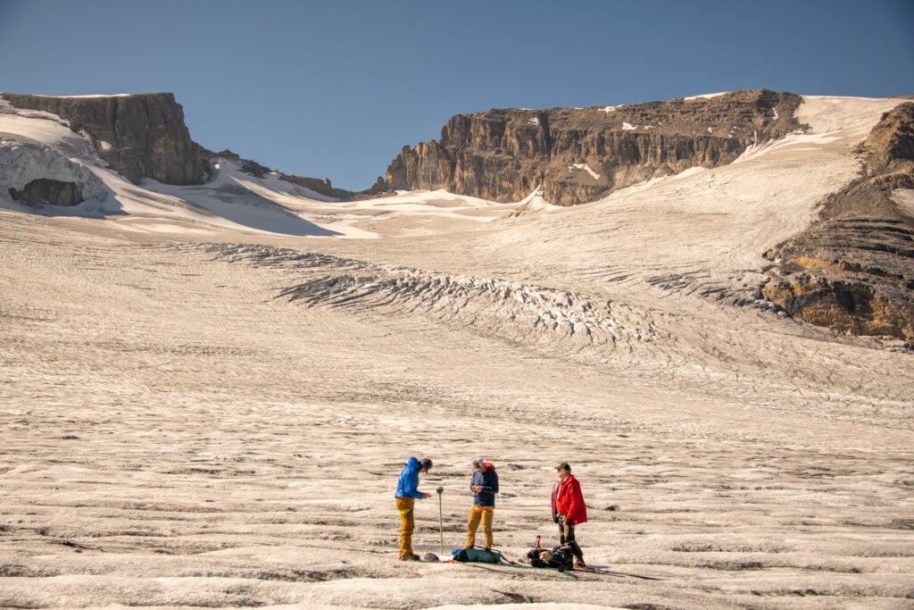
The water worries of southern Alberta ranching country feel like a world removed from the Peyto Glacier. Mark Ednie and Rod Smith lace their boots outside the Peter and Catharine Whyte Hut. The restless chatter of streams pouring off the Peyto fills the mountain air with a discordant requiem. They retrace their route down to the glacier, searching for mass balance stake number 162. Without GPS coordinates, it would be like seeking a needle in a frozen haystack. They stop to scan the glacier, before spotting the stake a few hundred metres away, jutting from the ice at a sharp angle.
When the sun sets on the 21st century, most mountain glaciers will be ghosts. Sediment ground and pushed by glaciers into distinct ridges called moraines will line alpine valleys. Nunataks, nubs of hard rock that once barely poked above the ice, will totter above a barren landscape. Lakes that at one time pooled at the foot of glaciers will appear like orphans in the alpine.
In Canmore, John Pomeroy steps outside the Coldwater Lab for some fresh air. He fears we’re not ready for a looming water crisis.
“Someone can say they don’t believe in climate models, that it’s junk science. They can argue and say, ‘well, your temperature records are flawed.’ Okay, every model can be improved. Whatever, that’s fine. But go take a look at the ice and see what’s going on there. You can’t argue with the ice. It’s retreating, and it’s on its way out,” he says. “We’re going to have to prepare for a de-glaciated world.”
This story is from the May/June 2026 Issue
History
Mary Vaux’s groundbreaking 19th-century study of B.C.’s Illecillewaet Glacier created an invaluable record of the glacier’s recession
Environment
Glaciers play a vital role in sculpting the landscape, and their retreat can bring about drastic consequences
Environment
Author Lynn Martel offers an examination of Canadian glaciers to understand their futures and the secrets they hold
Environment
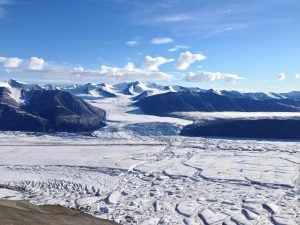
A study of more than 1,700 glaciers on northern Ellesmere Island found six per cent of ice coverage disappeared between 1999 and 2015