Travel

Canoeing in Alberta: A mystic trip down Milk River

A Southern Alberta paddling destination lined with fascinating geological formations and First Nations rock art

The historic Writing-on-Stone Provincial Park. (Photo: Callum Snape)
Expand Image
Advertisement

The campsite at Poverty Rock can only be reached by river, but it’s well worth our six hours of paddling to the remote spot. A stone pedestal in the middle of blowing Prairie grasses offers a bird’s-eye view of the expansive southern Alberta landscape. It reveals the winding Milk River, surrounded by a big blue sky, sandstone cliffs and green, rolling hills. Etched in the rock are modern-day versions of the world-renowned writings to come: initials and other drawings made by previous campers. At sunset, as we explore the area, a fiery orange glow illuminates the rock, along with the cliffs around us. It’s enough to take your breath away — and makes you wonder what’s around the next bend.

The Milk River is a favourite canoe trip in Alberta. It’s rich in archeological history and abundant in wildlife, home to many sensitive species that thrive in the mix of cliffs, hoodoos and grassy knolls found here. It got its name from American explorers Meriwether Lewis and William Clark — of the Lewis and Clark expedition — in the early 1800s. In his journal on May 8, 1805, Lewis wrote “the water of this river possesses a peculiar whiteness, being about the colour of a cup of tea with the admixture of a tablespoonful of milk.”

Map: Chris Brackley/Can Geo
Expand Image
Author Colette Derworiz sets out on the Milk River. (Photo: Callum Snape)
Expand Image

But the river’s story goes back much further. Formed by small streams in Alberta and  Montana, it dates back to the last ice age, when glaciers receded and the meltwater carved out the valley. The unique landscape along the waterway formed slowly as rain
and blowing sand shaped sandstone formations called hoodoos. The cliffs were created as large chunks of rock broke off during frosts. The Milk has long been a popular route for indigenous travellers. Archeologically, there’s evidence that First Nations used the area for at least 3,000 years, and there are early campsites, teepee rings, buffalo jumps and rock art — both pictographs and petroglyphs — throughout.

My journey begins at Gold Spring Park, a campground between the small town of Milk River and the United States border crossing of Coutts, about a three-hour drive from Calgary. On a breezy, warm August day, Callum Snape, a Banff-based photographer, and I meet up with our local guide, Ken Brown. Our plan is to explore a mere 53 kilometres of the Milk’s more than 1,100-kilometre length, heading eastward on the Canadian waters, switching between canoe and raft. Our final destination after two days on the water will be Writing-on-Stone Provincial Park, a national historic site tucked in the southeast corner of the province near the U.S. border.

I arrive with some nervousness. Not only has it been years since my last canoe trip, but there are rattlesnakes in these hills, and I’ve read they’ll actually swim alongside your boat. It’s weighing on my mind, so I ask Brown. With a chuckle, he says it’s unlikely — unless a snake happens to fall in the chilly river as it’s sunning itself on a rock. What a relief.

Still, neither Snape nor I are expert paddlers, and we’re sent out on our own for the first leg of the journey, canoeing a section of the river described in Prairie Paddling, one of the guidebooks, as “a non-stop boulder bash.” It’s true. On more than one occasion, we find ourselves turned backwards after hitting a rock that seems to come out of nowhere. “They’re like icebergs,” Snape says, as we nudge yet another rock and scramble to get the canoe back on track.

At times a challenging paddle, the waterway cuts between sandstone cliffs as it meanders through southern Alberta, passing Poverty Rock. (Photo: Callum Snape)
Expand Image
Advertisement

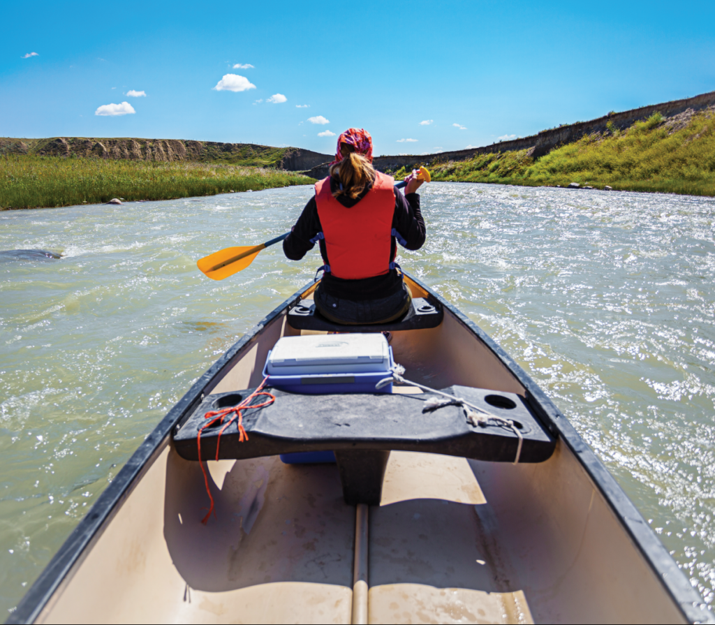
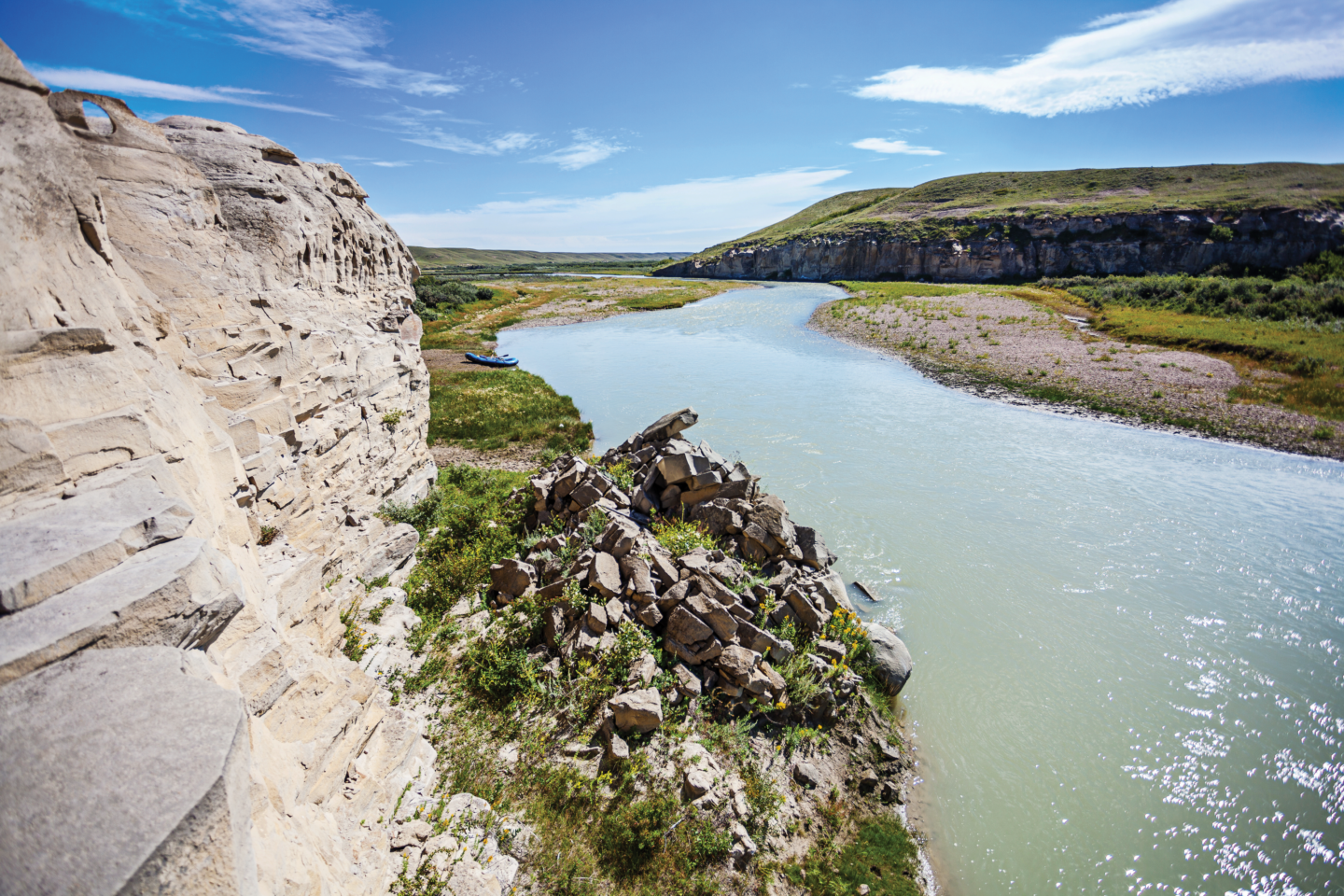
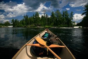
Fortunately, our boat doesn’t end up on the bottom of the river. Around us, there’s the famous mix of cliffs and grassy knolls that turn into hoodoos and coulees downstream. It makes an ideal environment for the sage grouse, rattlesnake and northern leopard frog, all creatures under threat. In fact, the area has the highest density of species at risk in Alberta. In spring and summer, migratory birds such as burrowing owls and ferruginous hawks also use the unique habitat. In our time on the river, we see our fair share of wildlife. Cliff swallows, their nests lining the layers of sandstone, constantly fly overhead, and hawks hover in the distance. The odd merganser duck scuttles across the water. Domestic cattle also wander into the river, watching us as we paddle by.

Within a few hours, after navigating the twists and turns of the channel, we arrive at Coffin Bridge. By August, the water is often too low to canoe all the way from Milk River to Writing-on-Stone. Brown meets us, stashing our canoe and replacing it with an inflatable raft that will better navigate the rougher rapids and exposed rock. A former teacher, Brown takes the oars and we get a front-row, guided tour. A longtime resident here, the 69 year old still remembers building rickety rafts on the Kootenay River, near where he grew up in British Columbia, and only making it around a couple of river bends before shattering to pieces. Now, through Milk River Raft Tours, he rents canoes to paddlers and guides others on much sturdier rafts.

The river, he says, is busy in mid-June and early July when the water is flowing fast and high. Yet, no two years are the same. The river constantly shifts its channel, eroding sediment from the steep cliffs and depositing it on sandbars. Sometimes, large floods cover the valley bottom, creating what’s called an alluvial flat. Trees, shrubs and grass grow in the rich mud, providing habitat for the wildlife. “This is a changing river,” he says. “It’s always interesting to come down the first or second time and see where it’s going to go.”

Our first day ends a few hours before sunset at Poverty Rock. We pitch our tents close to a wooden shelter, prepare easy-fix dinners and peppermint tea on propane camp stoves and then spend the breezy evening exploring the area’s hiking paths before going to sleep. 

It’s raining by morning, but the clouds soon lift for the next leg of rafting. As Brown paddles past 15- to 20-metre cliffs, he points out exposed fragments of bison bones from the year’s erosion. “It’s littered in this whole bank,” he says, asking us not to reveal the exact location because he worries about treasure hunters.

Brown’s local knowledge and high regard for the river, which runs through some private land, gives us some behind-the-scenes stops. Pulling the raft up to the bank, not far from Poverty Rock, we get our first look at the First Nations’ rock art — believed to depict everything from daily life to sacred ceremonies. The petroglyphs, which are carvings drawn with antlers, bones or other tools, look a lot like stick people, but they tell intricate stories about battles and hunts, or dreams and visions. Unfortunately, there’s also vandalism: visible marks from a saw reveal some of the failed efforts to remove the historic panels.

We linger for a few minutes before continuing up the trail, jumping slightly when we hear the distinctive sound of a rattlesnake. One slithers under a rock; another coils up in a low shrub, giving us a glimpse before raising its tail to provide its warning and we retreat back down the trail. Back on the water, we float down the river for another 15 or 20 minutes before stopping at the first major hoodoo along our journey. It’s an odd-looking sandstone rock, resembling a large mushroom in shape.

Interpretive guide Dezyre Yellow Horn stands in front of petroglyphlined hoodoos in Writing-on-Stone Provincial Park. (Photo: Callum Snape)
Expand Image

The landscape starts to change as we get closer to Weir Bridge, where Snape and I return to the canoe for the last couple of hours on the river. Soon, large trees start to appear on the rolling hills. Old cottonwoods, uprooted by the heavy spring flow of the river, cross the channel on the final stretch. By this point, we easily dodge the trees as we soak in the changing vistas.

After a couple hours of paddling, we reach Writing-on-Stone park, also known as Aisinai’pi National Historic Site, where it’s clear we’ve returned to civilization. There’s a sense of solitude that comes with paddling in the off-season and a sense of calm that comes with the even strokes of canoeing. Only the sounds of the wind and birds are around us, at least until that quiet is broken by the playful voices of visitors to the popular provincial park. Above us, on trails, tourists take photos as we paddle by.

We dock, check into our campsite and head up to the visitor centre for our own tour of the renowned rock art. “We don’t know why they started the drawings, but we’re glad they did,” says Dezyre Yellow Horn, an interpreter who hails from the Piikani Nation, a Blackfoot tribe. “For them to write … it had to be very important.” Stories are depicted in rock art — either in more petroglyphs or in pictographs, which are painted using ochre or drawn with a piece of ironstone or coal. As we move, Yellow Horn pounds the ground because there’s an aggressive bull snake in the area. One of the petroglyphs, believed to be about 1,000 years old, explains the mythical thunderbird.

The sheer sandstone walls and hoodoos of the Milk River valley hold the largest concentration of First Nations petroglyphs (carvings) and pictographs (paintings) on North America’s Great Plains. Much of the rock art portrays human figures and events. (Photo: Callum Snape)
Expand Image

“The thunderbird is famous,” Yellow Horn tells our group. “When you hear the thunder, that’s when you know that the spring is coming or that the spring is here. When he flaps his wings, that’s when you hear him. When you see lightning, those are his claws.” Following the tour, as a storm brews, Snape heads out to take photos and I head back to the interpretive centre for an evening talk on snakes. Afterward, I stop on the hillside for a few minutes to watch the changing light. The sunset turns the sky a brilliant pink, highlighting in bluish tones the distant hills. Finding my way back to the campsite through the hoodoos as it gets dark, I’m again struck by the historical, spiritual and environmental significance of this place. It feels like we’ve been introduced to an important part of Alberta’s  story that simply shouldn’t be missed.

Advertisement

Are you passionate about Canadian geography?

You can support Canadian Geographic in 3 ways:

Canadian Geographic Travel: The Edible Island

This story is from the Canadian Geographic Travel: Spring 2014 Issue

Related Content

People & Culture

The cowboy exclaims: The ballad of an ageing vaquero and his troubled horse, Bunny

The ultimate goal of vaquero horsemanship is to produce a “finished” horse: an exceptionally responsive animal that is a true partner to its rider

  • 2524 words
  • 11 minutes
Photo courtesy the Canadian Canoe Museum

History

Canoe love

Canadian Canoe Museum explores the link between paddling and romance

  • 1530 words
  • 7 minutes

Travel

Trans Canada Trail celebrates 30 years of connecting Canadians

The trail started with a vision to link Canada coast to coast to coast. Now fully connected, it’s charting an ambitious course for the future.

  • 1730 words
  • 7 minutes

Environment

I am Mutehekau Shipu: A river’s journey to personhood in eastern Quebec

In February 2021, the world was introduced to Mutehekau Shipu — also known as the Magpie River — when the people of Ekuanitshit, Que. and the regional municipality made a joint declaration granting the river legal personhood and rights. The declaration carries broad implications for the fight to protect nature across Canada and around the world.

  • 3623 words
  • 15 minutes