Exploration
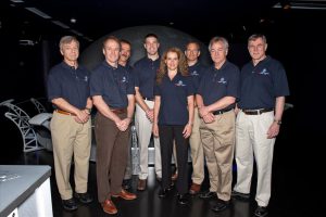
Canadian Space Agency astronaut profiles
The men and women that have become part of Canada’s space team
- 1067 words
- 5 minutes
Science & Tech

Three Earth-observation satellites launched in California, marking the long-awaited start of the Canadian Space Agency’s RADARSAT Constellation Mission (RCM).
The mission, which is the successor to the RADARSAT-2 satellite currently orbiting the Earth, will be able to capture images more frequently and precisely, helping government departments and researchers track everything from drought in agricultural areas to the impacts of climate change in the Arctic, said Magdalena Wierus, intermediate operations engineer at the Canadian Space Agency, during a teleconference last week.
“RCM is able to cover all regions of Canada within a 24-hour period, which was not possible with RADARSAT-2,” she said.
The RCM was originally expected to launch in November 2018, but mechanical problems with the SpaceX booster rocket — from which the satellites launch — along with technical and budget problems delayed the launch until this month.
Started in 1995, RADARSAT is a Canadian space satellite program aimed at collecting environmental data, such as soil moisture, changes in permafrost, and agricultural crop levels. More than a dozen government departments have requested satellite data from RADARSAT for purposes ranging from natural disaster preparation and mitigation to habitat monitoring.
RCM mission manager Steve Iris said that the data will be hugely important for monitoring and combating climate change in rural areas.
“We have a large country and the population density is at the southern border,” he says. “We have a large northern part of Canada [where] there’s not a lot of infrastructure to do monitoring, and this is where climate change will have the most impact.”
The RCM will be able to image any given location on 90 per cent of the Earth’s surface daily, but will mainly focus on Canada’s landmass. The RCM also includes an automated identification system to pinpoint marine vessels that may be in trouble, or rogue ships that “may not want to be found.”
Other advantages to the RCM include a lower cost compared to RADARSAT-2 and the security of having two other satellites should one malfunction.
Wierus is hopeful that the RCM will be operational for longer than its seven-year life expectancy. RADARSAT-1 was originally projected to operate for just five years, but remained operational for 17, and RADARSAT-2 has also outlived its original mission duration. However, because RCM consists of multiple satellites that must stay in precise alignment in order to function, the ultimate longevity of the mission will depend on conditions in orbit.
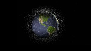
“It will depend on if they are dodging space debris,” said Wierus. “If it goes longer than seven years, we’ll be very, very happy — just as we were with RADARSAT-1 and RADARSAT-2.”
Are you passionate about Canadian geography?
You can support Canadian Geographic in 3 ways:

Exploration
The men and women that have become part of Canada’s space team

Exploration
The significant CSA events since Alouette’s launch

Environment
Michel Doyon, manager of flight and systems operations at the Canadian Space Agency, walks us through what space debris is and its impact on Canada

Exploration
A conversation with Canadian astronaut David Saint-Jacques, who is getting ready to travel to the International Space Station