Exploration
Subterranean trailblazers
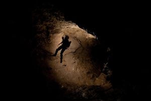
Caving: The ultimate underground sport
- 5055 words
- 21 minutes
This article is over 5 years old and may contain outdated information.
Science & Tech

Lost for days in the forests of Madagascar and eventually rescued by military helicopter. It might sound like the plot of a new action movie but it was the real life experience of a group of Canadian adventure scientist. And it was just the beginning of a successful two week expedition.
Adventure Science is a Canadian organization that matches athletes and scientists to explore unknown parts of the world.
Dr. Simon Donato started the group and has been looking to do research in Madagascar’s Great Tsingy region since 2010.
“Even though we live in a world that seems so connected … and you don’t think there are discoveries to be made, it’s just not true — you just have to get off the beaten path,” says Donato.
Donato became interested in the Tsingy while researching limestone deposits around the world as part of his job as a geologist in the oilsands. As one of Madagascar’s most remote locations it seemed the perfect place for an adventure science trip.
One of the more exciting finds was a new cave system, thought to be the third largest in the Tsingy.
George Kourounis is a Canadian adventurer and storm chaser and a Fellow of The Royal Canadian Geographical Society. As a personal friend of Donato and an expert on caves Kourounis jumped at the chance to come be part of the Madagascar trip.
“It looks like something out of a Lord of the Rings movie. It just these sharp spires of limestone and it’s just diabolical in terms of the landscape,” Kourounis says of the Tsingy landscape.
During the trip team members commuted into the jungle each day and spread out in an effort to cover as much ground as possible. As the cave expert on the team Kourounis was notified whenever a cave entrance was found.
The major cave they mapped is 1.6km and was unknown to the locals or park rangers that were part of the team.
“There’s no evidence of any human being in this cave,” says Kourounis. “When you think about it, I believe a dozen or so people have set foot on the moon, but there were parts of the cave where no one has ever been before.”
The trip had many goals including mapping an area that very little was known about, conducting a lemur survey, looking for dinosaur tracks in the area and searching for archeological sites.
They were able to accomplish all of their goals, finding dinosaur tracks and unknown archeological evidence as well as recording the diversity of lemurs in the region, one of the key areas for the species which is facing a lack of habitat.
Donato says the information will be the first scientific report of the area for the government of Madagascar.
“It’s an area that’s received minimal to zero research attention. So this is new data that the government can use to say, okay well now we have a sense of what’s in the region based on the very quick exploratory study that was done over the course of a few weeks,” he says. By using athletes with scientific training the Adventure Science team is able to start research which can then help other researchers direct their investigations of the region.
“Even though we go into these areas and you don’t know what you may or may not find, if you go out and adventure and explore, you’re always going to find something,” Donato says.
Are you passionate about Canadian geography?
You can support Canadian Geographic in 3 ways:

Exploration
Caving: The ultimate underground sport

Travel
Immerse yourself in Viking archaeology and Basque whaling history while taking in Newfoundland’s scenic coastline and incredible geology

People & Culture
A celebration of the Canadian Coast Guard’s renowned search-and-rescue capabilities — and more — as the special operating agency turns 60

Exploration
2022 is the International Year of Caves and Karst. Here’s why you should care about the hidden worlds beneath our feet.