On March 26, 2019, Federal Kumano exited the St. Lambert Lock across from Montreal and sailed up the St. Lawrence Seaway. The freighter, as long as two football fields, transited Lake Ontario and the Welland Canal to Lake Erie, reaching its destination of Ashtabula, Ohio, within four days.
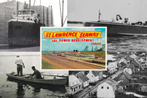
There was nothing unusual about the course, the cargo of titanium chloride or the Canadian-owned Federal Kumano itself, other than the fact that it was the first vessel of the 2019 season, marking the 60th anniversary of the St. Lawrence Seaway — the linchpin in the Great Lakes-St. Lawrence Seaway (see map). The megaproject, declared open on June 26, 1959, connected Montreal and Lake Ontario by a new system of channels, canals and locks, replacing an obsolete waterway built in the late 1800s and transforming the way wheat, corn, soybeans and other grains, iron products and ore, stone, road salt, cement, fuels and other products are moved between ports on the Great Lakes and the St. Lawrence and on to the Atlantic Ocean and global markets.
International and domestic politics and tensions, trade breakdowns and new alliances, booms and recessions, climate patterns and shifting global demand leave their mark in the seaway’s annual cargo summaries. Tariffs imposed on Canada by the U.S. in 2018 caused steel shipments to drop, while overall tonnage hit an 11-year high, mainly thanks to a banner year for Canadian grain — the result of high demand for corn and soybeans from Europe and China, both of which had imposed retaliatory grain tariffs on the U.S. The impacts of China’s March 2019 decision to boycott Canadian canola, meanwhile, are yet to be seen.
Annual transit and tonnage totals wax and wane, but North America’s inland seaway remains critical to the movement of essential food products and building-block materials to and from the heart of North America. Click or tap on the white dots on the map below to find out more about our binational marine superhighway.