
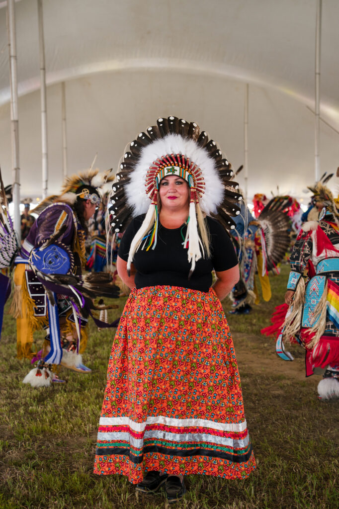
People & Culture
How Black matriarchs stitched quilting into the fabric of art history
Dating back hundreds of years, quilting was practiced by Black Nova Scotian matriarchs as a way of telling stories and continuing oral history
- 788 words
- 4 minutes
Environment
The Carolinian forest is a biodiversity hotspot in the most urbanized area of Canada. A dedicated few are fighting to protect what remains.
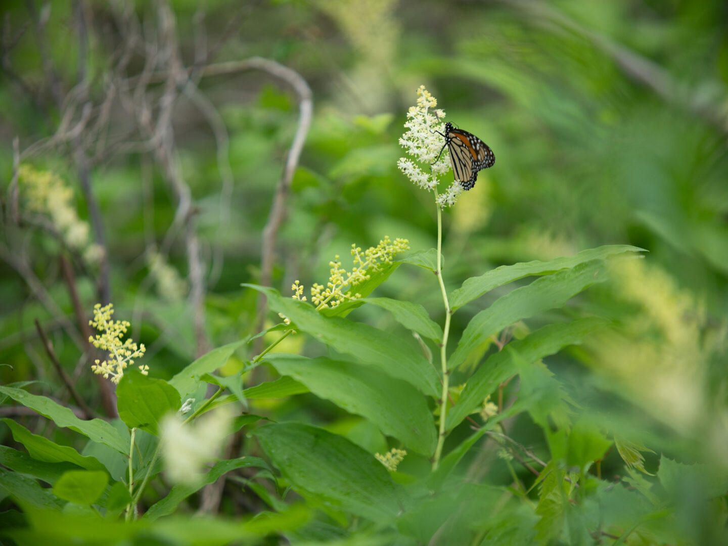
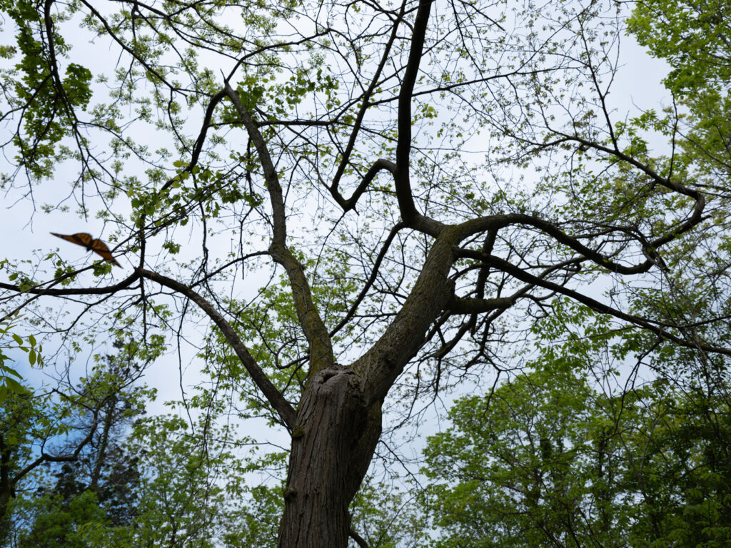
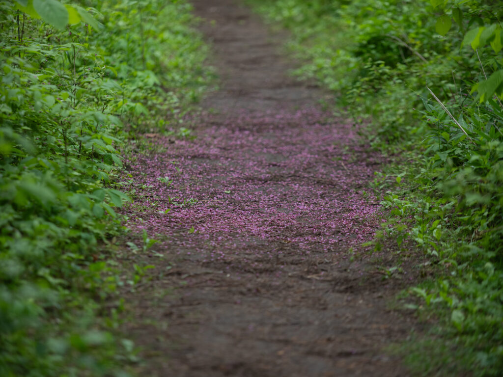
The insects sound like a roar here. Countless tiny expressions of life hum across the forests, prairies and wetlands of Point Pelee National Park just before sunset in late May. The birds haven’t yet roosted for the night, calling over the cacophony, infinite voices talking all at once.
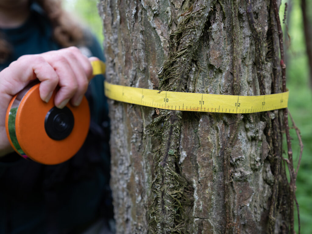
From my campsite, a 12-metre black walnut tree with a deeply grooved trunk spreads her branches into a lacy canopy. Beyond her, the Carolinian forest looks more like a jungle than a temperate forest. Coke-can-thick Virginia creeper vines drape from chinquapin oaks to hackberries, their five-point foliage arranged like Christmas lights on a string. Understorey plants like mayapple, Solomon’s seal and pink sprigs of invasive phlox fill in the forest floor between moss-covered logs and a thick mulch of old wood. It’s all moving. Anyone who says a forest is still hasn’t stared deeply enough.
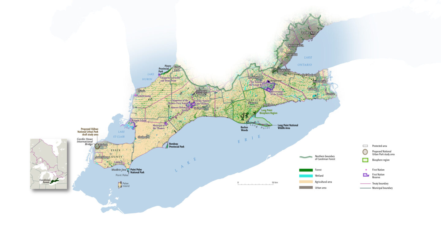
Point Pelee is in the southernmost reaches of the Carolinian forest in Canada, a life zone so-called for its resemblance to the Carolinas. Spanning the water-warmed landscape of the Great Lakes in southwestern Ontario from Toronto to Windsor, the Carolinian is a continuation of the eastern deciduous forest in the United States. But its mix of species and climate is all its own. The region encompasses the territories of 10 First Nations of the Wendat, Anishinaabe, Haudenosaunee, Mississauga and Lunaapeew peoples, who’ve stewarded the land here since time immemorial.
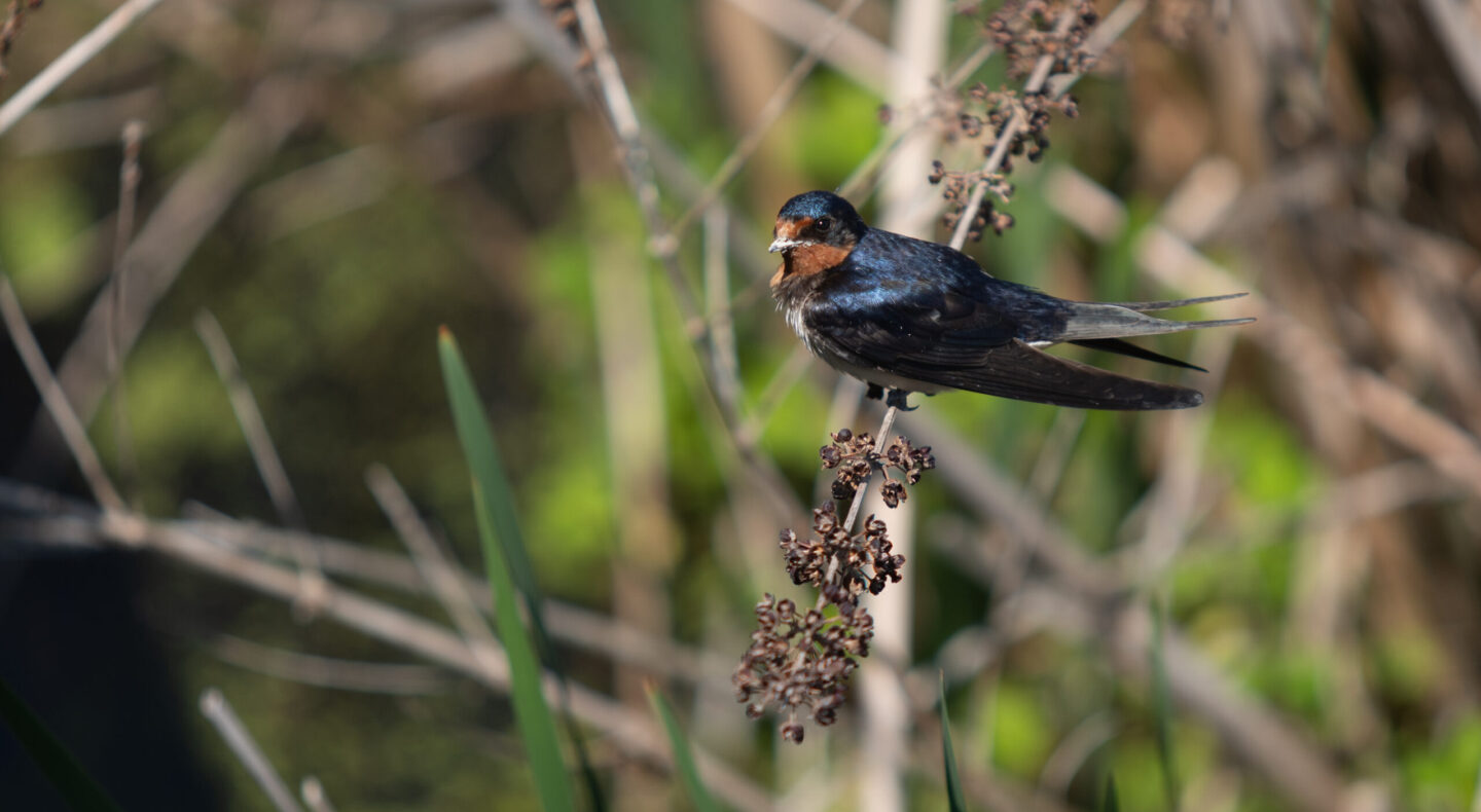
Despite it occupying just a fraction of a per cent of Canada’s landmass, this quilt of habitats is one of the most biodiverse places in the country. It’s home to more than 70 species of native trees — the most of any other forest region in the country — as well as more than 2,200 plant species, 400 birds and more than half of Canada’s species at risk.
But the quilt is unravelling. The Carolinian exists now in isolated pockets in the country’s most urbanized region, supporting 25 per cent of Canada’s population, the epicentre of its manufacturing industry and Ontario’s agricultural centre. Since colonization, the Carolinian zone has lost more than 90 per cent of its original extent. Every year, a bit more is lost. Like we ask of her constantly, Mother Nature bends to suit us. And the wild prairies, ambling wetlands and old-growth forest that once filled this region are hanging on by a thread.
“How much are we going to lose until we finally admit maybe it was too late yesterday?” asks Jennifer Nantais of Carolinian Canada Coalition, a charitable network working to grow healthy landscapes in the Carolinian zone for decades. “We need to start protecting what we have now and increasing that.”
While we can’t bring this region back to what it was originally, efforts to conserve and connect tracts of remaining Carolinian have seen recent gains. Amid the clawing for resources and space, there is hope here.
Once upon a time, vast tallgrass prairies swayed in the Lake Erie breeze. Karner blue butterflies — now extirpated — fluttered above magenta fireweed, white sprays of culver’s root and big bluestem grass. Rivers and streams percolated through the landscape from the lakes, creating giant wetlands and swamp forests deafening with songbirds, like the Carolina parakeet — a now extinct neotropical parrot. Pawpaw trees burst with custardy fruit on the banks of inland streams and rivers, their lima-bean sized seeds scattered in the forest gardens of Indigenous Peoples, such as the Haudenosaunee. Black bears and cougars tromped ancestral trails through tracts of thick, dark woods under the towering trunks of tulip trees.
Few other places in North America have seen change like the lands and waters of southwestern Ontario. Much of its early colonization history was shaped by war. European settlement began in earnest following the end of the Seven Years War in 1763, then United Empire Loyalists carved off pieces of land for themselves after the American Revolutionary War. And much of the theatres of the War of 1812 played out here; the remnants of bloody battle sites still lie scattershot across the landscape.
First Nations were pushed into smaller areas — or out entirely. In the 1920s, the RCMP chased out members of Caldwell First Nation from the newly established national park and burned their homes down. Caldwell First Nations Chief Nikki van Oirschot shares her great uncle’s memory of the event from when he was a child, told to her by her mother. “She remembers him telling this story to them and how afraid he was and how frightened he was; how they were literally running because they were getting burned out of their homes, just to get rid of the Indians [from] the park,” says the Chief.
Some of the first exports from the Carolinian were trees: red pines from Point Pelee and oaks from the globally significant oak savannahs, a kind of liminal space where oaks trickle into grasslands. Fishing also became big business in Lake Erie, as the water teemed with fish. Lake Erie is still one of the largest freshwater fisheries in the world. And with the longest growing season in the province, the Carolinian zone has seen agriculture for millennia. In 1869, the nascent Canadian government began an emigration campaign encouraging people to farm Ontario. People flooded into southwestern Ontario and began clearing land. By the early part of the 20th century, so much forest had been cleared in Norfolk County that the soil began to blow away.
As populations boomed, the Carolinian shrunk. In about 200 years, 95 per cent of wetlands were drained, more than 80 per cent of forest cover was lost and 99 per cent of tallgrass prairie had evaporated.
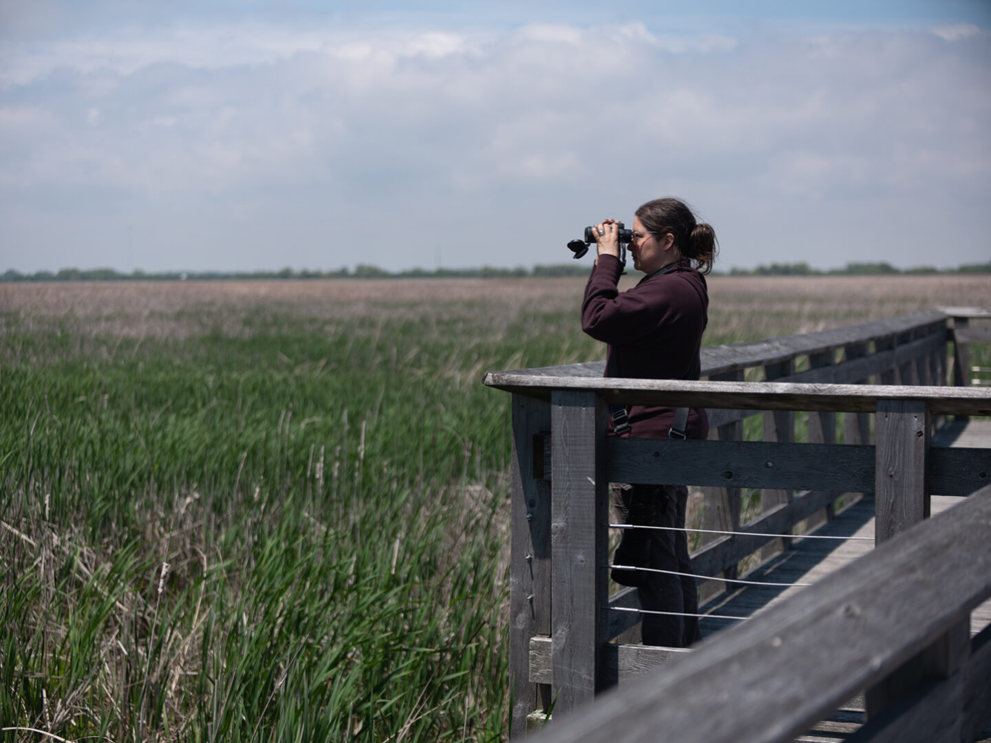
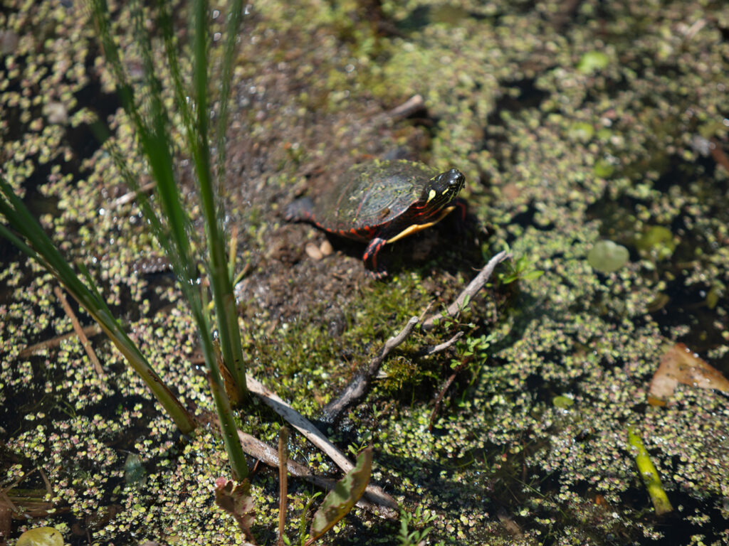
From the marsh at Point Pelee, narrow channels of open water wind through a thick colony of cattails like veins. The park is part of a thin slice along Lake Erie’s north shore that boasts the highest concentration of Carolinian species. Eastern musk turtles, swamp rose mallows, least bitterns and others make their homes in this marsh. Across the zone, wetland loss is in a tailspin, with more than 10,000 hectares (100 square kilometres) lost in the last decade.
Carolinian Canada’s Jennifer Nantais and I walk down the boardwalk toward open water. Invasive cattails and phragmites (a tall reed grass) have been choking the water here for 70 years, and park staff are in an ongoing battle to eradicate them. Nantais points to a red-winged blackbird clinging to a cattail. “I’ve never heard [birds] like here,” she says. “It’s just like driving back in time … the bird chorus, the insect chorus. You can’t beat it, and I don’t know another place that I can visit in a day where it sounds like this.”
Point Pelee juts out of Essex County, an agricultural region in the Carolinian that’s lost 97 per cent of its original habitat. The tiny, 15-square-kilometre park is a vital enclave — home to myriad at-risk and endangered species. The park is also a Ramsar Wetland of International Importance. Birds fill the skies, marshes, forests and beaches here each spring and fall. Monarchs, too, flutter into the park’s rare oak savannah habitat in early fall to rest on their long migration to Mexico.
“When you think of how old these landscapes are and how new the changes are and their impact on climate and biodiversity, we did so much damage in such a short time,” says Nantais. “And we’re in trouble: we’re at less than 15 per cent natural habitat cover. But we could [mitigate it] if we really got the support.”
Christina Lawrence, with the park’s resource conservation team, has been helping to manage the onslaught of invasive species and restore portions of the park to their natural state. One of those tasks is to restore species-at-risk trees, working to bolster tree populations and improve their genetic diversity.
The rarest of those trees is the red mulberry, a food source for songbirds and small mammals. Hybridization with the invasive white mulberry, disease and habitat loss and fragmentation have meant that there are only about 300 of these trees left in all of Canada, found in tiny groupings at a few dozen sites in the Carolinian zone. When the team started this project a decade ago, Lawrence says, Point Pelee had just under 20 red mulberry trees.
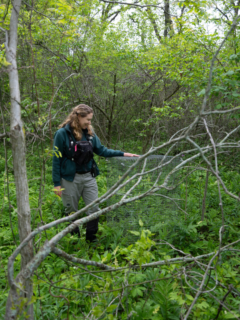
“Since we started the project, we found three to four new adult red mulberry trees that we didn’t know about,” she says. The park is relatively small, but the biodiversity is dense. Researchers still occasionally find species they didn’t know existed here.
To plant more red mulberries in Point Pelee, the team needed seeds. Up on scaffolding, they placed pollen bags over the female flowers of confirmed red mulberry trees as a barrier to the pollen of invasive trees — kind of like a tree condom. Once they gathered red mulberry pollen, they hand-pollinated the female flowers using paint brushes. The trees fruited, juicy red and purple clumps of oblong berries, and seeds were harvested and sent to a local nursery. When plant populations dip that low, seeds become more precious than gold.
Lawrence is eager to open the top of the cage of a tree planted in 2021. “We planted just over 50 red mulberry seedlings, and to this date, 29 have survived. If they grow into reproductive age, we’ve increased our red mulberry population.”
I peek in. The tree is about knee high, with papery, deeply grooved leaves. “I came out here yesterday, and I was looking at them and their little leaves. I was almost getting emotional,” smiles Lawrence. “They’ve come so far; they are like my babies.”
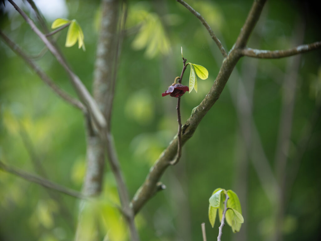
We brave poison ivy to get a glimpse at another rare tree: a stand of pawpaws, Asimina triloba. At the northern edge of their range here in the Carolinian, the forcing out of Indigenous Peoples — stewards of this tree — from the land and deforestation has meant pawpaws are few and far between. Lawrence tells me these ones may have been planted in the park as part of a forest regeneration project. We step into squishy, waterlogged terrain.
Lucky for us, the trees are flowering: the deepest maroon blooms dangling below the umbrella-like arrangement of their long leaves. Their fruit is the largest native fruit in North America and resembles a small green mango with soft sunshine-yellow flesh and large black seeds — which, some theorize, were spread across the continent by ice-age mega-fauna, like the North American giant ground sloth. There’s nothing else like this tree in Canada. The flowers are said to smell unpleasant, like rotting flesh, to attract flies and beetles, but the one I sniff smells tropical and banana-y, like Juicy Fruit gum.
At Queen’s Park in downtown Toronto, tulip trees and butternuts stand in manicured lawns with metal plaques nailed to their trunks, like specimens in a museum. In early June, the trees had just finished leafing out when the Ontario government passed Bill 5. Protestors’ boos rang through the gallery of the legislature immediately following the bill’s passing. “This is our home! Your home, too!” someone yelled. Outside, Indigenous leaders and community members, environmental groups and citizens gathered.
The controversial bill, says the province, is meant to boost the economy by fast-tracking development. It bins the 2007 Endangered Species Act, replacing it with the watered-down Species Conservation Act, which gives the government power to skirt municipal and provincial laws in any place it deems a “special economic zone.” First Nations leaders across the province are alarmed that the new bill tramples on their treaty rights.
“First Nations in Ontario do not want Bill 5,” Sol Mamakwa, NDP MPP for Kiiwetinoong in northern Ontario, said at the legislature two days before the bill’s vote. “Last week, the government said that they respect First Nations, that they respect treaty rights. Speaker, we know the Premier is telling untruths to First Nations.” He was ejected when he didn’t retract this statement.
The new Species Conservation Act redefines habitat as “a dwelling place, such as a den or nest site” and the area immediately around it for animals, and “the critical root zone” for plants — changes that one activist likened to an “invisible slaughterfest” for species at risk.
The Ontario government “says the purpose behind [the bill] is to speed things up and to make it easier to speed up economic development to address the threats from the south,” says Tony Morris of Ontario Nature, referring to the United States’ recent tariff hike. “I think, given the pattern of this government, the ultimate goal is really just to remove safeguards.”
While Ontario’s Bill 5 made waves, Canada passed the federal equivalent, Bill C-5, on June 20. Both the provincial and federal governments have assured meaningful consultation with Indigenous Peoples and environmental considerations, but many are concerned these bills, and others like them, are reversing course on promises to advance reconciliation and stop biodiversity loss.
One of those promises is the Kunming-Montreal Global Biodiversity Framework, a deal brokered by Canada under the UN Convention on Biological Diversity aimed at halting biodiversity loss within signatories’ borders, including protecting 30 per cent of their lands and waters by 2030.
About 10.9 per cent of the land in Ontario is considered protected, a number that’s been mostly stagnant for almost 30 years, according to the province’s own protected areas working group. Of the provinces and territories, Ontario has fallen to eighth place in the country for percentage of protected and conserved area. Similarly, the 2025 State of Ontario Biodiversity Report shows habitat loss, including fragmentation, has continued to deteriorate over the last five years.
Dan Kraus is a conservation scientist who’s worked on issues of biodiversity, endangered species and nature policy for more than 30 years. In 2020, Kraus co-authored a paper in Biodiversity and Conservation that identified the most significant and threatened places for biodiversity conservation in southern Canada. The Carolinian zone was top of the list.
“Nationally, we have that goal of protecting 30 per cent of Canada’s lands and waters by 2030, which we may achieve … but to actually do that in the Carolinian region I think is very, very unlikely to occur. But what we can do is protect the best of what’s left,” he says. “It took 200 years to shrink down the natural cover to what it is now. It’s going to take probably 200 years to build it back up to something that’s healthier and more resilient.”
Today, cottonwood trees shimmer in the summer breeze at Ojibway Shores, the last undeveloped land on Windsor’s waterfront. To the northwest, the Gordie Howe International Bridge crossing the Detroit River is set to open, a six-lane mega border crossing that will become the largest land port of entry to Canada. On either side of the Carolinian shoreline are cargo ship ports, razed clean of vegetation.
This parcel of land sandwiched by development “feels almost like nature making a stand,” says Mike Fisher, president of the Friends of Ojibway Prairie.
The 13.5-hectare plot is set to become part of a proposed national urban park — the second in the country after Toronto’s Rouge. As part of its strategy to protect 30 by 30, Canada announced a plan in 2021 to create six new national urban parks by 2025. The proposed Ojibway national urban park would ensure the connection of a 26-square-kilometre tract of mostly tallgrass prairie and black oak savannah, known as the Ojibway Prairie Complex, to the Detroit River. Within the so-called Automotive Hub of Canada, the complex is one of the largest relics of tallgrass prairie in the Carolinian zone, supporting more than 50 provincially at-risk species. In the spring, the Ojibway Prairie Complex was recognized as a key biodiversity area, joining the ranks with Point Pelee and Long Point Biosphere Region as some of the most important places in Canada for species and habitat conservation efforts under standards developed by the International Union for Conservation of Nature.
But the battle to preserve the land at Ojibway Shores was hard-fought. Ownership of the lands switched hands in the last century. In 2013, the Windsor Port Authority planned to clear the property to store construction materials for the bridge development, causing community uproar. “A good 300 people showed up [to contest it],” says Fisher.
The lands were transferred to Parks Canada in 2023, and the following year the federal budget committed $36.1 million over five years to create and support the proposed Ojibway national urban park. Proponents of the park are anxious to know when that will happen. When it does, the park is set to be co-managed by the Ojibwe, Odawa and Potowatomi nations of the Three Fires Confederacy, including Caldwell First Nation.
“These are First Nation lands. Before Canada was even conceived as a country, before contact, we were roaming these lands. We were caretaking,” says Caldwell Chief Nikki van Oirschot. Her administration’s work, and before that the work of former chief Mary Duckworth, helped foster Canada’s commitment to co-governance with the nation. “This fundamentally means we are going to do this together. We’re going to respect one another. We’re going to honour and uphold one another’s systems of governance,” she says.
For van Oirschot, the proposed park represents a move toward better relationships, not only with the land, but with Indigenous Peoples in the Carolinian. “We have a really great relationship with Parks Canada today. That wasn’t always the case, of course: with Point Pelee National Park, we have definitely a troubled history with what occurred there,” says Chief van Oirschot, referring to the forced removal of her people from the park.
Back at Point Pelee, a teepee rises high above a picnic area on the northwest shore. Beyond it, the Carolinian forest, green and dense and tangled, hums with life. This site was renamed Madbin Jina in 2020 by the late Caldwell knowledge-keeper Janne Irene Peters to signify a new way forward between the nation and the park. That same year, Caldwell First Nation’s reserve in Leamington, just outside Point Pelee, was finally established.
A plaque at Madbin Jina explains to visitors the meaning of the Anishinaabemowin expression.
“In the time of our ancestors, if someone was new to the area, lost, cold or hungry, the people would invite them into their lodges to ‘sit for a while.’ All who crossed their paths in peace were welcomed and cared for as they got their bearings, were fed and rested, all for a while (ajina).
“When you read ‘Madbin Jina’ know that the Ancestors are welcoming you to come ‘sit a while’ in peace, and enjoy what Mother Earth has to offer here.”

In Backus Woods, I look out through a green mist of forest to a vernal pool. Appearing as if by magic each spring, these fleeting little pools in a sprawling tract of Carolinian forest provide habitat for amphibians and reptiles, like the threatened Blanding’s turtle and Jefferson salamander.
“This right here is one my favourite little vistas,” says Kristen Bernard from the Nature Conservancy of Canada. “This will completely dry up by August if we have a regular summer — I don’t know what the regular summer is anymore — but right now you’re going to have your toads and your frogs and your salamanders. There’s quite a few wood ducks that nest and breed here in spots like this in Backus and elsewhere.”
Bernard walks me through a section of the woods owned and managed by the Nature Conservancy of Canada. Backus Woods in Norfolk County is one of the largest remaining tracts of older-growth Carolinian forest in the zone and the best example of a closed-canopy forest, a favoured breeding ground for the endangered prothonotary warbler. The woods are also home to some of the oldest trees left in the zone; the growth rings of one 1.35-metre-diameter tulip tree struck down by lightning revealed it was more than 500 years old.
Backus is part of the Long Point Biosphere Region, a 4,046-hectare network of protected areas in Norfolk County beginning at Long Point in Lake Erie. Where once the soil of Norfolk County blew away, conservation efforts mean it now boasts 25 per cent forest cover — the most forested land in the zone, and much of it is protected.
“When the land was settled here, a lot of land was cleared very quickly for agriculture. But the Big Creek ravine system is very steep, steep slopes. It was incompatible for clearing, you just couldn’t do it,” Bernard says. “So the strategy for NCC and others was to use that natural ravine system as part of that corridor to acquire and build and buffer lands on.”
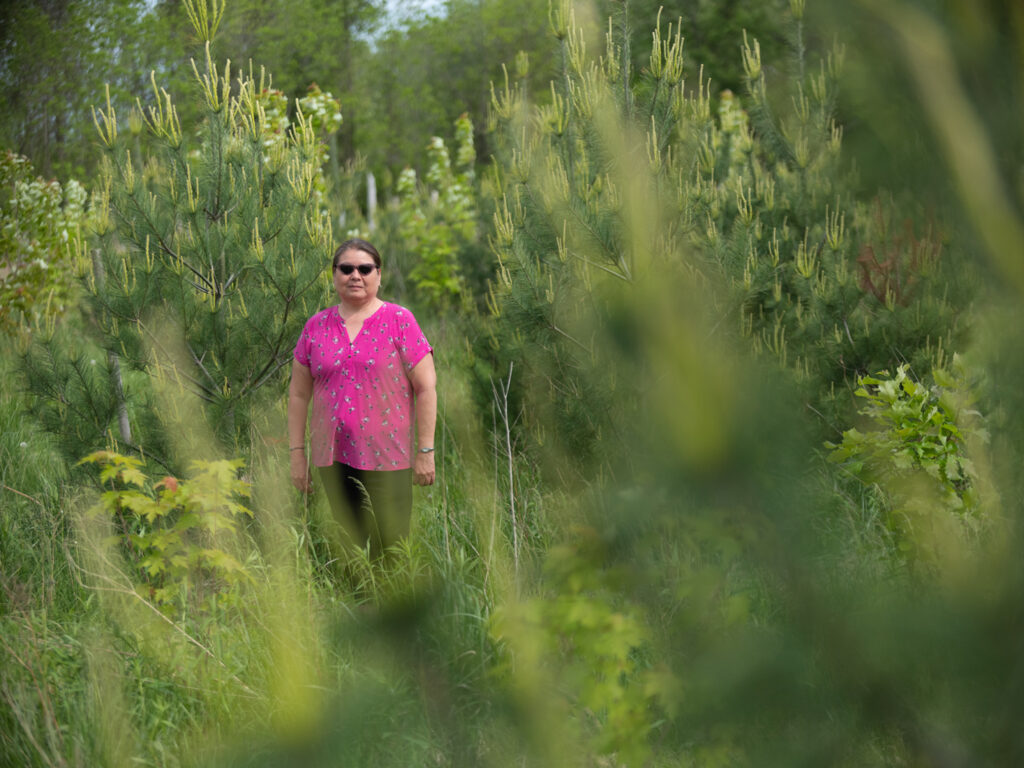
Bernard takes me to another site a few minutes down the road, a “buffer zone” along Highway 24 that the Nature Conservancy of Canada purchased and restored in 2009. Purple spikes of native lupine and myriad other native plants and trees now spread across a burgeoning oak savannah landscape on a former tobacco farm. “A lot of the [seed from] species that have been planted have been hand collected. When we’re doing this habitat restoration work, we come up with a seed list, but it’s really dependent … on natural cycles,” says Bernard.
Bernard explains the painstaking process of thinning non-native species and planting native ones back on the landscape, including New Jersey tea, a host plant for the extirpated mottled duskywing butterfly. In 2024, researchers reintroduced the species at this site. As we head back to her car, as if on cue, a mottled duskywing lands beside us.
“If [people] care about any of these initiatives, any of the ecosystems, [they] need to get on board and support the scaling up of native seeds.
It’s scaling up the available supply, but also supporting the demand, like getting municipalities, getting restoration projects to use appropriate native seed and plants,” says Carolinian Canada’s Jennifer Nantais.
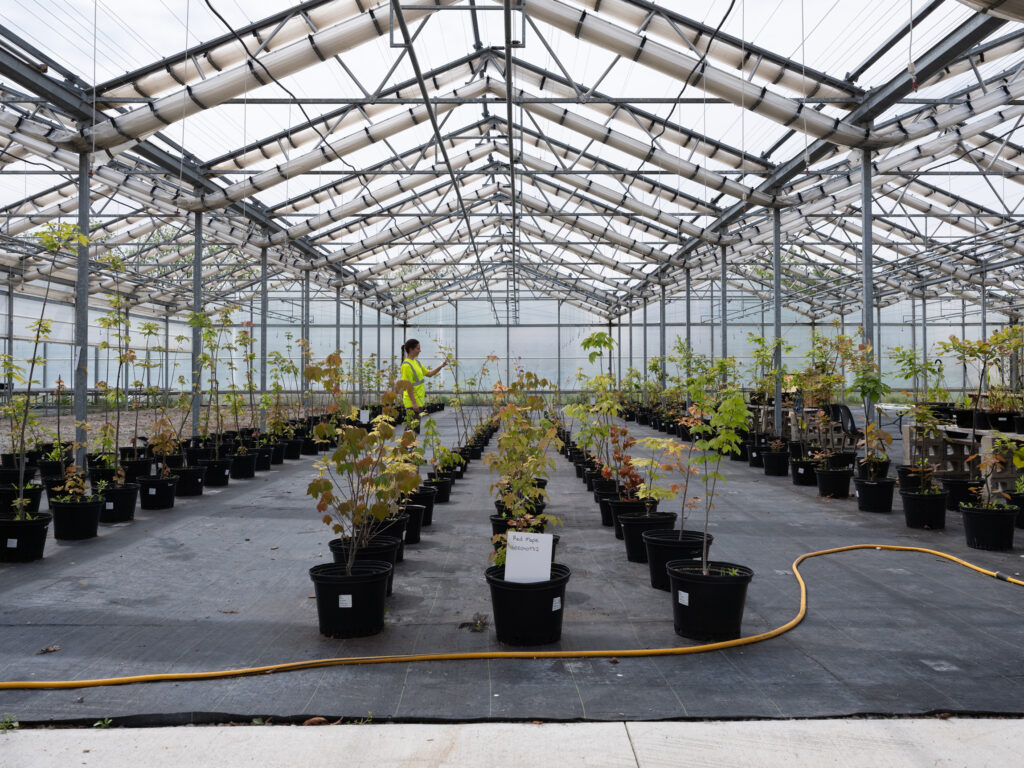
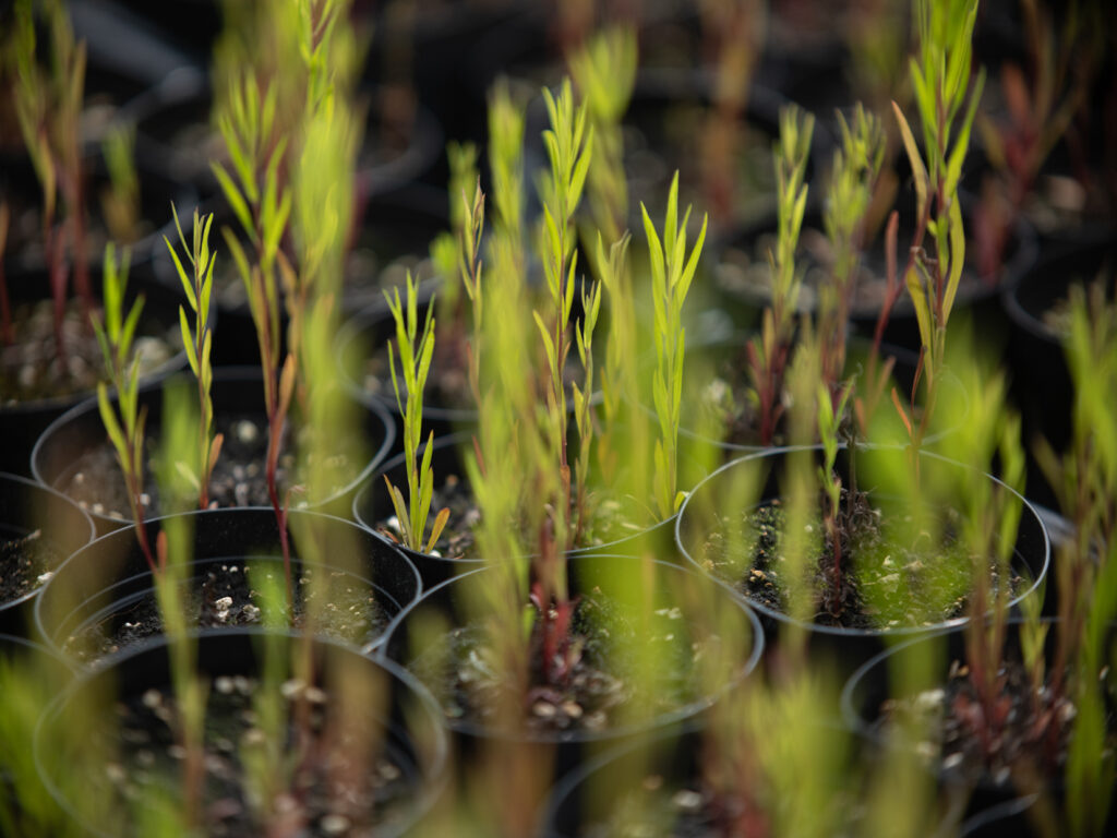
A 2023 assessment by Natural Resources Canada on the country’s seed supply found a “chronic lack” of appropriate seed and nursery stock. So even when they want to plant, project planners struggle to source the diversity, quantity and quality of native plants, seedlings or seeds. Nantais has been spending much of her time recently on Carolinian Canada’s southern Ontario seed strategy, aimed at connecting native seed and seedling growers in the region with organizations doing restoration work.
One of the growers engaged in this strategy is Kayanase, an Indigenous-owned native plant nursery and ecological restoration company about an hour’s drive north of Backus, in Six Nations of the Grand River. At the nursery on the banks of the Grand River, administrative team lead Carole Smith and ecologist Alyssa Paradis walk through their 5,000-square-metre native plant greenhouse.
At the end of May, it’s been picked over by eager gardeners, but there are still a few tables of plants and some rows of sugar maples in pots. Outside on the sprawling property, they’re busy building seed stock and developing a series of seed orchards.
Smith and Paradis walk me down to the tree seed orchard: rows and rows of native trees waiting to get large enough to produce viable seed. Started more than five years ago with 1,500 seedlings and a grant from Forest Ontario (now Forest Canada), the orchard includes some species, like white pine, that are just taller than I am. And until these trees produce seed, Kayanase ethically sources seed from the wild within a 75-kilometre radius. Six Nations stewards one of the largest tracts of old-growth Carolinian forest in the region.
As an Indigenous-owned and led business, Kayanase has traditional knowledge at its heart. “Sometimes I think it’s not in a particular practice or something that we do, but it’s more a translation of … the way we were raised and some of our cultural values,” Smith says. “Especially when it comes to wanting to restore Mother Earth, promoting stewardship and sustainability practices. It’s just bringing forward that need to preserve things for the next generation.”
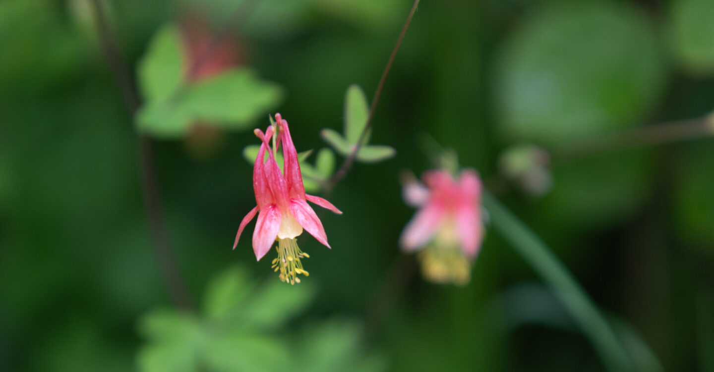
Seeds are hope. And from one tiny seed, tossed around in the water, frozen, burnt, waiting in the soil, springs life in infinite shapes and colours. A columbine’s red lantern-shaped flower dangling high above a doily of green foliage; a pawpaw’s umbrella-like canopy protecting a palm-sized fruit. Food for myriad species, and home — for us, too.
This story is part of a series about ecological corridors produced with support from Parks Canada. Learn more by visiting the Right of Passage website.
This story is from the November/December 2025 Issue
People & Culture
Dating back hundreds of years, quilting was practiced by Black Nova Scotian matriarchs as a way of telling stories and continuing oral history

Environment
The planet is in the midst of drastic biodiversity loss that some experts think may be the next great species die-off. How did we get here and what can be done about it?
Environment
As the impacts of global warming become increasingly evident, the connections to biodiversity loss are hard to ignore. Can this fall’s two key international climate conferences point us to a nature-positive future?
Environment
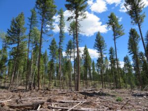
Human intervention in natural forest processes might seem counterintuitive, but experts say active management can actually help reduce wildfire risk and restore forests’ value to wildlife