People & Culture
On thin ice: Who “owns” the Arctic?
As the climate heats up, so do talks over land ownership in the Arctic. What does Canadian Arctic Sovereignty look like as the ice melts?
- 4353 words
- 18 minutes
This article is over 5 years old and may contain outdated information.
Mapping

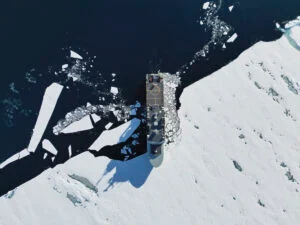
As the cruise ship Crystal Serenity prepares to set sail for its maiden voyage through the Northwest Passage this summer (accompanied by an icebreaker), it seems unlikely that any of its approximately 1,700 passengers (each of whom paid a minimum of nearly US$22,000) will be carrying a copy of a report that could one day help redefine how and where ships move through the Canadian Arctic.
To be fair, the Pew Charitable Trusts’ Integrated Arctic Corridors Framework report, released in April, probably isn’t something you’d throw into your suitcase alongside the binoculars and whatever book happens to be atop the New York Times best-seller list. Still, on a 32-day journey from Alaska to New York City that will include more than a dozen expedition experts offering “enrichment on board and guidance on shore, with numerous lectures, seminars and workshops during the transit,” according to Crystal Cruises, there’s plenty of time sink your teeth into 30-odd pages of a public-policy report to learn even more about the waters you’re sailing through, right?
Joking aside, the report, which addresses what it calls Canada’s lack of “a clear, cohesive vision for Arctic shipping policy” and suggests creating shipping corridors that would be classified as low, medium or high-risk, is a trove of maritime information that even those only mildly interested in the Arctic would find fascinating. For instance:
It’s the report’s 10 maps, though, that are perhaps the most fascinating, showing everything from what an integrated corridor system in the Beaufort Sea might look like to how current corridors overlap with critical habitat — something that those aboard the Crystal Serenity will no doubt be thinking about as the 250-metre ship noses its way through one of the world’s last truly wild frontiers.


Are you passionate about Canadian geography?
You can support Canadian Geographic in 3 ways:

This story is from the July/August 2016 Issue

People & Culture
As the climate heats up, so do talks over land ownership in the Arctic. What does Canadian Arctic Sovereignty look like as the ice melts?

Environment
The uncertainty and change that's currently disrupting the region dominated the annual meeting's agenda

Environment
Warming trends continue due to human-caused climate change

Environment
The Royal Norwegian Embassy and the Royal Canadian Geographical Society teamed up for two days of talks on the future of the Arctic and the “blue economy” in Norway and Canada