Wildlife
Should we kill one bird to save another?
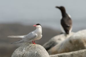
On New Brunswick’s Machias Seal Island, predatory gulls are pushing endangered Arctic tern colonies to the brink, creating a dilemma for wildlife managers
- 2151 words
- 9 minutes
This article is over 5 years old and may contain outdated information.
Mapping


For something so small, Melville Island sure punches above its historical weight. At various times since 1752, the speck of rock in the Northwest Arm of Halifax Harbour has been a quarantine station for free blacks from the United States and Irish immigrants, a processing depot for soldiers heading to the Crimean War and a prisoner-of- war camp.
The latter is depicted on this map, part of the Sherbrooke Collection — the largest and most complete set of War of 1812 documentation ever, which Library and Archives Canada acquired in 2013.
There had been a makeshift prison on the island since 1795, when the British used the island to incarcerate the crew of a French ship they had captured in the Caribbean. By 1805, however, as Brian Cuthbertson notes in Melville Prison and
Deadman’s Island: American and French Prisoners of War in Halifax 1794-1816, the British had purchased the island and built a proper facility, transforming the rocky outcrop into a full-fledged military prison.
Seven years later, with the War of 1812 barely two weeks old, the prison’s first recorded American inmate, David Stickney, arrived on July 4. Like many of the more than 10,000 inmates confined on the island from 1795 to 1816, Stickney was
jailed in the 46-metre by nine-metre two-storey red prison barracks (some were kept on a prison ship, pictured on the east side of the island).
The map also provides other clues to what life was like in the camp. Along with officer’s quarters, five privies, two cookhouses and 11 sentry boxes, note the prison yard, where captives exercised and daily roll call was taken, and the row of dots on the north and south side of the prison barracks, labelled “to air hammocks on.”
*with files from Isabelle Charron, early cartographic archivist, Library and Archives Canada
Are you passionate about Canadian geography?
You can support Canadian Geographic in 3 ways:
Wildlife
On New Brunswick’s Machias Seal Island, predatory gulls are pushing endangered Arctic tern colonies to the brink, creating a dilemma for wildlife managers
Mapping
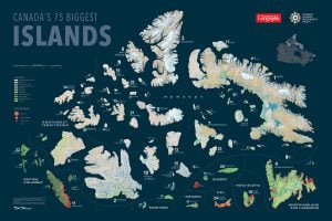
Canadian Geographic's cartographer Chris Brackley shares insights into his process in charting the country's largest islands for an exclusive wall map
People & Culture
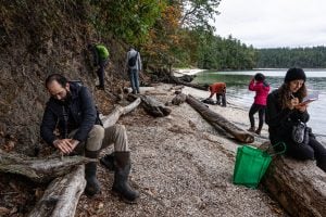
Naming leads to knowing, which leads to understanding. Residents of a small British Columbia island take to the forests and beaches to connect with their nonhuman neighbours

Mapping
Maps have long played a critical role in video games, whether as the main user interface, a reference guide, or both. As games become more sophisticated, so too does the cartography that underpins them.