This article is over 5 years old and may contain outdated information.

Mapping

General James Murray's massive mapping mission

A look at the cartographic gem commissioned 250 years ago by Quebec’s military governor
  • Sep 30, 2013
  • 498 words
  • 2 minutes
General James Murray's map of the St. Lawrence, 1763. Library and Archives Canada, NMC 135035 Expand Image
Advertisement

What would you do if, after years of fighting for a territory you didn’t know very well, you finally found yourself in possession of it? If you were British general James Murray and the territory was Quebec in 1760, you’d make a map.

After French forces surrendered at Montreal in 1760, New France was effectively handed over to the British — although peace wasn’t official until 1763 with the signing of the Treaty of Paris. (This year marks the pact’s 250th anniversary.) Murray, military governor of Quebec from 1760 to 1763, immediately asked his surveyors to create a map of Britain’s newest domain.

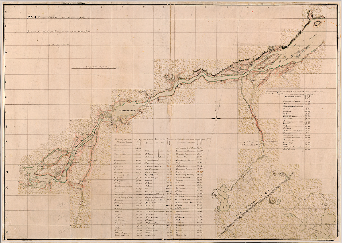
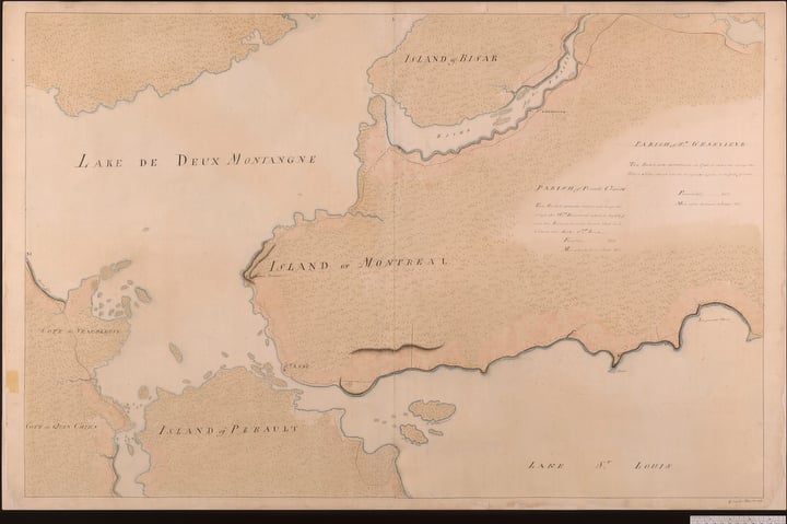
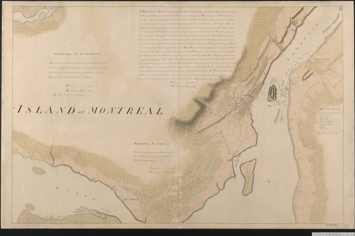
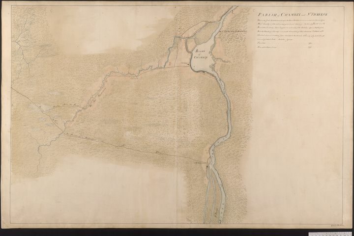
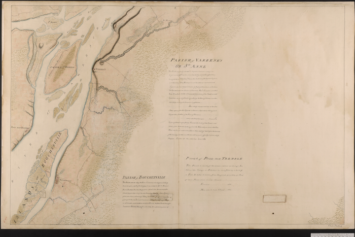
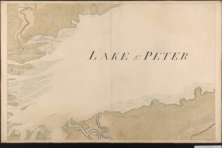
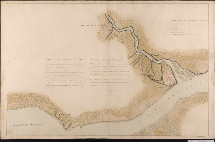
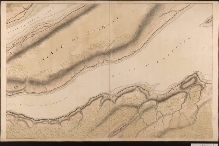
What a map it is. It depicts in exacting and beautiful detail a huge stretch of the St. Lawrence River region, from Les Cèdres, just southwest of Montreal, to Isle-aux- Coudres, 105 kilometres northeast of Quebec City. What’s more, one of the original versions of the map is vast, composed of four sections that together measure about 14 by 11 metres; it’s believed this form was for official use. The other version consists of 44 sheets, which were more portable and likely easier to display.

Apart from showing geographical features, the Murray map also lists information the British would have found extremely helpful, including land ownership, local history and the “number of families and men able to bear arms.”

Seven copies of the map were made, but the whereabouts of only five are known. One is at the University of Michigan’s William Clements Library, two are at the British Museum in London and, fortunately, two are held by Library and Archives Canada, so Canadians can be connected to this quintessential piece of the nation’s history.

Here, we take a closer look at this cartographic achievement.

Expand Image
Lake of Two Mountains (written here as “Lake de Deux Montangne”) is the river delta where the Ottawa River meets the St. Lawrence River. (Map courtesy Library and Archives Canada, NMC 135039)
Expand Image
Montreal appears as a small settlement on the Island of Montreal. (Map courtesy Library and Archives Canada, NMC 135039)
Expand Image
Today, Chambly, Que., a city southeast of Montreal, sits next to the Chambly Basin. (Map courtesy Library and Archives Canada, NMC 135039)
Expand Image
Varennes, today a suburb of Montreal, appears as a red dot on the map, with St. Thérèse Island to the east. (Map courtesy Library and Archives Canada, NMC 135039)
Expand Image
Lac Saint-Pierre, located in the St. Lawrence River downstream of Montreal, is now a UNESCO biosphere reserve. (Map courtesy Library and Archives Canada, NMC 135039)
Expand Image
The city of Trois-Rivières is located today at the confluence of the Saint-Maurice and St. Lawrence rivers. (Map courtesy Library and Archives Canada, NMC 135039)
Expand Image
The red buildings of present-day Quebec City are visible on the lower half of the map. (Map courtesy Library and Archives Canada, NMC 135039)
Expand Image
This map shows a close-up of Île d’Orléans, east of present-day Quebec City. (Map courtesy Library and Archives Canada, NMC 135039)
Advertisement

Are you passionate about Canadian geography?

You can support Canadian Geographic in 3 ways:

Related Content

Assassin's Creed Odyssey landscape

Mapping

Inside the intricate world of video game cartography

Maps have long played a critical role in video games, whether as the main user interface, a reference guide, or both. As games become more sophisticated, so too does the cartography that underpins them. 

  • 2569 words
  • 11 minutes

People & Culture

In search of promised lands

Uprooted repeatedly by development projects, the Oujé-Bougoumou Cree wandered boreal Quebec for 70 years before finding a permanent home. For some, the journey continues.

  • 7148 words
  • 29 minutes

Travel

Go with the fleuve: 5 days in La Belle Province

Following the St. Lawrence’s winding course through Quebec delivers a feast of history, culture and food

  • 2137 words
  • 9 minutes

Mapping

Creative Cartography: Matt Cusick’s map collages

This article is part of a series of Q&As with some of the best artists working with maps. Read…

  • 1186 words
  • 5 minutes