
Mapping
Nine artworks that reveal the history and perils of exploring Canada’s North
Notable works capture the danger and drama of Arctic exploration
- 1081 words
- 5 minutes
This article is over 5 years old and may contain outdated information.
Mapping
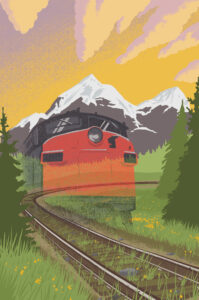
Early maps of the railways that shaped our country


Old maps are fascinating in part because they can tell us not only how people once saw the world but also how that world was shaped. That’s certainly true of the railway maps shown below, whether it’s the scarlet-lettered 1880s-era map of the Grand Trunk Railway or the map of the Maritimes targeted at “business-men, tourists and sportsmen.”
Here’s a brief explanation of four of these maps, provided by Sara Viinalass-Smith, an early cartographic archivist with Library and Archives Canada.

This map features information on rail and ship transportation, mining and where to find wildlife for hunting and fishing in the Maritimes. For example, the * symbol on the map represents moose and caribou hunting locations. The map also allowed those using it to locate iron, gold and coal mines, as well as mineral springs, granite and gypsum. It also advises on where one can locate accommodations. Businessmen and sportsmen would have had all the information necessary for an exciting and lucrative trip to the Maritimes.

Produced for the 1857 Canadian Almanac, this map includes proposed and current railways, roads, steamer routes, canals, counties, districts and townships. Upper and Lower Canada, specifically the Great Lakes and Georgian Bay regions, are featured in Canada west. The two vignettes depict a train and a coat of arms.

This coloured bird’s-eye view map was produced for the Canadian Pacific Railway Company Passenger Department in 1915. The pictorial map on the right shows the Laurentian Mountains with a red line running through them, perhaps indicating the CPR rail line serving the area. To the left is a topographic map of the Gatineau Valley.


The Canadian Pacific Railway originally produced this two-sided map as an informational pamphlet, probably around 1892. The front shows the CPR’s lines and connections in the area of Canada and United States between the latitudes of about 38 degrees north and about 54 degrees north, while the reverse lists regulations governing homesteads, lands, immigration and settlers’ effects — important information, perhaps, for those wishing to settle in Canada.

This story is from the July/August 2015 Issue
Mapping
Notable works capture the danger and drama of Arctic exploration
People & Culture
What does it mean for Canada if we continue to pull up train tracks?
Exploration
A century after the start of the thrilling expedition that strengthened claims to Canadian sovereignty in the Arctic, the first Canadian Arctic Expedition remains a largely unknown part of the country’s history
People & Culture
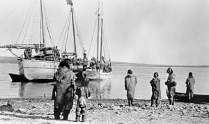
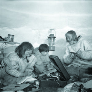
Launched in 2002, Project Naming invites Canadians to engage in identifying Indigenous people from Library and Archives Canada to help tell the story behind every photograph