
Environment
The health of the Fraser River
Follow the team of specialists diagnosing the ills of British Columbia’s Fraser River
- 1997 words
- 8 minutes
History
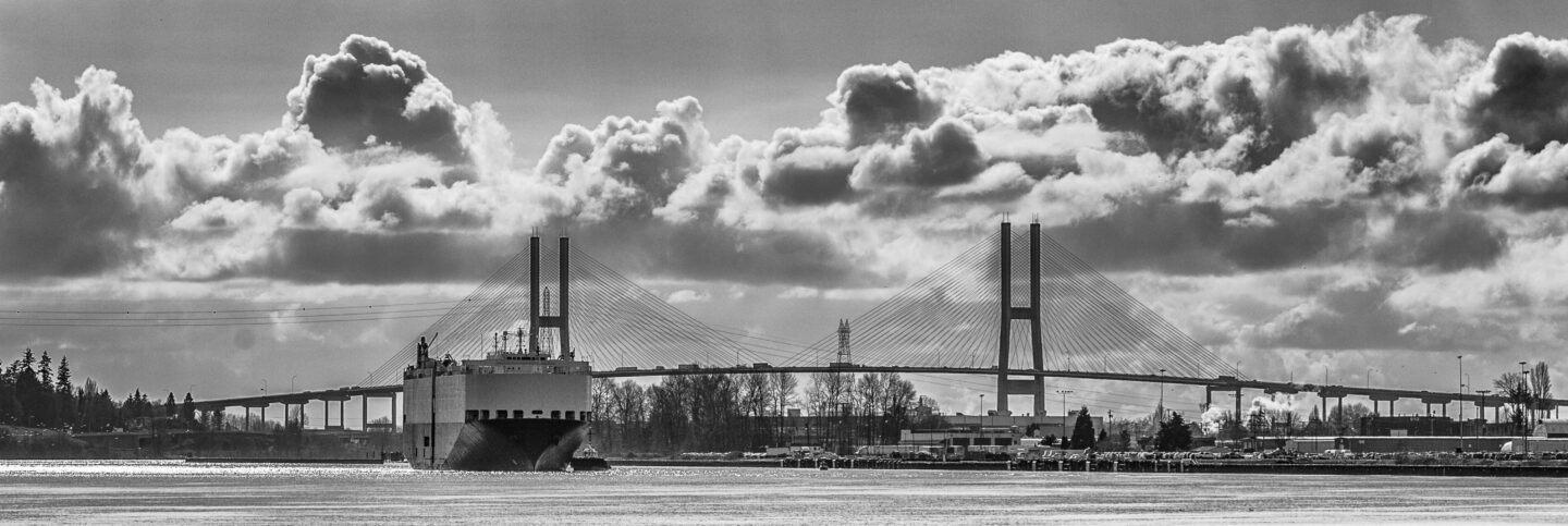
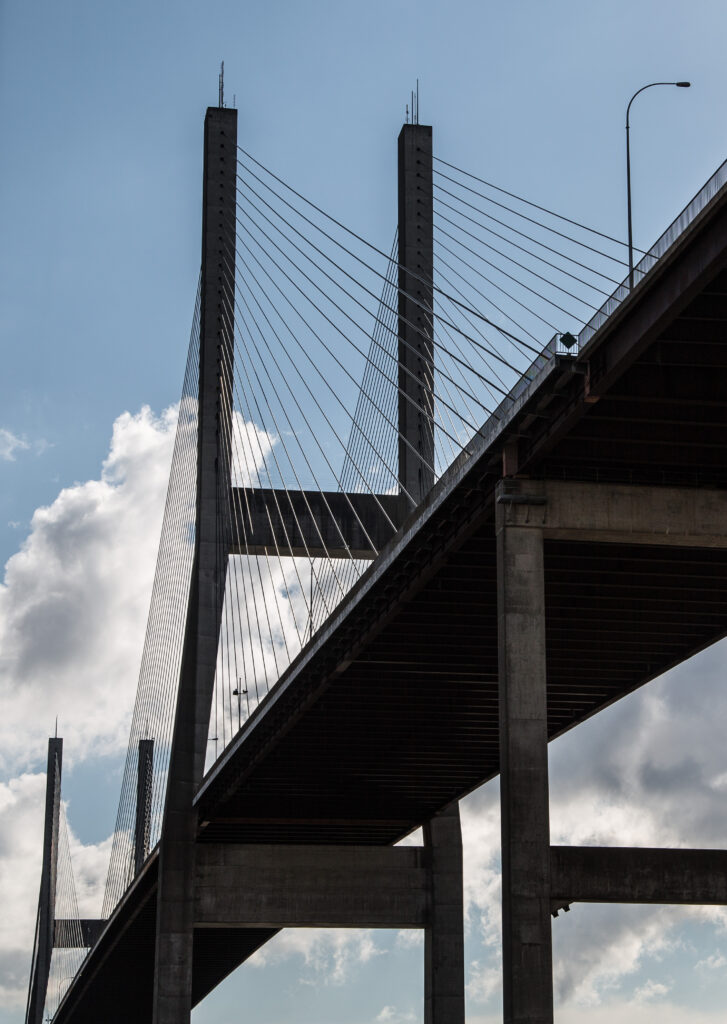
In his newest book, Incredible Crossings, renowned historian and best-selling author, Derek Hayes, combines hundreds of visuals with meticulously researched commentary to educate readers on the bridges, tunnels and inland ferries that connect British Columbia
The Alex Fraser Bridge, named after the provincial Transportation and Highways Minister under whose watch the project began, is the centrepiece of a system of new major roads built within a few years of each other. The planning began in the 1970s; in 1973 the required right-of-way on the north side was acquired from Grosvenor, the owner of the land on Annacis Island, who no doubt realized the bridge was likely to add considerable value to their land.
The bridge was completed in 1986 and connected a new Highway 91 from interchanges with Highway 99 in Richmond in the north to another in Delta to the south, thus creating a new route to the US boundary. The southern part was completed in 1986 at the same time as the bridge, as was a connection north to the Queensborough Bridge (now High- way 91A), but the link on Lulu Island, now usually referred to as the East-West Connector, was not completed until 1989.
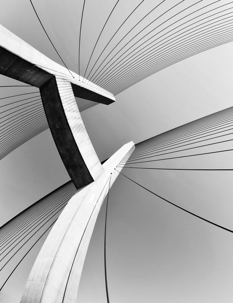
The Alex Fraser Bridge is a cable-stayed bridge, which at the time of completion was the longest of this type in the world, a record it held for 19 years. With towers 154 m high it was also the highest structure in Metro Vancouver, equivalent to a 50-storey building. This record has long since been lost to many relatively recent buildings in Downtown Vancouver, where the height limit now stands at 200 m.
The towers sit on steel piles, which on the north side had to be driven down 90 m to find a solid footing, perhaps not so surprising since the whole of Annacis Island is but a sandbar in the river. The pilings had to be then topped with caps that required 450 truckloads of concrete, which for reasons of structural integrity needed to be all poured in a single pour. This necessitated the utilization of virtually every available cement truck in the entire region. The base of the towers can in theory withstand an impact by a large freighter moving at 12 knots, likely faster than a large ship would be moving at this location.
Attached to the towers are some 192 specially manufactured steel cables from 50 to 237 m in length that were imported from the UK. Each cable is made up of 283 strands of galvanized steel about the thickness of a pencil. The cables support a bridge deck that is 930 m long, and it has been estimated that if laid end to end they would be 26 km long. The multiple fans of cables make the Alex Fraser Bridge one of the Lower Mainland’s most photogenic bridges.
The bridge construction was not without some controversy. In 1984 the St. Mungo Cannery site at the south end of the bridge was bulldozed for construction despite it being a significant historical site and an ancient Indigenous midden. And in the summer of 1985, to the outrage of many, a sewer line was accidentally cut while an access ramp was being prepared, dumping millions of litres of raw sewage into the river.
Excerpted with permission from the book Incredible Crossings: The History and Art of the Bridges, Tunnels and Ferries That Connect British Columbia by Derek Hayes, published by Harbour Publishing, 2022.


Environment
Follow the team of specialists diagnosing the ills of British Columbia’s Fraser River
Wildlife
This past summer an ambitious wildlife under/overpass system broke ground in B.C. on a deadly stretch of highway just west of the Alberta border. Here’s how it happened.
People & Culture
As wildfire seasons worsen, residents of British Columbia’s southern interior have been repeatedly evacuated. They may be climate evacuees, but this hasn’t stopped them finding solutions, Canadian Geographic writer David Geselbracht reports in his new book Climate Hope.
Travel
The nation’s coolest road trips — literally