Environment
Why mountains matter in Canada
They sustain us, enrich our lives and inspire us
- 1287 words
- 6 minutes
History
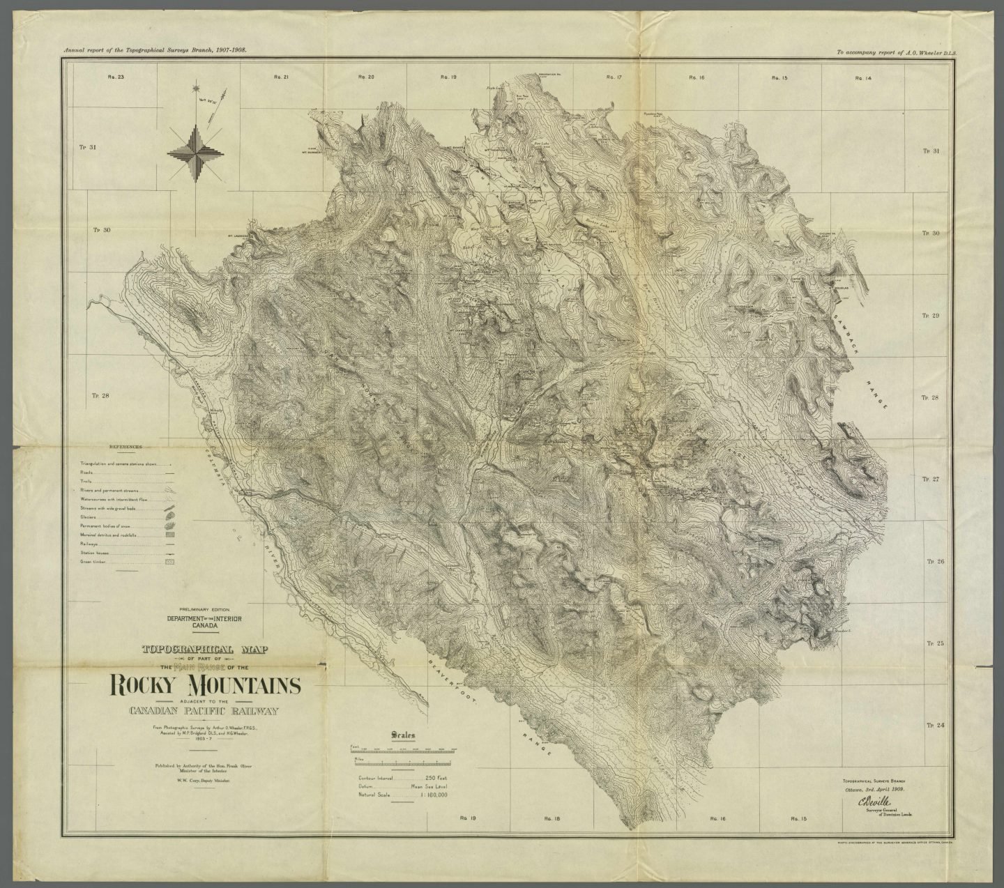
On a summer’s day in 1886, French-born Canadian surveyor Édouard-Gaston Deville planted a camera on a mountain, pointed it at the horizon and took panoramic shots of the soaring peaks around him. After measuring the distance between each peak and the survey point, Deville made a photogrammetry map of the mountainous region. Excited to share his invention, he took the method to the 1893 Chicago World’s Fair.
Photogrammetry is the use of photography to make maps. A camera is carried up to a high point, then used to take photos of the surrounding area. The photographer-surveyor records the altitude and measures the angles to other peaks and photo
stations. The photos are then combined with the field measurements to create a topographic map.
While Deville didn’t invent photogrammetry (the idea was first put forward by French mathematician François Arago, and the
term was coined by Prussian architect Albrecht Meydenbauer), his method was the first practical use of it.
After arriving in Canada in 1874, Deville quickly rose through the ranks, becoming surveyor general (the highest surveying
office in the land) within 11 years. A year after acquiring this title, Deville took his technique to the Rockies. His previous work as a hydrographer for the French navy in the waters of Peru and Polynesia could not have prepared him for the mountainous terrain in B.C. and Alberta. He needed a camera that was rugged but lightweight enough to be carried up slopes. Determined to conquer the mountains, he designed and constructed his own camera for the field.
Between the first photos Deville took in the Rockies and his death in Ottawa in 1924, Canadian surveyors used his method to map 83,678 square kilometres — an area roughly the size of Ireland. Deville was also a mentor to renowned surveyor and mountain climber Oliver Wheeler, who took a copy of Deville’s camera to map the northern slopes of Everest in 1921.
Photogrammetry has since been used to combine live action with computer-generated images in film and video games,
including in The Matrix and Star Wars: Battlefront. Deville and the other pioneers of photogrammetry didn’t know it at the time, but the force was with them.
Are you passionate about Canadian geography?
You can support Canadian Geographic in 3 ways:

Environment
They sustain us, enrich our lives and inspire us
Environment
A new report by Alpine Club of Canada scientists and other experts highlights worrying trends in Canada’s mountain ecosystems
Environment
Glaciers play a vital role in sculpting the landscape, and their retreat can bring about drastic consequences
History
Dora Nipp, CEO of the Multicultural History Society of Ontario, reflects on the importance of chronicling migrant, ethnic and Indigenous stories as an essential means to understanding Canada in the 20th century and beyond