History
Bluenose: Behind the sails
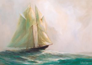
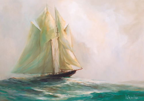
The symbolism of the iconic Canadian fishing and racing schooner Bluenose may be as relevant today as it was 100 years ago when the ship first hit the water
- 3226 words
- 13 minutes
This article is over 5 years old and may contain outdated information.
Science & Tech

Toys, fruit and compressed gas might seem like three very different things, but they share one common factor: they are transported across the world via ships. Tens of thousands of commercial ships transport products like these every day, fueling the global economy.
This interactive map, created by Kiln and the UCL Energy Institute, shows the movement of the world’s commercial shipping fleet in 2012 based on 250 million individual data points.
You can see routes for five different vessel types as well as statistics including carbon dioxide emissions and maximum freight carried.
The map highlights China’s heavy shipping traffic, with Shanghai being the busiest container port in the world.
Other high traffic areas include the Panama Canal, which sees approximately 14,000 ships passing through it each year. The canal is currently undergoing a 6.9 billion dollar expansion project to allow bigger ships with more containers to pass through.
Despite being such an important part of the global economy, the world’s commercial shipping fleet does have a major downside: it results in the daily production of more than one million tones of carbon dioxide, one of the main contributors to climate change.
According to the World Shipping Council, shipping accounted for approximately 2.1 per cent of global greenhouse gas emissions in 2012. However, they still deem shipping as more carbon-efficient than rail, truck, or air transportation.

History
The symbolism of the iconic Canadian fishing and racing schooner Bluenose may be as relevant today as it was 100 years ago when the ship first hit the water

Exploration
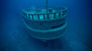
Yvonne Drebert and Zach Melnick set out to make a documentary about invasive quagga mussels in the Great Lakes. Along the way, they found the wreck of what is likely the steamship Africa, last seen on a stormy October night in 1895.

Mapping
Maps have long played a critical role in video games, whether as the main user interface, a reference guide, or both. As games become more sophisticated, so too does the cartography that underpins them.

Environment
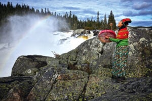
In February 2021, the world was introduced to Mutehekau Shipu — also known as the Magpie River — when the people of Ekuanitshit, Que. and the regional municipality made a joint declaration granting the river legal personhood and rights. The declaration carries broad implications for the fight to protect nature across Canada and around the world.

History
The symbolism of the iconic Canadian fishing and racing schooner Bluenose may be as relevant today as it was 100 years ago when the ship first hit the water

Exploration
Yvonne Drebert and Zach Melnick set out to make a documentary about invasive quagga mussels in the Great Lakes. Along the way, they found the wreck of what is likely the steamship Africa, last seen on a stormy October night in 1895.