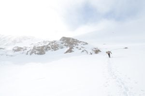
I love unfolding one of my family’s old canoe trip maps and reading the notes my parents made along their frayed, water-stained edges.
Their chronicles about the length of a portage in minutes, the condition of a favourite campsite, or about how to run a set of rapids in high water, added a personal dimension to the standard topographic maps of the Allagash River and the lakes of the Adirondacks. Not only did they tell stories about the trip (“this site turns to mud in the rain”), they provided useful information too.
Of course, you can’t buy a family map; you have to be lucky enough to inherit one. At least that was the case until 2006 when a 17-year-old from Toronto named Jeffrey McMurtrie began trying to improve a map of Algonquin Park that had led him and his dad astray one too many times.
“When I started out I wanted to correct these mistakes I knew about,” McMurtrie said about his first map of Algonquin Park. “But then I started to read some of my dad’s Algonquin books and say ‘oh! There’s some sort of neat historic site over there. I’ll check that out next time I’m there, but I’d always forget. And so, for me, putting that information on the map was basically notes to myself.”
He began to share screenshots of his maps on online forums to help people plan trips, and soon people were asking where they could buy one. Two years after beginning his Algonquin Park map, he put it online.
“I shared it with a few friends and they were really encouraging,” he said. “So I swamped out anything from the original base map that wasn’t mine with stuff that was, and then put it online.”
He said the feedback was incredible right from the beginning. Not only in praise of the map, but also corrections and comments that he would add to the map. Soon people were asking for print copies, which McMurtrie says he didn’t want to do.
“I didn’t want to deal with manufacturing, storage and logistics, and all that,” he says. “That wasn’t my driver or motivator. I relented because people said, ‘it’s not nearly as useful to me if I can’t pick it up and bring it with me on the trip.’”
Ten years later and McMurtrie, 27, is now a full time cartographer running his own company. His success is probably because using a Jeff’s Map is like using an old family map crossed with a guidebook. Unlike many canoeing maps, Jeff’s Maps answers your questions before you ask them.
“Maps represent opportunities and potential,” he says. “When I update a map I try to do it in a broader sense. You know, what are the types of problems that people have planning trips? And how can I, through the map, help solve some of things. So it’s well beyond just updating the map itself. It’s all fun, but working on that type of problem is neat because there’s no template or guideline for that.”
With four maps online and a two more in the works, including one of the French River that he finished recently, McMurtrie says he has no plans for stopping any time soon.
“To me the most important thing of all is to keep updating them,” he says. “They evolve. Stuff changes, and even outside of that, I get people’s comments and perspective’s on things that I might not have realized.”