Science & Tech
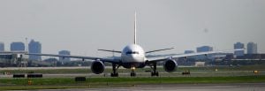
Surprising facts about Canadian airports
How much do you know about the places that deliver us to the sky?
- 288 words
- 2 minutes
This article is over 5 years old and may contain outdated information.
People & Culture
A writer follows his relatives' path across "The Rock", 80 years after they helped put it on the map

The highway I drove to Gander last summer wasn’t there in 1935, when my grandfather sent his brother to Newfoundland, and there was no famous airport yet, either. There had been a railway that passed by, though Gander wasn’t really a stop on the line, much less a station, for the good, straightforward reason that there still wasn’t, at that point, any Gander at all.
Today, it’s a thriving town of 11,000, and though the airport may no longer be the hub of military and commercial aviation that it once was, it can still shepherd up to 1,000 aircraft through the skies on a given day. The story of Gander’s dynamic past and its evolving future is one I explore in the July/August 2016 issue of Canadian Geographic, now available on newsstands. Last August, when I made the journey west from St. John’s, it was 80 years to the month since my great-uncle, Maurice Banks, set out in that same direction as one of the men commissioned, as a newspaper of the day put it, to bring the 20th-century to the wilderness.
It was a plan formulated far away, in London, which is where my grandfather comes in. In the early 1930s, first as director general of Britain’s Post Office, then as head of the Air Ministry, Donald Banks had devoted himself to planning and implementing regular North Atlantic mail, freight, and (eventually) passenger service.
The Bankses were Guernseymen. Maurice, the younger of the two brothers, became a pilot in the First World War, when he was barely 18. Flying a seaplane in 1918, he sank a German submarine. Returned to civilian life, he flew commercially across Canada in the 1920s before joining Donald at the Air Ministry. As an operations officer, he helped put plans into practice, in the field (and the air) working to establish the British Empire’s air-mail routes to South Africa, Australia, South America, as well as Canada and Newfoundland.
He later wrote a short account of his decisive 1935 visit to Newfoundland, which he made with an Air Ministry colleague named Ivor McClure. Like me, they departed St. John’s heading west, though they travelled by rail, in a small survey car hitched to the rear of the regular Newfoundland train. It halted whenever they wanted to explore a likely site; passengers waited while the airport-diviners unhitched. After laying a temporary siding alongside the main line, they went about their explorations until the next train came along to take up the towing to the next potential site.
“Newfoundland was a closed book to us,” Maurice wrote. Flat, fog-free, accessible terrain was what they were after. They didn’t have detailed maps, and there was no good meteorological data available. Locals spoke of a man who knew all the deep secrets of Newfoundland fog and where it didn’t amass, but I’m not sure that they ever tracked him down, let alone his Shangri-La.
The visitors ended up selecting two sites. Botwood, on the Bay of Exploits, was chosen as a base for flying-boats. For the main aerodrome they tabbed the woods beyond Milepost 213 on the railway line, a place called Hattie’s Camp by the seasonal loggers and rabbit-hunters who knew it best. The spring of 1936 brought in new neighbours: the crews who’d been hired to (as a recent Airport publication put it) “draw forth a functional airport from a long sprawl of rock-strewn bog and pug and boreal forest.”
Last year, having finished up a morning visit to Gander’s airport, I re-read Maurice’s account of those early days. It was just past noon, and I’d been advised that the terminal restaurant brewed the best bowl of chowder in town, so that’s what I ordered. There was no gazing back, from my table, to 1935, but I was doing my best, looking out through the gift shop windows across the tarmac of what was, when it opened in 1939, the world’s largest airport.

Map: Chris Brackley/Canadian Geographic
Science & Tech
How much do you know about the places that deliver us to the sky?

Exploration
The aircraft was discovered by an international dive team on a steep ledge nearly 50 metres below the surface of the lake in central Newfoundland
Travel
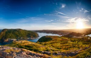
Immerse yourself in Viking archaeology and Basque whaling history while taking in Newfoundland’s scenic coastline and incredible geology

Wildlife
Writer Stephen Smith takes to Newfoundland’s shores in his quest to see the ‘capelin roll’ — the spawning spectacle of a tiny fish with a massive ecological, historical and cultural impact