
Environment
The sixth extinction
The planet is in the midst of drastic biodiversity loss that some experts think may be the next great species die-off. How did we get here and what can be done about it?
- 4895 words
- 20 minutes
Environment
Photographs from across the country reveal why Key Biodiversity Areas are critical to the planet’s future
As biodiversity faces mounting threats from climate change, habitat loss and species decline, countries worldwide are taking action to protect nature. Key Biodiversity Areas (KBAs) are critical in sustaining life on Earth. These sites, identified through scientific and measurable criteria, support rare or threatened species, unique ecosystems and essential natural processes.KBAs span land, freshwater, and marine environments, ranging from small habitat patches to vast landscapes.
The images below showcase some of Canada’s most vital natural areas, selected using rigorous criteria that assess ecological value, global significance, and the presence of threatened species. The Canadian Key Biodiversity Areas (KBA) program employs a set of scientific “lenses” to identify places that play a disproportionately significant role in conserving biodiversity. These areas help guide where conservation efforts should be focused, whether it is restoring threatened habitats, such as wetlands and grasslands, or safeguarding sensitive breeding, feeding, or resting sites.
To bring these places to life, amateur and professional photographers from across the country partnered with Wildlife Conservation Society Canada to capture a visual snapshot of the nearly 1,000 KBAs now being assessed from coast to coast to coast. This curated selection of images highlights the diversity of ecosystems and species encompassed by the KBA initiative.
Discover more at KBACanada.org—you may just find an ecological treasure close to home.
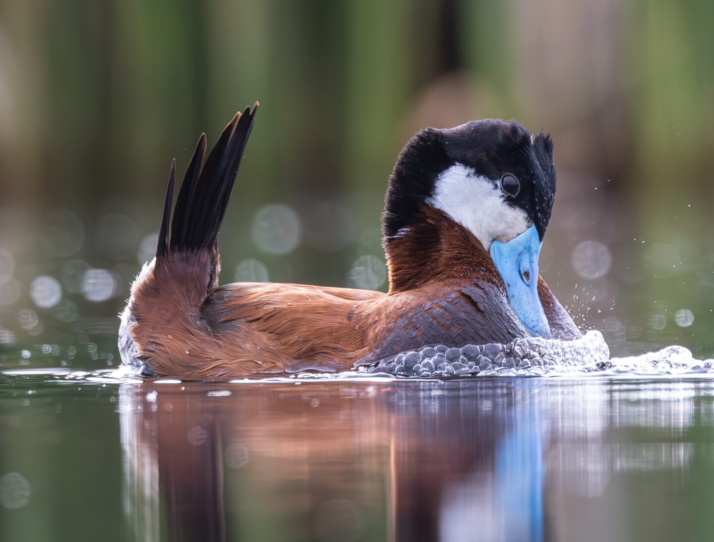
Located northwest of Winnipeg, Grants Lake Wildlife Management Area is a small, primarily cattail-filled marsh. This once vast wetland is now a fraction of its original size and surrounded by intensive agriculture. However, efforts have been underway to improve diversity within the area by managing water levels and creating new “potholes” (shallow wetlands that are typical of the prairie region).
Historically, this has been a famous wetland for geese and, to a lesser extent, for ducks. Despite the habitat changes, it is still not uncommon for there to be about 100,000 Canada geese and a similar number of snow geese using the wetland and adjacent cultivated fields during fall migration. This photo features a male ruddy duck performing a mating display in one of the remaining wetland areas.
High breeding densities of red-winged blackbirds, yellow-headed blackbirds, and marsh wrens have also been observed at Grants Lake.
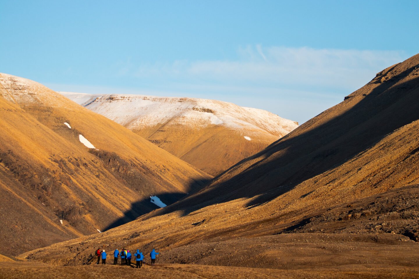
The Lancaster Sound Polynya is an area of open water that persists in the Arctic Ocean throughout the winter months. The shape and extent of the polynya vary from year to year, and are influenced by the severity of the winter, water currents and winds. Ice starts to develop in late September, with the sound becoming completely ice-covered by mid to late October. However, an open lead regularly develops along the south shore of Devon Island beginning in mid-November. In this photo, a group of eco-tourists hike through the otherworldly high-Arctic landscape of the Devon Islands.
Many large marine mammals, such as bearded Seals, harp Seals, narwhals, belugas, walruses and polar bears, feed in the waters here or pass through them during migration. The area is also used by huge numbers of dovekies, small seabirds that pass through on their way to breeding grounds in Greenland.
As the ice-free season in the Arctic Ocean grows due to climate change, so does ship traffic, posing a risk of oil spills, noise pollution and collisions for whales passing through or feeding in Lancaster Sound.
This candidate KBA site spans a section of the Appalachian Mountains on the Gaspé Peninsula in eastern Québec, running across two mountain ranges: the Chic-Chocs and McGerrigle Range. It includes some of the highest peaks found in eastern North America. The mountains within the KBA are rugged and high enough to host one of the largest expanses of alpine tundra on the eastern side of the continent. The surrounding valleys feature both coniferous and hardwood forest areas as well as many lakes and streams. The KBA encompasses a mix of provincial (Quebec national) parks, ecological and game reserves and private lands.
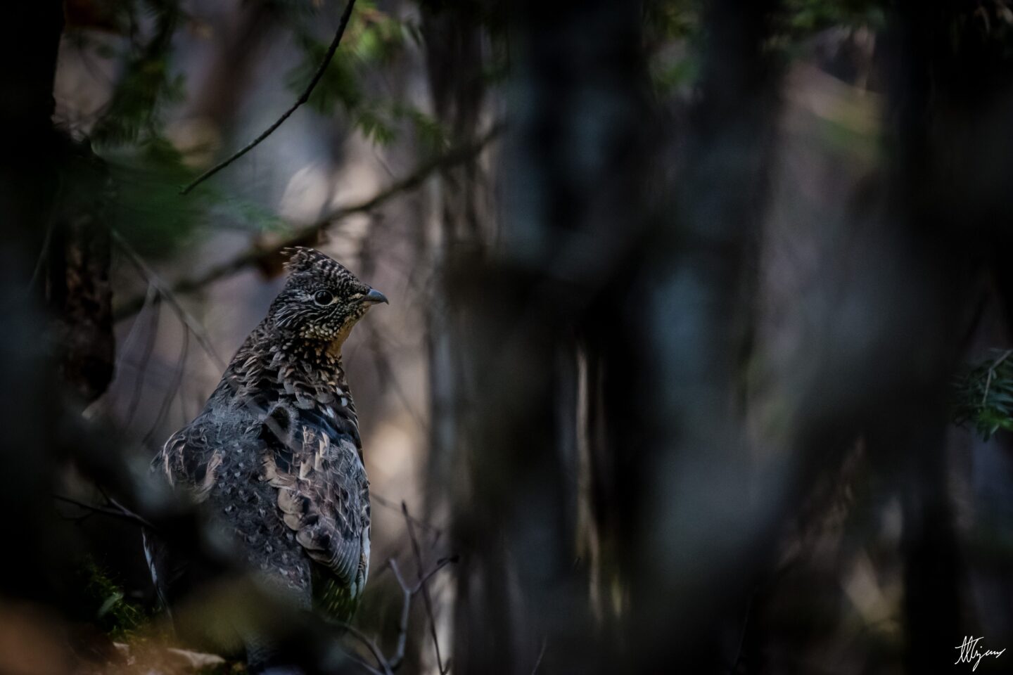
The forests are home to Bicknell’s thrushes, a small songbird designated as threatened in Canada and vulnerable in Québec. In this photo, a ruffed grouse is captured in the undergrowth of the forest. The area is also renowned for its numerous lakes and swift-flowing rivers.
The KBA’s spruce forests and high plateaus also support the last remaining wild caribou herd south of the St. Lawrence River, an emblematic species officially designated as threatened in Québec and as endangered in Canada. Human activities are leading to the isolation and confinement of the caribou population in and around the Gaspésie National Park.
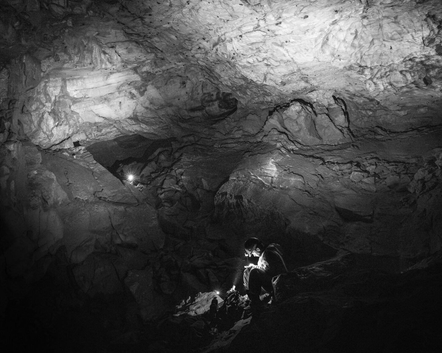
This site, directly abutting the east side of Jasper National Park, could be mistaken for just another mountain valley in the Alberta Rockies if not for the unusually high abundance and diversity of rare species found here. It also contains Cadomin Cave, which is one of the largest bat hibernacula in Alberta. In this photo, a group of scientists conduct a winter count of bats in the cave to assess the health of the colony. At least three bat species are found in the cave, two of which are considered endangered in Canada thanks to the spread of deadly white-nose syndrome.
As well, half of the entire Canadian population of a globally imperilled moss species, Porsild’s bryum, is found within the area. Other rare and unusual species known from the area include purple alpine braya, the endemic three-lobed fleabane, pink false dandelion, Davis’ locoweed, capitate lousewort, long-legged kyotis and Jepson’s potentilla.
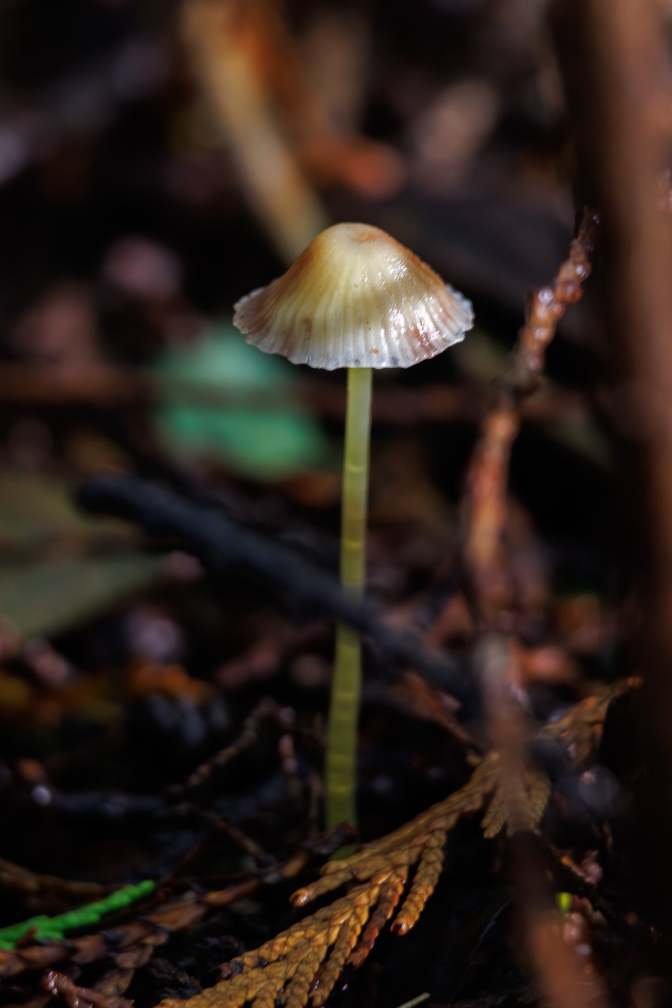
The Tofino Mudflats are situated on the west coast of Vancouver Island near the town of Tofino and this KBA encompasses the shorelines and mudflats of the Browning Passage as well as adjacent Chesterman Beach. Approximately half of the site is made up of six distinct mudflats. The mudflats, exposed daily by the tide, support a rich invertebrate community as well as plant life in the form of eel grass beds and algae, giving way to saltmarsh and then forest at the high-water mark. In this photo, a tiny mushroom sprouts from a log along the forest edge.
The area hosts globally important numbers of migrating Western Sandpiper every year. Based on surveys in 2019-2021, each spring and fall an estimated 600,000 Western Sandpiper stop at the site, with individuals staying two to five days to replenish the critical fat reserves needed for their remaining migration.
Heavy recreational use of beaches and residential development along them has been a growing threat to the fragile ecology of the mudflats.
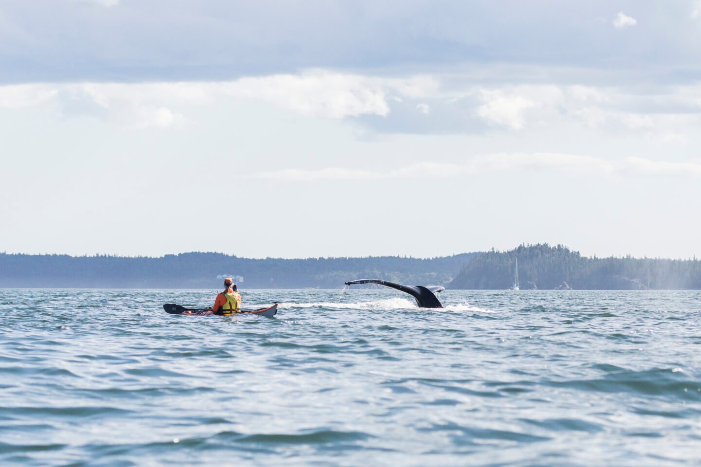
This ocean area off the southern coast of New Brunswick is rich in marine life thanks to the strong currents and upwellings created by the narrow passages that lead through to Passamaquoddy Bay. Large groups of seabirds feed in the area in the late summer, fall and winter. During fall migration, globally significant numbers of Bonaparte’s gull pass through. In December, gulls and ducks can be found in the hundreds or even thousands. Other species of interest that frequent the waters of the KBA include wolffish, white sharks, harbour porpoises and porbeagle sharks.
There are both commercial fishing and tourism operations in the area, with several boats taking visitors out to see whales and seabirds. In this photo, a sea kayaker is approached by a humpback whale, a typical sight in this whale watching hotspot.
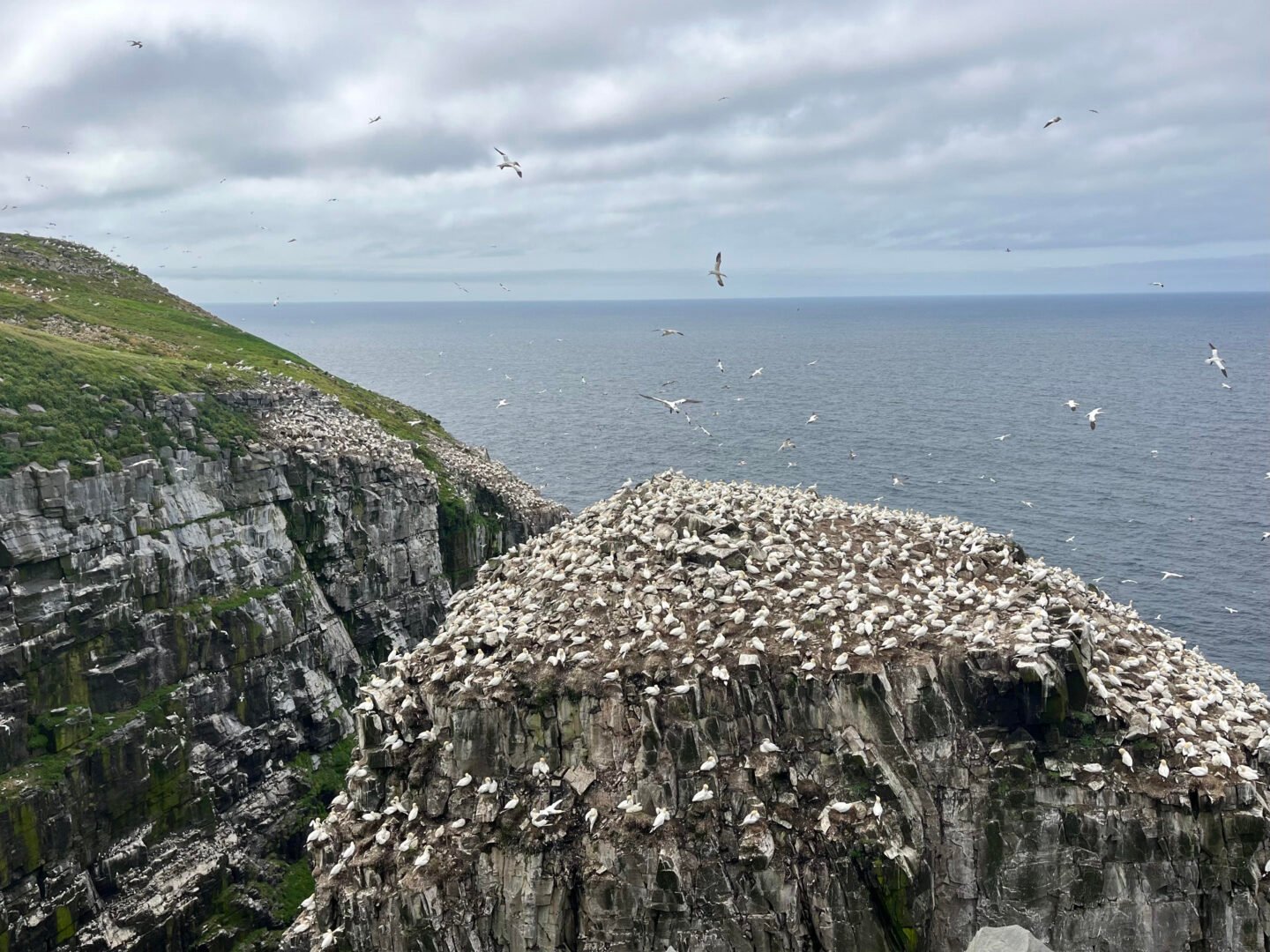
Perched at the southwestern tip of the Avalon Peninsula, the cliffs of the cape stretch 130 metres above Placentia Bay. Just offshore is a “sea stack,” a vertical column of rock known as Bird Rock. Both the mainland and Bird Rock are home to thousands of seabird nests.
Black-legged kittiwakes are abundant here with numbers reaching up to 40,000 in 2011. A large colony of northern gannets (featured in this photo) is also present, with breeding numbers estimated at 50,000 in 2022. Other seabirds nesting at Cape St. Mary’s include thick-billed murres, common murres, razorbills, black guillemots, herring gulls, great black-backed gulls, great cormorants, and double-crested cormorants.
The seabird nests are surrounded by a unique terrestrial ecosystem of mosses, lichens and vascular plants adapted to and thriving from nutrients in air-borne seabird guano. This plant community is very rare in Canada and limited to a few dozen sites nationwide.
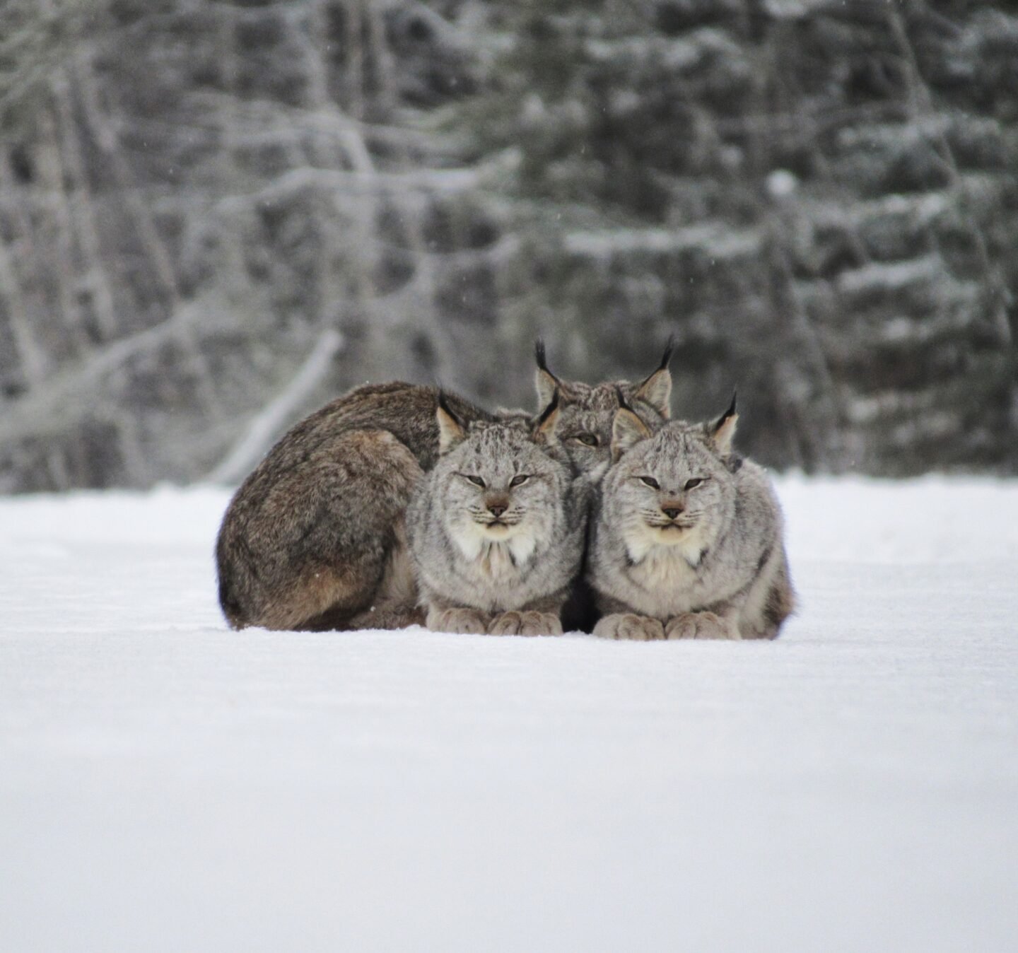
Lake Superior, the largest of all the Great Lakes, is, by volume, the third largest freshwater lake in the world and contains 10 per cent of the entire world’s surface fresh water. The vast lake is fed by more than 200 rivers and is home to more than 80 species of fish, including a number of cold water fish such as Siscowet Lake trout, a large deep water lake trout form unique to Lake Superior, pygmy whitefish and kiyi, a cisco species that was previously found in all of the Great Lakes (except Lake Erie) but is now found only in Lake Superior. The lake also supports many major habitats in good ecological condition, including coastal wetlands. As the largest and healthiest Great Lake, it is a crucial part of the biodiversity and ecological network of the Great Lakes region.
The lake is bordered on the Canadian side by a number of large parks and ecological reserves. In this photo taken along the wild north shore of the lake, a mother lynx watches a visitor carefully as her two cubs stay close.
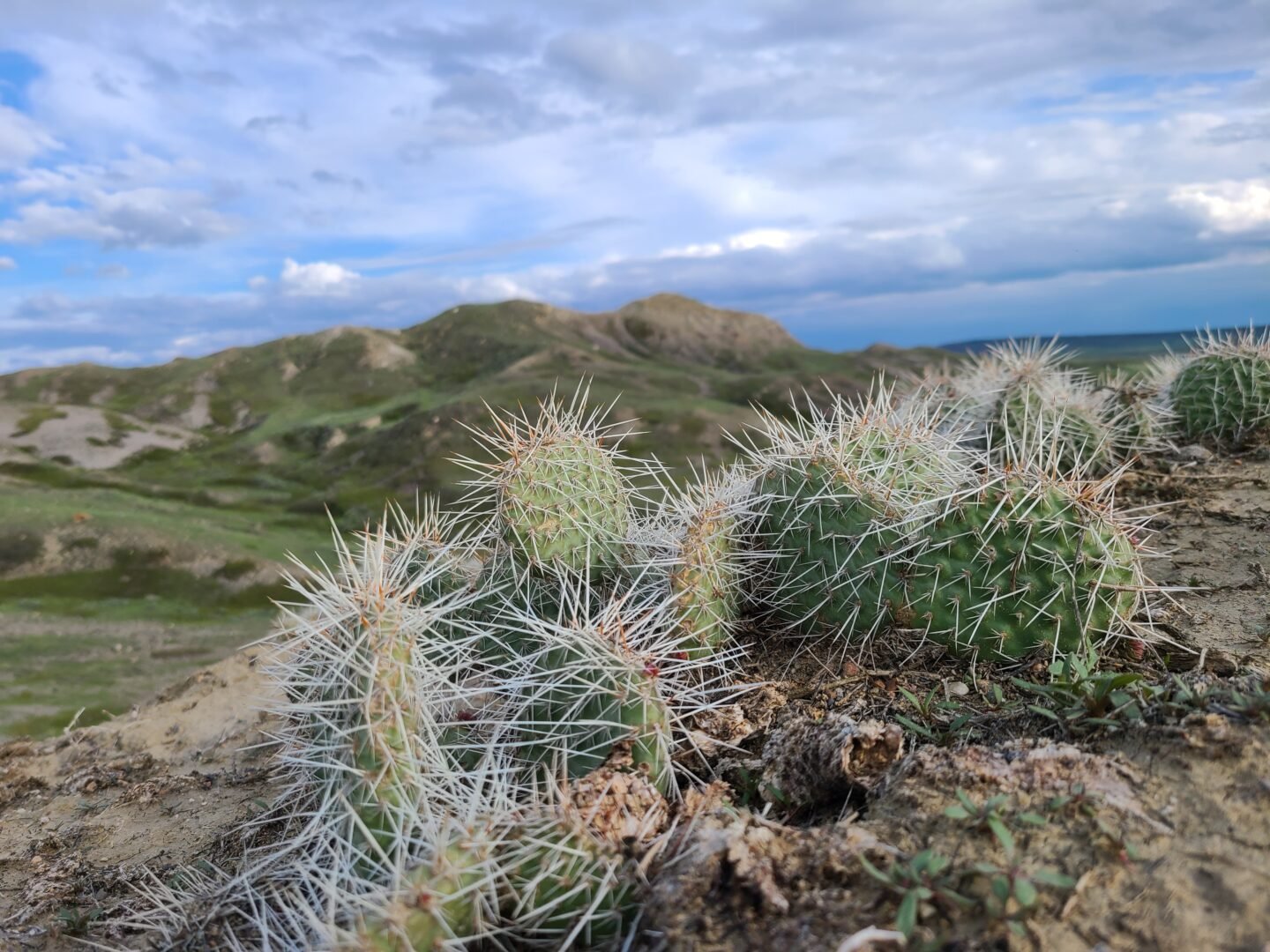
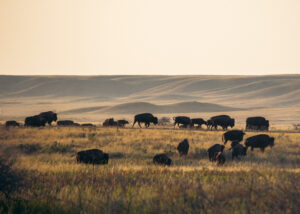
This prairie site comprises temperate grasslands, shrublands and badlands within the Milk River Watershed in southern Saskatchewan. It encompasses the two separate blocks that comprise Grasslands National Park, as well as the areas between and surrounding these blocks. There are large sections of unbroken native prairie between the blocks, one of the most threatened ecosystem types in Canada. The KBA encompasses sections of Dixon Community Pasture, Mankota Community Pasture, and Masefield Pasture, which are semi-natural pasturelands that provide critical habitat for many species at risk. It is situated on land that has been culturally significant to Indigenous peoples for centuries. Grasslands National Park contains thousands of archaeological sites, making it one of the largest concentrations of undisturbed pre-contact cultural landscapes in Canada.
At least 30 species recognized as at risk in Canada can be found within the KBA. The site is home to the only remaining colonies of black-tailed prairie dog in Canada, half of Canada’s greater sage-grouse and over a third of Canada’s remaining wild plains bison. More than two dozen burrowing owls have also been seen in the park.
The hot, arid conditions found here are well-suited to species like prickly pear cactus, featured in this photo.
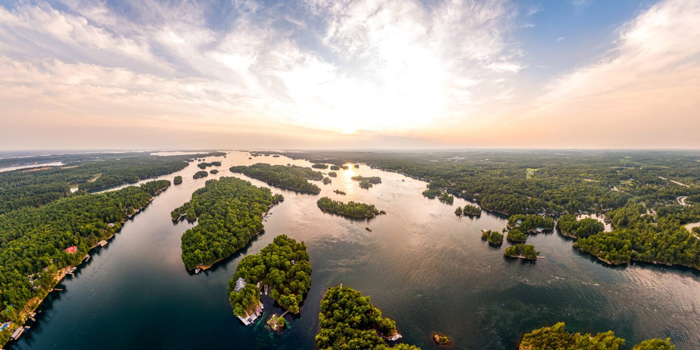
The Thousand Islands is the meeting point between the Canadian Shield to the north and the Adirondack Mountains forest to the southeast, resulting in relatively high species diversity and the presence of nationally rare aquatic and terrestrial species. The St. Lawrence River valley itself forms a wildlife migration corridor, as well as a movement corridor for people. Consisting of hundreds of islands and adjacent lands along the river, the Thousand Islands KBA is a diverse landscape that is particularly important for reptiles and amphibians. Uncommon species found here include the gray ratsnake, pugnose shiner, deerberry, Blanding’s turtle, American water willow and pitch pine.
The area has a recorded human presence spanning thousands of years, with records of Indigenous Peoples visiting the islands seasonally to camp and fish dating back 10,000 years to the end of the last Ice Age.
Sandhills are a unique habitat that formed when the melting of the Laurentide Ice Sheet produced huge lakes that covered much of the prairie provinces. When these lakes eventually drained away and disappeared, they left large depositions of sand across the region. Sand dunes are a dynamic habitat, as periods of dune stabilization and destabilization alter the shape of each dune, as well as the types of plants that grow there. The Great Sandhills KBA encompasses the largest sand dune field in the prairie provinces, covering over 1,900 km² in south-central Saskatchewan. Sand dune habitats have been disappearing due to human activities, and it is estimated that nearly half of the original area of open, active sand dunes in the southern Canadian prairies has now been lost.
Several species that depend on sand dune habitat are found in this KBA, including Ord’s Kangaroo Rat, Gold-edged Gem Moth (which relies on Prairie Sunflower growing in the dunes) and Gibson’s Big Sand Tiger Beetle.
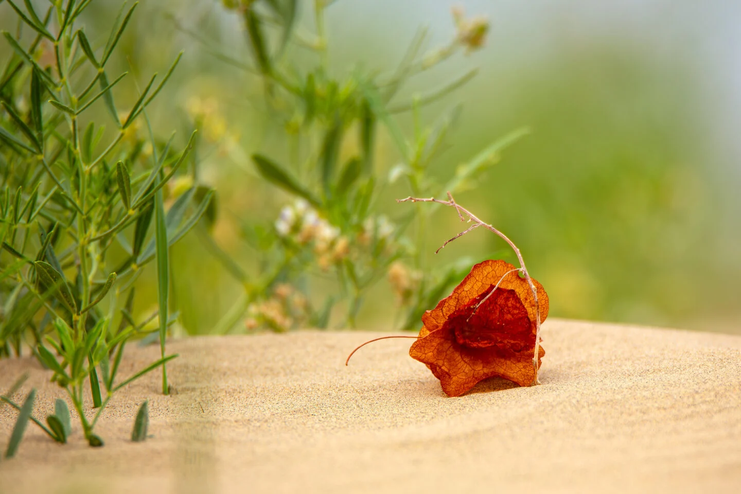
In this photo, a bright red winged dock leaf rests in the sandy dunes. This striking plant thrives in one of Canada’s most unique and fragile ecosystems.
Environment
The planet is in the midst of drastic biodiversity loss that some experts think may be the next great species die-off. How did we get here and what can be done about it?
Environment
As the impacts of global warming become increasingly evident, the connections to biodiversity loss are hard to ignore. Can this fall’s two key international climate conferences point us to a nature-positive future?

Environment
Decisions around where to establish new protected areas in Canada should consider wildlife and ecosystem health first
Environment
Environmental scientist Dr. Ciara Raudsepp-Hearne explains how Canada can expand protected areas to maximize biodiversity protection