History
2014 Victoria Strait Expedition
This year's search is about much more than underwater archaeology. The Victoria Strait Expedition will contribute to northern science and communities.
- 1205 words
- 5 minutes
This article is over 5 years old and may contain outdated information.
History
New tools create maps of archaeological sites

August 20, 2014, 20:00 Mountain Standard Time
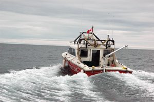
We have another week of regular operations before we turn the Laurier’s attention toward the Victoria Strait Expedition, but that doesn’t mean that we’re not busy.
We are continuing to work our way toward St. Roch Basin, moving eastward from Cambridge Bay. This included two days in Simpson Strait, a narrow and shallow bottleneck channel located south of King William Island and characterized by many twists and turns. This winding and shallow route creates inevitable challenges for the ships that serve the communities of Gjoa Haven on King William Island, and its neighbour Taloyoak located to the northeast on Boothia Peninsula. Each year, our work here includes the set up and/or maintenance of the many navigation towers and navigation buoys in this channel from the beginning of the shipping season that typically runs from August until the October freeze-up.
Today, terrestrial archeologists Douglas Stenton and Robert Park were able to take full advantage of clear skies and warm weather (roughly 8 C) to get to shore and conduct surveys of their own in Douglas Bay on the south coast of King William Island and on Adelaide Peninsula at a place known as Starvation Cove. This year they’ve added some new advanced technology provided by colleague S. Brooke Milne of the Centre for Earth Observation Science at the University of Manitoba — ground-based LiDAR. LiDAR (short for light detection and ranging) is a more recent remote-sensing technology that can measure the distances and shape of a target surface over a larger area.
LiDAR works similarly to echolocation (think bats), but uses ultraviolet, visible and near-infrared wavelengths rather than sound waves. Similarly, the Canadian Hydrographic Service has also used airborne bathymetric LiDAR in previous years with great success as certain wavelengths are able to penetrate into shallow waters to map the seabed. A key advantage to LiDAR is its ability to generate 3D elevation maps to help highlight unique features on the ground. For Stenton and Park, this new tool will help to create high-resolution maps of archaeological sites.
As we waited for Stenton’s and Park’s return later that evening, I was again struck by the difference between our current modern operations and the historical efforts and labour required as the European explorers were first trying to sail and chart the Arctic. In a period of hours, Stenton and Park were able to take full advantage of great conditions to conduct their surveys and return to the ship by helicopter from Starvation Cove to a full dinner prepared by our talented cooking staff. The historical contrast isn’t lost on any of us.
History
This year's search is about much more than underwater archaeology. The Victoria Strait Expedition will contribute to northern science and communities.
History
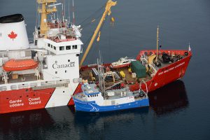
Introductory insights into the Canadian Coast Guard’s role in the search area
History
Arctic historian Ken McGoogan takes an in-depth, contemporary perspective on the legacy of Sir John Franklin, offering a new explanation of the famous Northern mystery
People & Culture
On April 12, Franklin enthusiasts had a rare opportunity to come together in the same room as The Royal Canadian Geographical Society presented their 2016 Can Geo Talks