In the summer of 1939, Prentice G. Downes, a bespectacled Boston schoolteacher, arrived in the northern Manitoba village of Brochet. He secured a canoe, a grubstake and camping gear, rustled up a trapper for a travelling companion and set off into the unknown. Their destination was Nueltin Lake, the mystical “Sleeping Island Lake” of the Chipewyans, in present-day Nunavut. Getting there involved traversing an unmapped territory of whitewater rivers, boggy, bug-infested portages and sprawling, windswept lakes — the same landscape that challenges modern-day adventurers equipped with GPS, lightweight gear and resilient canoes.
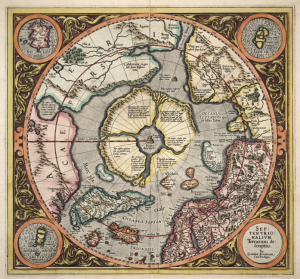
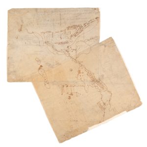
Despite the difficulties of route finding, living off the land and navigating islandpocked lakes and rocky rapids, Downes still managed to keep a detailed journal, which evolved into his 1943 travelogue Sleeping Island, a classic among canoe trippers. He also made accurate, hand-drawn maps on the trail, in the same manner as David Thompson, the North West Company cartographer who mapped much of Western Canada in the early 1800s. Later on, Downes delivered lectures at Harvard’s Institute of Geographical Exploration, was commissioned by the U.S. government to map parts of Alaska’s Aleutian Islands and became a member of the prestigious Royal Geographical Society.
But for Robert Cockburn, a professor emeritus in English at the University of New Brunswick in Fredericton, it was Downes’ allusions in Sleeping Island to his previous northern journeys that were most captivating. Cockburn interviewed Downes’ widow, tracked down his travelling companions and spent three decades analyzing and reconstructing journals dating back to Downes’ first expedition in 1936. He discovered that Downes was as much an astute and sensitive ethnographer as a skilled adventurer and cartographer. Cockburn uncovered Downes’ unpublished Cree and Chipewyan dictionary and his detailed documentation of the First Nations dreamscape, which garnered him the Cree moniker “the-man-who-talks-about-dreams.”
A 2011 updated reprint of Sleeping Island was the first off the press for Ottawa’s McGahern Stewart Publishing — a small printing house with a mission to bring “out-of-print and never-before-published accounts of northern travel to the public’s attention” — and co-publisher Hugh Stewart says its second title continues to support the company’s goals. Distant Summers, a Cockburn-edited collection of the unpublished diaries of Downes’ 1936-1940 and 1947 northern travels, is to be released in two volumes this year, the first coming out in April.
Downes learned of the outbreak of the Second World War only after he returned to civilization in 1939. “It is too incredible and insane,” he writes in his journal. “Better to be back in the Barrens among civilized people.” In the end, the war curtailed Downes’ northern travels just as float planes, mineral exploration and accurate maps changed the nature of the Canadian North forever. “The transitional period before the Second World War was the last of the Old North,” says Cockburn. “Very little has been written about that era. Downes saw a lot of it, and his journals are his greatest legacy.”