Between 1990 and 2016, ship traffic in the Canadian Arctic roughly tripled, with most of the increase happening in Nunavut waters.
In light of this increased traffic, the Government of Canada undertook research to develop a network of low-impact marine transportation corridors that would pose less risk to communities and the environment.
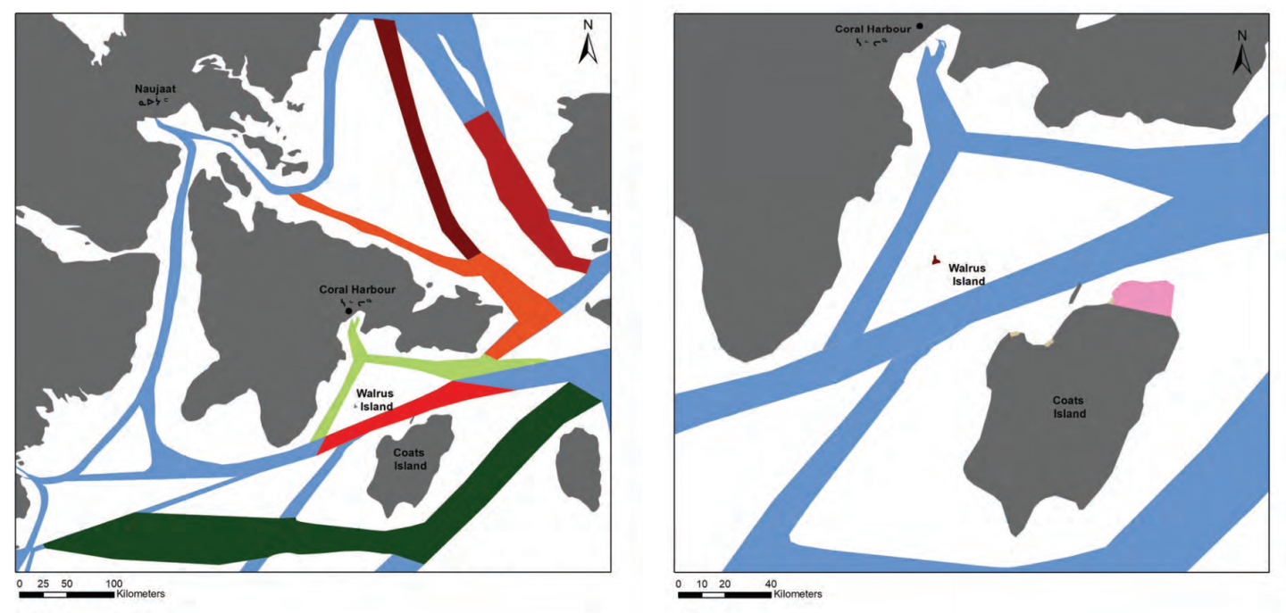
A team of researchers from the University of Ottawa incorporated insights from those Inuit communities personally affected by the increase in shipping traffic. The project mapped locations of whales, walruses and other significant marine resources, as well as historical sites in Coral Harbour.
Changes recommended to shipping routes include avoiding migratory bird sanctuaries, restricting shipping during caribou migration and avoiding ice breaking during seal pupping seasons.
Recommendations also include the following:
- Only ships providing essential services should use the corridor between Southampton Island and Coats Island
- All corridors should be 80 kilometres from shore except where too narrow to allow for this distance
- Resupply ships should combine efforts for fewer trips and increased efficiency
- Visitors should need permits to visit proposed protected areas such as Walrus Island
Other changes were recommended not for environmental benefits but for the safety of ships, such as avoiding narrow passages where icebergs tend to hide beneath the surface of the water. The report also recommends there be increased work opportunities for people from the area on the ships.
The recommended routes are not mandatory, but some operators have already agreed to use them.
The report now rests with the federal government, which will decide what recommendations to incorporate into a new low-impact shipping network. The final product is still years away, despite the rapidly shrinking extent of Arctic sea ice. In 2019, the minimum ice cover tied for second lowest on record since modern record-keeping began.
In 2019, a 122-page atlas was created by Oceans North, World Wildlife Fund Canada and Ducks Unlimited Canada. Canadian Geographic created maps from the atlas’s data, overlaying marine mammal habitat concentrations with shipping routes, commercial fisheries and areas of oil and gas throughout the North. Take a look at the interactive map to see shipping routes reflected in the atlas.