Environment
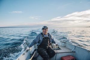
Inside the fight to protect the Arctic’s “Water Heart”
How the Sahtuto’ine Dene of Déline created the Tsá Tué Biosphere Reserve, the world’s first such UNESCO site managed by an Indigenous community
- 1693 words
- 7 minutes
Mapping
While most of the delta lies within the federally protected Wood Buffalo National Park, activity outside the park could threaten its future

If the boreal forest acts like lungs for the Earth, the Peace-Athabasca Delta in northern Alberta is a beating heart, one of many sacred ecosystems that march our blue speck of a planet forward in the collective hum of existence. The rivers, lakes, marshes and grasslands comprising one of the world’s largest inland freshwater deltas serve as a refuge for more than one million migratory birds each year, as habitat for 279 different animal species, including the globe’s largest free-roaming herd of wood bison, as an enclave for native grasses and sedges, and as the lifeblood for the local Cree, Chipewyan and Métis peoples. This combination of outstanding ecological and biological attributes led to the park’s UNESCO World Heritage Site designation in 1983.
While 80 per cent of the delta lies within the federally protected Wood Buffalo National Park, Canada’s largest, no park is an island. Upstream of the vital waterways that intersect in the delta lie hydroelectric dams, uranium and coal mines, pulp and paper mills, wastewater dumps and oil sands tailings ponds. Effluent from these industrial operations ultimately flows back to the heart, the delta.
It’s these environmental stressors, along with a lack of environmental monitoring and Indigenous representation in the management of the park, that sparked a petition to UNESCO led by the Mikisew Cree First Nation. Now, nearly a decade later, the park is teetering on the edge of inclusion on the United Nations’ list of World Heritage in Danger after Canada failed to move quickly enough to tackle recommendations made by an international monitoring mission in 2016. In fall 2023, Canada was given three years to make good or face the embarrassment of the international community potentially having to intervene.

Situated at the confluence of the Peace, Athabasca and Birch rivers on the western tip of Lake Athabasca and centred on Lake Claire, the Peace-Athabasca Delta is an incredibly dynamic hydrological space. The massive wetland is hole-punched with small ponds and lakes that, together, act as the ecological cradle of the delta, providing highly productive habitat for muskrats and other mammals, birds, reptiles and amphibians, insects, fish, and native plants. These bodies of water and the channels that connect them rely on periodic floods — primarily in the spring and summer — to replenish their water stores. Many of these water bodies are what scientists call “perched basins,” which sit at a slightly higher elevation than the surrounding wetlands and can only be replenished by high flooding events.
Varying flow volumes from the Peace, Athabasca and Birch rivers are an important factor as to when the delta will flood. However, there are innumerable other factors that contribute to flooding the delta, including precipitation levels, beaver activity, wind direction, and, most importantly, river ice volumes and ice jams during the spring break-up. Since the W.A.C. Bennett Dam was constructed on the Peace River in the 1960s, the Mikisew Cree First Nation, researchers and others have noted profound changes in the timing and volume of flooding events in the delta. These changes are credited to the Bennett Dam, as well as other dams on the delta’s major waterways, with climate change also a factor, according to UNESCO’s report from their 2022 monitoring mission to the park. Here is how the waterways in the delta are affected by high and low water volumes.

When the water flowing down the Peace River is relatively higher than the water levels in Lake Athabasca and Lake Claire, the Peace River’s water flows into the delta. This causes the delta’s smaller rivers and channels to reverse their normal flow direction, flooding the delta with higher than normal water levels. These high water events can occur during spring melting and river ice break-up, and at other times during the summer.

Most of the time, the Athabasca River flows into Lake Athabasca, then quickly exits the area via the Rivière des Roches and the Chenal des Quatre Fourches, bypassing the heart of the delta centred on Lake Claire. Similarly, the Peace River bypasses the delta, joining the Athabasca River’s waters to form the Slave River. Under these conditions, there is generally less water in the delta, cutting off these perched basins and making water access to hunting and trapping grounds more difficult or impossible for local First Nations and Métis communities.
Are you passionate about Canadian geography?
You can support Canadian Geographic in 3 ways:

This story is from the January/February 2024 Issue

Environment
How the Sahtuto’ine Dene of Déline created the Tsá Tué Biosphere Reserve, the world’s first such UNESCO site managed by an Indigenous community

Places
In Banff National Park, Alberta, as in protected areas across the country, managers find it difficult to balance the desire of people to experience wilderness with an imperative to conserve it

Places
It’s an ambitious plan: take the traditional Parks Canada wilderness concept and plunk it in the country’s largest city. But can Toronto’s Rouge National Urban Park help balance city life with wildlife?

Places
Not all, but many of Canada's national parks will reopen to some extent on June 1