Environment
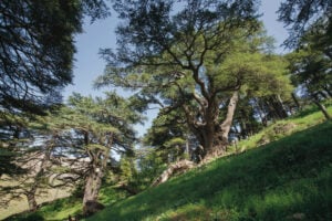
The importance of forests for our survival
An in-depth look at how trees work to keep us alive and the value of old-growth forests
- 2431 words
- 10 minutes
This article is over 5 years old and may contain outdated information.
Mapping
Species richness in Canada’s remaining intact forests


There’s not a place left on Earth that hasn’t been affected by humans in some way. The swaths and splinters of “intact forest” shown here, however, might be about as close as you can come to truly pristine landscapes. These ecologically vital Canadian forests are essentially undisturbed by the wide-reaching impacts of industrial, agricultural and urban development. In these forests, the natural patterns of ecosystems can continue to play out largely unhindered. That means, among other things, that native species, from large carnivores to the smallest plants, live in viable, interconnected populations, and that the ecosystem is resilient to natural disturbances such as outbreaks of pests and fires. Read on to find out what this map illustrates about species richness* in Canada’s intact forests.
Canada’s intact forests, shown here in all shades of green, are in the major “forest ecozones” recognized by the Canadian government for its National Forest Inventory. These ecozones either are or were once covered in forests. Areas in which forest no longer grows, or that show visible evidence of human influence, are not considered intact and are shown in white.
To be dubbed “intact,” each forest block must be big — 50,000 hectares or larger, according to the Global Forest Watch Canada study that produced this data — so outer boundaries can act as buffers against human influences.
About 340 million hectares of intact forest remain in Canada. More than 90 per cent of that is boreal (the world’s largest intact forest), while the rest is temperate forest in the south. Alberta has less remaining intact boreal (16 per cent) than any other boreal province or territory, all of which have at least 50 per cent of their original boreal cover.
Low species richness is not necessarily an indicator of forest health: Canada’s largest unbroken intact forests are spread across the North, where species variety is naturally lower. The most crucial conservation sites are farther south, where species richness is highest and forests are most fragmented.
*Species richness is the number of different species in an area. For this map, that’s all forest-dwelling mammals, birds, reptiles, amphibians and trees, as well as at-risk plants.
Environment
An in-depth look at how trees work to keep us alive and the value of old-growth forests
Environment
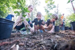
Six new mini forests were planted in cities across Canada in 2023 as part of a national pilot project to combat biodiversity loss and create new green spaces in urban areas — and the work is just beginning
Environment
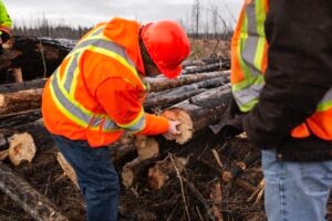
As forest fires grow in size, intensity and severity, foresters are rethinking forest management
Environment
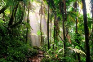
Trees in tropical regions of the globe can withstand temperatures up to 32.3 degrees Celsius and still effectively store carbon