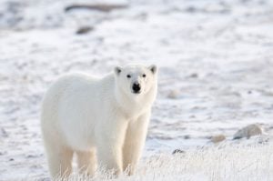
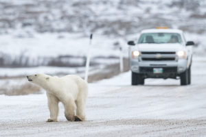
As Hudson Bay slowly enters the winter freeze-up, Churchill’s famous polar bears have began disappearing onto the ice to hunt seals. Thanks to Polar Bears International’s Bear Tracker map, we can see to where they’re disappearing.
The interactive map is currently tracking 14 polar bears: five from the Western Hudson Bay population and 9 from the Southern Hudson Bay population. The location data — released with a time delay for the bears’ safety — comes from GPS collars, which have automatic release timers, and are worn loose enough that the bear could push it over its head if it felt so inclined.
The trackers help scientists understand how the polar bears use their habitat. Here, Alysa McCall, director of conservation outreach and staff scientist at Polar Bears International, explains a bit of what we’ve learned from the Bear Tracker map.
What new information have we gleaned from this fall’s collected data?
We just started tracking this group in the last couple months, but it’s really only been a couple weeks since we started seeing significant movements as the sea ice has started forming around the edges of the bay.
Already we are learning that these bears have different strategies. For example, two Western Hudson Bay (WHB) bears have moved very far north up the west coast of the bay, anxious to get onto the first swaths of sea ice that appeared in November. Another WHB bear, however, was happy to stay close to her home base, expending less energy but waiting longer for her first meal of the fall. We have also learned that likely two WHB bears are likely pregnant and denning.
How old is the program?
We’ve been doing this for about four years now, but polar bears have been collared since the early 1990s in Hudson Bay, making this a very long and very valuable dataset for understanding polar bear behavior and habitat use.
Are there any particular stories you could share about an individual bear?
One neat example right now is X19627, the purple icon bear sponsored by Bering Time. She was collared in the fall of 2014 with a yearling cub and since then has moved 2901 km!
Because she was collared last year with a yearling, we can guess that she likely weaned her cub this past spring and found a new mate. This means that her current inland location may be where she is pregnant and denning for the winter. If she is in fact pregnant, she won’t budge on the Tracker until about February or March of 2016, when she will lead her new cub(s) out onto the sea ice for the first time to hunt seals. At that point, she won’t have eaten in about seven or eight months!
What’s so special about this map?
I think it is amazing that in the winter months, when Hudson Bay is completely dark for much of the day, we can still get a sense of what some polar bears are doing and where they are. Though they are hundreds of kilometers out on the frozen water, far away from any human or form of civilization, we can still see how far they travelled in the last week, if they are close to other collared bears, and more. Technology is pretty amazing!


