Travel
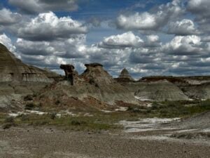
The great dinosaur road trip, Alberta
Exploring the staggering diversity and volume of the province’s Cretaceous sites
- 2267 words
- 10 minutes
This article is over 5 years old and may contain outdated information.
Mapping
If you've ever wondered what it would look like if you mapped all the fossils ever discovered, wonder no more
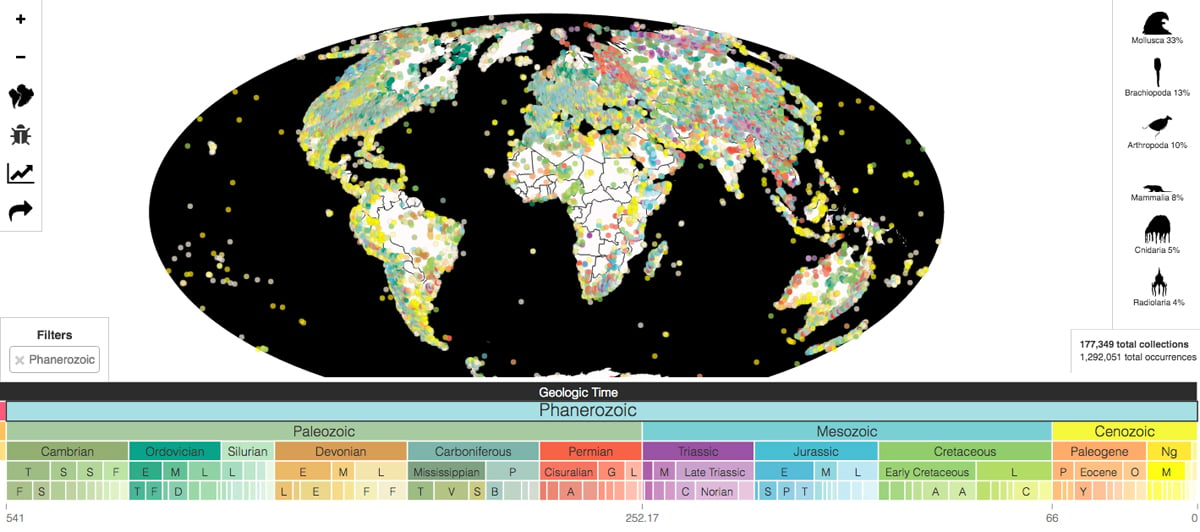
“Revealing the history of life” might sound like an impossibly ambitious goal for a single map, but the Paleobiology Database’s Navigator platform lives up to its premise.
The database contains information on almost every fossil ever documented around the world, and though it’s been around in one form or another since 1998, the Navigator allows the public to explore its contents through time, space and taxonomy on one beautiful, user-friendly interface.
The database’s intended audience is researchers, but you don’t have to have a doctorate in paleontology to explore the map; pictograms accompany the taxonomical classifications so you can tell if the specimens on the map were reptiles, birds, mammals or invertebrates, and the plotted points are colour-coded by geological time period.
Playing around with the map’s search filters reveals Alberta to be rich in fossils dating to the Cretaceous period, while British Columbia is a hotbed for Early Jurassic specimens. Users can also zoom in on Newfoundland to explore some of the oldest fossils ever discovered — mollusks that lived around 541 million years ago.
If exploring the Database whets your appetite for fossils, you may want to plan a visit to the new Phillip J. Currie Dinosaur Museum.
Travel
Exploring the staggering diversity and volume of the province’s Cretaceous sites
Science & Tech
How peering into our ancient past could transform our understanding of contemporary climate change
Mapping
As Canada's most famous trail celebrates its near completion, Esri Canada president Alex Miller discusses the ambitious trail map that is helping Canadians get outdoors

Environment
It’s official: Nova Scotia is home to the oldest known pine tree fossils in the world.After examining the remains of charred twigs found in a gypsum quarry near…