I have a confession to make: I like getting lost.
Not the “no idea where I am” lost. More like the “I’m not exactly sure where we are” lost. If you’re in that kind of position, then you’re taking risks, being challenged and are most likely on an adventure of some kind. In my book, these are all good things.
While it can be a bit stressful to not know where you are, finding out is usually fun. It’s a challenge. A puzzle. The key is to use a variety of different navigation techniques, not just one or two. Modern navigation techniques are essential for extended travel and are incredibly powerful. However, there is something that is so appealing about the simplicity and reliability of more traditional navigation techniques. Most of them don’t require you to have anything besides an awareness of what’s around you.
Here are seven of the many tools (both modern and less so) I use to find my way in the arctic.
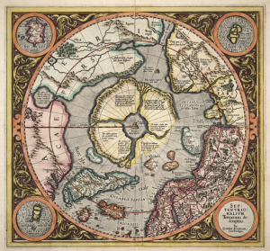
1. Maps
There are maps in my office, bedroom and dreams. Aeronautical maps with their 1:500,000 scale are great for an overview of a large area; topographic maps show elevation, and are great for navigation because of their 1:50,000 scale. But remember – maps can be flat out wrong. People made them and people make mistakes.
2. Compass
Everyone should be able to take a bearing with a compass, and be able to figure out where north, south, east and west are. With the large scale and vast expanses of landscape up north we often were able to set a bearing for the day and stick with that. I usually have one tucked into the map case of any trip I’m on.
3. GPS
Global Positioning Systems has become the most ubiquitous way to navigate, and probably the one most responsible for getting people lost. It’s so tantalizing to only rely on GPS and not verify and hone your skills in other navigation techniques, for those situations when your batteries run out, for instance. Navigation by GPS in the Arctic is not practical simply because the frigid temperatures drain your batteries too fast. They are, however, excellent for verifying your position in the warm tent at night.
4. Sun
The sun moves 15 degrees every hour. At noon the sun is directly south and at midnight it’s directly north. If it’s 6 pm then the sun has travelled 90 degrees clockwise (15 degrees x 6 hours), or due west. During the New Land expedition, we drew circle on our skis marked off at 15 degrees so that we could quickly take a rough bearing if we know what time it was.
5. Snow drifts
Storms create snow drifts that are unique in size, shape and orientation. We use drifts from a particular storm to help check your bearing. You can take the bearing of the drifts and match that up against what bearing you want to be heading.
6. Wind
For a limited period of time, until you notice it shift, you can check your bearing with respect to the direction of the wind.
7. Ded (deducted) reckoning
I describe this as basically guessing how far you’ve travelled from a previous position. If you knew where you were, then you know where you are. We humans are actually pretty good at it.
While map and compass are the old-school tools for navigation, and GPS is now the standard, the more traditional navigation techniques can help verify where you are. Expand your skill by practicing those less used navigation techniques when you know where you’re going and the stakes are low. Don’t be afraid to get lost.