Travel
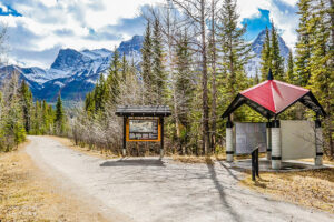
Trans Canada Trail celebrates 30 years of connecting Canadians
The trail started with a vision to link Canada coast to coast to coast. Now fully connected, it’s charting an ambitious course for the future.
- 1730 words
- 7 minutes
This article is over 5 years old and may contain outdated information.
Mapping

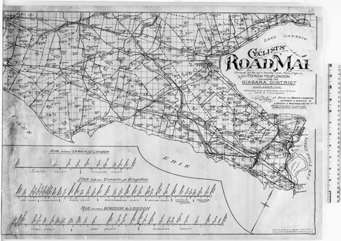
“Roll on, spring!” One can imagine Canadians uttering such a cry in the waning days of winter during the late Victorian era, eager to get out on their bicycles and explore the countryside. During the mid- to-late 1890s, a full-fledged bicycle craze was in full swing in North America, with people spending money not only bicycles themselves but also on the accoutrements that went with them (just as hundreds of thousands of Canadians do today), including tools, locks, clothing and maps. Maps like the two pictured here were instrumental in opening up the countryside to urban bike owners, for whom it wasn’t uncommon to spend a weekend away in one of the many hotels that catered to cycling clientele. A short description of each map is provided below.
As Sara Viinalass-Smith, an early cartographic archivist at Library and Archives Canada, notes: “Street’s map (at right) shows only roads that were deemed passable by bicycles. It also features the rail lines that crossed the region. They were important for cyclists not only because they were consistently passable on bicycles but because cyclists could ride the rails in one direction, making their cycling excursions easier. On the map, distance is shown by two mile squares and population is listed under each place name. At the bottom of the map, Street documented the stops between various popular destinations, noting the counties in which these villages, towns and cities were situated, their populations, and the distances between them.”

Are you passionate about Canadian geography?
You can support Canadian Geographic in 3 ways:

This story is from the April 2015 Issue
Travel
The trail started with a vision to link Canada coast to coast to coast. Now fully connected, it’s charting an ambitious course for the future.
Science & Tech
Celebrating Canadian Innovation Week 2023 by spotlighting the people and organizations designing a better future

Mapping
Maps have long played a critical role in video games, whether as the main user interface, a reference guide, or both. As games become more sophisticated, so too does the cartography that underpins them.

Wildlife
Canada jays thrive in the cold. The life’s work of one biologist gives us clues as to how they’ll fare in a hotter world.