
Kids
Giant floor maps put students on the map
Canadian Geographic Education’s series of giant floor maps gives students a colossal dose of cartography and is a powerful teaching tool
- 1487 words
- 6 minutes
This article is over 5 years old and may contain outdated information.
Mapping
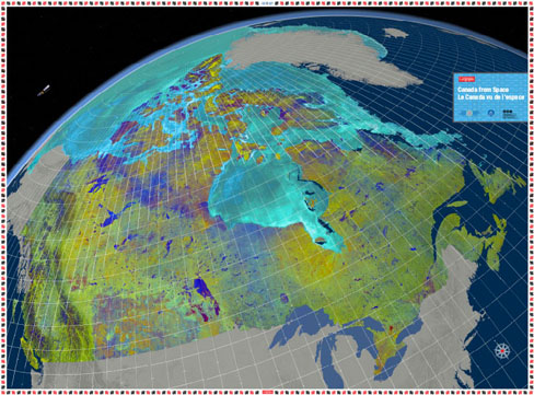
Most maps have a legend — something to indicate what the different symbols mean. But such prescriptive labeling didn’t make sense with this particular map.
The Canada from Space giant floor map was born from raw satellite data; it’s literally how a satellite might see Earth from above. In this case, the satellite is called RADARSAT-2. But as cartographer Chris Brackley explains, a satellite sees things very differently than us.
The images come from radar, which uses a beam that bounces back to get a pattern of what the surface of the earth is like. The resulting data is “not exactly what you would expect to see with [a human] eye at all,” says Brackley.
The finished product was officially revealed today in Ottawa. This project is part of a collaboration between the Canada Aviation and Space Museum (CASM), the Royal Canadian Geographical Society (RCGS) and the Canadian Space Agency.
Unlike the original RADARSAT, RADARSAT-2 is able to capture multiple angles of the same place. This lets scientists create colour images, rather than just black and white. Brackley wanted to stay as true as possible to the satellite’s view, adding only minor enhancements, such as hill-shading and clarifying the separation between land and sea.
“It’s this primary, unfinished, unvarnished piece of work that allows the students to be primary interpreters of information that’s never really been interpreted before,” he says.
That’s one of the reasons Brackley had trouble creating a legend. What orange represented in one part was not the same as what orange represented in another. Glaciers have a “melted-rainbow-popsicle” look, he says.
It’s serving up raw data to students to let them make informed guesses (with the help of teachers) about what might be happening in a given place, Brackley says.
Sara Black, a member of the CG educational team, is excited for the possibilities of the project, which will be available to all CG education members, in both English and French.
“We want to show how space satellite or satellite technology influences Canadians.”
Reserve a Canada from Space giant floor map for your classroom here.
Are you passionate about Canadian geography?
You can support Canadian Geographic in 3 ways:
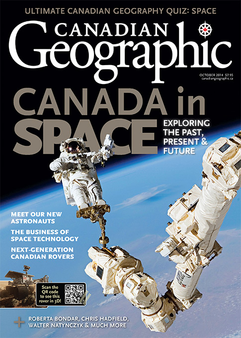
This story is from the October 2014 Issue
Kids
Canadian Geographic Education’s series of giant floor maps gives students a colossal dose of cartography and is a powerful teaching tool
Science & Tech
Celebrating Canadian Innovation Week 2023 by spotlighting the people and organizations designing a better future
Exploration
Caving: The ultimate underground sport
Mapping
Canadian Geographic cartographer Chris Brackley continues his exploration of how the world is charting the COVID-19 pandemic, this time looking at how artistic choices inform our reactions to different maps